Astronaut Captures Massive Pacific Typhoon From ISS Cupola Revealing Earth’s Hidden Power
NASA astronaut snaps stunning view of a massive Pacific typhoon swirling directly below the International Space Station.
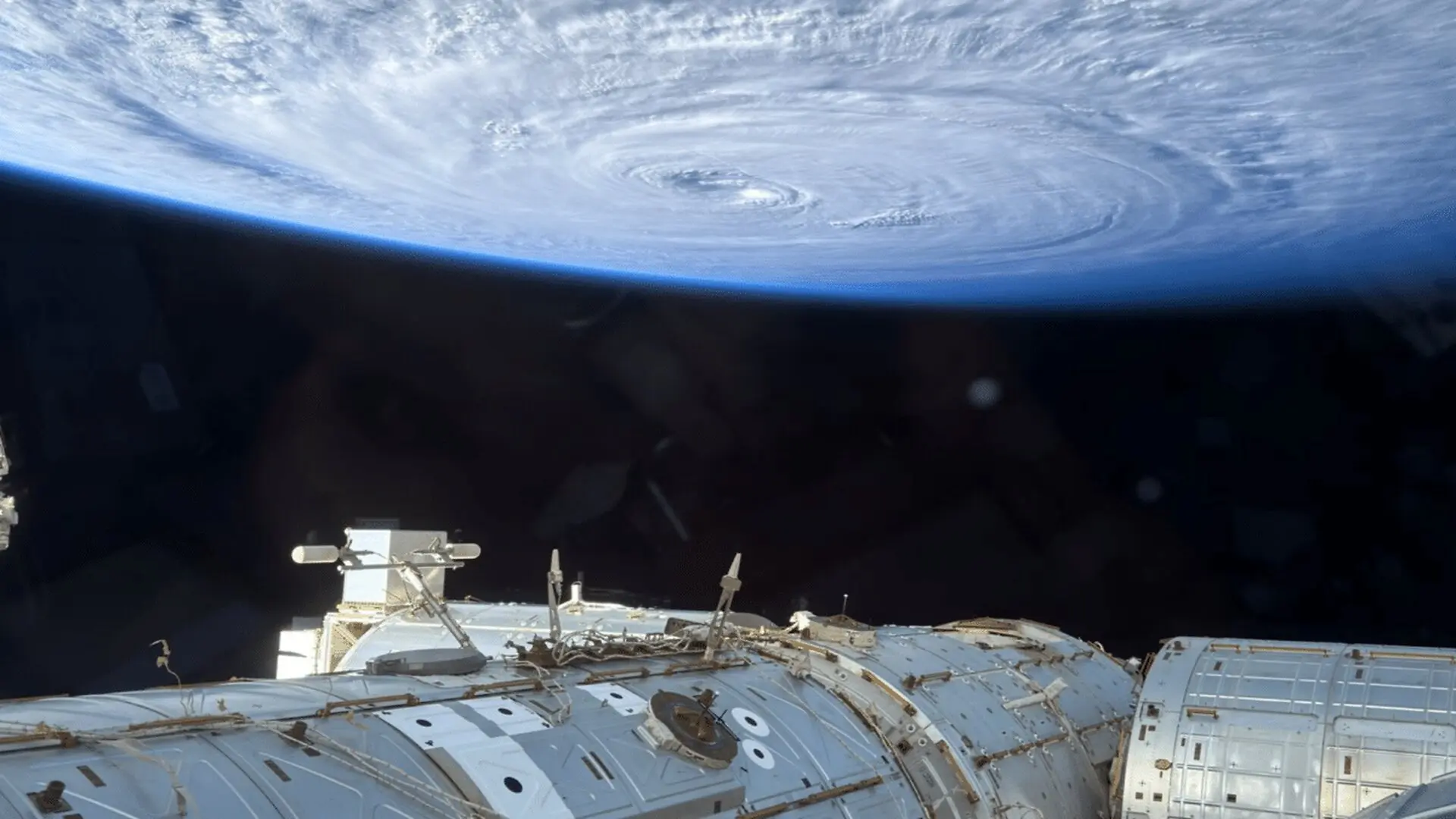
From the cupola of the International Space Station, NASA astronaut Anil Menon photographed a massive tropical cyclone swirling over the Pacific Ocean on 2 August 2026. The image, taken with a consumer‑grade iPhone, captures the full expanse of the storm and underscores how everyday technology now complements scientific instruments in delivering a global view of Earth’s weather.
Orbiting View Reveals the Full Reach of a Super Typhoon
Seen from roughly 250 miles (400 km) above the surface, the storm’s spiral bands stretch across thousands of kilometres of ocean, a scale that ground‑based observations cannot convey. The photograph highlights the organized circulation that characterises major tropical cyclones, turning a regional hazard into a planetary phenomenon.
Analysts identified the system as Super Typhoon Dolphin, which attained category 5 intensity earlier in 2026 before weakening to a category 3 as it tracked westward toward Japan’s Okinawa Island. The satellite perspective allows scientists and the public alike to appreciate the storm’s structure and the atmospheric forces guiding its movement.
— Anil Menon (@astro_anil) August 2, 2026
Smartphone Imaging Joins the Astronaut Toolkit
Menon’s use of an iPhone inside the ISS cupola—a viewing module built by the European Space Agency—demonstrates how mobile cameras have become reliable tools for documenting Earth from orbit. The device’s compact design lets crew members capture rapidly changing scenes without the logistical constraints of larger, specialised equipment.
The trend of leveraging consumer technology for space photography extends beyond this storm. Recent images from NASA’s Artemis II mission show astronauts employing smartphones during lunar orbit, reinforcing the versatility of handheld devices in both scientific and outreach contexts.
How the ISS Provides a Unique Planetary Vantage Point
Orbiting Earth at about 17,500 mph (28,000 km/h) and circling the globe roughly every 90 minutes, the International Space Station offers an unmatched platform for observing weather patterns, ocean currents, and human activity. Its average altitude of 250 miles (400 km) places crew members within a thin window that captures large‑scale atmospheric phenomena in a single frame.
Since its launch in 2000, the ISS has hosted an international roster of astronauts and supported thousands of experiments across biology, physics, medicine, and Earth science. The continuous stream of imagery from its windows has chronicled storms, volcanic eruptions, auroras, and other dynamic events, linking scientific inquiry with public awareness.
Approaching the End of an Era, Preserving a Visual Legacy
NASA plans to decommission the ISS around 2030, culminating in a controlled re‑entry that will guide the station’s remnants to a remote area of the Pacific Ocean. In the years leading up to retirement, crew members will keep recording Earth’s evolving landscape, adding to a growing archive of orbital photography.
Images like Menon’s super‑typhoon shot serve as visual reminders of the immense energy flowing through our atmosphere and the delicate interplay between surface conditions and the surrounding environment. From the quiet of space, a single snapshot can encapsulate the magnitude of planetary weather systems.
This article has been fact checked for accuracy, with information verified against reputable sources. Learn more about us and our editorial process.
Last reviewed on .
Article history
- Latest version
Cite this page:
- Posted by Divya Iyer