Bermeja: The Phantom Island That Eluded Explorers and Sparked a $22 Billion Oil Dispute
The mysterious island of Bermeja, long shown on maps but never found, fueled a $22 billion Gulf oil dispute.
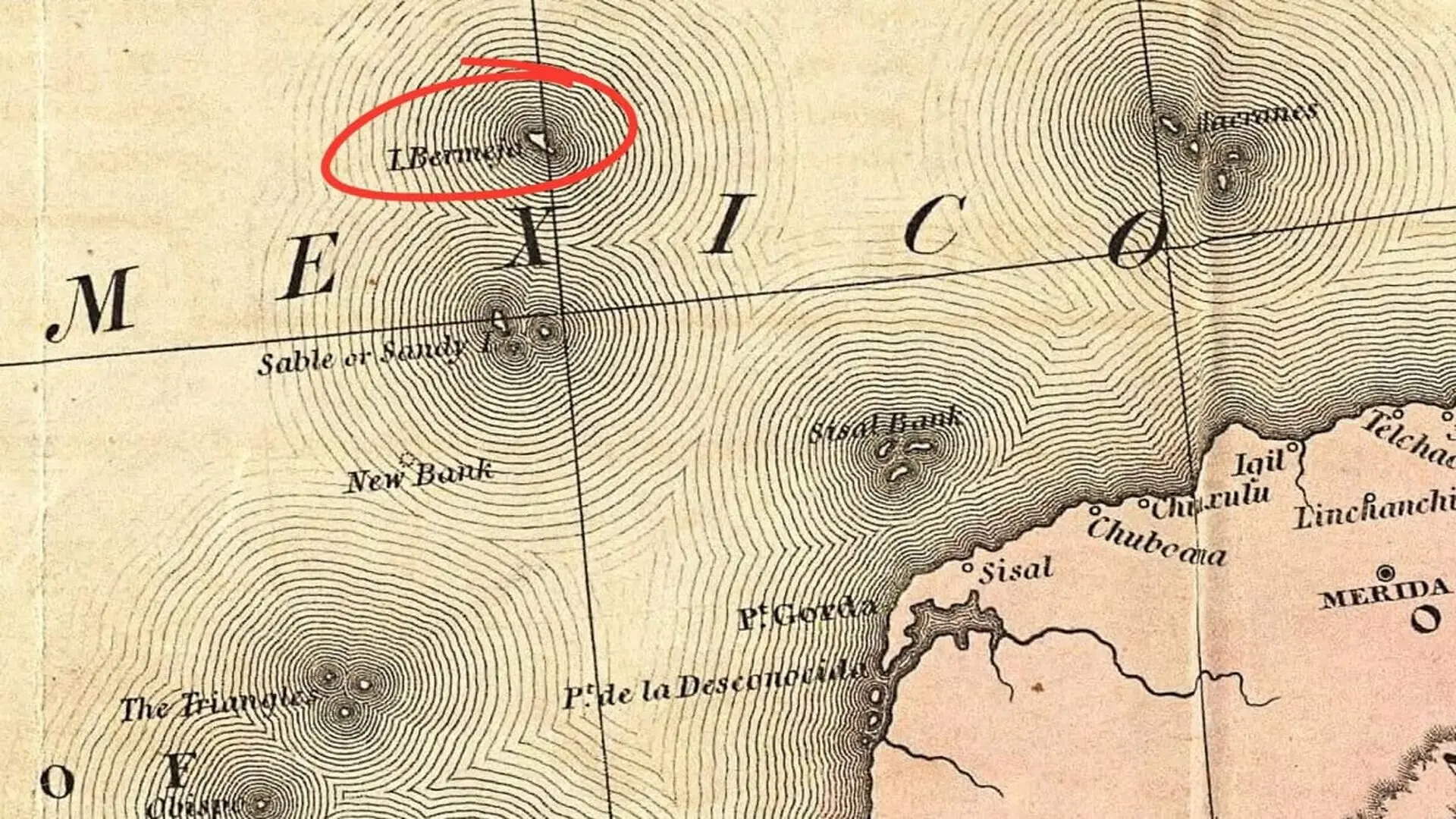
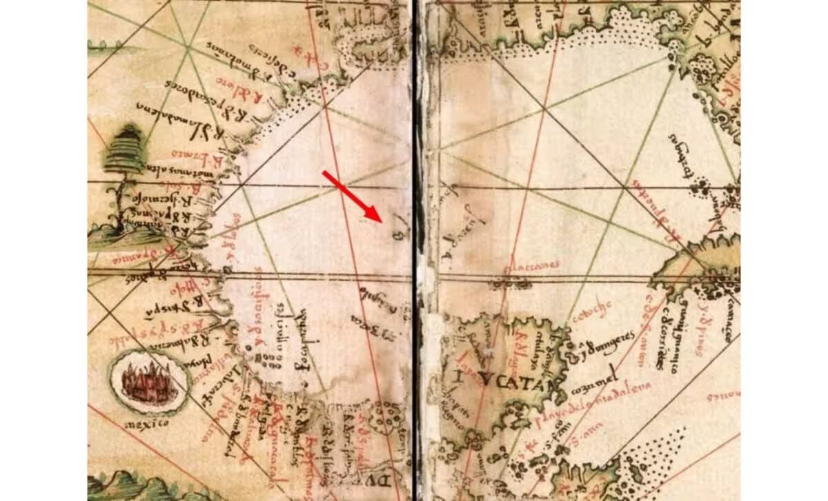
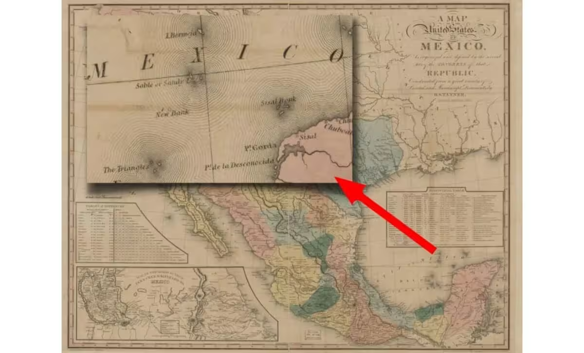
The phantom of Bermeja first appeared on a 1535 Spanish “Carta Universal,” placing a landmass at 22°33′ N, 91°22′ W and estimating its size at roughly 50 miles (81 km). Though cartographers never visited the spot, the island quickly found its way onto subsequent maps and even into Mexican schoolbooks.
When the Spanish Crown ordered a verification in 1775, Captain Miguel Alguete sailed northward, documenting clear skies and an unobstructed horizon. Despite the favorable conditions, his log records only endless water, offering the earliest official denial of the island’s existence.
Mexican authorities revived the quest in 1997, deploying modern GPS and satellite navigation to the historic coordinates. The high‑tech sortie likewise returned empty‑handed, confirming that no landform could be detected at the plotted location Bermejaevidence.
Historical Charts Keep a Phantom Island Alive
The specified point lies in a remote stretch of the Gulf of Mexico, surrounded entirely by open sea. While geological processes can erase islands, exhaustive surveys have yet to uncover any submerged mound or remnant that could correspond to the legendary Bermeja.
High‑Resolution Oceanic Surveys Find No Trace
In 2009, the research vessel Sierra set out under the auspices of the National Autonomous University of Mexico, joined by experts in geography, limnology and marine science. Simultaneously, aircraft conducted aerial sweeps of the target zone.
Teams mapped roughly 6,517 miles (10,488 km) of seafloor, cataloguing every square meter and producing 933 high‑resolution photographs. The data revealed a flat abyss with no seamounts, volcanic structures, or other signatures of a former island.
Sediment cores extracted from the bottom showed no interruption in deposition for about 5,300 years, indicating that the coordinates have remained underwater for millennia ever existed.
Bermeja’s Absence Shapes Gulf Oil Boundary Talks
One theory suggests that 16th‑century navigators often added islands to charts as waypoints, sometimes mistaking fleeting phenomena—such as a wave crest or a surfacing whale—for land, especially when pressure to report new discoveries was high.
Under the United Nations Convention on the Law of the Sea, an island near a coastline can extend a nation’s Exclusive Economic Zone by 200 nautical miles. This provision became central to the 1998 negotiations between Mexico and the United States over the “Treaty of the Western Gap,” which concerned the Hoyos de Dona—depressions where ancient salt domes trap lucrative hydrocarbons.
“The establishment of a boundary is an important step for providing the necessary certainty for our deepwater offshore oil and gas program beyond the 200 mile Exclusive Economic Zone, particularly in light of the remarkable advances that have been made in deepwater drilling capabilities. These new technologies have generated a high level of interest in the Gulf of Mexico deepwater region.”
Estimates placed the contested oil fields at roughly $22 billion. Despite mounting scientific evidence that Bermeja never existed, Mexico signed the treaty, citing the island’s long‑standing presence in historical documents to safeguard its offshore interests as the nation prepared to privatize its energy sector. The 2009 survey was, in part, a diplomatic effort to reinforce those claims.
This article has been fact checked for accuracy, with information verified against reputable sources. Learn more about us and our editorial process.
Last reviewed on .
Article history
- Latest version
Reference(s)
- Dempsey, Caitlin. “The Map Myth of Bermeja Island.”, October 27, 2022 Geography Realm <https://www.geographyrealm.com/map-myth-bermeja-island/>.
- <https://www.nationalgeographic.com/culture/article/110714-giant-sunken-island-atlantis-science-nature-geoscience>.
Cite this page:
- Posted by Divya Iyer