Satellites Track 1.4 Km³ Of Magma Moving 50 Km Underground Without An Eruption
Satellite data uncover hidden changes beneath Africa’s remote terrain, revealing shifting ground processes previously unseen.
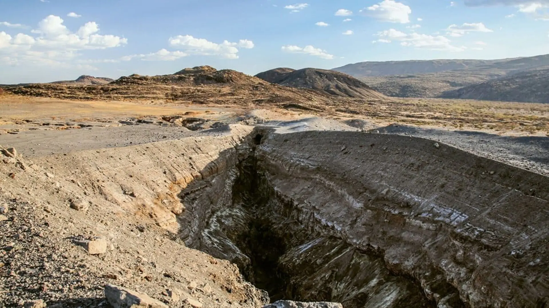
A massive, silent flow of magma moved beneath Ethiopia’s Rift Valley between December 2024 and March 2025, traveling roughly 50 kilometers and displacing about 1.4 cubic kilometers of molten rock without breaching the surface. The phenomenon, documented in Science Advances, offered scientists an unprecedented window into crustal deformation processes.
Thousands of tremors and subtle surface shifts were recorded as the magma advanced, allowing researchers to trace the event in near‑real time using satellite observations and seismic networks. The data reveal how molten material can exploit deep fractures, reshaping the surrounding rock.
The study was carried out by an international consortium that included experts from the University of Pisa, the GFZ Helmholtz Centre for Geosciences, the University of Potsdam, CNR‑IREA, Addis Ababa University, and several additional institutions. Their findings underscore the growing role of space‑based instruments in decoding Earth’s most energetic geological mechanisms.
From Space to the Rift: Turning a Remote Landscape into a Live Laboratory
The episode began on 22 December 2024 when colleagues at Addis Ababa University alerted Carolina Pagli at the University of Pisa to an unusual subsurface disturbance. Within hours, the team launched a coordinated monitoring effort that fused satellite imaging, seismic recordings, and field surveys.
Central to the investigation was synthetic aperture radar interferometry (InSAR), a technique capable of detecting ground movements on the order of millimetres by comparing radar images taken at different times. In a region where on‑the‑ground access is limited, data from Europe’s Sentinel‑1 constellation and Italy’s COSMO‑SkyMed satellites delivered a high‑resolution picture of the evolving surface deformation.
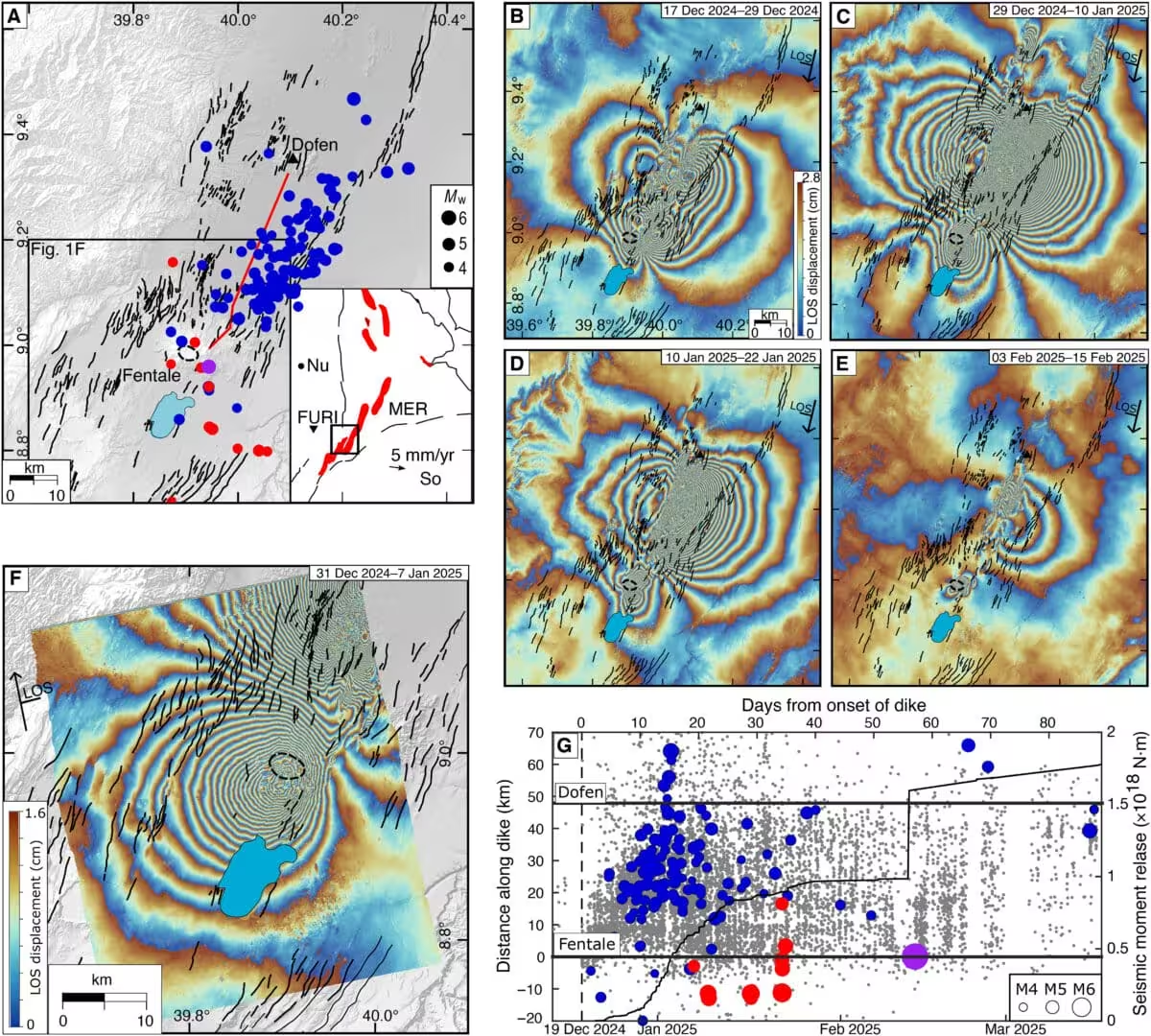
“These episodes emerge only after centuries of stress accumulation within the crust, making them exceptionally rare to capture,” Pagli explained. “When the disturbance was first reported on 22 December 2024, we began a three‑month campaign that tracked the magma’s path and supplied vital information for risk assessment and emergency response in Ethiopia.”
A Deep Magma Pulse That Never Reached the Surface
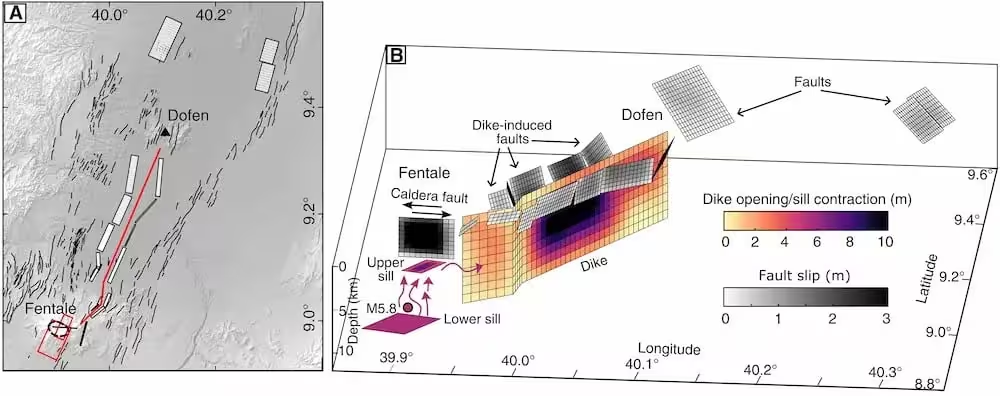
The intrusion unfolded beneath the Fentale magmatic system, a component of the active East African Rift where the African plate is gradually pulling apart. Rather than erupting, the magma exploited pre‑existing fractures, spreading laterally and generating noticeable uplift as well as a magnitude 5.8 earthquake.
Observing a magma body of this scale while it was still migrating is an uncommon opportunity; most similar events are identified retrospectively after geological signatures have been examined.
The research article demonstrates that molten rock can travel extensive distances underground without immediately triggering a volcanic eruption. These insights refine our understanding of stress accumulation in rift environments and the response of the crust when large volumes of magma shift beneath it.
How Satellite Monitoring Is Redefining Volcanic Surveillance
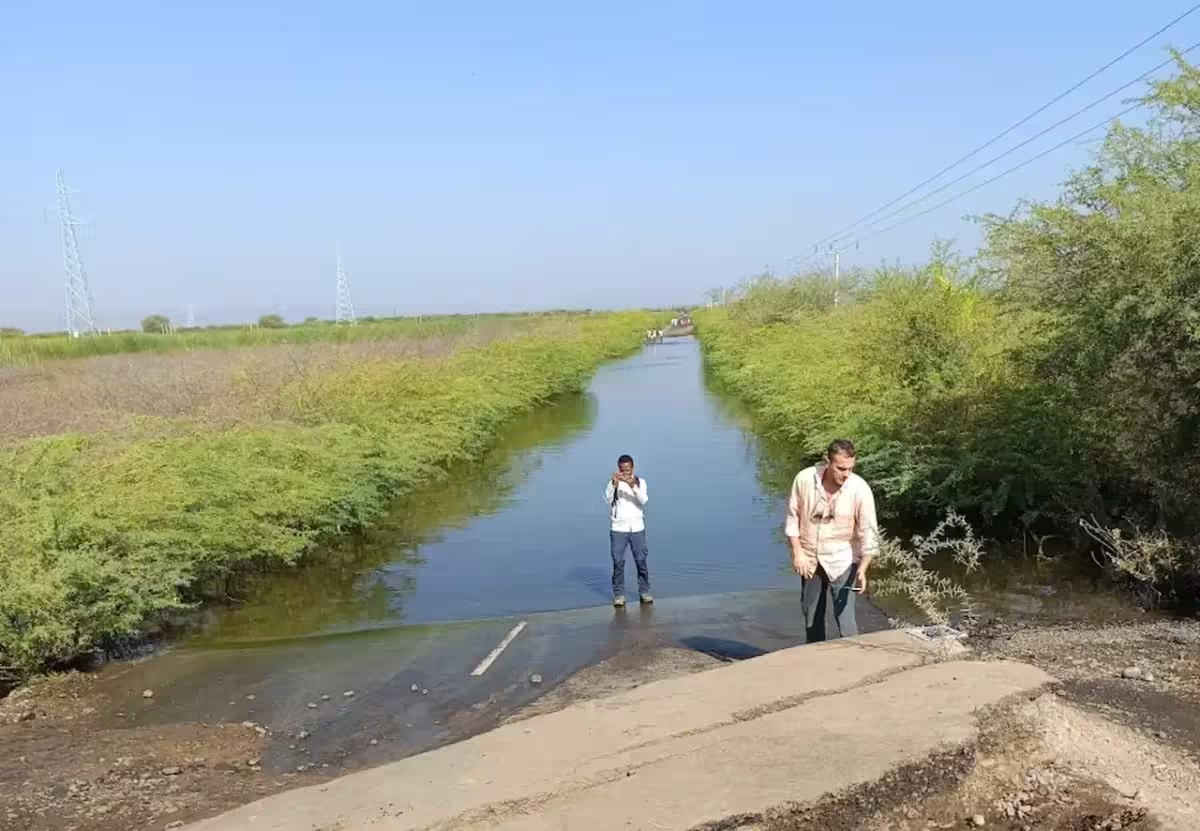
The Ethiopian Rift Valley remains a key natural laboratory for studying continental breakup and the early stages of ocean basin formation. Supported by the Space It Up initiative, the current work illustrates how orbital platforms can continuously monitor remote or inaccessible zones, delivering critical data that would be impossible to gather from the ground alone.
“Observing the Earth from orbit is fundamentally reshaping our approach to studying large‑scale geological processes,” Pagli added. “I also hope this work inspires the next generation of scientists, especially women, to pursue research careers and contribute to an inclusive scientific community.”
By integrating satellite interferometry with ground‑based seismic records, the researchers produced one of the most comprehensive models to date of a deep magma intrusion, a methodology that could enhance early‑warning systems for volcanic and tectonic hazards worldwide.
This article has been fact checked for accuracy, with information verified against reputable sources. Learn more about us and our editorial process.
Last reviewed on .
Article history
- Latest version
Reference(s)
- “Carolina Pagli - Home - Carolina Pagli.”, April 8, 2015 Carolina Pagli <https://people.unipi.it/carolina_pagli/>.
- <https://www.esa.int/Applications/Observing_the_Earth/Copernicus/Sentinel-1>.
- Agency, European. “COSMO-SkyMed.” <https://earth.esa.int/eogateway/missions/cosmo-skymed>.
- Pagli, Carolina., et al. “Deep magma underpressure and connectivity drive large dike intrusions.” Science Advances, vol. 12, no. 28, July 10, 2026 American Association for the Advancement of Science (AAAS), doi: 10.1126/sciadv.aed6073. <https://www.science.org/doi/10.1126/sciadv.aed6073>.
- “Space It Up! | SIU!.”, July 3, 2025 Space It Up <https://spaceitup.it/>.
Cite this page:
- Posted by Vikram Desai