Lidar Uncovers 400 Hidden Amazon Geoglyphs Hinting at a Civilization of Up to 3 Million
Amazon survey reveals hundreds of unknown structures, hints at thousands more, shedding light on ancient builders and their sudden disappearance.
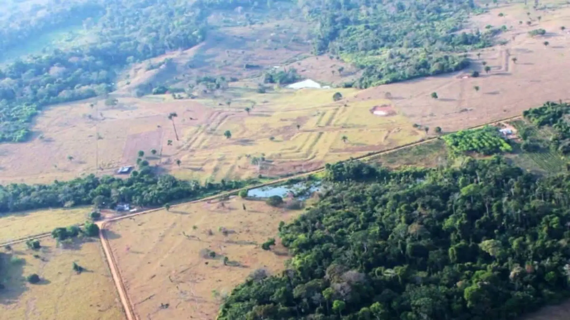
A sweeping lidar survey of Brazil’s western rainforest has uncovered an extensive network of earthworks that point to a previously unknown civilization, dubbed the Aquiry, which may have supported millions of inhabitants before European contact.
Laser imaging uncovers a hidden Amazonian empire
Using airborne lidar, researchers mapped 1,740 square miles of northern Brazil, revealing close to 400 previously undocumented geoglyphs—geometric ditches and raised embankments that would have been invisible beneath the dense canopy.
Population estimates dwarf earlier assumptions
According to the Nature study published on July 29, the Aquiry civilization likely peaked between 100 C.E. and 300 C.E., supporting between 1.25 million and 3 million people across more than 70,600 square miles of what is now northern Brazil.
Settlements far from the main waterways
Unlike many pre‑Columbian societies that clustered along major rivers, the newly identified villages appear dispersed across interior forest, suggesting a different model of settlement and resource use. The surveyed region represents less than 3 percent of the Amazon basin, implying that similar population densities could have existed elsewhere.
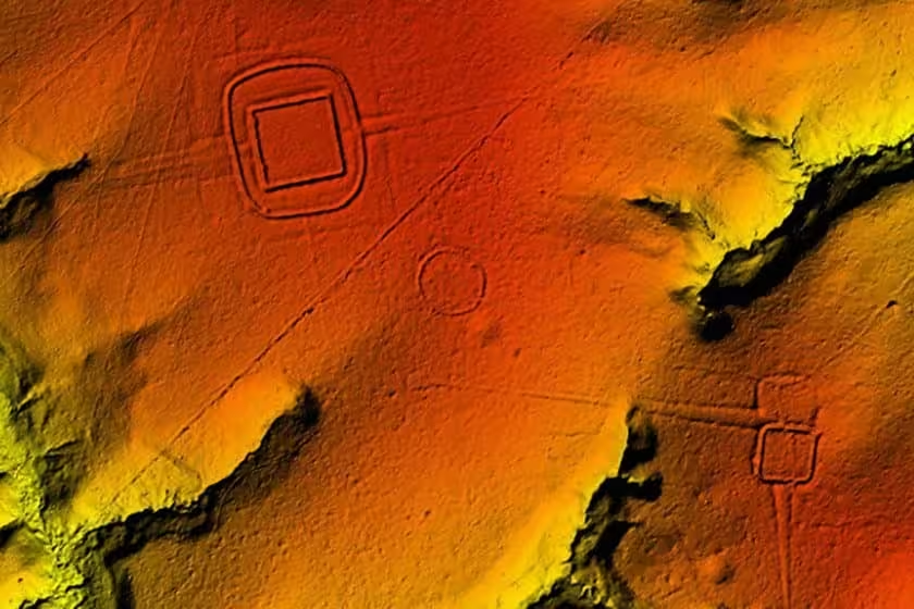
Village life centered on communal longhouses
Archaeologists infer that typical Aquiry settlements housed roughly 300 residents in shared longhouses, cultivating squash, maize, manioc, Brazil nuts and peach palms. The culture likely emerged around 600 B.C.E. and persisted for more than a millennium before its eventual decline.
Geoglyphs as ceremonial arenas
The earthworks themselves were not residential zones but appear to have functioned as venues for public gatherings, political deliberations, ritual performances and athletic contests, according to lead author Martti Pärssinen in an interview with NewScientist:
“venues for gatherings, political decision‑making and displays of chiefly generosity, ritual dancing, music, feasting, athletic competitions and ball games.”
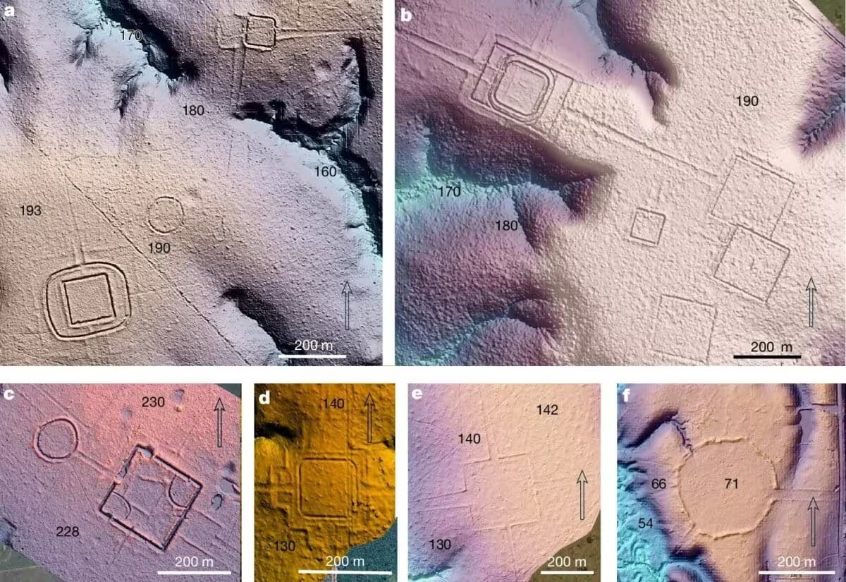
Scale and construction of the earthworks
Most geoglyphs cover about seven acres, though some extend up to 123 acres. Their designs range from simple circles and squares to intricate octagons and nested patterns, with ditches up to 40 feet wide and 16 feet deep—constructed without metal tools or draft animals.
Sudden abandonment and lingering mysteries
While roughly 1,700 geoglyphs have been catalogued, researchers estimate the total could reach 23,000–30,000, far exceeding earlier projections of around 10,000 for the entire Amazon. Pärssinen noted:
“We do not know why the geoglyphs were suddenly abandoned between A.D. 850 and 950,” adding that “the available evidence points to a relatively rapid collapse.” This timing aligns with declines in other pre‑colonial societies such as the Maya, Tiwanaku and Wari.
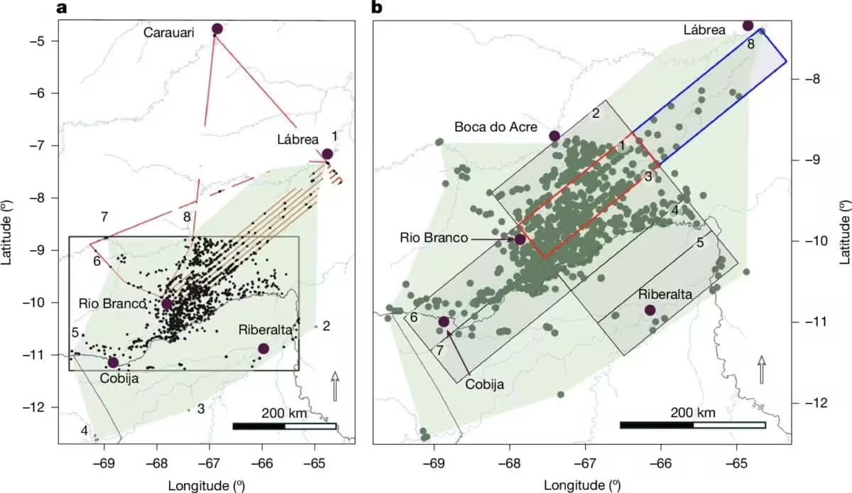
Scholarly reaction to the new population figures
Michael Heckenberger, an anthropologist at the University of Florida not involved in the study, described the revised estimates as “mind‑blowing” yet credible, emphasizing that much remains unknown about the broader landscape surrounding the earthworks and calling for further investigation.
This article has been fact checked for accuracy, with information verified against reputable sources. Learn more about us and our editorial process.
Last reviewed on .
Article history
- Latest version
Reference(s)
- Pärssinen, Martti., et al. “Over 20,000 precolonial earthworks in the Southwest Amazonia.” Nature, July 29, 2026 Springer Science and Business Media LLC, doi: 10.1038/s41586-026-10835-7. <https://doi.org/10.1038/s41586-026-10835-7>.
- <https://www.newscientist.com/article/2582152-lost-civilisation-in-the-amazon-may-have-numbered-3-million-people/>.
- “Michael Heckenberger.” <https://aiis.clas.ufl.edu/michael-heckenberger/>.
Cite this page:
- Posted by Vikram Desai