Scientists Have Found Earth’s Hidden 8th Continent, a Vast Sunken World Larger Than India Beneath the Pacific Ocean Floor
Ancient Earth maps missed a hidden Pacific landmass larger than India—discover the surprising tectonic truth behind this submerged giant.
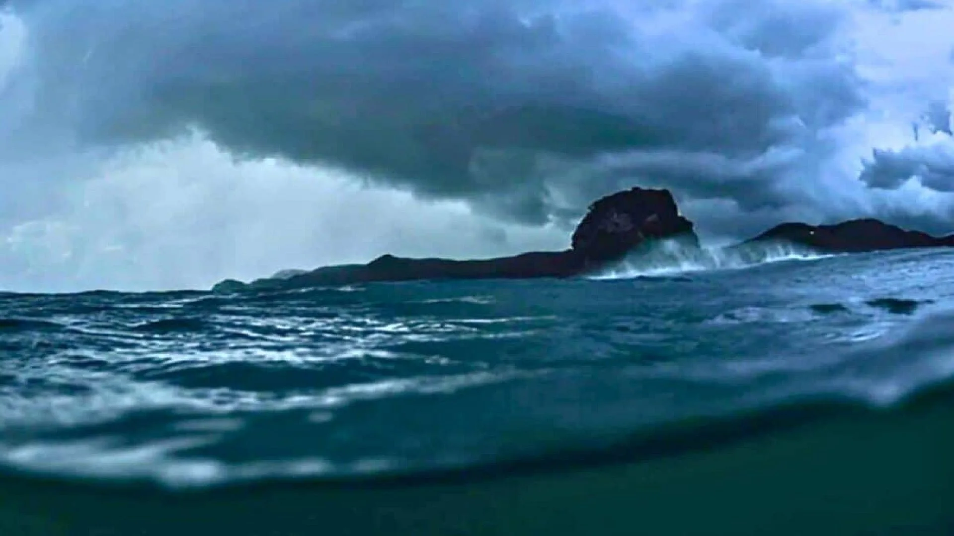
For many generations maps have displayed seven continents, but that picture has been quietly questioned since 2017, based on solid geological evidence rather than speculation.
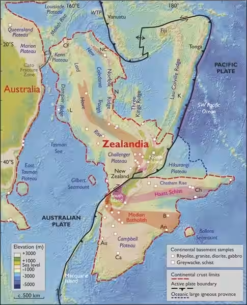
Hidden beneath the southwest Pacific lies a land area of roughly 1.9 million square miles—larger than India and about two‑thirds the size of Australia. It possesses its own crustal makeup, a distinct tectonic past, and even dinosaur fossils that date to a period after the region began to subside. Today only New Zealand, New Caledonia and a few minor islands emerge above sea level; the majority, up to 94 percent, remains concealed beneath the ocean.
The submerged continent is called Zealandia. In March 2017, eleven geologists presented a formal argument in the Geological Society of America’s journal GSA Today that it should be regarded as Earth’s eighth continent, not merely a fragment or a collection of islands.
Geological Evidence That Sets Zealandia Apart
Earlier surveys dismissed the area as scattered continental crust, but recent advances in satellite gravity mapping, detailed seafloor topography and deep‑sea drilling have allowed scientists to outline the entire submerged structure with unprecedented accuracy.
The data reveal a landmass that rises above the surrounding ocean floor, composed of silica‑rich rocks typical of continental interiors rather than the basalt that characterises oceanic plates. Its crust averages 20 kilometers thick, considerably thicker than the roughly 7 kilometers of oceanic crust, though still thinner than most continents. The underwater landscape of ridges, plateaus and basins forms a continuous, coherent block.
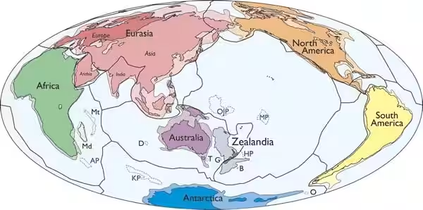
The 2017 authors wrote unequivocally: “Zealandia is not just a collection of continental fragments. It is a coherent continent and should be recognized as such.” Their statement remains the most compelling peer‑reviewed case for continental status.
The concept dates back further. In 1995, geophysicist Bruce Luyendyk coined the name Zealandia for the submerged region, reigniting debate over its classification. Even earlier, Sir James Hector suggested in 1895 that New Zealand represented the tip of a sunken continental ridge, a hypothesis largely overlooked at the time.
From Gondwana to the Deep Ocean
Zealandia once formed part of Gondwana, the ancient supercontinent that included Antarctica, Australia, South America, Africa and the Indian subcontinent. When Gondwana began to fragment over 100 million years ago, Zealandia split from what is now eastern Australia and experienced intense tectonic stretching. This strain thinned its crust, causing the landmass to gradually sink.
Estimates vary, but many researchers place the onset of submergence around 85 million years ago, with complete inundation possibly reached by 25 million years ago. Some scientists argue that portions of the continent stayed above water for a longer interval.
Fossil discoveries support a prolonged emergence. In New Zealand and the Chatham Islands, remains of sauropods, ankylosaurs and dinosaur-like predators have been unearthed—species that lived after Zealandia’s separation from Gondwana, indicating that parts of the continent remained habitable for millions of years. A dinosaur foot bone from the Chatham Islands, highlighted in a BBC Future feature on Zealandia, underscores the potential for additional buried treasures.
In 2017, an international crew aboard the research vessel JOIDES Resolution drilled more than 4,000 feet into the seabed at six locations across Zealandia. The recovered cores contained pollen, spores and microfossils typical of shallow marine or terrestrial settings, providing direct proof that sizable sections of the continent were once above sea level.
Implications for Resources and Earth Science
Recognizing Zealandia has practical ramifications. Under the United Nations Convention on the Law of the Sea, nations may claim an extended continental shelf beyond their standard Exclusive Economic Zones if they can demonstrate geological continuity. New Zealand’s claim, bolstered by the confirmed extent of Zealandia, could dramatically increase its entitlement to marine mineral deposits, seabed mining permits and potential hydrocarbon reserves.
Beyond economics, the submerged continent forces scientists to revisit concepts of plate tectonics and continental drift, especially in scenarios where landmasses have been heavily deformed or submerged over geologic time. Zealandia’s unique crustal characteristics offer a natural laboratory for studying how continents respond to prolonged tectonic stress.
This article has been fact checked for accuracy, with information verified against reputable sources. Learn more about us and our editorial process.
Last reviewed on .
Article history
- Latest version
Reference(s)
- “GSA Today - Zealandia: Earth’s Hidden Continent.” <https://www.geosociety.org/gsatoday/archive/27/3/article/GSATG321A.1.htm>.
- “TPRSNZ1895 28.2.7.1.” <https://paperspast.natlib.govt.nz/periodicals/TPRSNZ1895-28.2.7.1.10>.
- Gorvett, Zaria. “The missing continent that took 375 years to find.”, February 8, 2021 BBC <https://www.bbc.com/future/article/20210205-the-last-secrets-of-the-worlds-lost-continent>.
Cite this page:
- Posted by Vikram Desai