Scientists Mapping the Mediterranean for the First Time Found an Active Structure Still Moving Deep Under the Seafloor
A standard seafloor survey off Sicily revealed an anomaly that defied expectations. The discovery in the data not only alters existing charts but also compels specialists to reassess potential hazards.
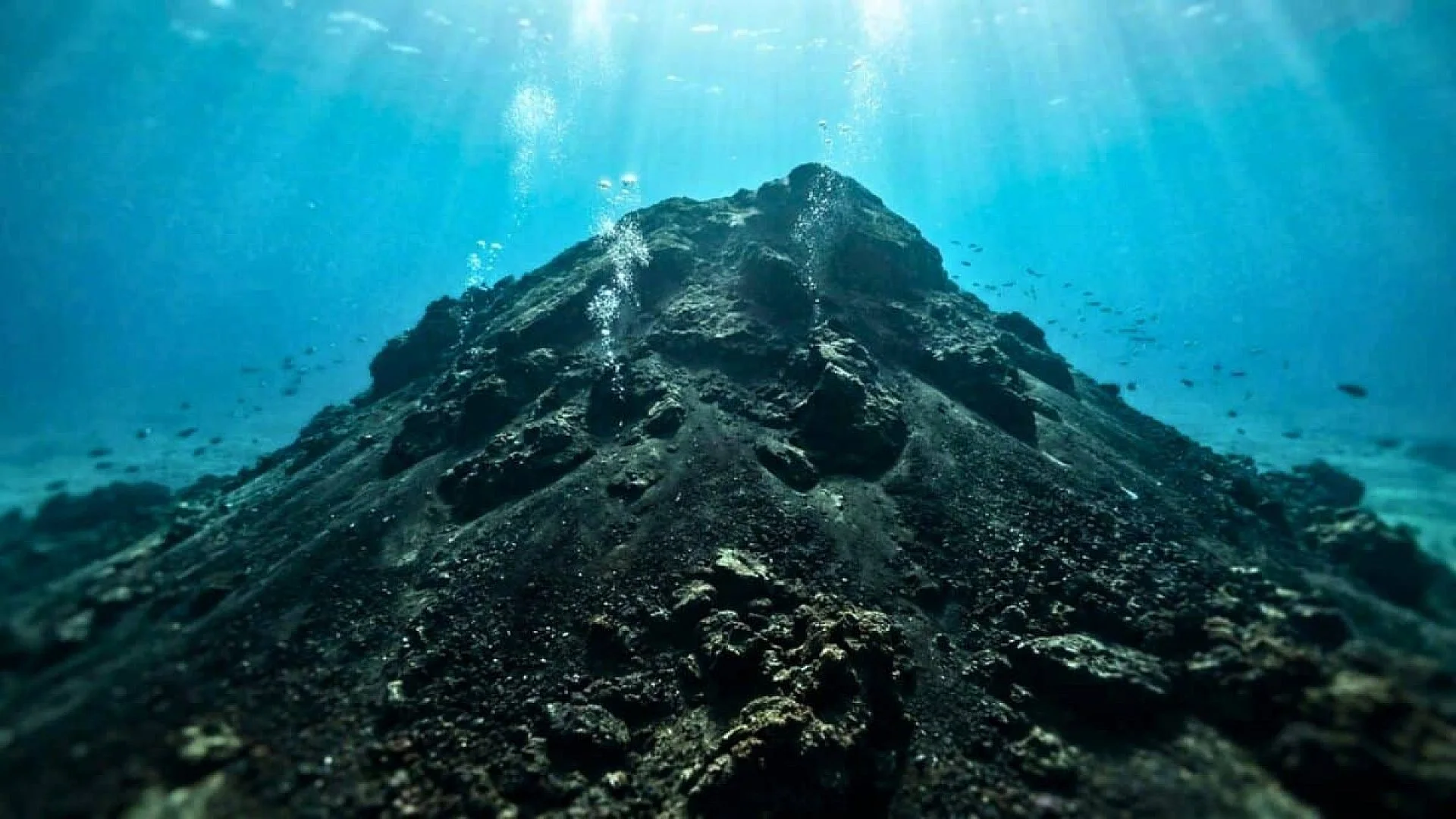
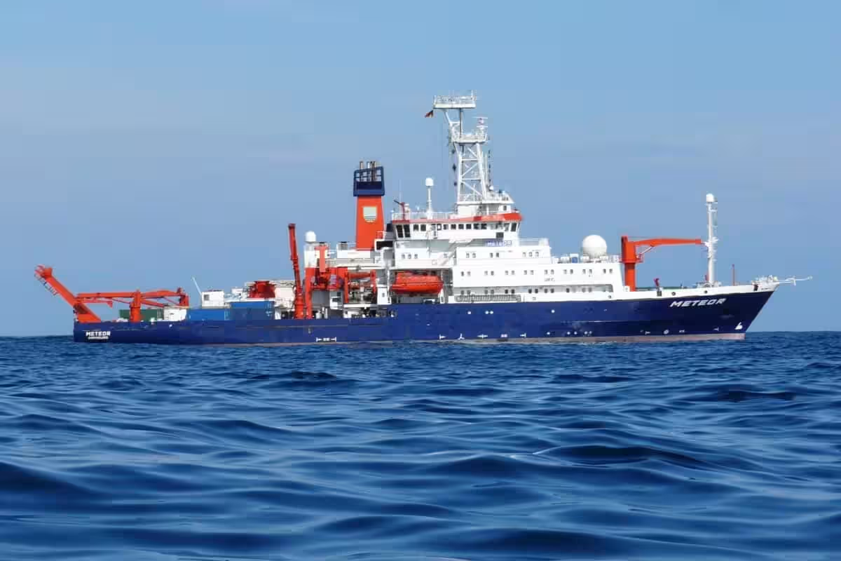
A geophysicist’s eyes widened as he stared at the screen aboard the research vessel METEOR. What he saw shouldn’t have been there – a hidden volcano emerging from the sonar data, barely six kilometers from the southwestern coast of Sicily. The rocky structure was wrapped in a solidified lava flow stretching four kilometers to the west.
That moment of astonishment belonged to Emanuele Lodolo, a researcher at Italy’s National Institute of Oceanography and Experimental Geophysics (OGS). “We were quite surprised about this, because we were really very close to the coast,” he said. The edifice, named Actea, was one of six volcanoes recently discovered during mapping of the Sicily Channel, a busy shipping lane off the island’s southwestern coast.
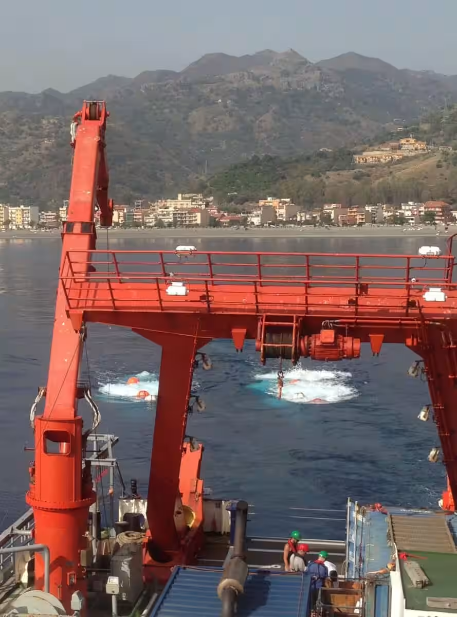
The expedition, called M191 SUAVE (Submarine Volcanism in the Western Sicilian Channel), brought together scientists from the GEOMAR Helmholtz Centre for Ocean Research in Kiel, the Monterey Bay Aquarium Research Institute (MBARI), Italy’s OGS and Victoria University of Wellington. For three weeks, they worked aboard the German research vessel METEOR, scanning the Mediterranean floor.
They deployed a multibeam echosounder and a magnetometer to map volcanic structures both exposed on the seafloor and buried in sediment. The survey uncovered three volcanic centers at least six kilometers wide and 150 meters high – the height of the Tour Montparnasse in Paris. Entirely underwater. Entirely absent from existing geological models.
The Old Maps Were Wrong
The real jolt came from something the team didn’t expect. Many seafloor features that predictive bathymetry had flagged as seamounts, and that geologists had long interpreted as volcanic edifices, turned out to be either nonexistent or entirely non-magmatic in origin. The theoretical map had failed in both directions – missing real volcanoes and inventing phantom ones.
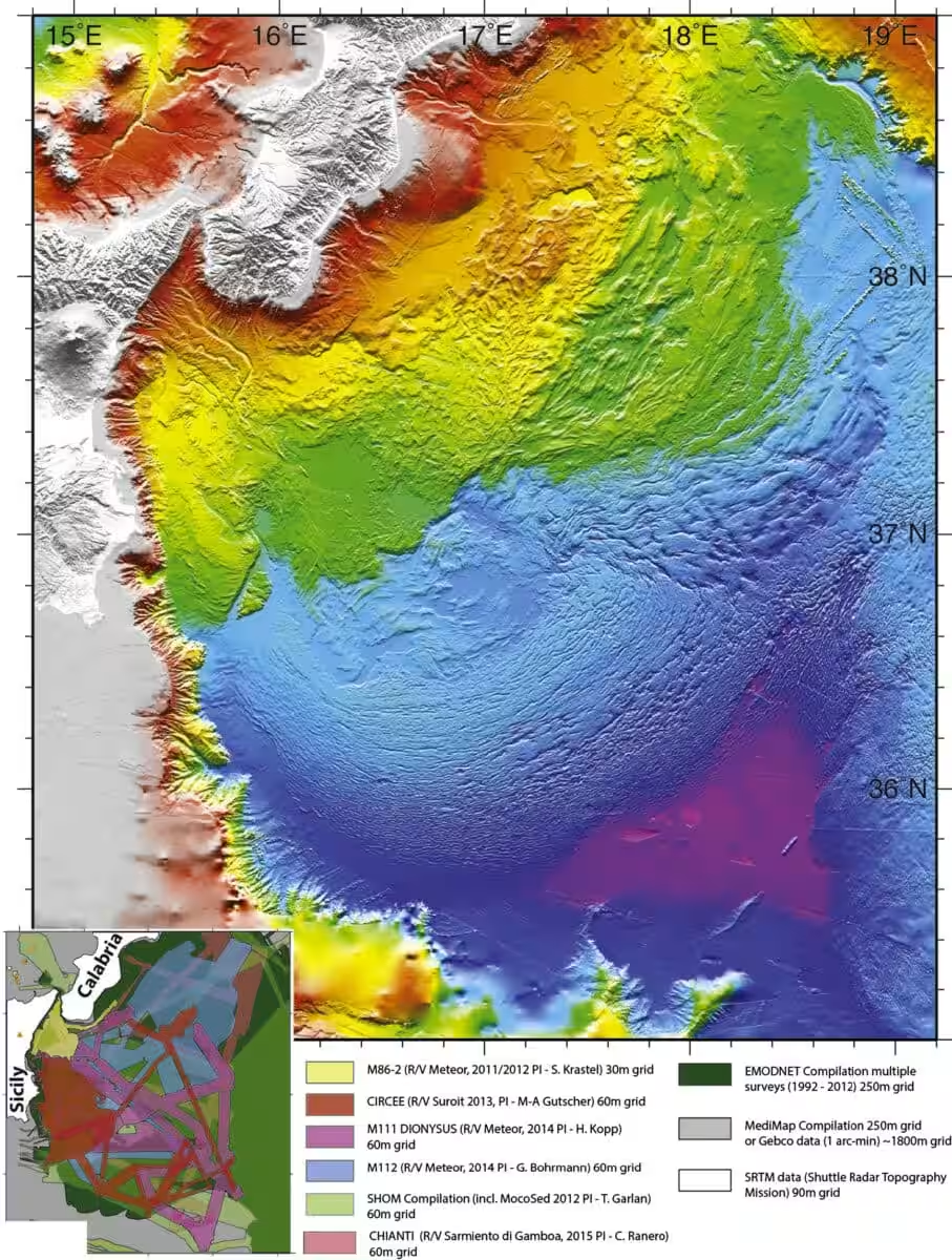
Scientists still understand volcanism in passive continental rifts less clearly than in other tectonic settings. The western Sicily Channel sits in the central Mediterranean, a zone of pronounced crustal extension where volcanic forms cluster tightly along extensional faults. That complexity made the area difficult to read without high-resolution mapping.
The new survey reset the picture. The team compared their multibeam data point by point against older predictive models. Feature after feature on previous maps either dissolved under scrutiny or proved to have no magmatic origin. Meanwhile, entirely new structures, including Actea and its five companions, appeared clearly for the first time. Earlier work published in Earth and Planetary Science Letters had documented active tectonics in the Calabrian subduction zone to the northeast, but the western Sicily Channel remained far less understood until this expedition.
A Volcano Breathing at the Shoreline’s Edge
Among all the newly identified edifices, Actea draws the sharpest focus. It is the closest to shore, resting on the northern sector of the Capo Granitola fault zone. It sits at depths between 62 and 70 meters. Its summit rises to just 34 meters below sea level. That is shallower than many diving spots crowded with swimmers each summer.
Actea alone carries signs of magmatic reactivation, probably occurring sometime between the Last Glacial Maximum and the early post-glacial rise in sea level. A substantial, recently emplaced lava flow supplies the evidence. A central question remains open. Actea and its volcanic neighbor Climene share an intriguing trait: bubbles stream from their craters.
Without chemical samples of those bubbles, pinning down their source is impossible. They could signal biogenic activity venting methane. They could also indicate hydrothermal circulation. The finding shows that magmatic and hydrothermal processes are still active in both ancient and recent volcanic terrains. The seafloor here is not dead geology. It is a system that breathes, quietly, out of sight.
A related ScienceDaily report has noted that the wider region sits on an active plate boundary where tectonic stresses continue to accumulate, though the newly mapped volcanic field introduces hazards separate from the earthquake threats studied before.
Ferdinandea Already Showed What the Channel Can Do
This patch of Mediterranean has already demonstrated its capacity for surprise. In July 1831, the submarine cone of Ferdinandea began erupting. It built a volcanic island roughly 65 meters above sea level, less than 300 meters wide, with a perimeter approaching one kilometer. An island surfaced from nowhere, midway between Sicily and Tunisia.
While England, France, Spain, and the Kingdom of the Two Sicilies scrambled to claim it, the sea had other plans. The cone, made of tephra easily chewed apart by wave action, sank rapidly once the eruption stopped. By January 1832 it was gone. The island has broken the surface four times in recorded history. The diplomatic fight ended without resolution, swallowed before anyone could settle it.
The channel is shallow by Mediterranean standards. When volcanic pressure builds sufficiently, the gap between a submarine eruption and a surface event narrows to tens of meters, not kilometers. Ferdinandea’s summit now sits just six meters below the surface, a hidden hazard for vessels with deeper keels. Italian authorities moved early. In 2000, military divers planted a Sicilian flag on the submerged peak to forestall any new sovereignty claims if the island rises again.
What Changes Now
Finding submerged volcanoes this close to densely settled Sicilian coastlines drives home how little is known about the submerged terrain near shore. It also sharpens the urgency of assessing volcanic risk for heavily populated coastal zones. The risk extends to infrastructure. Communication cables and gas pipelines cross this seafloor.
Sample analysis from these volcanic structures helps researchers piece together the region’s geological past and feeds directly into hazard protection planning, particularly for seabed infrastructure. The study proposes a revised tectono-magmatic framework for the Sicily Channel. It emphasizes how faults control where volcanoes form and how they evolve. The work lays a foundation for future geochronological and geochemical campaigns targeting the timing, sources, and life cycle of volcanism in this active rift setting.
More than 80 percent of the planet’s volcanic activity happens underwater. The Mediterranean carries millions of ferry passengers a year, sits under hundreds of daily flights, and hosts pipelines and data cables that route a significant share of internet traffic between Europe and Africa. That its depths are only now receiving serious high-resolution mapping, well into the 21st century, says something about what remains unknown on the planet people inhabit.
This article has been fact checked for accuracy, with information verified against reputable sources. Learn more about us and our editorial process.
Last reviewed on .
Article history
- Latest version
Reference(s)
- Gutscher, Marc-André., et al. “Active tectonics of the Calabrian subduction revealed by new multi-beam bathymetric data and high-resolution seismic profiles in the Ionian Sea (Central Mediterranean).” Earth and Planetary Science Letters, vol. 461, March 1, 2017, pp. 61-72. Elsevier BV, doi: 10.1016/j.epsl.2016.12.020. <https://www.sciencedirect.com/science/article/abs/pii/S0012821X16307336?via%3Dihub>.
- “Southern Italy: Earthquake hazard due to active plate boundary.” ScienceDaily <https://www.sciencedaily.com/releases/2017/01/170124111527.htm>.
Cite this page:
- Posted by Vikram Desai