Mysterious Robot Submarine Maps Hidden Teardrop Formations on Dotson Ice Shelf Before Vanishing
A robot submarine discovered strange terraces, teardrop pits and hidden fractures under Antarctic ice before disappearing on its next mission.
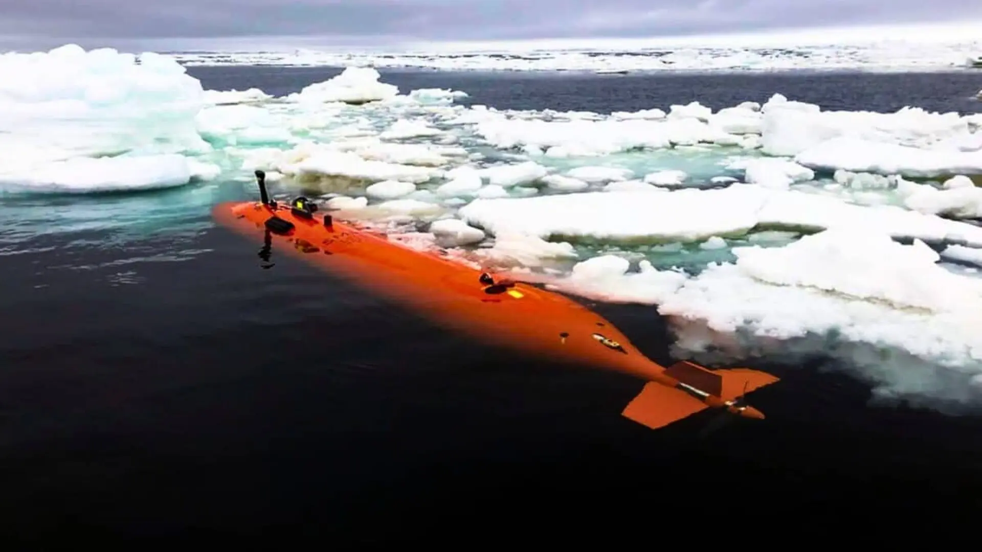
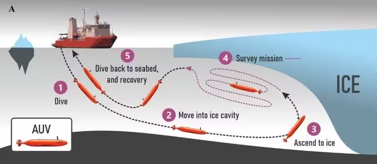
Beneath a thick slab of Antarctic ice, an orange‑painted autonomous submarine named Ran slipped through a maze that no satellite or surface ship could trace. The seven‑meter vehicle followed a pre‑programmed itinerary under the Dotson Ice Shelf, operating out of contact with the research vessel that deployed it. Once it entered the hidden cavity, scientists could only await its return.
During the 2022 austral summer, Ran spent 27 days navigating the sub‑ice void, covering more than 1,000 km of distance and descending to a record depth of 17 km beneath the shelf. Equipped with an upward‑looking sonar, the robot recorded currents, temperature and salinity, while some missions lasted beyond a full day under ice up to 500 m thick.
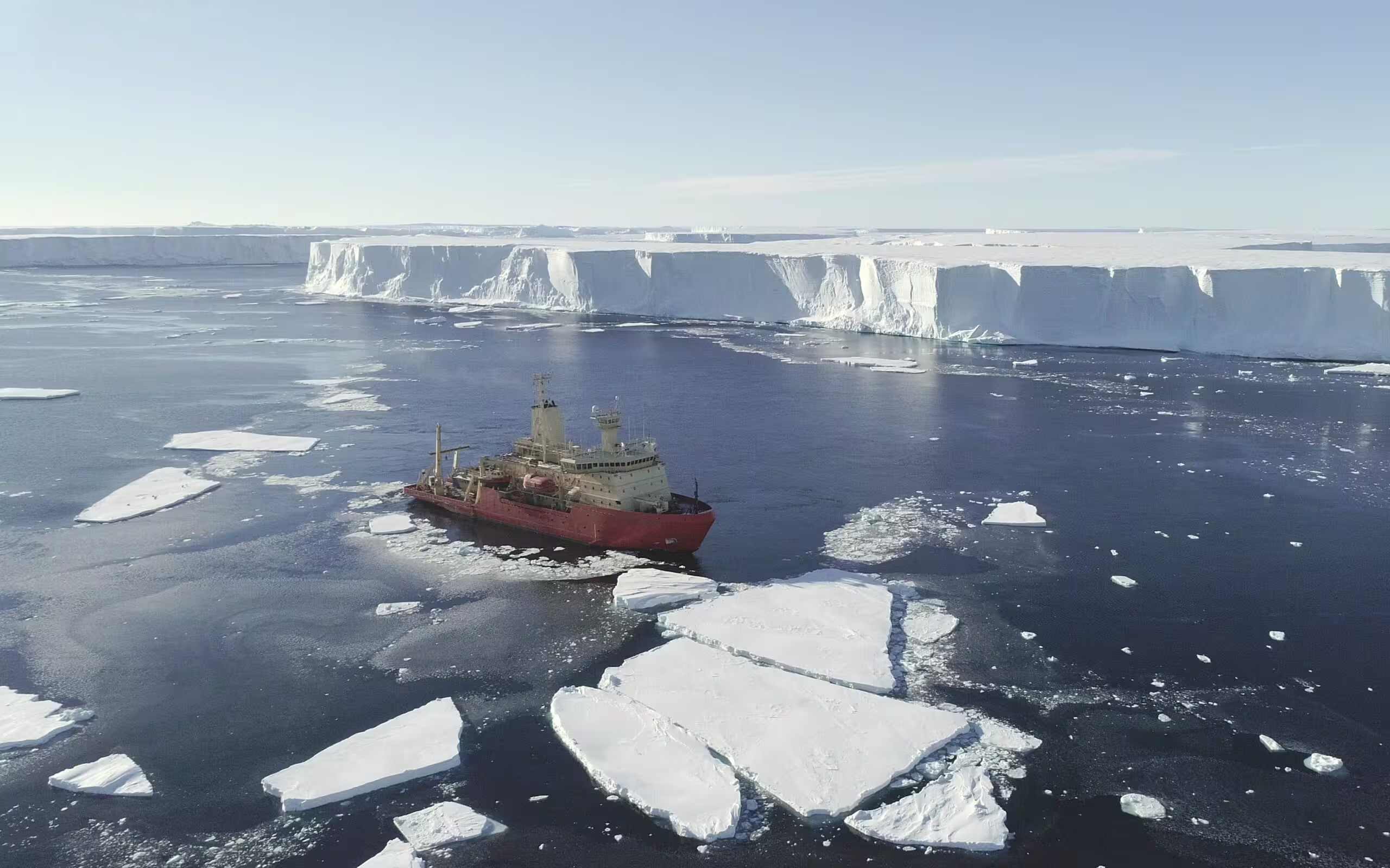
The expedition was led by Professor Anna Wåhlin of the University of Gothenburg, working with the International Thwaites Glacier Collaboration and partner institutions. Their aim was to image the ice underside directly, rather than infer its shape from surface observations. A follow‑up mission in January 2024 was cut short when Ran completed a single dive before failing to surface.
Sub‑Ice Sonar Maps Reveal Hidden Terrains
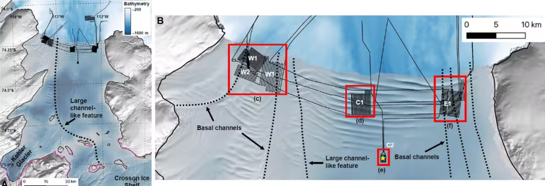
Data collected in 2022 exposed features that surface surveys missed. Ran’s multibeam sonar generated six high‑resolution mosaics spanning roughly 140 km² of the ice base, unveiling terraces, channels, fractures, smooth erosion zones and previously unseen formations. The Science Advances study led by Wåhlin highlighted stark contrasts in melting patterns across the same shelf.
In the eastern and central sectors, the base displayed flat terraces ranging from 200 to 2,000 m in width, bounded by steep faces 0.5–5 m high. Some terraces formed multi‑level stacks with reliefs of 5–40 m, patterns the team linked to slower melting, localized convection and intermittent warm‑water intrusions.
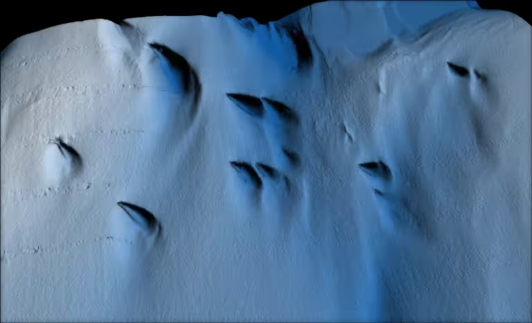
Conversely, the western portion appeared smoother and more eroded, dotted with clusters of teardrop‑shaped depressions invisible from the surface. The study measured an average width of 68 m for these features, with individual spans ranging from 20 to 170 m.
Rapid Currents Accelerate Melting on the West Side
Current measurements indicated sluggish flows of 0.01–0.04 m s⁻¹ in the central and eastern zones, while the western outflow, rich in meltwater, surged to 0.25 m s⁻¹. This faster stream coincided with basal melt rates of roughly 15 m yr⁻¹.
Wåhlin’s team attributed the intensified erosion to shear‑driven turbulence and the intrusion of modified Circumpolar Deep Water, a warm water mass that can melt ice from below. The teardrop depressions were confined to this high‑velocity region, suggesting that frictional forces and Coriolis effects within a 5–15 m thick boundary layer may sculpt the asymmetric shapes.
Beyond the teardrop features, Ran also traced full‑thickness fractures, some of which widened and eroded at their bases. Satellite archives referenced in the research showed that the oldest fractures in one sector first emerged at the surface in the 1990s, while newer cracks were only a few years old when mapped.
Another Sub‑AUV Confirms Complex Mixing Patterns
A 2025 investigation published in Ocean Science offered a complementary perspective. Led by Maren Elisabeth Richter of the University of East Anglia, the team deployed an AutoSub Long Range vehicle, gathering over 100 km of seabed tracks and measuring current speed and turbulent mixing. Their findings revealed stark spatial variability in mixing intensity across the cavity.
Background turbulent dissipation hovered around 10⁻¹⁰ W kg⁻¹, with localized hotspots reaching 10⁻⁸ W kg⁻¹. Average vertical heat fluxes were near 0.1 W m⁻², while peak values surged to 52 W m⁻². Enhanced mixing aligned with zones where currents accelerated along slopes, vertical shear intensified, and the seabed steepened.
The authors linked these mixing dynamics to broader trends in West Antarctic ice loss. Citing a 2019 mass‑balance analysis by Eric Rignot et al., they noted that Dotson contributed approximately 0.6 mm to global mean sea‑level rise between 1979 and 2017, and that warm deep water can penetrate the cavity to reach grounding lines.
Ran’s Final Mission Ends in Mystery
The opportunity to verify the 2022 sonar maps with a repeat survey vanished in February 2024 when Ran failed to surface after its scheduled dive. Extensive acoustic sweeps, helicopter overflights and drone searches yielded no trace, leading researchers to conclude that the vehicle remains trapped deep beneath the ice.
Consequently, the 2022 expedition stands as the most detailed exploration of Dotson’s hidden cavity. The study demonstrated that convection, turbulence, warm‑water incursions, fractures and boundary‑layer dynamics can each imprint distinct signatures on the same ice shelf, with mapped features extending up to 17 km beneath the surface.
This article has been fact checked for accuracy, with information verified against reputable sources. Learn more about us and our editorial process.
Last reviewed on .
Article history
- Latest version
Reference(s)
- Wåhlin, Anna., et al. “Swirls and scoops: Ice base melt revealed by multibeam imagery of an Antarctic ice shelf.” Science Advances, vol. 10, no. 31, August 2, 2024 American Association for the Advancement of Science (AAAS), doi: 10.1126/sciadv.adn9188. <http://www.science.org/doi/10.1126/sciadv.adn9188>.
Cite this page:
- Posted by Divya Iyer