LiDAR Reveals 396 Hidden Amazon Geoglyphs Suggesting Ancient Civilization of Millions
Newly mapped geoglyphs expose the vast scale of an ancient civilization that reshaped southwestern Amazonia.
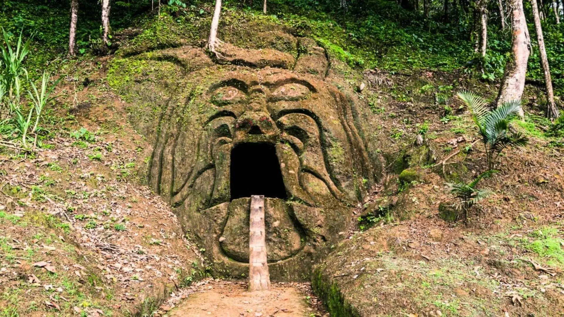
When viewed from above, the southwestern Amazon looks like a continuous green blanket. Yet once the forest floor is examined, a network of ditches, raised banks and straight pathways outlines circles, squares and rectangles that are invisible amid the dense vegetation.
Researchers employed laser pulses that penetrated gaps in the canopy, allowing the reflected signals to generate high‑resolution maps of the ground. These scans uncovered monumental earthworks created by societies that inhabited parts of modern‑day Brazil, Bolivia and Peru more than two thousand years ago.
The project identified 396 previously unknown geoglyphs across an area of roughly 4,500 square kilometers. By extrapolating the density of sites found in the surveyed zones, the authors of a Nature study estimate that upward of 20,000 related earthworks could be hidden throughout the broader region.
Laser Scanning Reveals Hidden Shapes Under the Canopy
The team relied on LiDAR—light detection and ranging—to investigate terrain that conventional aerial photography cannot resolve. An aircraft emits millions of laser pulses toward the surface; some travel between leaves and branches before striking the soil.
Specialized software records the time each pulse takes to return, converting those measurements into a three‑dimensional model of the landscape. By digitally stripping away the vegetation, archaeologists can discern shallow depressions, embankments, platforms and roads that would otherwise blend into the forest floor.
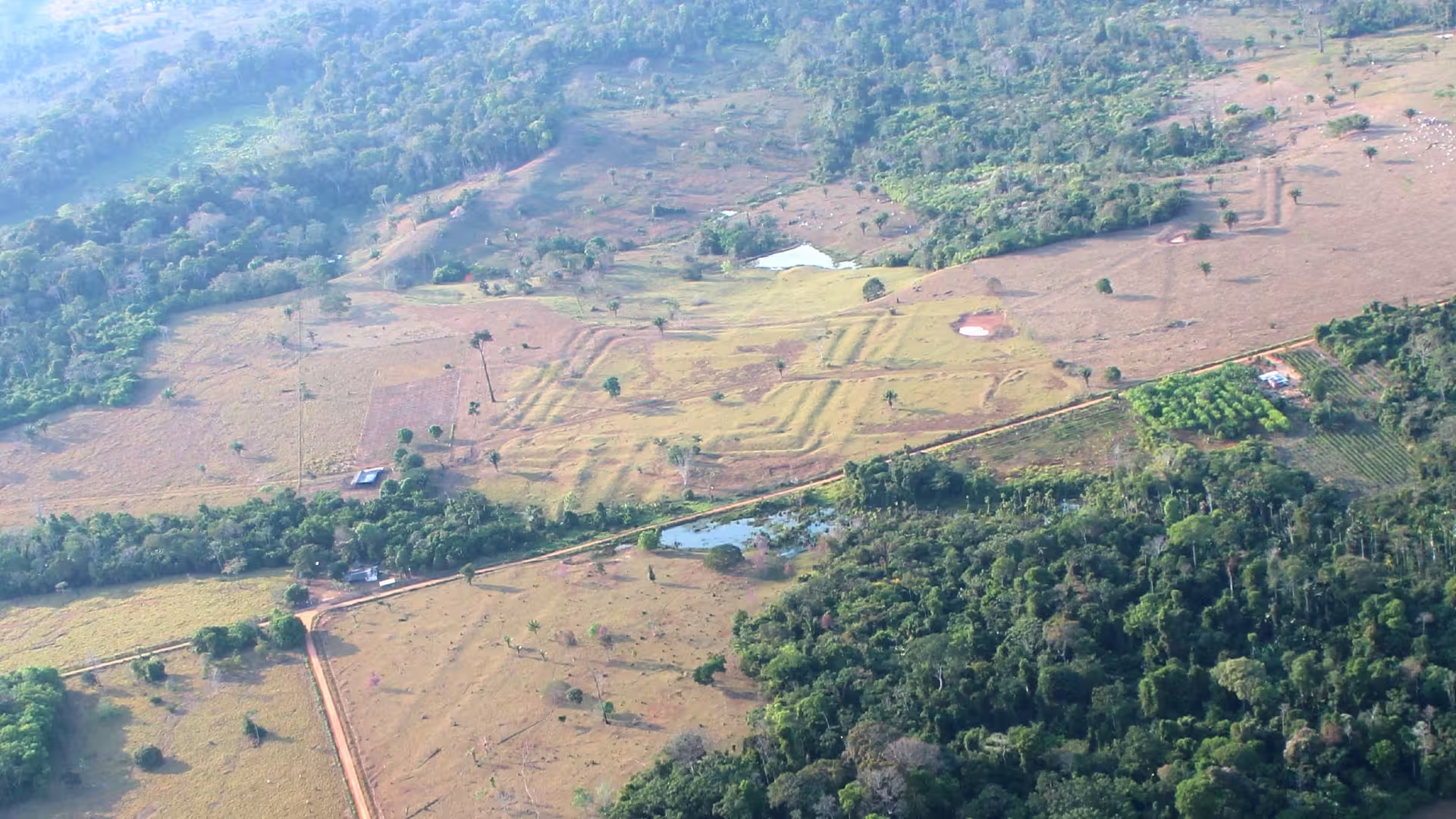
The survey spanned nearly 1,740 square miles of southwestern Amazonia, documenting circular and rectangular enclosures, connecting avenues, entryways and other deliberately engineered features formed by excavating soil and piling it along perimeter edges.
Thick foliage still limited detection in certain locales, as not every laser pulse reached the ground. Moreover, large portions of the region remain unmapped, meaning the recorded structures represent only the fraction visible within the surveyed sectors.
Ancient Aquiry Society Constructed Monumental Sites
Archaeologist Martti Pärssinen of the University of Helsinki refers to the multicultural group responsible for many of the earthworks as the Aquiry civilization, a name derived from the Acre River that translates to “river of caimans” in an Indigenous Arawakan tongue.
“The peoples that made up the Aquiry shared a common worldview and erected ceremonial hubs using a variety of monumental geometric forms,” Pärssinen told Live Science. He noted that the constructions feature deep ditches bordered by high outer embankments.
Construction activity spanned roughly from 600 B.C. to A.D. 850. Inhabitants lived in multi‑family longhouses clustered around the ceremonial hubs, cultivating maize and squash while also exploiting fish, game, nuts, palms and other forest resources.
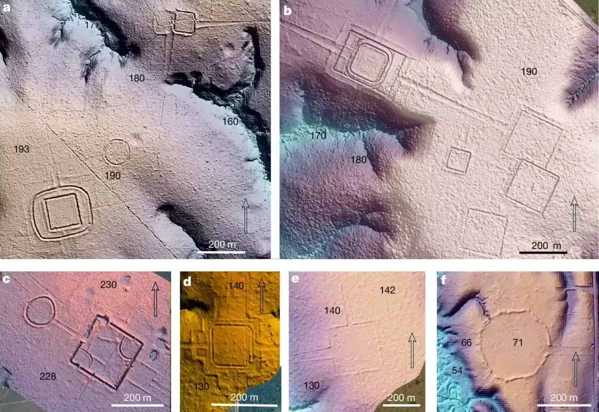
These enclosed spaces hosted communal gatherings, political deliberations and public feasts where chiefs distributed food to demonstrate generosity. Pärssinen also linked the sites to networks of neighboring groups and to spiritual beings acknowledged in local belief systems.
Earlier investigations had already recognized that these formations were part of a broader regional building tradition. A study of geometric earthworks in Acre’s Rio Branco region documented planned structures in upland forests away from major waterways, underscoring a widespread architectural practice.
Monument Count Suggests Large Aquiry Population
Prior to the latest LiDAR campaign, researchers had recorded roughly 1,700 geoglyphs across the area. The new dataset enabled the Nature team to compare zones of high and low monument density and to model how many sites might exist in unsurveyed terrain.
Their calculations produce an estimate of between 24,000 and 30,000 earthworks throughout southwestern Amazonia. About two‑thirds of these may belong to the Aquiry period, although the total fluctuates based on assumptions about site distribution and the extent of vegetation cover.
To gauge the labor force required, the authors applied an average of roughly 300 individuals per earthwork, combined with radiocarbon chronologies that indicate how many monuments were likely active simultaneously.
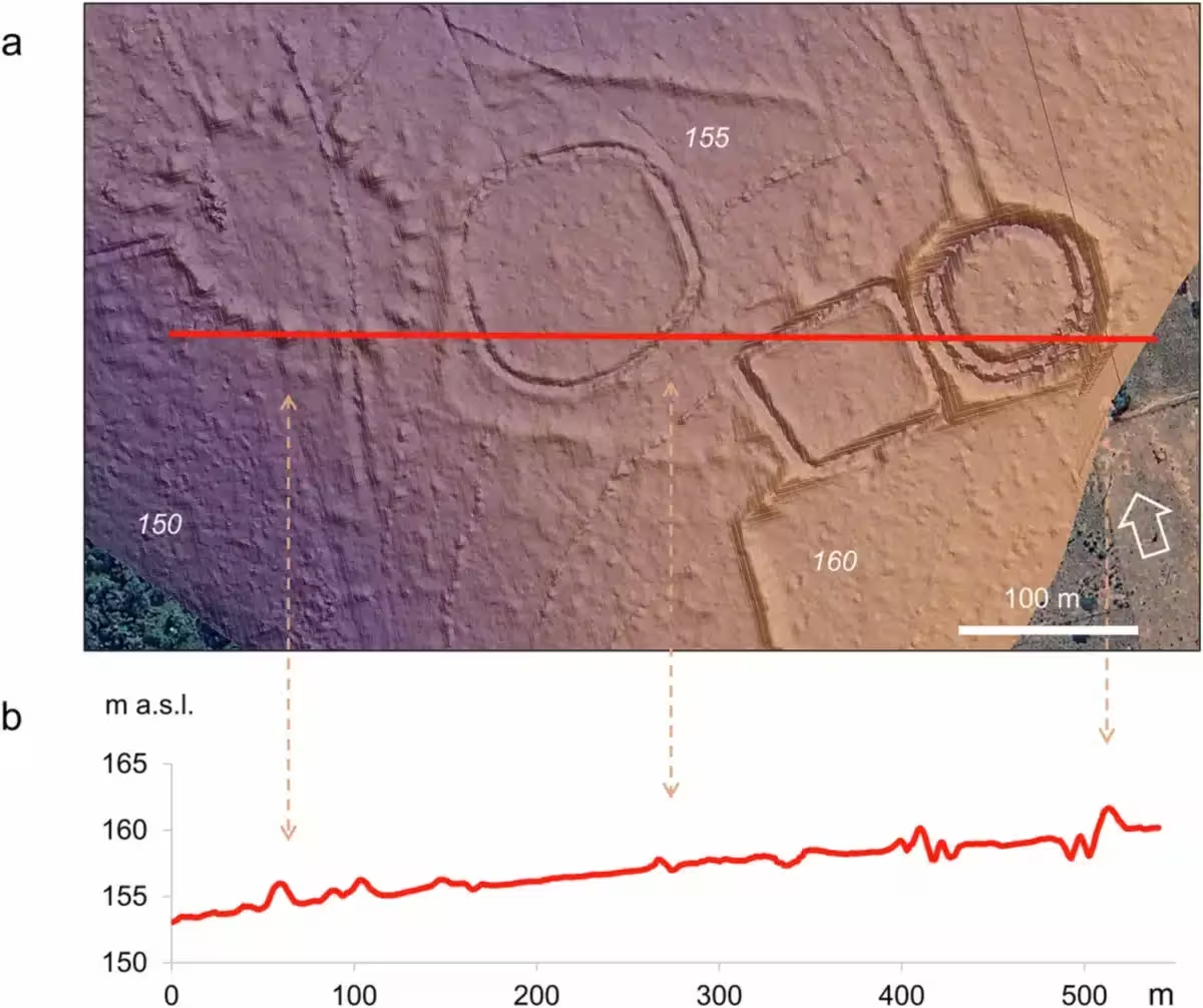
The model places the demographic peak of the Aquiry civilization between A.D. 100 and 300. During that interval, an estimated 1.25 million to 3 million people may have inhabited the cultural sphere defined by the monuments.
These figures represent modeled approximations rather than direct counts. They integrate the number of earthworks, construction requirements, evidence from nearby settlements, occupation chronologies and comparative data from well‑studied archaeological and ethnographic cases.
Interconnected Earthworks Shaped a Vast Landscape
The geoglyphs do not constitute a random assortment of identical structures. Their creators employed multiple geometric plans, positioned entrances deliberately, and laid out straight avenues that linked enclosures to surrounding territories.
Research from the University of Helsinki indicates that some ceremonial pathways began as wide as 15 to 40 meters before narrowing away from the earthworks, reflecting a design that integrated public space, food production and inter‑community communication in ancient Amazonian earthwork roads.
Occasionally, scholars have drawn parallels with Peru’s Nazca Lines, which feature animal, plant and humanlike figures alongside geometric motifs. The two traditions are separated by roughly 1,700 kilometers and emerged in distinct cultural and ecological settings.
“The Nazca geoglyphs represent a different phenomenon and were probably unrelated to the Aquiry civilization,” Pärssinen explained, adding that the straight roads, lines and geometric designs of both cultures are best appreciated from an aerial perspective.
Archaeological evidence dates the abandonment of Aquiry ceremonial centers to around A.D. 850 to 950. After the sites fell out of use, the encroaching forest gradually obscured many of the banks, ditches and pathways that once defined the landscape.
This article has been fact checked for accuracy, with information verified against reputable sources. Learn more about us and our editorial process.
Last reviewed on .
Article history
- Latest version
Reference(s)
- Pärssinen, Martti. “Over 20,000 precolonial earthworks in the Southwest Amazonia - Nature.”, July 29, 2026, pp. 1-6. Nature, doi: 10.1038/s41586-026-10835-7. <https://www.nature.com/articles/s41586-026-10835-7>.
- “Martti Pärssinen.” University of Helsinki Research Portal <https://researchportal.helsinki.fi/en/persons/martti-p%C3%A4rssinen/>.
- Killgrove, Kristina. “Lasers reveal hundreds of geoglyphs made by a mysterious civilization in the Amazon rainforest thousands of years ago.”, July 29, 2026 Live Science <https://www.livescience.com/archaeology/americas/lasers-reveal-hundreds-of-geoglyphs-made-by-a-mysterious-civilization-in-the-amazon-rainforest-thousands-of-years-ago>.
- Pärssinen, Martti. “Geometrically patterned ancient earthworks in the Rio Branco region of Acre, Brazil: New evidence of ancient chiefdom formations in Amazonian interfluvial terra firme environment.”, January 1, 2003, pp. 97-133. University of Helsinki Research Portal <https://researchportal.helsinki.fi/en/publications/geometrically-patterned-ancient-earthworks-in-the-rio-branco-regi/>.
- Kalliola, Risto. “Ancient Amazonian Earthwork Roads: Unveiling Ceremonial, Livelihood, and Networking Significances.”, April 14, 2026 University of Helsinki Research Portal, doi: 10.1017/laq.2025.10168. <https://researchportal.helsinki.fi/en/publications/ancient-amazonian-earthwork-roads-unveiling-ceremonial-livelihood/>.
Cite this page:
- Posted by David Anderson