LiDAR Reveals Massive 2,500-Year-Old Maya City El Yesal Deep In Mexico Jungle
Archaeologists unveil the first detailed study of a hidden Maya city deep in the jungle, revealing its secrets after centuries of burial.
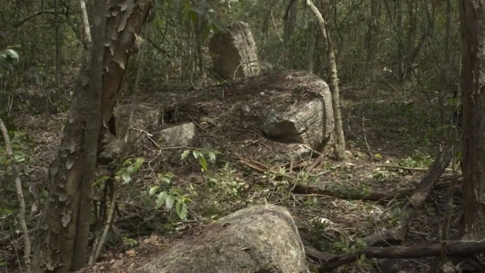
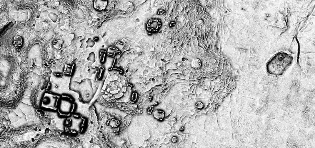
Deep within the Balam Kú Biosphere Reserve of Campeche, Mexico, archaeologists have mapped a sprawling Maya settlement that predates 600 BC. The site, named El Yesal, encompasses more than a square kilometre of pyramids, plazas, terraces and other urban features, confirming the existence of a major city that thrived for over two millennia.
The hidden complex first emerged from airborne LiDAR surveys, which pierced the dense canopy to reveal the outlines of ancient architecture. Although the area had attracted only brief field visits before, the recent systematic study has documented its full extent.
The investigation was coordinated by Professor Ivan Šprajc of the Slovenian Academy of Sciences and Arts, under a programme approved by Mexico’s National Institute of Anthropology and History (INAH). Šprajc highlighted El Yesal as one of the largest known Maya urban centres in the Central Lowlands.
Gigantic Ceremonial Platform Redefines City’s Scope
Excavations centered on a massive ceremonial precinct built around a “Great Acropolis,” a square platform roughly 150 metres on each side and rising about 15 metres above the surrounding terrain. Four pyramidal structures crown the platform, with the tallest reaching 27 metres above its surface.
Architectural analysis links the acropolis to other prominent Maya sites. Archaeologist Atasta Flores Esquivel noted parallels with Edzná, especially features associated with the Petén tradition during the Early Classic and earlier Preclassic periods.
Test pits within the Great Acropolis and the adjacent North Acropolis recovered pottery fragments attributed to the Mamom and Chicanel phases. These finds place the foundation of the settlement between roughly 600 BC and AD 200, during the Middle to Late Preclassic era.
Peak Development During the Late Classic
Evidence suggests a pronounced expansion between AD 600 and 900, when new plazas, sizable structures and artificial terraces were added, especially in the northern sector of the site.
Researchers also identified hill‑top complexes featuring embankments and terraces that may have served defensive functions, hinting at a fortified urban layout.
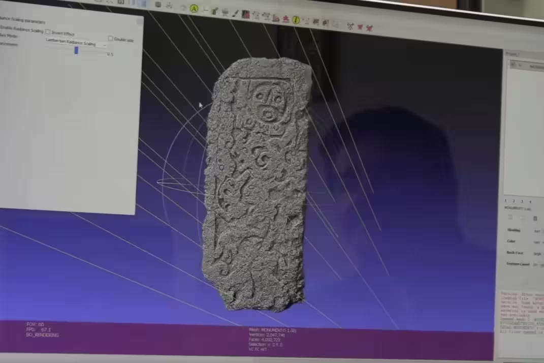
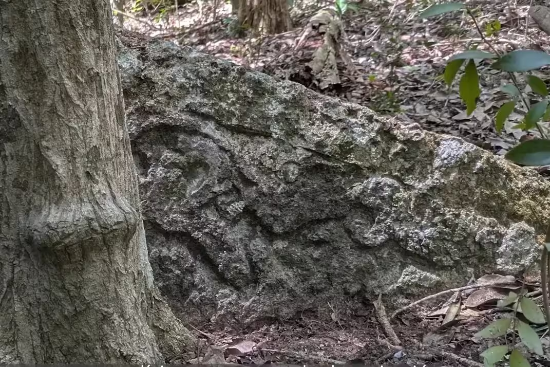
A weathered stone stela, captured through high‑resolution photogrammetry, revealed a ruler clutching a ceremonial staff and wearing a headdress associated with Yopaat, the Maya storm god. Although erosion erased much of the original carving, the digital reconstruction offers a rare glimpse of elite iconography at El Yesal.
Market‑Like Arrangements Suggest Economic Activity
Adjacent to the Great Acropolis, archaeologists uncovered clusters of low, elongated structures arranged in rectangular and circular patterns. These “nested complexes” resemble the Chiik Nahb area at Calakmul and are interpreted as possible market districts, shedding light on the city’s commercial organization.
The project received logistical support from the Balam Kú Biosphere Reserve, a component of the Great Maya Forest Biocultural Corridor established in 2025 to link protected zones across Mexico, Guatemala and Belize. Findings reported by INAH provide a foundation for future research into El Yesal’s connections with neighboring centres such as Calakmul, Balamkú and Uitzilná, and underscore the untapped archaeological wealth concealed within the reserve.
This article has been fact checked for accuracy, with information verified against reputable sources. Learn more about us and our editorial process.
Last reviewed on .
Article history
- Latest version
Reference(s)
- “Šprajc – Podiplomska šola ZRC SAZU.” <https://ps-zrc-sazu.org/kdosmo/sprajc/?lang=en>.
- <https://www.researchgate.net/profile/Atasta-Esquivel>.
- “Bautizan como Minanbé, “no hay camino”, a ciudad maya virgen al norte de la Biosfera de Calakmul.”, June 22, 2026 <https://inah.gob.mx/boletines/bautizan-como-minanbe-no-hay-camino-a-ciudad-maya-virgen-al-norte-de-la-biosfera-de-calakmul>.
Cite this page:
- Posted by Vikram Desai