Archaeologists Discover Hidden 2,400 Year Old Structure Using Underground X Ray Tech
Archaeologists are using non-invasive underground signals to finally decode the mysteries of an ancient, enigmatic fortress in Calabria without digging.
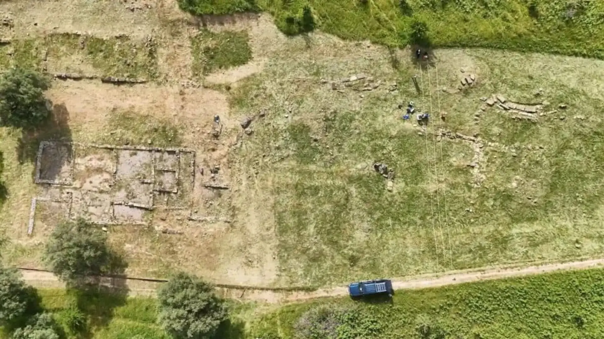
Archaeologists from the University of Catania have unveiled hidden structural remains beneath the surface of Castiglione di Paludi, a pivotal Hellenistic site in Italy’s Cosenza province. By employing advanced geophysical techniques, the team successfully mapped long-lost architectural features without removing a single layer of soil, preserving the site’s delicate stratigraphy for future study.
The settlement, established during the 4th century BC, has long been a subject of historical debate. Scholars have frequently questioned whether the site was founded by Greek colonists from Magna Graecia or by the indigenous Bruttian population. With its orderly street grid, monumental gateways, and defensive walls, the site stands as a testament to complex urban planning, yet its true cultural origin remains obscured by time.
A Fortress Guarding Ancient Mysteries
Castiglione di Paludi is defined by its massive fortification circuits and a central road, known as the plateia, which served as the city’s primary artery. A particularly enigmatic element of the site is a degraded, central structure that disrupts this main road at its midpoint. Researchers believe this edifice likely served a public or sacred function, and identifying its exact purpose could be the key to understanding how Hellenistic influence permeated this region of the Western Mediterranean.
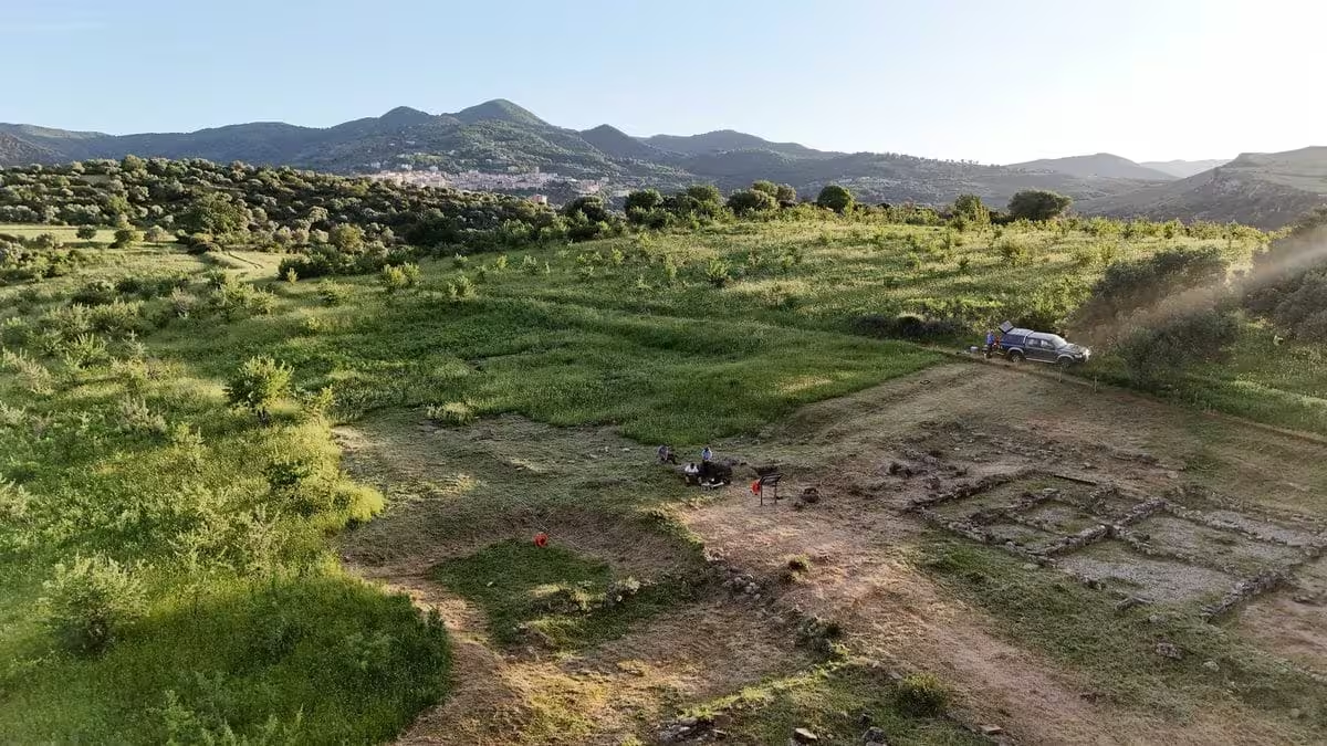
To investigate the site, experts from the University of Catania’s Departments of Humanistic Sciences and Biological, Geological, and Environmental Sciences utilized non-invasive sensing methods. The team conducted Electrical Resistivity Tomography (ERT) to detect variations in soil conductivity, which often signal the presence of buried stone foundations or man-made debris. This was paired with high-precision magnetometry to identify subtle fluctuations in the Earth’s magnetic field caused by subsurface architectural remnants.
Mapping the Subsurface
The survey focused on two primary zones, utilizing a grid-based approach with GPS localization to ensure accuracy. The process involved running eleven parallel scan lines in each area, with magnetometry sensors positioned 2.30 meters apart to capture detailed magnetic signatures. This data was then processed to create a 3D model of the terrain, allowing the team to “see” through the ground.
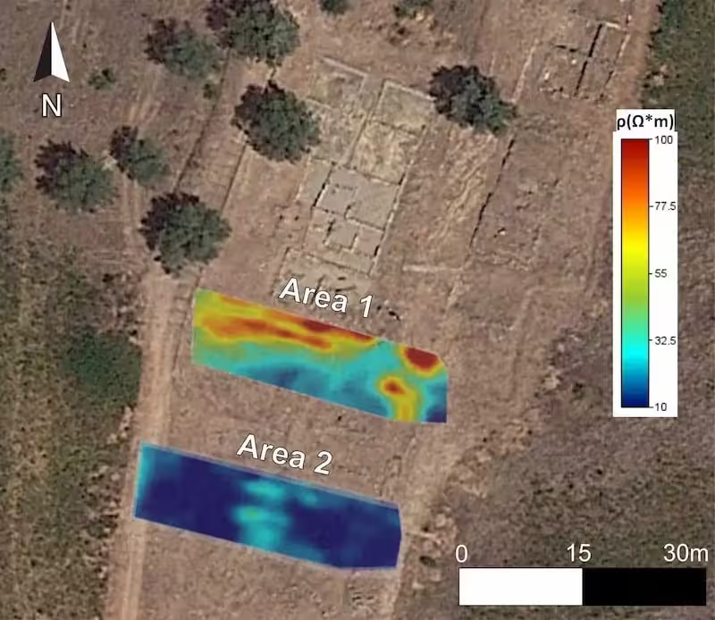
The results provided distinct signatures for the two zones. In Area 1, the University of Catania researchers identified clear, high-resistivity anomalies between 1.5 and 2 meters below the surface, which align with evidence of buried masonry. These findings were strongly corroborated by the magnetic gradient data. Conversely, Area 2 showed relatively uniform resistivity and stable magnetic readings, suggesting a lack of significant structural remains in that specific sector.
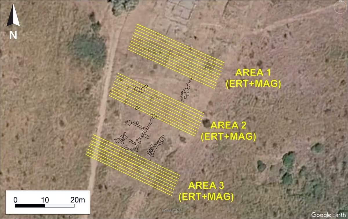
By confirming the presence of a buried structure in Area 1 through these geophysicalmethods, the team has established a precise roadmap for future archaeological excavations, ensuring that upcoming physical exploration can be targeted and efficient.
This article has been fact checked for accuracy, with information verified against reputable sources. Learn more about us and our editorial process.
Last reviewed on .
Article history
- Latest version
Reference(s)
- “Geofisica e archeologia svelano i segreti di Castiglione di Paludi | UnictMagazine.”, August 1, 2026 <https://www.unictmagazine.unict.it/geofisica-e-archeologia-svelano-i-segreti-di-castiglione-di-paludi>.
Cite this page:
- Posted by Vikram Desai