Satellite Radar Uncovers 2,600-Year-Old Hidden Temple Beneath Egypt’s Ancient City Buto
Scientists uncover a massive buried structure under Egypt’s Nile Delta, sparking debate over its identity and potential clues from recent discoveries.
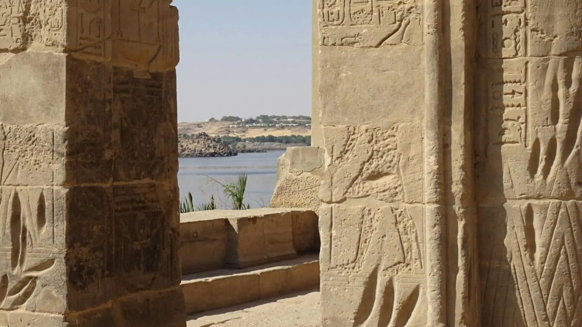
Archaeologists have identified a massive subterranean building dating to roughly 2,600 years ago beneath the historic Egyptian settlement of Buto in the Nile Delta. Initial digs revealed mud‑brick walls and a suite of cultic objects, bolstering the hypothesis that the hidden edifice served as a temple during the 26th Dynasty.
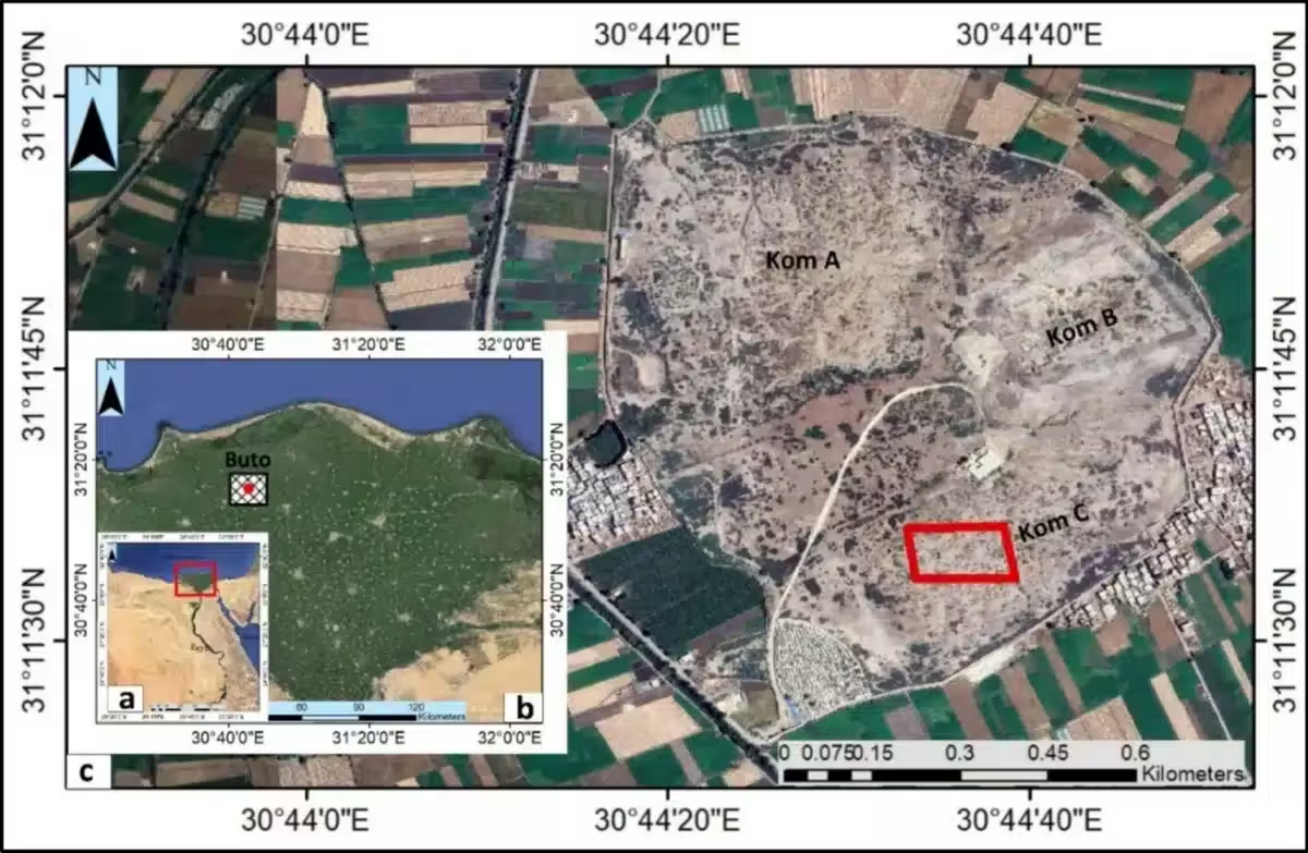
The find lies at Tell el‑Fara’in, the archaeological site commonly referred to as Buto, which first emerged around 5,600 years ago in Egypt’s Predynastic era. Over millennia, the city endured cycles of destruction and rebuilding, while successive layers of mud and sediment eventually concealed some of its earliest structures.
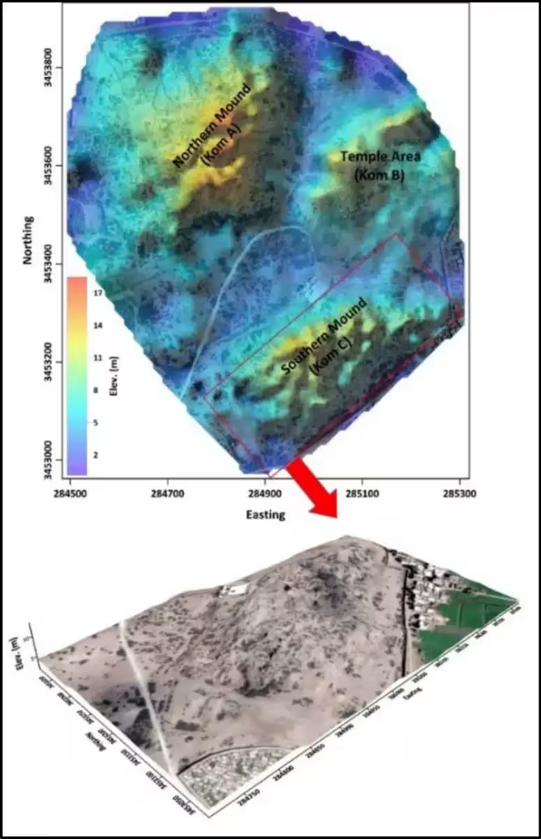
Given the site’s complex stratigraphy, researchers turned to a combination of satellite radar data and electrical resistivity tomography (ERT) to pinpoint buried architecture without extensive surface excavation.
Six‑Metre‑Deep Structure Mapped by Radar and ERT
The team began by analysing Sentinel‑1 C‑band imagery captured on 5 May 2018, processing the data with SNAP 9.0.0 to locate large‑scale anomalies that could indicate hidden constructions.
Those anomalies guided the placement of ERT survey lines. By injecting low‑frequency electrical currents into the ground and measuring variations in conductivity, the researchers generated three‑dimensional models of subsurface features.
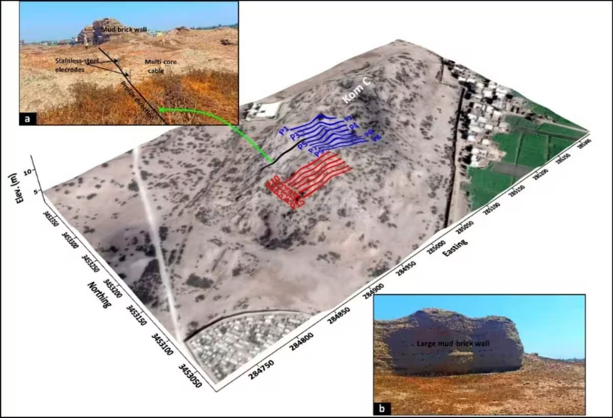
Within the upper three metres, the scans highlighted a layer interpreted as broken pottery and debris, likely linked to Roman‑period occupation. At roughly six metres depth, the ERT data revealed a substantially larger construction, consistent with a Saite‑era (26th Dynasty) feature.
Religious Artifacts Hint at Temple Identity
A focused 10 × 10 metre trench exposed mudbrick walls that matched the geophysical signatures. Among the recovered items were a small offering basin, numerous amulets depicting deities such as Isis, Horus, Taweret, and Wadjet, and a bronze pendant bearing a child‑Horus motif.
Additional finds included amulets representing a crouching lion and Anubis, fragmented limestone statues described as being in erotic poses, and a faience plaque bearing twin reliefs of Hathor. A steatite scarab inscribed with the name of King Thutmose III also emerged from the layer.
The study, published in Applied Geophysics, concluded that the assemblage of cultic objects strongly supports the interpretation of the buried complex as a temple dating to the 26th Dynasty.
“Collectively, these artefacts indicate the presence of a religious site with strong cultic and ceremonial associations, further reinforcing the interpretation of the structure as a temple from the 26th Dynasty,” the researchers wrote.
Remote Sensing Validates Multi‑Phase Occupation
Beyond the artefactual evidence, the project showcases the power of integrating satellite remote sensing with ground‑based electrical measurements in archaeologically layered contexts.
The authors highlighted the role of three‑dimensional inversion algorithms in revealing buried mudbrick walls and structural outlines, emphasizing the method’s precision in detecting concealed settlements.
“The results of this study demonstrate the effectiveness of combining geophysical measurements and remote sensing data,” the team explained, noting that the approach offered “a very accurate vision in detecting buried settlements in a complex region.”
The investigators recommend further ERT surveys to explore deeper occupation phases at Buto and suggest that another, as yet unidentified, temple may lie beneath a thick clay stratum.
“Our findings suggest that, in addition to the known temple, another temple may remain buried under a thick clay layer,” they added.
While additional surveys will clarify the full extent of the underground complex, the current evidence from the limited trench strongly points to the remains of an ancient temple beneath the historic city of Buto.
This article has been fact checked for accuracy, with information verified against reputable sources. Learn more about us and our editorial process.
Last reviewed on .
Article history
- Latest version
Reference(s)
- Abouarab, Mohamed A. R.., et al. “Multi-scale detection of buried archaeological elements across different occupation phases: an integrated approach using radar satellite imagery and electric resistivity tomography at Buto, northwestern Nile Delta of Egypt.” Acta Geophysica, vol. 74, no. 2, March 10, 2026 Springer Science and Business Media LLC, doi: 10.1007/s11600-026-01809-4. <https://link.springer.com/article/10.1007/s11600-026-01809-4>.
Cite this page:
- Posted by Vikram Desai