Scientists Capture Subduction Zone Mid‑Collapse Off Vancouver Island as Plate Drops 5 km
Scientists uncover a massive crack under Vancouver Island that splits the crust and exposes a hidden collapse never seen before.
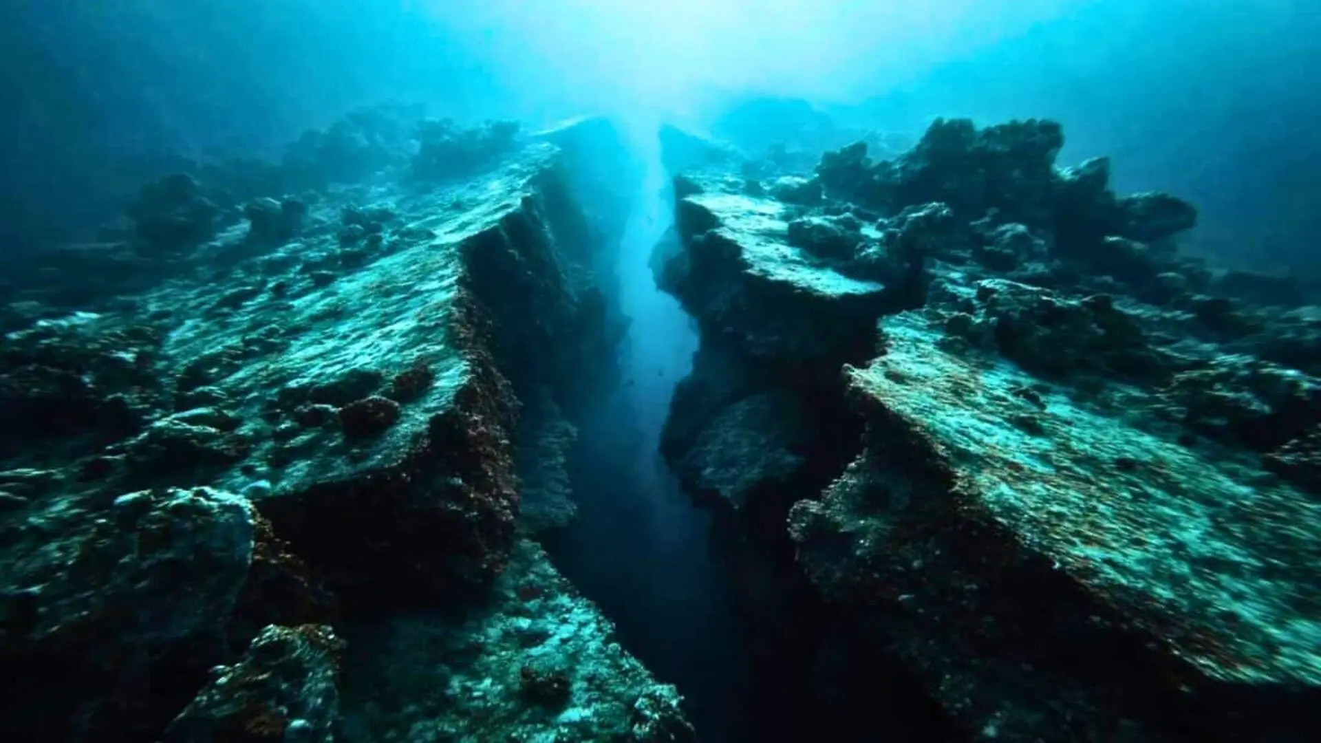
A fresh acoustic survey off the coast of Vancouver Island has revealed a section of the oceanic crust that has subsided roughly five kilometres along a fault that appears ready to rupture completely. The research team used sound‑wave imaging to map the seafloor within the northern Cascadia subduction zone, where the Juan de Fuca and Explorer plates descend beneath the North American continent. Their findings, reported in Science Advances, offer the most detailed view so far of a subduction system caught in the act of termination.
Subduction zones develop wherever one tectonic plate slides beneath another, driving the planet’s biggest earthquakes and the most explosive volcanic eruptions while slowly dragging ancient crust back into the mantle.
Geologists have long debated how these immense systems finally cease, because a never‑ending subduction process would eventually consume the oceans and pile continents together. The new seafloor images from off Vancouver Island address part of that puzzle by showing the Juan de Fuca plate separating in fragments rather than snapping in a single event.
Acoustic Survey Uncovers a Five‑Kilometre Drop in the Subducting Slab
The data were collected during the 2021 Cascadia Seismic Imaging Experiment (CASIE21), conducted from the R/V Marcus G. Langseth, a research vessel operated by Lamont‑Doherty Earth Observatory. The expedition was directed by Lamont scientist Suzanne Carbotte, who also co‑authored the new paper with colleague Anne Bécel.
To peer beneath the ocean floor, the crew emitted acoustic pulses into the seafloor and captured the returning signals with a 15‑kilometre‑long streamer of hydrophones. This seismic reflection technique works like a medical ultrasound for the Earth’s interior, delivering high‑resolution images of hidden faults and cracks. Researchers from Lamont‑Doherty, Louisiana State University, Auburn University, the University of Texas at Austin, and other institutions are currently analyzing the dataset.
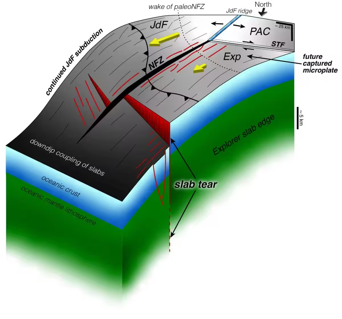
Analysis of the acoustic images uncovered several tears cutting through the descending slab, including a major fracture where the plate has dropped about five kilometres. Brandon Shuck, an assistant professor at Louisiana State University who led the study while a postdoctoral researcher at Lamont, emphasized that the data provide a rare glimpse of a subduction zone in the middle of its breakup rather than a reconstruction after the fact.
“We now have a clear snapshot of a subduction system in the process of dying,” Shuck explained. “Instead of a single catastrophic failure, the plate is fragmenting incrementally, generating smaller microplates and new boundaries. It resembles a train losing cars one at a time rather than a sudden derailment.”
Silent Segments of a 75‑Kilometre Fracture Indicate Completed Plate Separation
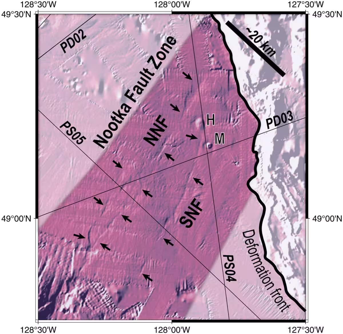
Seismic monitoring along the fault offered an independent line of evidence. Over the 75‑kilometre‑long rupture, certain stretches still produce modest earthquakes, while adjacent portions have become seismically quiet. That quiet is not a data gap; it signals that those rock blocks have already detached, because a fully separated piece no longer scrapes against its neighbour.
“When a fragment breaks away completely, it stops generating earthquakes since the rocks are no longer locked together,” Shuck noted. The silent sections likely represent plate fragments that have drifted away from the part still being pulled beneath the continent.
The primary fault where the slab dropped five kilometres remains only partially detached. “A large fault is actively tearing the subducting plate,” Shuck said. “It isn’t fully separated yet, but it is close.” Scientists describe this overall behavior as episodic or piecewise termination: instead of a single massive split, the plate separates in a series of steps.
Each tearing episode unfolds over millions of years, but together they can gradually halt an entire subduction system. As individual fragments detach, the remaining slab loses part of the downward pull that drives its subduction, much like a train losing momentum as cars are uncoupled. Over many such events, the cumulative loss of force can eventually stall the whole process.
Fragmented Remnants of Extinct Plates Align With the Observed Breakup Pattern
Carbotte highlighted that geologists have known for decades that subduction can cease when a buoyant segment of oceanic crust reaches the trench, yet witnessing the breakup in real time has been elusive. “We have not previously had such a vivid view of the process in action,” she said. “These observations improve our grasp of the life cycle of tectonic plates.”
The piecewise pattern documented off Vancouver Island also sheds light on scattered plate fragments identified elsewhere, such as the fossil microplates of the Farallon plate that once subducted beneath North America before disappearing beneath Baja California. Previously, those fragments were interpreted as evidence of a dying subduction zone, but the mechanism behind their formation remained uncertain. Cascadia now supplies a live example, demonstrating that subduction zones unwind gradually, leaving behind microplates as a record of their disassembly.
Implications for Seismic Risk as Fault Tears Influence Rupture Propagation
The new structural details do not alter the fundamental assessment that the Pacific Northwest can still generate very large earthquakes and tsunamis, a hazard established by decades of research independent of this work. What the acoustic images add is a finer‑scale map of faults and fractures embedded within the plate.
Scientists are now examining whether a major rupture could cross one of these tears or whether the gaps might act as barriers that limit the spread of seismic slip. Refining this understanding is expected to enhance the models used to evaluate earthquake risk across the region. The CASIE21 survey was funded by the National Science Foundation, and the extensive dataset continues to be scrutinized by researchers seeking to clarify how such structural complexities shape seismic behavior in the Pacific Northwest.
This article has been fact checked for accuracy, with information verified against reputable sources. Learn more about us and our editorial process.
Last reviewed on .
Article history
- Latest version
Reference(s)
- Shuck, Brandon., et al. “Slab tearing and segmented subduction termination driven by transform tectonics.” Science Advances, vol. 11, no. 39, September 26, 2025 American Association for the Advancement of Science (AAAS), doi: 10.1126/sciadv.ady8347. <https://www.science.org/doi/10.1126/sciadv.ady8347>.
- Day, Adrienne. “Only 270 Million Square Kilometers to Go: The R/V Marcus G. Langseth Helps Map the World’s Oceans.”, June 27, 2024 State of the Planet <https://news.climate.columbia.edu/2024/06/27/only-270-million-square-kilometers-to-go-the-r-v-marcus-g-langseth-maps-the-worlds-oceans/>.
Cite this page:
- Posted by Vikram Desai