NISAR Radar Reveals Hidden Crevasses Around Antarctic Mountain What Optical Images Miss
New satellite data debut shows first Antarctic image, uncovering hidden details beneath the ice.
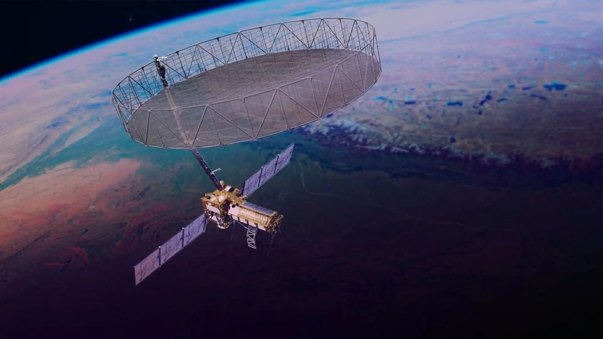
The NASA‑ISRO Synthetic Aperture Radar (NISAR) mission has delivered a radar snapshot of an Antarctic nunatak and the surrounding glacier that reveals surface details far beyond the reach of conventional optical satellites.
Instead of relying on visible light, NISAR emits microwave pulses and records the echoes that bounce back from the ground. This approach works day and night, penetrates clouds and can see through snow, providing continuous coverage of the planet’s most remote regions.
After a year of instrument testing and calibration, the mission opened its data archive to the public on 20 July 2026, supplying researchers worldwide with a steady flow of measurements from land and ice surfaces.
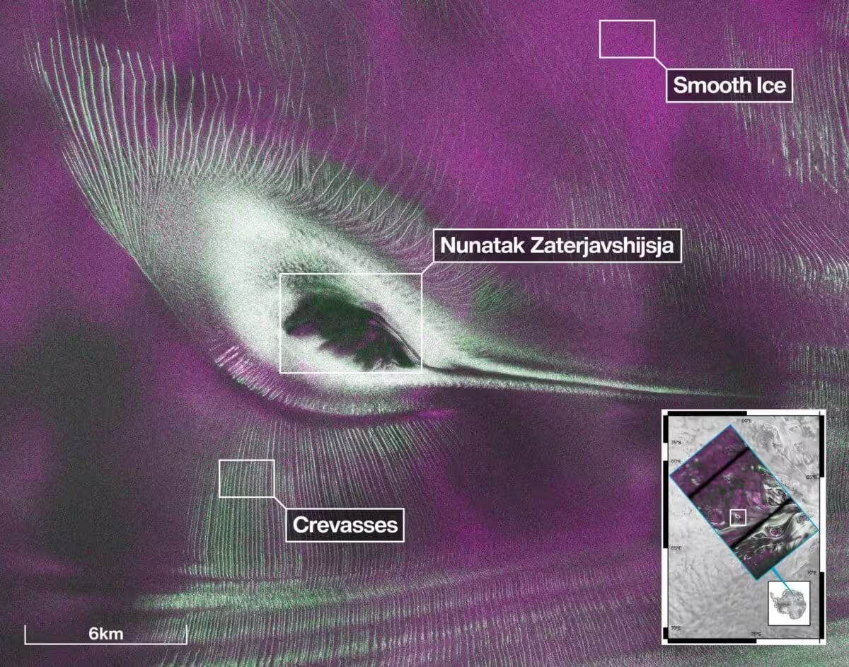
Among the earliest publicly released images is a radar view of Nunatak Zaterjavshijsja, a rocky outcrop in East Antarctica that juts out of a seaward‑flowing glacier. The picture uncovers fractures and internal ice structures that remain elusive in standard photographs.
Radar Uncovers Hidden Crevasse Networks in Antarctic Ice
The nunatak image was generated from L‑band radar data collected in August 2025 during the satellite’s testing phase. The surrounding ice appears broken into a web of sharp green lines that mark crevasses, while smoother sections are rendered in magenta tones.
Crevasses form as the glacier is forced around the exposed rock, building stress that cracks the ice. In the radar composite, those cracks show up as bright green features; smoother ice surfaces reflect the signal and appear magenta. According to NASA, the image was processed by signal‑analysis engineer Seongsu Jeong, who highlighted the unique insights radar can provide.
“First, it’s a beautiful image, with rich details of features that provide insights to how the glacier is moving,” Jeong said. He also noted that: “because radar can often see through snow and deep into the ice, NISAR can observe fundamentally different properties of Antarctic ice than can be seen in optical imagery. With NISAR we’re seeing what’s hidden beneath the surface.”
In the color scheme, magenta denotes relatively smooth facets that cause specular reflection, while green signals volume scattering caused by the radar penetrating snow or bouncing off rough crevasse walls. White areas represent a mix of both reflection types.
Dual‑Band Radar Expands Earth‑Observation Toolbox
NISAR distinguishes itself from earlier missions by carrying both an L‑band and an S‑band radar, the first free‑flying spacecraft to host the two systems together. The longer‑wavelength L‑band can reach the ground beneath forest canopies, whereas the shorter‑wavelength S‑band captures details of vegetation structure such as leaf size and canopy geometry.

Since launch, NISAR has revisited virtually every land and ice‑covered region on Earth roughly every 12 days, compiling high‑resolution measurements of cities, farmlands, landslides, earthquake zones, subsidence in Mexico City, and the frozen expanse of Antarctica.
Massive Global Archive Launches for Climate Tracking
The public release of NISAR’s data marks the start of a multi‑petabyte repository aimed at monitoring planetary change. The satellite routinely generates dozens of terabytes of data each day as it repeatedly scans large swaths of the globe.
Researchers in India, operating from the Indian Space Research Organisation’s Space Applications Centre in Ahmedabad, are distributing S‑band products through the Bhoonidhi portal. U.S. teams have been providing calibrated L‑band datasets continuously since 20 July, covering observations that began on 17 June 2026.
Alaska Satellite Facility Distributed Active Archive Center in Fairbanks reports that NASA radar data from NISAR are available for download by the scientific community. Earlier releases featured roughly 25 sample products in January and thousands of pre‑calibrated files in February.
NISAR’s footprint stretches from the vicinity of the South Pole up to 77.5° north latitude, well beyond the Arctic Circle. As the mission nears the first anniversary of its 30 July 2025 launch from the Satish Dhawan Space Centre in India, it continues to build a detailed record of seasonal and long‑term transformations across the planet.
This article has been fact checked for accuracy, with information verified against reputable sources. Learn more about us and our editorial process.
Last reviewed on .
Article history
- Latest version
Reference(s)
- Alanis, Rafael. “NISAR’s L-Band Radar Reveals ‘Hummingbird’ in Antarctica - NASA Science.”, July 22, 2026 NASA <https://science.nasa.gov/photojournal/nisars-l-band-radar-reveals-hummingbird-in-antarctica/>.
- Cermak, Alicia. “NISAR - NASA Science.”, June 15, 2023 NASA <https://science.nasa.gov/mission/nisar/>.
- Marder, Nathan. “NISAR Data Overview - NASA Science.”, July 22, 2025 NASA <https://science.nasa.gov/mission/nisar/data/>.
- “ASF Home | Alaska Satellite Facility.”, November 22, 2022 Alaska Satellite Facility <https://asf.alaska.edu/>.
Cite this page:
- Posted by Karan Das