Scientists Map Hidden Aerial Rivers Over South America That Shape Rainfall Patterns
Scientists map invisible rivers high above South America, uncovering a hidden water‑cycle network that transports moisture across vast distances.

A new study has unveiled an extensive network of invisible “aerial rivers” that shuttle moisture through the atmosphere above South America, shaping precipitation patterns far from their source.
Unlike the fleeting atmospheric rivers that dominate headlines, these aerial currents are persistent pathways formed by a blend of sea breezes, low‑level jets and larger‑scale atmospheric rivers, allowing water vapor to travel thousands of kilometres.
Building on earlier work that traced moisture from Scandinavia to Madagascar, the research team applied advanced mathematical models and observational climate records to map the journey of water from its entry point into the sky to the locations where it falls as rain.
How Scientists Follow the Invisible Moisture Highway
The core concept is straightforward: identify the origins of atmospheric moisture and track its trajectory as winds carry it across the continent. In practice, this requires following a dynamic, ever‑shifting system.
Researchers pinpointed dominant “upwind basins” that supply the bulk of moisture feeding downstream regions. Water joins the aerial rivers through evaporation from soils and transpiration by vegetation, the latter releasing vapor as plants breathe.
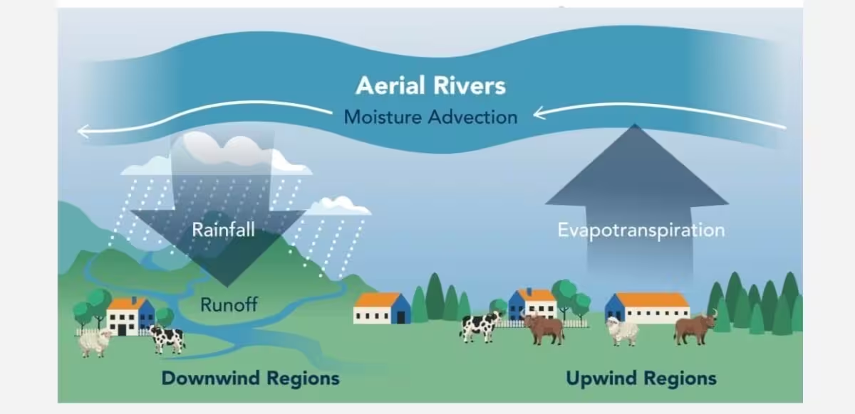
The team also identified “turning points” where the contribution of a given upwind source to a downstream area abruptly declines. According to the Nature Communications paper, this framework allowed the authors to quantify the reach, speed and eventual precipitation delivered by each aerial river.
A key finding is that these atmospheric streams are not static; shifting wind patterns can invert moisture flow toward coastal cities within a single day.
Four Distinct Aerial River Classes Across South America
To make sense of the complex web, the scientists categorized the continental aerial rivers into four groups—G1 through G4. G1 zones act as headwaters, where ocean‑derived moisture first enters the continent and embarks on its inland trek, though they are not always situated directly on the coastline.
G2 areas represent the next stage, where atmospheric drainage intensifies and some water vapor is lost as the flow progresses farther inland.
In G3 regions, the rivers slow dramatically and retain far less moisture, making these zones heavily reliant on local evaporation for rainfall. Many of these areas sit upstream of major river basins.
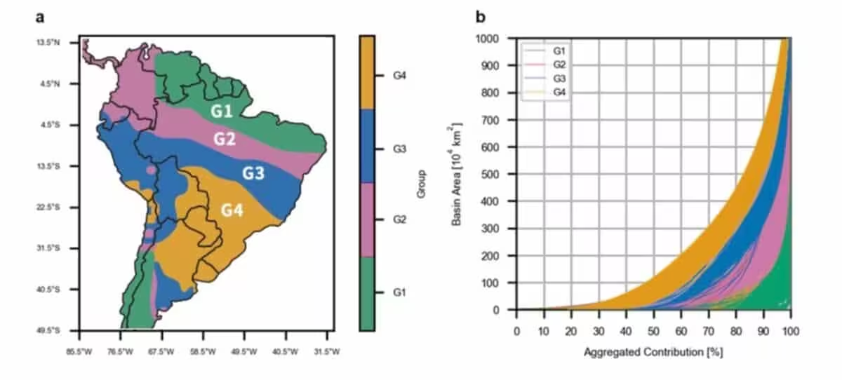
G4 zones, described as atmospheric plains, sit farthest downwind, receive the smallest share of aerial‑river moisture and often host water‑scarce urban centers.
Deforestation Upstream Alters Rainfall Downstream
Vegetation plays a crucial role in fueling these moisture highways. When forests in an upwind basin are cleared, the reduction in transpiration can ripple through the aerial river network. The study highlights the Peruvian Ucayali basin, where deforestation upstream is linked to a 5–13 % decline in annual rainfall and a 19–50 % drop in runoff within the downstream region.
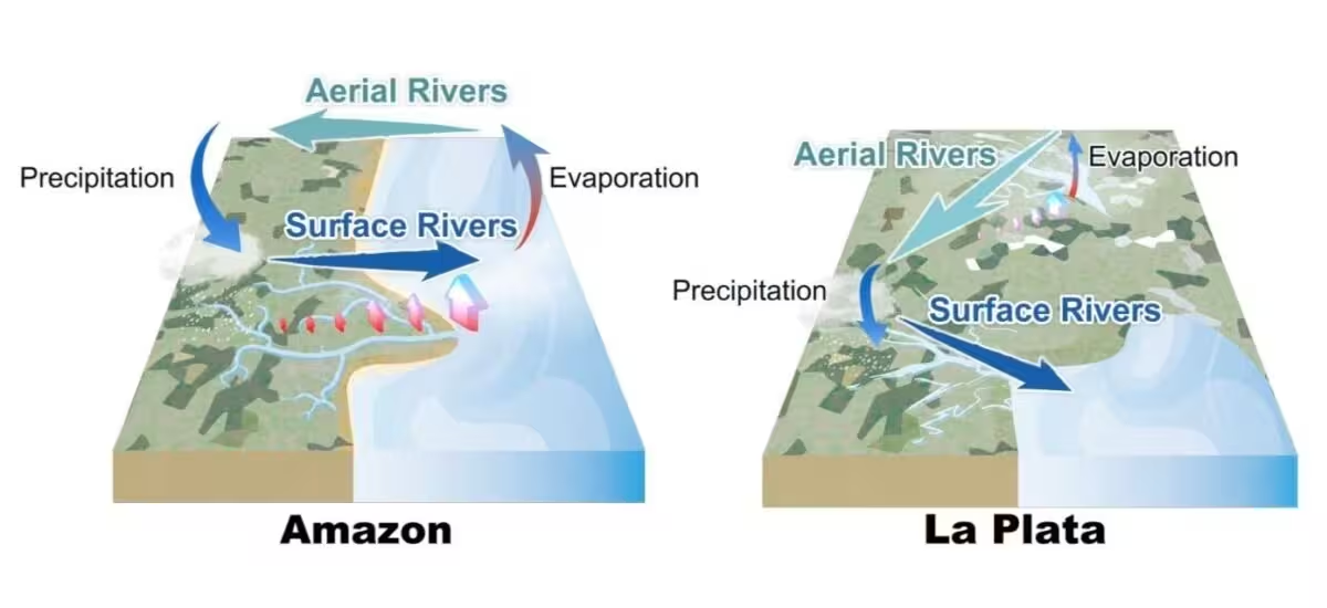
The authors argue that protecting and restoring forests—especially in upwind catchments—is essential for sustaining the moisture supply that drives precipitation across the continent.
“These basins often transcend administrative and topographic boundaries,” the researchers explain. “Their effective management requires institutional collaboration among entities responsible for regional governance.”
The analytical framework introduced in this work can be adapted to examine aerial river systems and their primary moisture sources in other parts of the globe, offering a new tool for climate and water‑resource planning.
This article has been fact checked for accuracy, with information verified against reputable sources. Learn more about us and our editorial process.
Last reviewed on .
Article history
- Latest version
Reference(s)
- Weng, Wei., et al. “Hydrological regimes and drainage systems of aerial rivers across South America.” Nature Communications, August 3, 2026 Springer Science and Business Media LLC, doi: 10.1038/s41467-026-76303-y. <https://doi.org/10.1038/s41467-026-76303-y>.
Cite this page:
- Posted by Zara Tariq