Hawaii Volcanoes Help Scientists Decode Hidden Lunar Secrets With Radar
Researchers use Hawaiian lava studies to unveil fresh techniques for decoding the Moon’s ancient volcanic history, offering new insights into lunar geology.
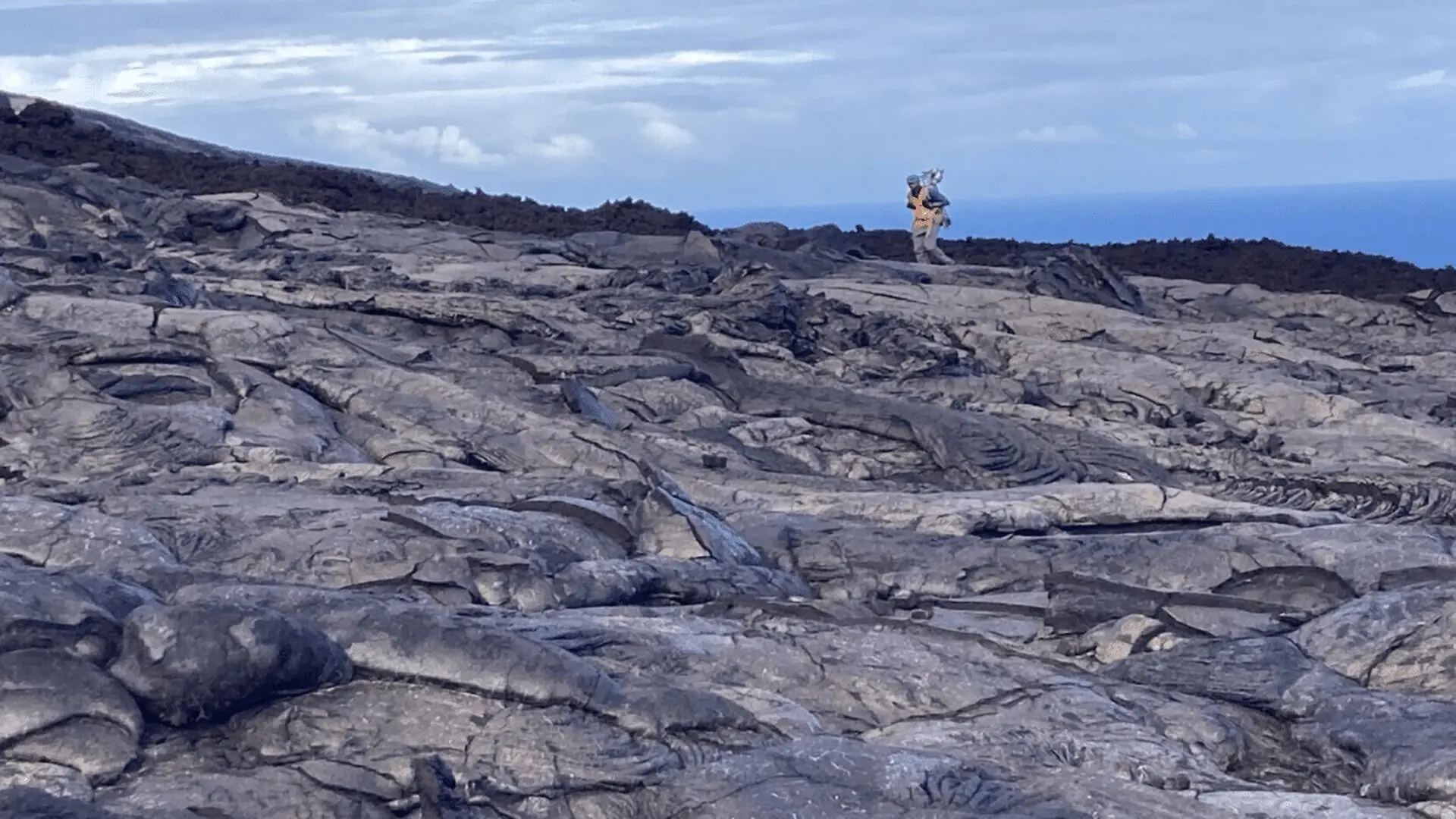
A team of geologists from the University of Western Ontario has leveraged volcanic sites in Hawaii to refine interpretations of lunar surface data, shedding light on the Moon’s volcanic past. By pairing on‑the‑ground observations with remote sensing from orbiting spacecraft, the researchers aim to bridge the gap between Earth analogues and extraterrestrial terrain.
Hawaiian Volcanic Terrains Offer Clues to Moon’s Ancient Eruptions
Field teams ventured to the rugged lava fields of Hawai‘i Volcanoes National Park, selecting sites whose morphologies echo certain lunar volcanic structures. Their objective was to create a robust reference for deciphering images and radar returns gathered by lunar orbiters.
The investigation compared terrestrial measurements of lava flow textures and micro‑scale geological features with data acquired by NASA’s Lunar Reconnaissance Orbiter (LRO) and its Mini‑RF radar instrument. By aligning these datasets, the scientists sought to understand how similar formations appear across different sensing modalities.
“When you’re looking at something from orbit, you have to interpret what you’re seeing,” said Neish, an expert in orbital radar observations and the geology of planetary surfaces. “Going into the field allows us to understand what those features actually look like up close.”
Direct examination of Hawaiian volcanic formations enables researchers to calibrate interpretations of distant planetary landscapes, linking spacecraft signatures to tangible geological processes.
“By studying lava flows on Earth, where we know the geology, we can better understand what the LRO, and the Mini‑RF in particular, are telling us about similar volcanic features on the Moon,” said Neish, a professor of Earth sciences.

Radar Scans Uncover Subtle Features Invisible to Optical Cameras
The study underscores the complementary role of radar in planetary exploration. While optical cameras capture shape and albedo, radar waves provide insight into surface roughness and material composition.
Using high‑resolution terrain models, the team identified features that elude detection in conventional images, allowing a finer appraisal of volcanic and impact‑related structures across the lunar surface.
“We focus on really fine‑scale topography because that’s where LiDAR and radar excels,” said Neish. “It can detect roughness variations at the centimetre scale, revealing incredibly fine details hidden from optical images.”
These findings reinforce the value of Earth‑based fieldwork as a context provider for orbital datasets, ensuring that remote observations are anchored in well‑understood geological frameworks.
“Remote sensing gives us incredible information about planetary surfaces, but understanding what that data means requires connecting it back to what we know from the ground,” said Vanga, a PhD candidate in geology with a specialization in planetary science. “Field studies like this help us better interpret what spacecraft are seeing and improve the tools we use to explore other worlds.”
Moon Studies Extend Past Ice Detection
The researchers also evaluated whether Mini‑RF radar could detect signatures of potential water ice deposits on the Moon. Although the instrument did not reveal strong ice indicators, the analysis yielded valuable insights into lunar geology.
The same radar data used to hunt for resources proved effective for characterizing volcanic history, crater morphology, and the broader processes that have sculpted the Moon over billions of years.
“We didn’t really find much evidence, honestly, for water ice with the Mini‑RF instrument,” said Neish. “But what we did find was a lot of great information about volcanism and impact cratering and all the geologic processes that shape the Moon – all critical for future space missions and humanity’s eventual lunar outposts.”
These results highlight that lunar exploration involves more than resource identification; a thorough grasp of the Moon’s geological evolution is essential for selecting landing sites and planning sustainable habitats.
The University of Western Ontario study adds a new layer to our understanding of Earth’s nearest celestial neighbor. By integrating field observations, radar analysis, and orbital data, scientists are constructing a more detailed narrative of the Moon’s formation and ongoing transformation.
“The Moon is not just a distant object in the sky,” said Neish, a professor in Western’s department of Earth sciences. “It’s a world with a history, and we’re trying to understand that history.”
Implications for Upcoming Lunar Missions
As international space agencies gear up for renewed lunar landings, precise knowledge of surface conditions becomes increasingly critical. Astronauts and robotic explorers will encounter terrains forged by ancient eruptions, asteroid impacts, and long‑term geological change.
Linking Hawaiian analogues with lunar datasets equips researchers with refined tools for mapping uncharted regions, potentially guiding mission planners toward scientifically rich and safe landing zones.
While the Moon remains the most accessible extraterrestrial body, many chapters of its history are still unwritten. Ongoing collaborations that meld terrestrial fieldwork with space‑based instrumentation continue to reveal that lunar landscapes hold far more information than visible imagery alone can convey.
This article has been fact checked for accuracy, with information verified against reputable sources. Learn more about us and our editorial process.
Last reviewed on .
Article history
- Latest version
Reference(s)
- Renaud, Jeff. “Hawai‘i serves as model for studying the Moon’s volcanic history.”, July 23, 2026 Western Communications. Western University <https://news.westernu.ca/2026/07/hawaii-lunar-volcanism/>.
Cite this page:
- Posted by Vikram Desai