Scientists Have Mapped a Tectonic Plate Tearing Apart Under the Pacific Northwest
New seismic imaging reveals the Cascadia subduction zone is breaking apart deep beneath the seafloor, offering a rare look at a major tectonic transition.
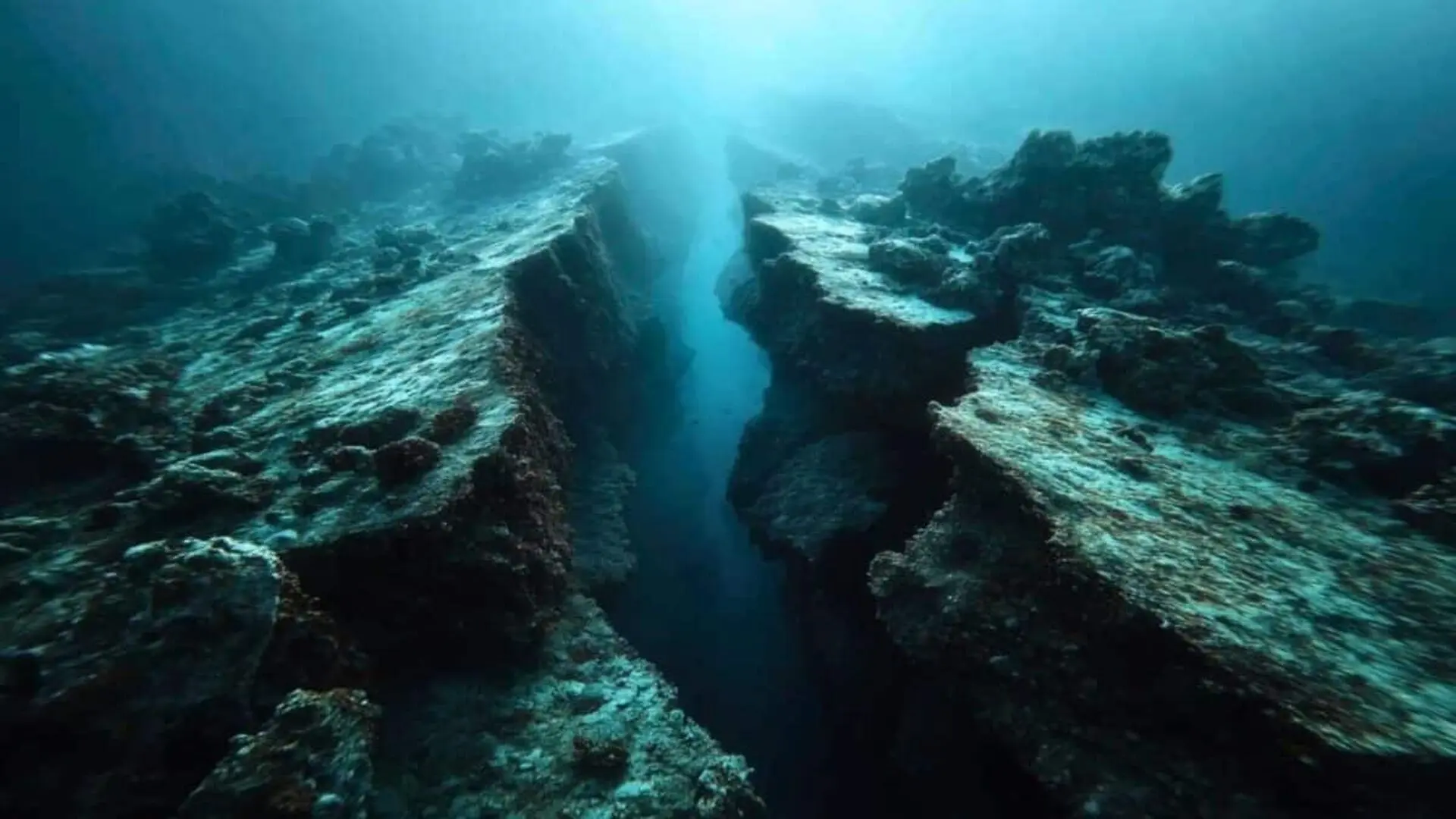
Geologists have successfully mapped a tectonic plate in the process of fracturing deep beneath the seafloor off the west coast of Vancouver Island. The discovery reveals how a segment of the Cascadia subduction zone is gradually winding down, a complex geological transition unfolding over the course of millions of years.
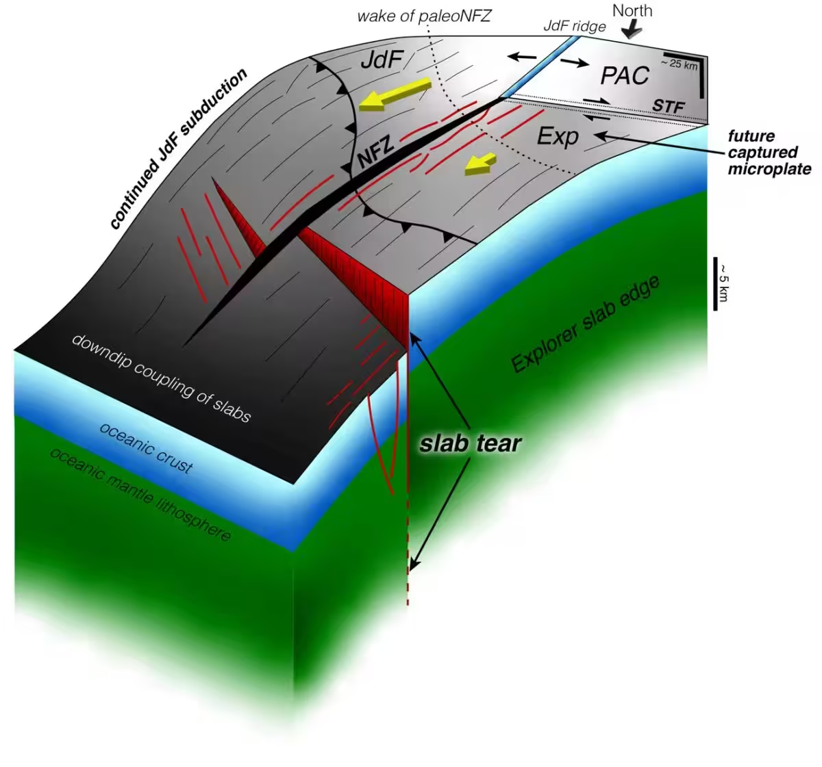
Detailed in the journal Science Advances, the findings center on the northern reaches of the Cascadia region. Here, the Explorer and Juan de Fuca oceanic plates are sliding beneath the North American plate. Advanced seismic imaging has confirmed that this descending slab is being fragmented by massive faults, allowing discrete sections of the crust to break away even as other parts continue their steady descent into the Earth’s mantle.
The Mechanics of a Fragmenting Plate Boundary
Subduction zones occur where tectonic plates collide and one is forced beneath the other, a process that defines the western edge of North America. At the northern tip of the Cascadia system, near British Columbia, the geometry of these converging plates becomes exceptionally intricate.
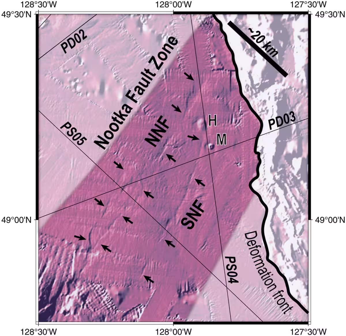
The research focuses on the intersection of the Juan de Fuca plate and the smaller Explorer micro-plate, which are divided by the Nootka Fault System. This transform boundary facilitates horizontal movement, acting as a catalyst for the structural decay of the sinking lithosphere. While the Juan de Fuca plate maintains its subduction, portions of the Explorer slab are effectively detaching, illustrating a piecemeal, rather than instantaneous, collapse of the plate boundary.
Mapping Subsurface Tears with Seismic Waves
To visualize these deep-earth structures, researchers utilized seismic reflection imaging during the 2021 Cascadia Seismic Imaging Expedition, deploying the research vessel R/V Marcus G. Langseth. By transmitting acoustic waves into the seafloor and capturing the echoes via a 15-kilometer-long array of 1,200 hydrophones, the team generated high-resolution images of the crustal architecture.
The data revealed significant structural ruptures, including a vertical displacement of approximately 5 kilometers across a primary fault line. Over a 75-kilometer span, the researchers identified a mosaic of seismically active and relatively quiet zones, providing a clear map of where rock connections have been severed and where they remain intact.
Understanding Piecewise Termination
The study introduces the concept of “piecewise termination” to describe this gradual loss of subduction capability. Unlike a singular catastrophic failure, the Nootka Fault System acts as a partition, allowing different segments of the plate to disconnect over tens of thousands of years. This process provides a modern, observable laboratory for understanding how ancient, fossilized subduction boundaries—like those found off the coast of Baja California—likely formed in the deep geological past.
Earthquake Risks Remain Unchanged
While this research offers new insights into the tectonic evolution of the Pacific Northwest, it does not diminish the immediate threat of significant seismic events. The broader Cascadia subduction zone remains fully capable of producing massive earthquakes and tsunamis.
Instead of altering hazard assessments, these findings offer a deeper look at the variables that may dictate how a future earthquake rupture propagates. The team is now investigating whether these crustal tears could act as barriers or conduits for seismic energy. Ultimately, the study confirms that the northern Cascadia boundary is not failing in a single, sudden event, but is instead undergoing a slow, segment-by-segment reorganization that will continue to reshape the region for ages to come.
This article has been fact checked for accuracy, with information verified against reputable sources. Learn more about us and our editorial process.
Last reviewed on .
Article history
- Latest version
Reference(s)
- Shuck, Brandon., et al. “Slab tearing and segmented subduction termination driven by transform tectonics.” Science Advances, vol. 11, no. 39, September 26, 2025 American Association for the Advancement of Science (AAAS), doi: 10.1126/sciadv.ady8347. <https://www.science.org/doi/10.1126/sciadv.ady8347>.
- Day, Adrienne. “Only 270 Million Square Kilometers to Go: The R/V Marcus G. Langseth Helps Map the World’s Oceans.”, June 27, 2024 State of the Planet <https://news.climate.columbia.edu/2024/06/27/only-270-million-square-kilometers-to-go-the-r-v-marcus-g-langseth-maps-the-worlds-oceans/>.
- School, Columbia. “Earth’s Crust Is Tearing Apart off the Pacific Northwest—and That’s Not Necessarily Bad News.”, September 30, 2025 State of the Planet <https://news.climate.columbia.edu/2025/09/30/earths-crust-is-tearing-apart-off-the-pacific-northwest-and-thats-not-necessarily-bad-news/>.
Cite this page:
- Posted by Vikram Desai