NASA Radar Reveals Hidden Cold War City Under Greenland Ice and Its Toxic Legacy
NASA’s Greenland radar test uncovered a Cold War-era city buried 100 feet deep, raising concerns about its toxic legacy resurfacing.
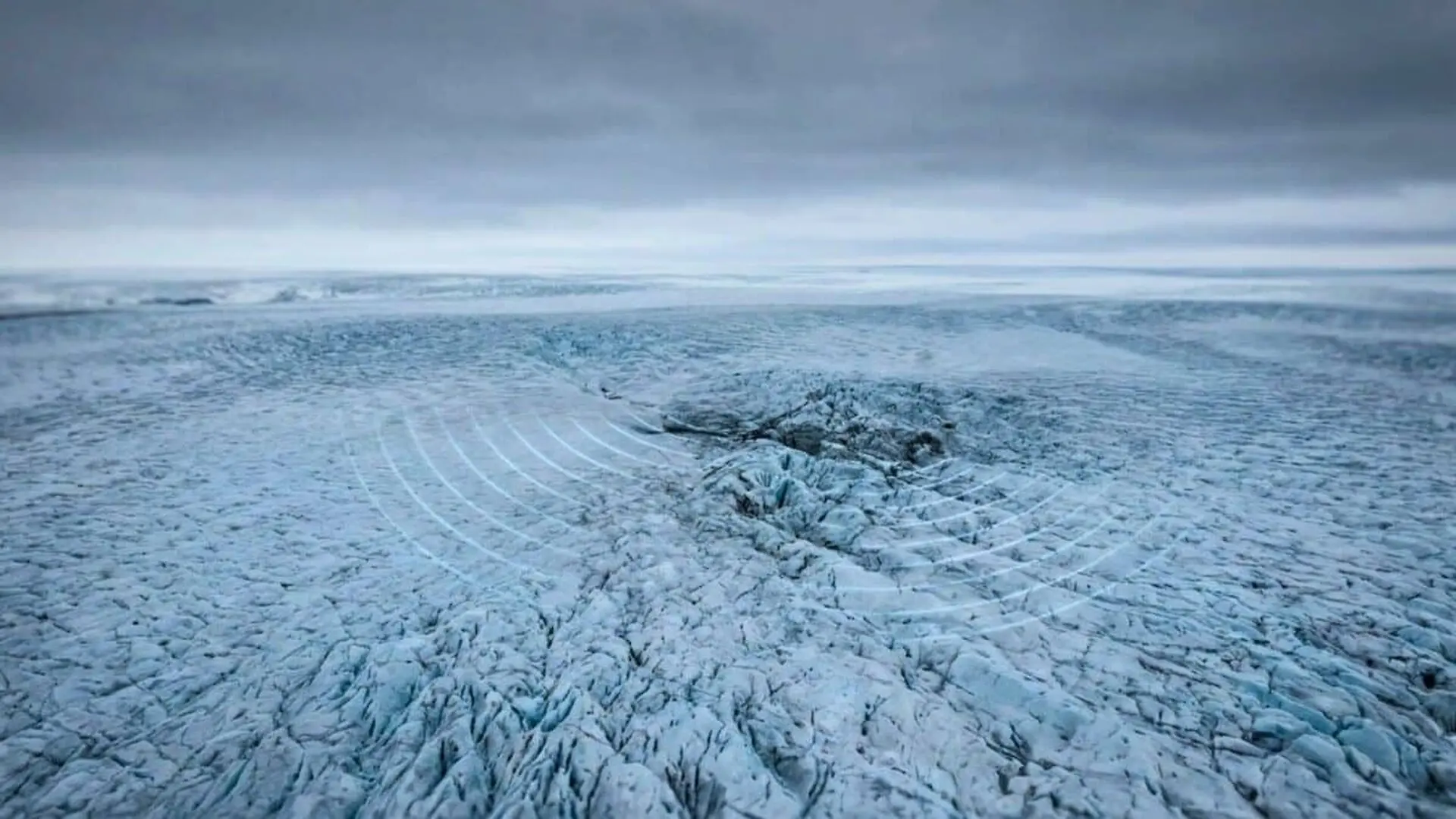
During a routine instrument test over northern Greenland in April 2024, a team aboard a Gulfstream III captured the most detailed radar view yet of Camp Century, the abandoned U.S. Cold‑War outpost that has lain sealed under more than 30 metres of ice and snow since 1967.
Radar Anomaly Leads to a Surprise Find
NASA scientist Chad Greene was flying roughly 150 miles east of Pituffik Space Base with a group of engineers when the aircraft’s radar returned an unexpected signal from beneath the ice surface. The mission, intended to calibrate the instrument’s performance, was not aimed at locating hidden structures.
“We were mapping the ice bottom and suddenly Camp Century showed up,” recalled Alex Gardner, a cryospheric scientist at NASA’s Jet Propulsion Laboratory who co‑led the effort. “At first we weren’t sure what we were looking at.”
A Cold‑War “City Under the Ice”
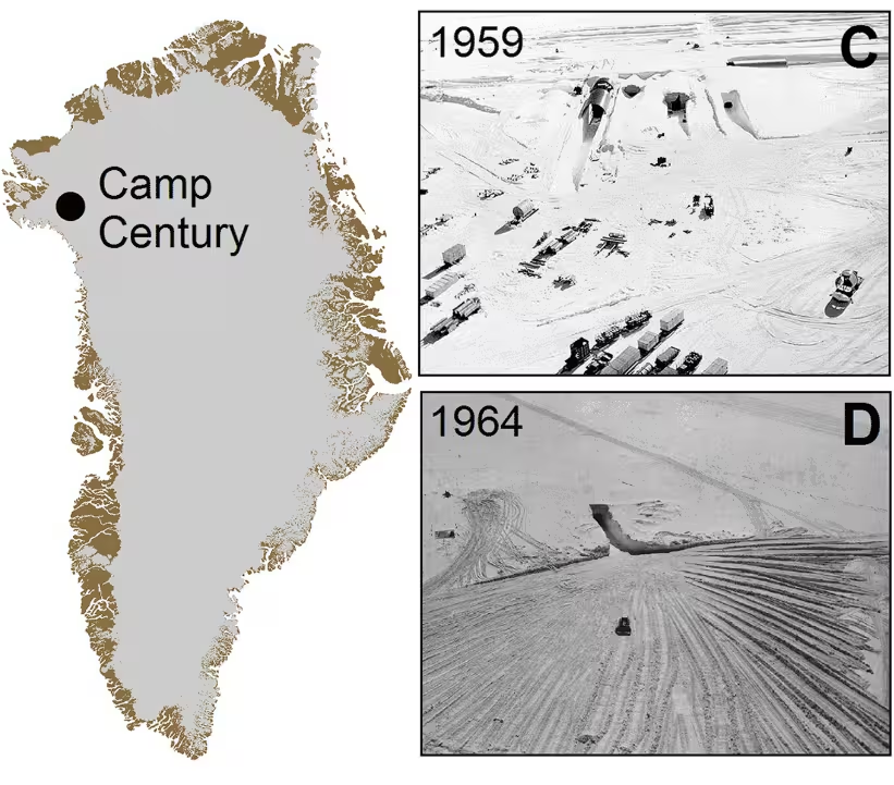
Constructed in 1959 by the U.S. Army Corps of Engineers, Camp Century consisted of a network of 21 tunnels totaling about three kilometres of underground corridors carved into the near‑surface layer of the northwestern Greenland Ice Sheet. The installation earned the nickname “city under the ice.” While its official purpose was polar research, a 2016 study in Geophysical Research Letters indicates that personnel also evaluated the feasibility of deploying ballistic missiles from within the Arctic ice sheet.
Decommissioned in 1967 with only minimal removal of equipment, engineers assumed that continual snowfall would permanently entomb the site. Decades of accumulation have now buried the concrete structures at a depth of at least 30 metres (roughly 100 feet) beneath the ice surface.
UAVSAR Delivers a Three‑Dimensional Portrait
The April flights carried NASA’s UAVSAR (Uninhabited Aerial Vehicle Synthetic Aperture Radar) mounted beneath the aircraft. Unlike conventional ground‑penetrating radar that looks straight down, UAVSAR scans both downward and laterally, producing maps with added dimensionality. When Greene and Gardner overlaid the new radar image on historic layout plans, the tunnel network aligned closely with the observed structures.
“The latest data reveal individual buildings inside the hidden city in a way we’ve never seen before,” Greene explained.
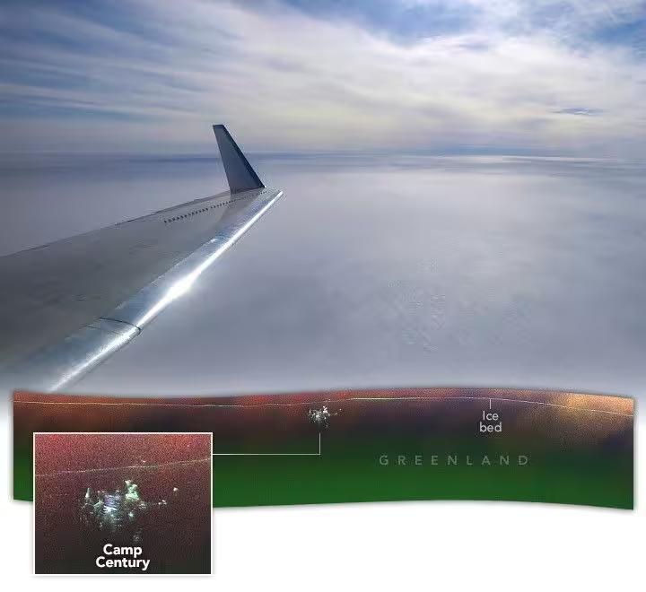
Interpreting the radar requires caution. A bright line that appears “above” the base in the image actually marks the ice‑bed interface located a mile beneath the surface; the radar return captures this distant layer rather than the camp itself.
The NASA Earth Observatory described the UAVSAR capture as an intriguing curiosity, noting that the scientific value of the image is still being assessed. Greene and Gardner clarified that their primary aim was to evaluate UAVSAR’s ability to map internal ice layers and the ice‑bed boundary, a step toward future surveys of Greenland, Antarctica, and other ice‑covered regions.
“Without precise knowledge of ice thickness, we can’t reliably forecast how ice sheets will respond to rapidly warming oceans and atmosphere, which limits our ability to predict sea‑level rise,” Gardner emphasized.
Legacy Waste and Climate Risks
Camp Century’s waste field spans roughly 55 hectares—about the size of 100 football fields—and contains an estimated 200,000 liters of diesel fuel, 240,000 liters of untreated wastewater (including sewage), polychlorinated biphenyls (PCBs) embedded in building materials, biological residues, and low‑level radioactive coolant from the portable nuclear generator that powered the outpost.
A 2016 climate‑modeling study projected that, under a business‑as‑usual emissions pathway (RCP 8.5), the ice sheet above the camp could transition from net accumulation to net ablation within the next 75 years. Net ablation—driven by melting, sublimation, and wind erosion—would erode the natural seal and potentially expose the buried contaminants.
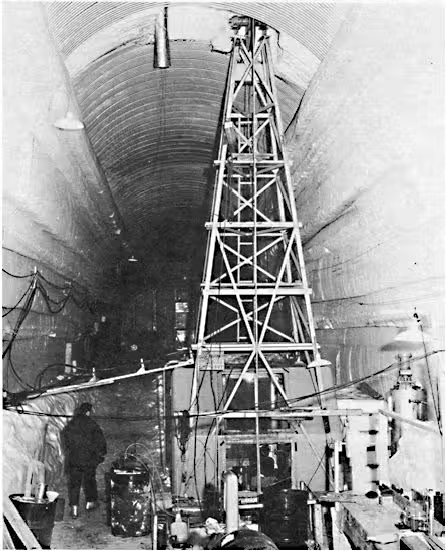
The original engineering of the base’s nuclear power plant (PM‑2A) is documented in the U.S. Army Corps of Engineers 1961 report, underscoring the technical legacy now intertwined with climate‑change concerns.
NASA’s Earth Observatory has begun integrating depth estimates derived from conventional radar and the 2024 UAVSAR flight into broader models that aim to predict when, under varying climate trajectories, the camp and its contaminant stockpile might emerge from the ice.
This article has been fact checked for accuracy, with information verified against reputable sources. Learn more about us and our editorial process.
Last reviewed on .
Article history
- Latest version
Reference(s)
- Colgan, William., et al. “The abandoned ice sheet base at Camp Century, Greenland, in a warming climate.” Geophysical Research Letters, vol. 43, no. 15, August 4, 2016, pp. 8091-8096. American Geophysical Union (AGU), doi: 10.1002/2016GL069688. <https://doi.org/10.1002/2016GL069688>.
- “UAVSAR - Aerial Instruments - NASA Jet Propulsion Laboratory | NASA Jet Propulsion Laboratory (JPL).” <https://www.jpl.nasa.gov/missions/uninhabited-aerial-vehicle-synthetic-aperture-radar-uavsar/>.
- Migrate, NASA. “New View of the “City Under the Ice” - NASA Science.”, November 25, 2024 NASA <https://science.nasa.gov/earth/earth-observatory/new-view-of-the-city-under-the-ice-153616/>.
- “CONTENTdm.” <https://usace.contentdm.oclc.org/digital/collection/p266001coll1/id/3968/>.
Cite this page:
- Posted by Karan Das