Moonlit Earth Captured by Artemis II Reveals Unseen Nighttime Landscape
Discover breathtaking Earth views from Artemis II astronauts: city lights, auroras, and cosmic reflections in vivid detail
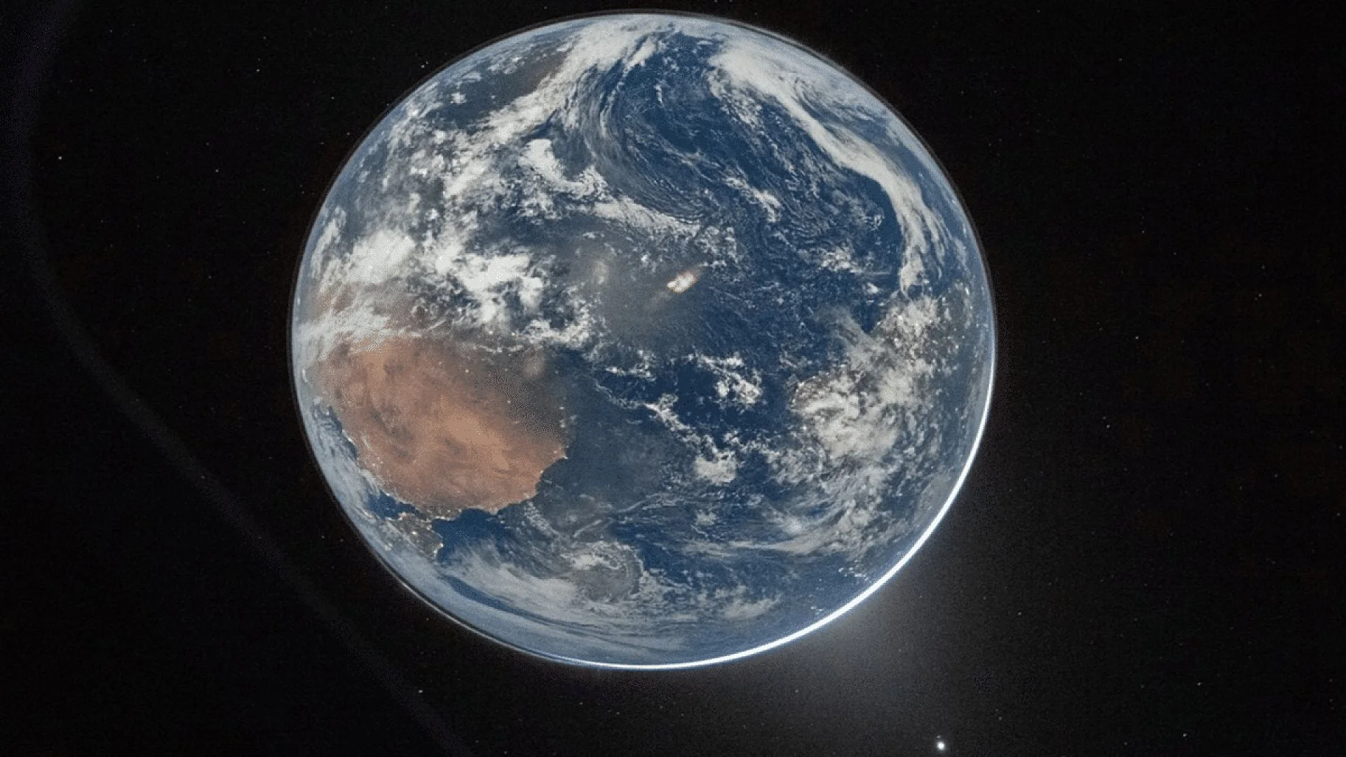
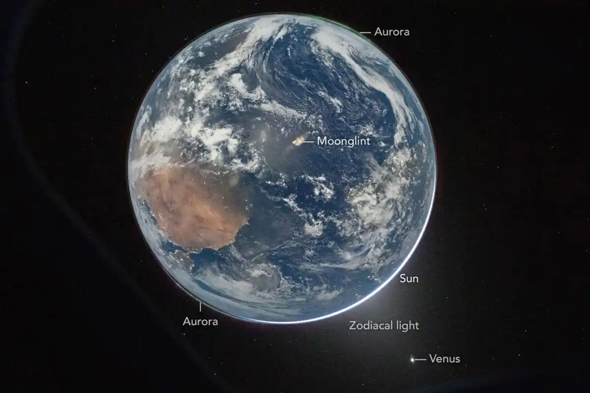
A fresh photograph from NASA’s Artemis II flight shows Earth awash in moonlight, framing the planet against the deep black of space and highlighting its nocturnal glow. Captured aboard the Orion crew capsule, the image displays illuminated city clusters, shimmering auroras and other celestial features, underscoring Earth’s role as a vibrant, inhabited world.
Moonlit View of Earth from Orion
The picture was snapped shortly after Artemis II performed its translunar injection burn, sending the spacecraft on a trajectory toward the Moon. At that distance the crew witnessed the planet silhouetted against a thin band of sunlight, while moon‑reflected light revealed details usually hidden in darkness. Green auroral arcs encircle both poles, the result of solar particles striking the upper atmosphere, and a faint glow of zodiacal light—sunlight scattered by interplanetary dust—lies just below the horizon, a rarely documented sight in a single frame.
Night‑time Illumination Reveals Human Footprint
The most eye‑catching element of the Artemis II shot is the network of artificial lights stretching across continents such as Spain, Portugal, northern Africa, sub‑Saharan Africa and Brazil. The crew employed a camera set to an ISO of 51 200, a sensitivity high enough to capture these faint glows alongside natural phenomena. This capability offers scientists a new visual dataset for tracking global energy consumption, urban sprawl and the extent of light pollution, while also underscoring how human activity intertwines with Earth’s natural systems.
Why the Image Matters to Science
Miguel Román, deputy director for atmospheres and data systems at NASA’s Goddard Space Flight Center, noted that the photograph “reminds us that Earth at night is visually compelling, physically complex, and scientifically underexplored (I see this image as a glimpse of what Earth science can become in the future).” Existing satellite programs such as NASA’s Black Marble map nighttime illumination over time, but the Artemis II capture is distinctive because it was taken by humans in deep space, merging scientific observation with striking visual impact. Viewing the planet from this distance enriches understanding of energy flows, urban growth and solar‑wind interactions, while also providing the public with a powerful reminder of Earth’s beauty and fragility.
This article has been fact checked for accuracy, with information verified against reputable sources. Learn more about us and our editorial process.
Last reviewed on .
Article history
- Latest version
Reference(s)
- Dauphin, Lauren. “A Moonlit Earth as Seen From Artemis II - NASA Science.”, June 4, 2026 NASA <https://science.nasa.gov/earth/earth-observatory/a-moonlit-earth-as-seen-from-artemis-ii/>.
Cite this page:
- Posted by Karan Das