Ancient Greeks Built a Massive Harbor That Suddenly Sank Beneath the Waves
Ancient Greeks physically reshaped the Cyrene coastline to build a grand harbor, but a new discovery reveals what they unknowingly hid beneath the stones.
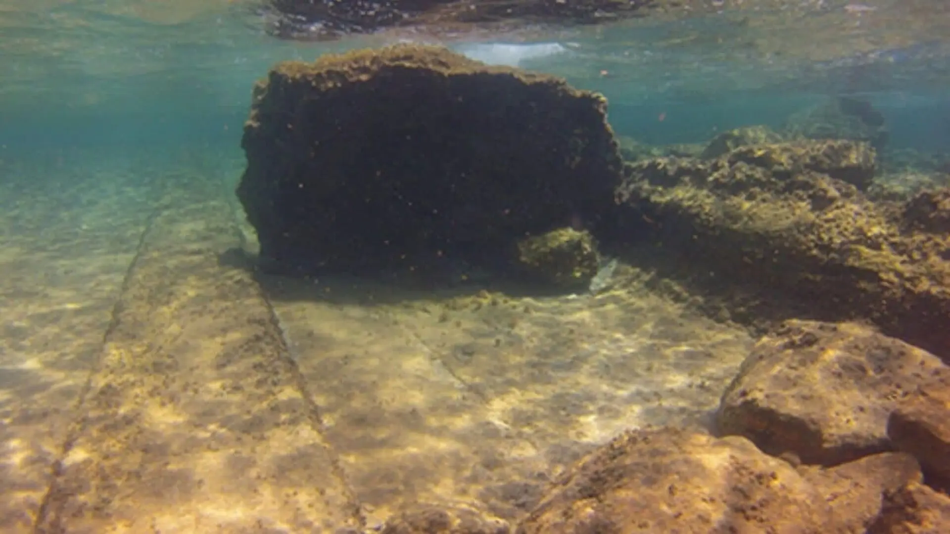
Centuries ago, Greek settlers in Cyrene undertook a massive engineering project, excavating roughly 170,000 cubic meters of stone to transform a hazardous coastal inlet into a functional harbor. Today, that site, known as Apollonia, rests about 8 feet (2.4 meters) below the Mediterranean surface. New research suggests that this dramatic submersion was driven by the shifting earth beneath the city rather than global changes in sea level.
Founded in 631 BCE by colonists from Thera (modern-day Santorini), Cyrene established Apollonia to serve as its vital maritime link. While the Greeks developed a sophisticated port for trade and naval power, they were unknowingly building upon a volatile network of braided tectonic faults. A recent investigation, published in Libyan Studies, explores how these geological forces shaped the fate of the ancient harbor.
Engineering an Ancient Seaport
The study, led by oceanographer Nic Flemming of the U.K. National Oceanography Center and archaeologist Ahmad Emrage from the University of Benghazi, sought to quantify the extent of the human-led transformation of the coastline. Evidence of earlier pottery suggests the location served as a modest trading post before it was fully developed. However, as Cyrene’s economy—driven largely by the export of the prized, now-extinct silphium plant—and its military ambitions grew, the need for a major harbor became paramount.
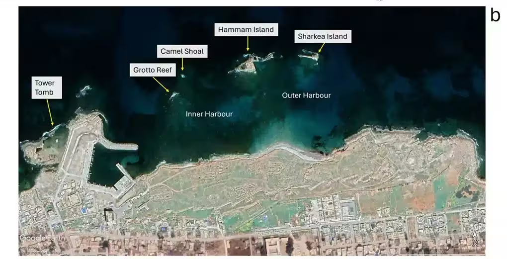
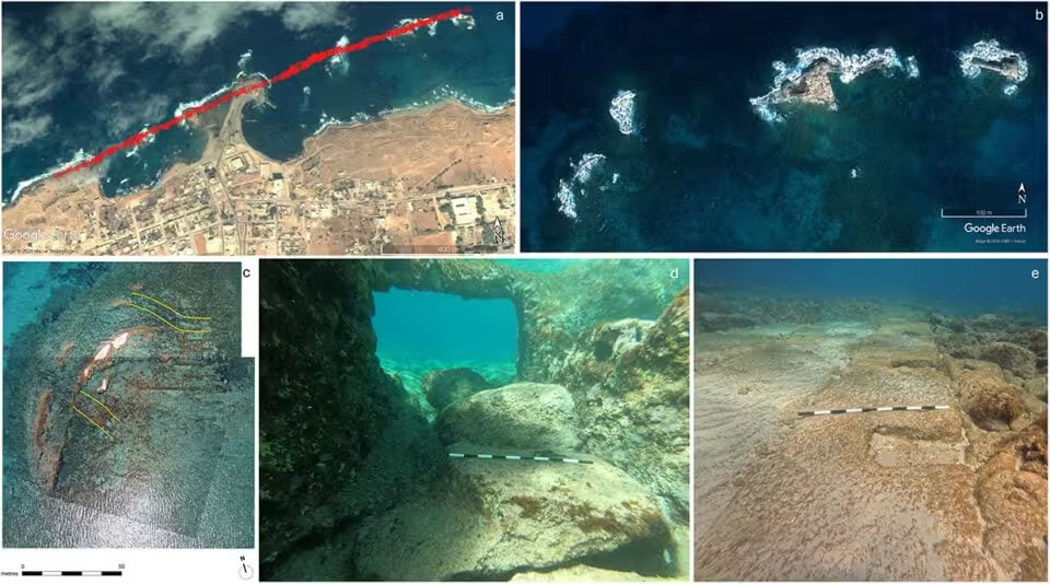
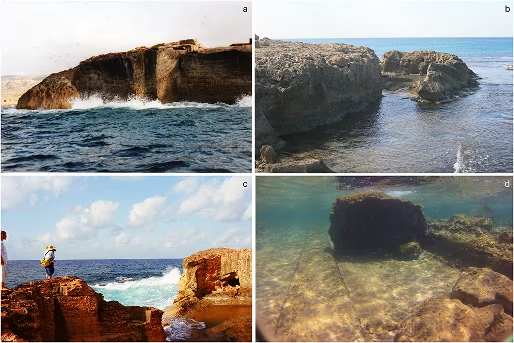
To defend against turbulent waters, engineers likely constructed a rubble breakwater during the first century of their occupation. Archaeological surveys, including underwater observations conducted by Flemming as far back as 1959, confirm the existence of these stone fortifications. The vertical carving evident on the submerged stone walls of Grotto Reef and Hammam Island indicates where laborers sourced massive quantities of rock to build their coastal defenses.
Tectonic Instability Beneath the Foundations
The Hellenistic builders remained unaware of the braided fault lines beneath them, which are fueled by the constant collision of the African and Eurasian tectonic plates. Historical records confirm that the region was no stranger to seismic activity, with several major earthquakes causing significant structural damage to Cyrene’s land-based architecture over the centuries.
These researchers argue that this active geology is the primary culprit behind the harbor’s descent. By evaluating geophysical data, the team determined that the area underwent a significant tectonic subsidence of approximately 12 feet (3.8 meters) between the eighth and ninth centuries CE. While historical periods of uplift partially countered this drop, the net result remains a displacement of about 8 feet, aligning perfectly with the current depth of the submerged slipways found on Hammam Island.
A Case Study in Human Adaptation
The authors are cautious about attributing the sinking to a single cataclysmic event, noting that the geological subsidence was likely a cumulative process. Future efforts will focus on refining the chronology of the rock-carving efforts and precisely mapping the timing of the region’s seismic pulses.
Protecting these findings is becoming increasingly difficult as both natural erosion and human-related damage threaten the site. Despite these challenges, researchers emphasize that Apollonia remains a peerless laboratory for studying how early civilizations navigated the constraints of their environment. The ambition of its Hellenistic design and the preservation of its underwater ruins solidify its status as a landmark of archaeological and engineering history.
This article has been fact checked for accuracy, with information verified against reputable sources. Learn more about us and our editorial process.
Last reviewed on .
Article history
- Latest version
Reference(s)
- Flemming, Nic. “A port for Cyrene: pre-colonisation coastal topography and rationale for early port buildings and construction at Apollonia | Libyan Studies | Cambridge Core.”, pp. 1-14. Cambridge Core, doi: 10.1017/lis.2026.10043. <https://www.cambridge.org/core/journals/libyan-studies/article/port-for-cyrene-precolonisation-coastal-topography-and-rationale-for-early-port-buildings-and-construction-at-apollonia/CA58C536B2881A6997D0A53D1A45FFE5>.
Cite this page:
- Posted by Divya Iyer