Failed Mega Rice Project’s 4,500‑km Canal Network Still Drains Peatlands
Borneo’s abandoned rice megaproject cut 4,475 km of canals through peatlands, leaving lasting damage that still hampers restoration efforts.
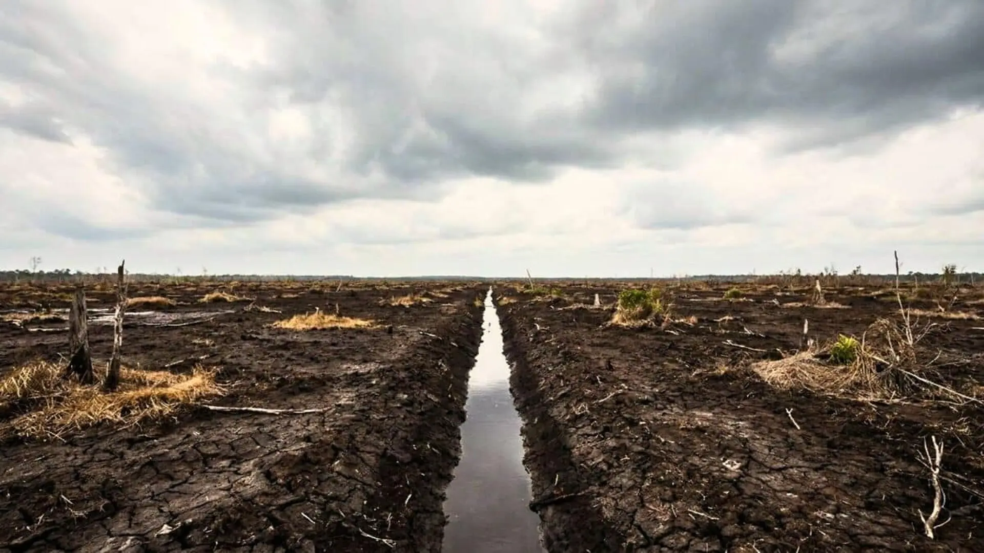
Trials that blocked drainage canals in Central Kalimantan succeeded in raising water levels across peatlands scarred by Indonesia’s ill‑fated Mega Rice Project, yet the constructed dams could not fully counteract the sinking of the peat adjacent to the waterways.
In the 1990s, the Indonesian government aimed to transform roughly one million hectares of Borneo’s peat swamp into rice paddies. Between 1996 and 1998, workers cut more than 4,475 kilometres of primary, secondary and tertiary canals through the regencies of Kapuas, Pulang Pisau, Barito Selatan and the municipality of Palangka Raya. The scheme fell short of its production goals and was abandoned in 1999.
How the canal maze drained the peat
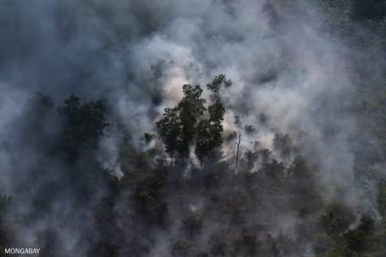
The extensive canal system accelerated surface runoff, stripped the peat of its retained moisture and lowered surrounding groundwater tables. This over‑drainage triggered irreversible drying, peat subsidence and recurrent fires, especially during the dry season.
After the project’s termination, large stretches of the northern Block A canal network lay idle, offering little utility for farming or other activities. The ensuing desiccation also hampered restoration, as seedlings struggled to survive on increasingly dry substrate.
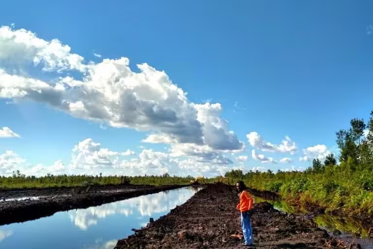
Deep, open canals hastened peat decomposition and risked exposing acidic sulfide layers that are toxic to many crops. Moreover, the drainage altered the water‑logged, acidic environment that underpins tropical peat ecosystems.
A subsequent study by Wageningen University and Research flagged the abandoned zones as highly prone to forest and peat fires. Restoration efforts typically start by elevating the water table and rewetting the surface to curb fire risk and aid reforestation.
Timber dams raise local water tables
The Climate Change, Forests and Peatlands in Indonesia initiative introduced canal‑blocking measures in northern Block A. In partnership with Wetlands International Indonesia and Wildlife Habitat Canada, researchers installed seven small dams—locally called tabat—using timber poles, geotextiles and soil‑filled bags.
Monitoring spanned from December 2004 to September 2005, with daily surface‑water readings and weekly groundwater measurements taken from observation wells.
During the dry season, water‑level differences of up to 60 centimetres were recorded immediately upstream and downstream of the first dam. Upstream, surface water stayed within roughly 30 centimetres of the peat surface, while downstream levels dropped to about 60 centimetres below.
The dams succeeded in storing water throughout the dry spell, yet their influence waned with distance, as rainfall quickly coursed through the canal network via surface runoff and groundwater flow.
Although the study did not formally quantify the dams’ impact on vegetation, field notes highlighted vigorous growth and high survival rates among newly planted jelutung, pulai and belangiran trees near the blockage points. The authors suggested establishing dedicated monitoring plots for a more precise evaluation.
Subsidence persists despite higher water tables
Follow‑up research in the northern sector of Block C also reported elevated water tables after canal closures, but these gains fell short of offsetting ongoing peat subsidence adjacent to the canals.
As the peat surface sank, the canals deepened into depressions that intercepted water flowing across the landscape. The 2014 Wageningen analysis described the canals as “eating” themselves into the peatland, heightening the danger of dam overtopping during extreme rain events.
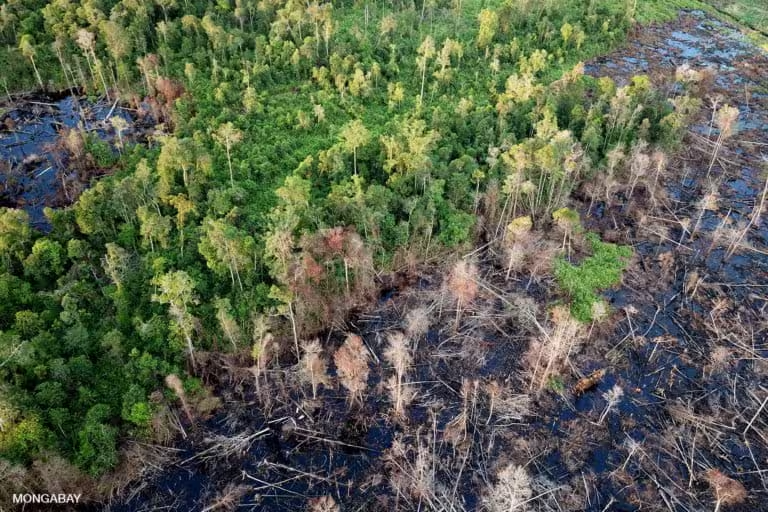
These findings spurred revisions to canal‑blocking techniques and dam designs, while underscoring the need for deeper investigation into how drainage reshapes peatland topography before broader restoration strategies can be refined.
2020 rice‑expansion proposal rekindles debate
In May 2020, the Indonesian government unveiled plans to convert 900,000 hectares of Borneo’s peatlands into rice paddies. Mongabay reported that Pulang Pisau—home to one of the largest canals from the original Mega Rice Project—featured prominently among the targeted zones.
Officials argued that updated policies and modern technology would avert a repeat of the earlier failure. Critics, however, warned that cultivating rice on peat at such a scale would likely trigger further drainage and environmental harm.
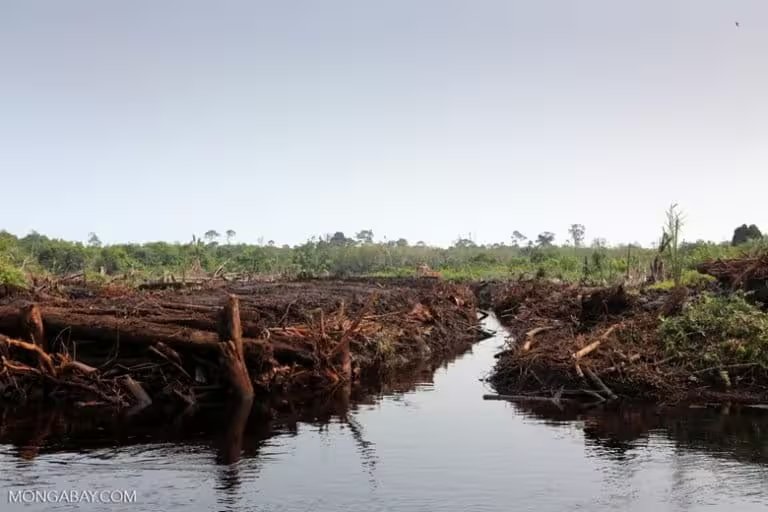
A pilot on an 80‑hectare former‑project site yielded less than three tonnes of rice per hectare—about half the productivity recorded in Java and Bali. The initial planting phase envisioned covering 164,000 hectares and mobilising roughly 300,000 farmers.
The government emphasized that the scheme would rely on already‑cleared land rather than intact peat forest. By 2020, the Peatland Restoration Agency had identified 60,000 hectares of abandoned former‑project terrain deemed potentially suitable for agriculture because the peat was shallow and the sites lay outside designated forest zones.
This article has been fact checked for accuracy, with information verified against reputable sources. Learn more about us and our editorial process.
Last reviewed on .
Article history
- Latest version
Reference(s)
- Ritzema, H.P.. “Canal blocking strategies for hydrological restoration of degraded tropical peatlands in Central Kalimantan, Indonesia.”, vol. 114, January 1, 2014, pp. 11-20. Research Portal - Wageningen University & Research, doi: 10.1016/j.catena.2013.10.009. <https://research.wur.nl/en/publications/canal-blocking-strategies-for-hydrological-restoration-of-degrade/>.
- Jong, Hans. “In Indonesia’s new rice plan, experts see the blueprint of an epic past failure.”, May 19, 2020 Mongabay <https://news.mongabay.com/2020/05/indonesia-mega-rice-project-peatland-food-crisis/>.
Cite this page:
- Posted by Linda Wilson