Satellite Radar Finds 9-Centimeter Uplift of 700,000-Year-Old Iranian Volcano
A long‑silent volcano near Iran’s border is awakening, exposing a hidden magma buildup that scientists warn authorities cannot ignore.
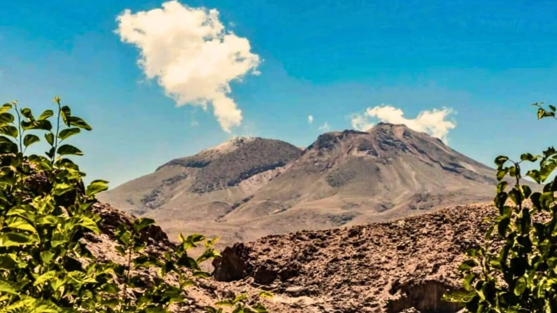
A quiet swelling has been recorded on the summit of Taftan, the 3,940‑metre‑high stratovolcano perched on the Iran‑Pakistan frontier. Between July 2023 and May 2024 the peak rose roughly 9 centimetres (3.5 inches), a steady deformation that persisted throughout the ten‑month monitoring interval, according to research published in Geophysical Research Letters in November 2025.
No seismic tremor or abnormal precipitation accompanied the uplift. Scientists excluded external triggers and concluded that the movement originates from pressure building within Taftan’s shallow hydrothermal system—an underground network of hot water and gases located about 490 to 630 metres beneath the summit. The discovery places the volcano in a class of dormant yet dynamically active systems that exhibit measurable ground deformation without an imminent eruption.
Space‑Based Radar Reveals Subsurface Motion Unseen on the Ground
Taftan lies in the sparsely populated Sistan and Baluchestan Province, an area devoid of permanent seismometers, continuous GPS stations, or gas‑monitoring equipment. The only real‑time insight into the mountain’s behavior comes from orbiting platforms.
The investigators employed Interferometric Synthetic Aperture Radar (InSAR), a method that tracks minute surface changes by comparing radar images captured from the same orbital track at different times. The imagery was sourced from the Sentinel‑1 satellite constellation, part of the European Union’s Copernicus programme, which uses C‑band radar capable of penetrating clouds and operating in darkness.
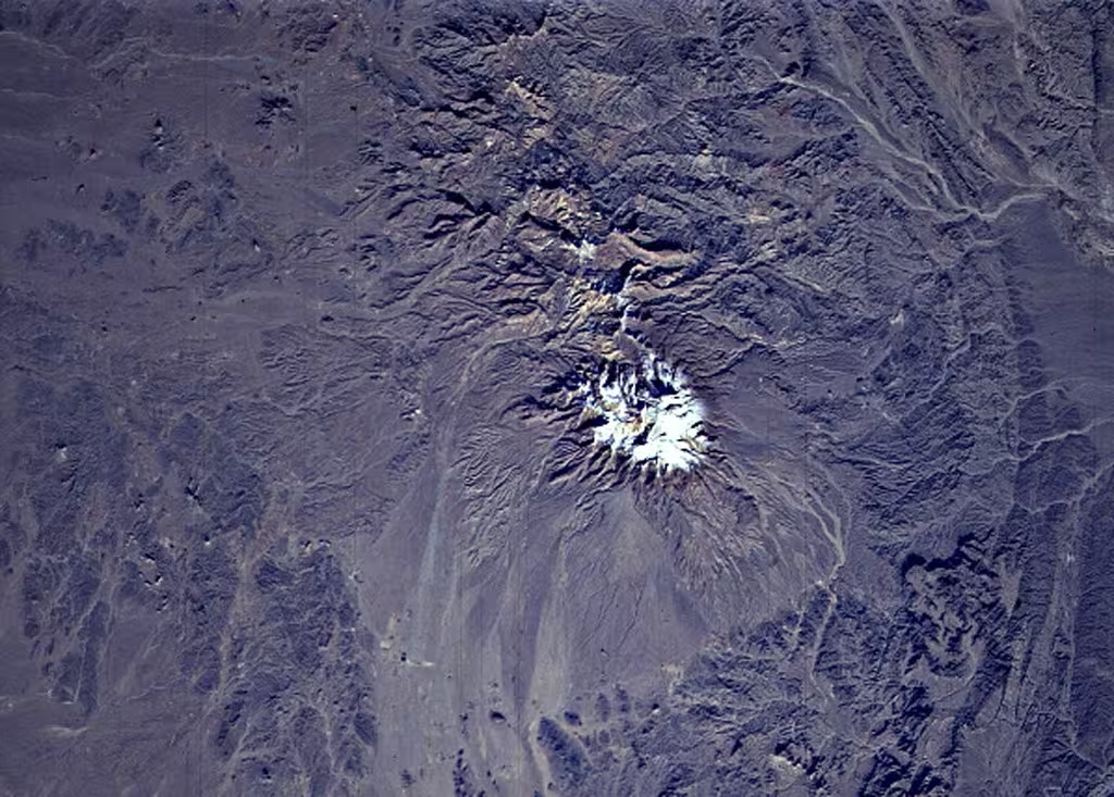
With a six‑day revisit cadence, Sentinel‑1 enabled the team to assemble a high‑resolution time series that captured a sub‑ten‑centimetre rise centered on the summit—an amount that would be invisible without satellite‑based radar. The uniform deformation pattern confirms the source lies within the volcano’s own interior.
A Volcano Marked by Sparse Eruptive History and Ambiguous Historical Accounts
Taftan’s eruptive record is remarkably thin. The Smithsonian Global Volcanism Program lists no confirmed Holocene eruptions, and radiometric dating of summit rocks places the last verified magmatic activity between 700,000 and 800,000 years ago, based on zircon U‑Pb and K‑Ar analyses.
Two historical mentions exist but remain uncertain. In January 1902 observers reported prolonged gas emissions and a nocturnal glow, while an April 1993 account described a lava flow that later studies suggest may have been molten sulphur rather than true lava.
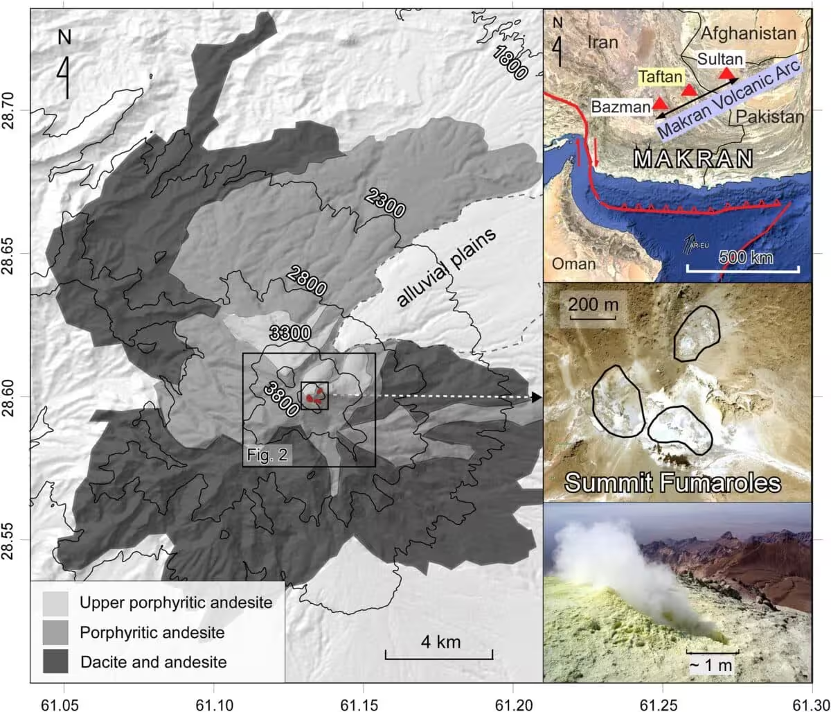
Consistent across field visits are the vigorous fumaroles that carpet the upper southeast summit, emitting sulphur‑rich vapors and coating the terrain with altered clay. Expeditions in 1999 and 2003 documented SO₂‑laden plumes and hot acidic springs on the volcano’s flanks.
Taftan forms part of the Makran‑Chagai Arc, a tectonic belt created by the subduction of the Arabian Plate beneath the Eurasian Plate, a setting that continuously drives gas‑rich fluids upward through the crust.
What Is Driving the Observed Uplift?
Modeling suggests two viable mechanisms that fit the inferred source depth. The first scenario involves volatiles migrating from a deeper magmatic source, accumulating in fractures and pores of shallow rock, and gradually pushing the surface upward. The second envisions a modest pulse of partially molten material releasing gases into the shallow plumbing, thereby pressurizing the hydrothermal layer a few hundred metres below the summit.
In both cases the principal magma reservoir remains well beneath the surface—more than 3 kilometres deep. The detected movement reflects redistribution of existing gases rather than fresh magma ascending toward the surface.
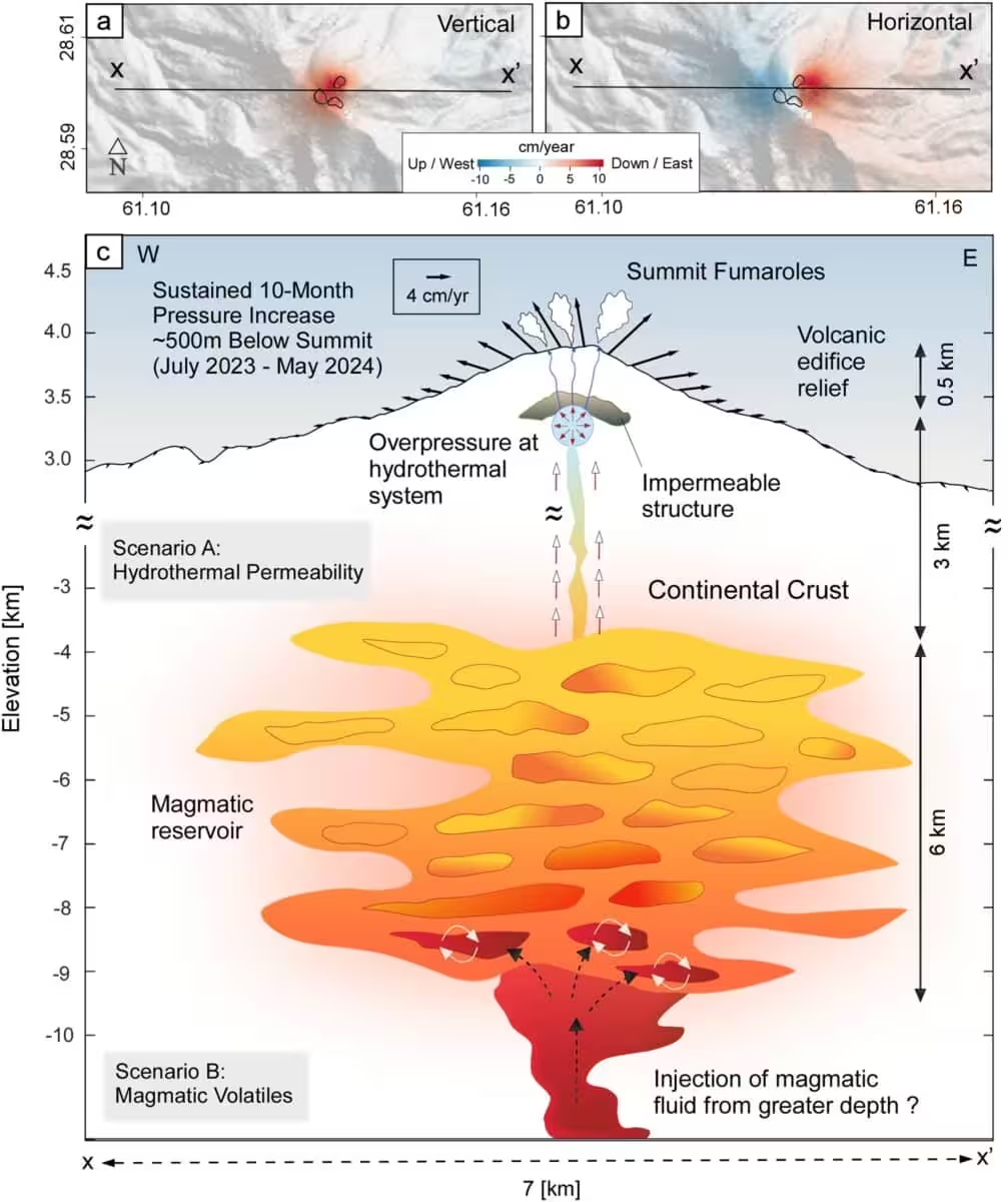
The uplift rate slowed over time, a pattern the authors interpret as gas finding new pathways through fractures and partially relieving pressure. Senior author Pablo J. González of Spain’s Institute of Natural Products and Agrobiology (IPNA) warned, “It has to release somehow in the future, either violently or more quietly. This study doesn’t aim to produce panic in the people. It’s a wake‑up call to the authorities in the region in Iran to designate some resources to look at this.”
Potential Hazards Linked to Shallow Hydrothermal Pressure
The current deformation does not signal an imminent eruption—no seismic precursors, no accelerating deformation, and no marked increase in gas emissions have been recorded. The principal concern lies in the possibility of phreatic, or steam‑driven, explosions that can occur when superheated water flashes to steam near the surface, often without clear warning.
Taftan’s fumaroles continuously release sulphur dioxide, and residents of Khash, a city about 50 kilometres distant, have occasionally reported sulphur odours drifting downwind, confirming an ongoing connection between the hydrothermal system and the atmosphere.
The authors advocate establishing a basic ground‑based monitoring network, including gas analyzers for sulphur dioxide, carbon dioxide, and water vapour at the summit vents, complemented by seismometers and GPS stations. Coupled with continued Sentinel‑1 observations, such a network would enable scientists to track whether pressure is dissipating or building. With nearly 192,000 people living within a 100‑kilometre radius of Taftan, according to the Global Volcanism Program, even modest monitoring could provide critical early‑warning capability.
This article has been fact checked for accuracy, with information verified against reputable sources. Learn more about us and our editorial process.
Last reviewed on .
Article history
- Latest version
Reference(s)
- Mohammadnia, Mohammadhossein., et al. “Spontaneous Transient Summit Uplift at Taftan Volcano (Makran Subduction Arc) Imaged Using an InSAR Common‐Mode Filtering Method.” Geophysical Research Letters, vol. 52, no. 19, October 7, 2025 American Geophysical Union (AGU), doi: 10.1029/2025GL114853. <https://agupubs.onlinelibrary.wiley.com/doi/10.1029/2025GL114853>.
- “Sentinel-1.”, October 18, 2024 Earth Science Data Systems, NASA <https://www.earthdata.nasa.gov/data/platforms/space-based-platforms/sentinel-1>.
Cite this page:
- Posted by Vikram Desai