Huge Ancient Maya City Discovered Hiding in Plain Sight Beside a Mexican Highway
Forgotten lidar data has revealed a vast, hidden Maya city concealed beneath the forest canopy, surprising locals who farmed near the ruins for years.
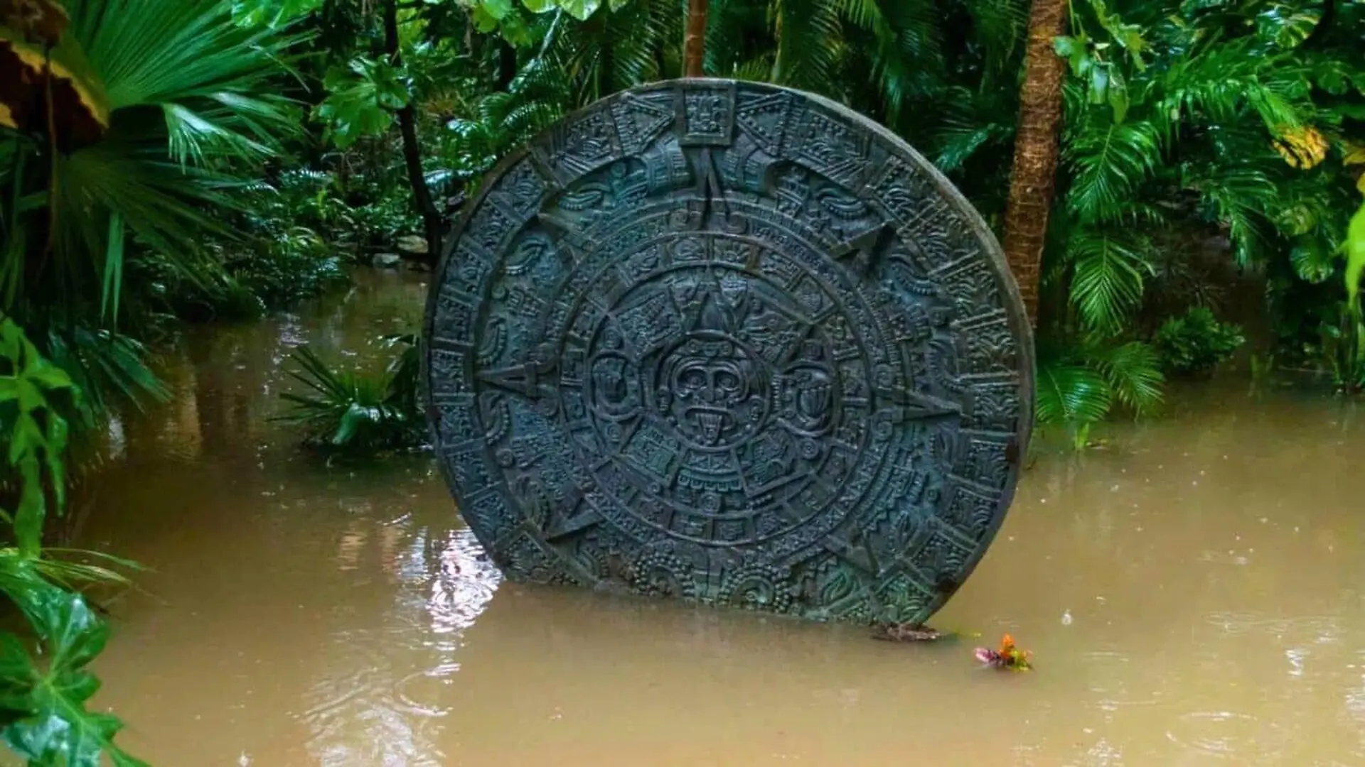
Archaeologists have uncovered a massive, previously undocumented Maya city hidden in plain sight within the dense forests of Campeche, Mexico. Situated mere minutes from a major highway and surrounded by farmland worked for generations, the site—dubbed Valeriana—has remained entirely unknown to both government officials and the scientific community until now.
The discovery emerged from a re-examination of lidar data originally captured in 2013 for a forestry project. While the initial goal was to monitor deforestation and canopy health, researchers realized the laser-mapping data contained a wealth of archaeological information. By repurposing this environmental survey, the team was able to identify an sprawling urban landscape characterized by monumental architecture, including pyramids, large plazas, residential compounds, and a ballcourt, all connected by an intricate network of causeways.
A Hidden Urban Landscape
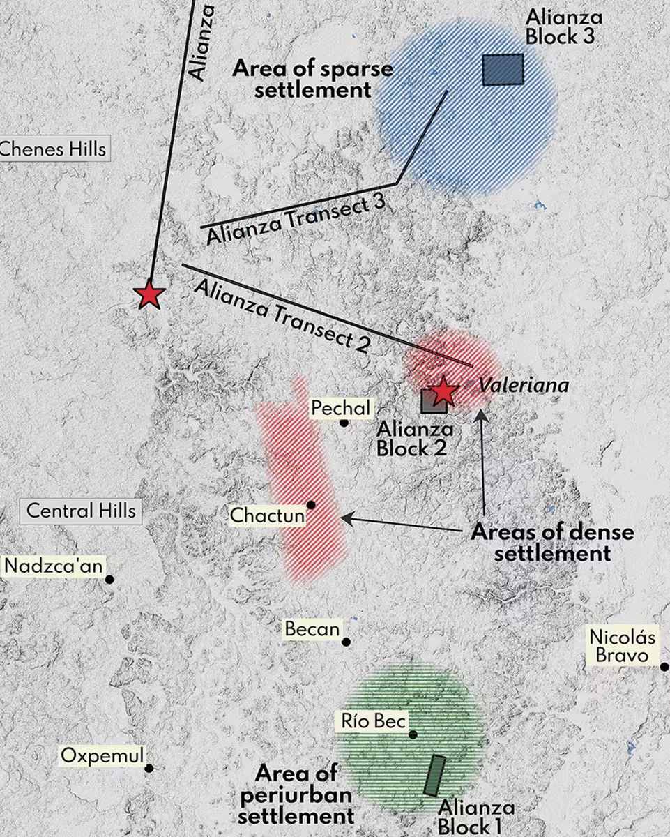
The study, published in the journal Antiquity, utilized 122 square kilometers of data to test whether ancient Maya population centers were truly as dense and widespread as recent models suggest. By treating the forest-monitoring data as a randomized archaeological sample rather than a targeted search, lead researcher Luke Auld-Thomas and his colleagues bypassed the selection bias that has historically skewed archaeological maps toward known ruins.
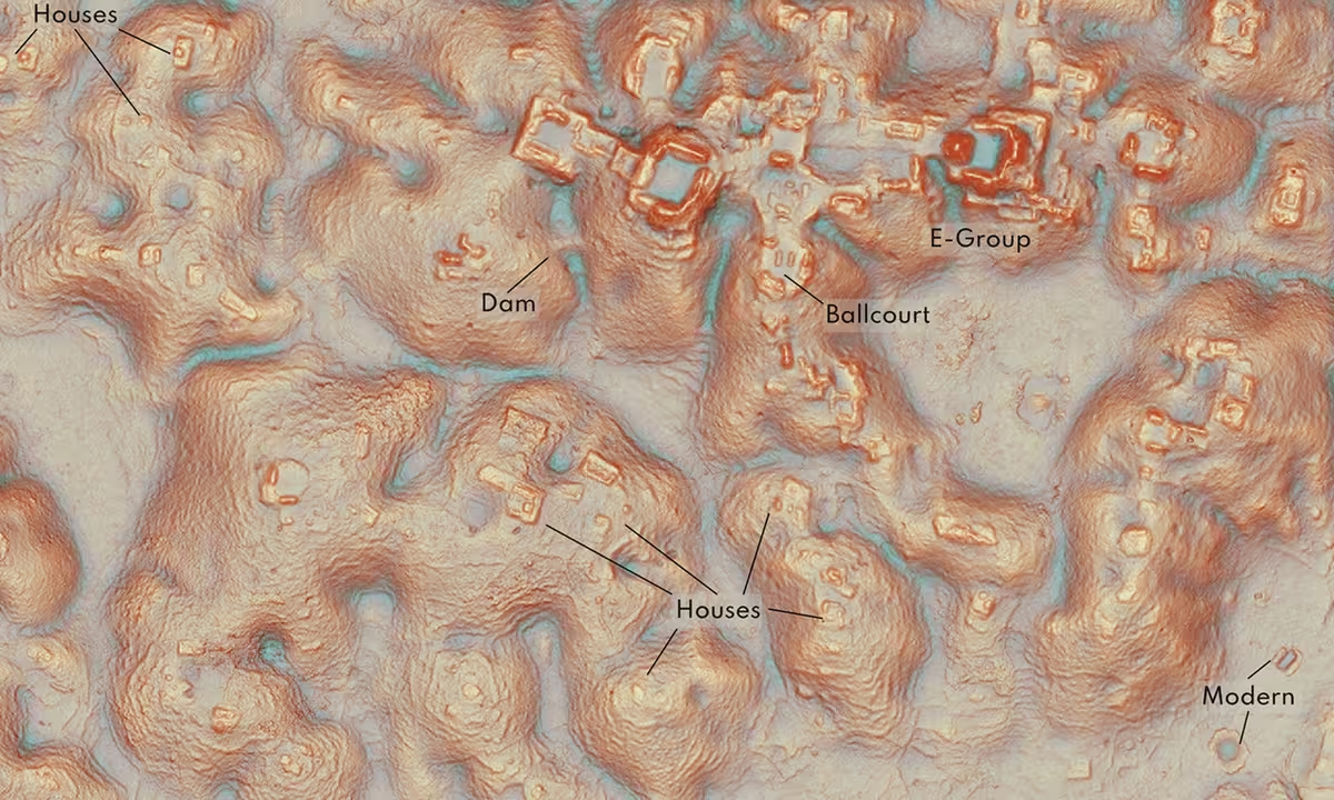
The analysis revealed a striking reality: the Campeche forest is far more densely settled than previously estimated. Valeriana alone features two massive monumental precincts connected by dense residential sprawl, with an estimated density of 426 structures per square kilometer. The presence of an E-Group architectural complex—a diagnostic feature often associated with the early development of Maya cities—suggests the city may have been established before 150 A.D., functioning as a major political capital for centuries.
Challenging Assumptions About Maya Settlement Patterns
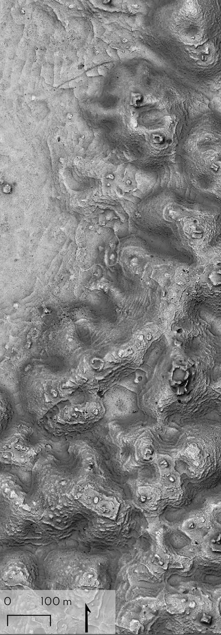
The data suggests that the Maya lowlands were not characterized by scattered, isolated city-states, but rather by a continuous, highly engineered urban fabric. Across the 16.6-square-kilometer block examined at Valeriana, researchers identified thousands of man-made structures, including agricultural infrastructure and reservoirs designed to capture seasonal water.
This findings indicate that the Maya civilization maintained a complex, high-density landscape that stretched far beyond the iconic ruins commonly visited by tourists. By removing the bias of “targeted” research, the team confirmed that dense urban networks were a standard feature of the region, rather than an exception.
Technological Constraints and Future Directions
Despite the revolutionary nature of the lidar findings, the researchers remain cautious. Because the project relied on remote sensing without ground-level excavation, they emphasize that the identification of structures is preliminary. Natural geological formations or modern rock piles can occasionally mimic the appearance of ancient house mounds, and there is an inherent challenge in determining the exact chronology of the buildings.
As noted by external experts like University of Florida anthropologist Susan Gillespie, while lidar offers an unparalleled view of the landscape’s layout, it cannot distinguish between buildings occupied simultaneously and those constructed centuries apart. Nevertheless, the discovery of Valeriana highlights how much of the ancient world remains obscured, waiting to be revealed by the intersection of modern technology and archaeological inquiry.
This article has been fact checked for accuracy, with information verified against reputable sources. Learn more about us and our editorial process.
Last reviewed on .
Article history
- Latest version
Reference(s)
- Auld-Thomas, Luke. “Running out of empty space: environmental lidar and the crowded ancient landscape of Campeche, Mexico | Antiquity | Cambridge Core.”, vol. 98, no. 401, pp. 1340-1358. Cambridge Core, doi: 10.15184/aqy.2024.148. <https://www.cambridge.org/core/journals/antiquity/article/running-out-of-empty-space-environmental-lidar-and-the-crowded-ancient-landscape-of-campeche-mexico/FFDB435047017853F26CFC5D8804B08D>.
Cite this page:
- Posted by Vikram Desai