NASA Satellite Image Shows How Philadelphia’s Green Landscape Shaped America’s Founding
NASA’s satellite image reveals a hidden green border around Philadelphia, showing how a 341‑year‑old decision still shapes the city from space.
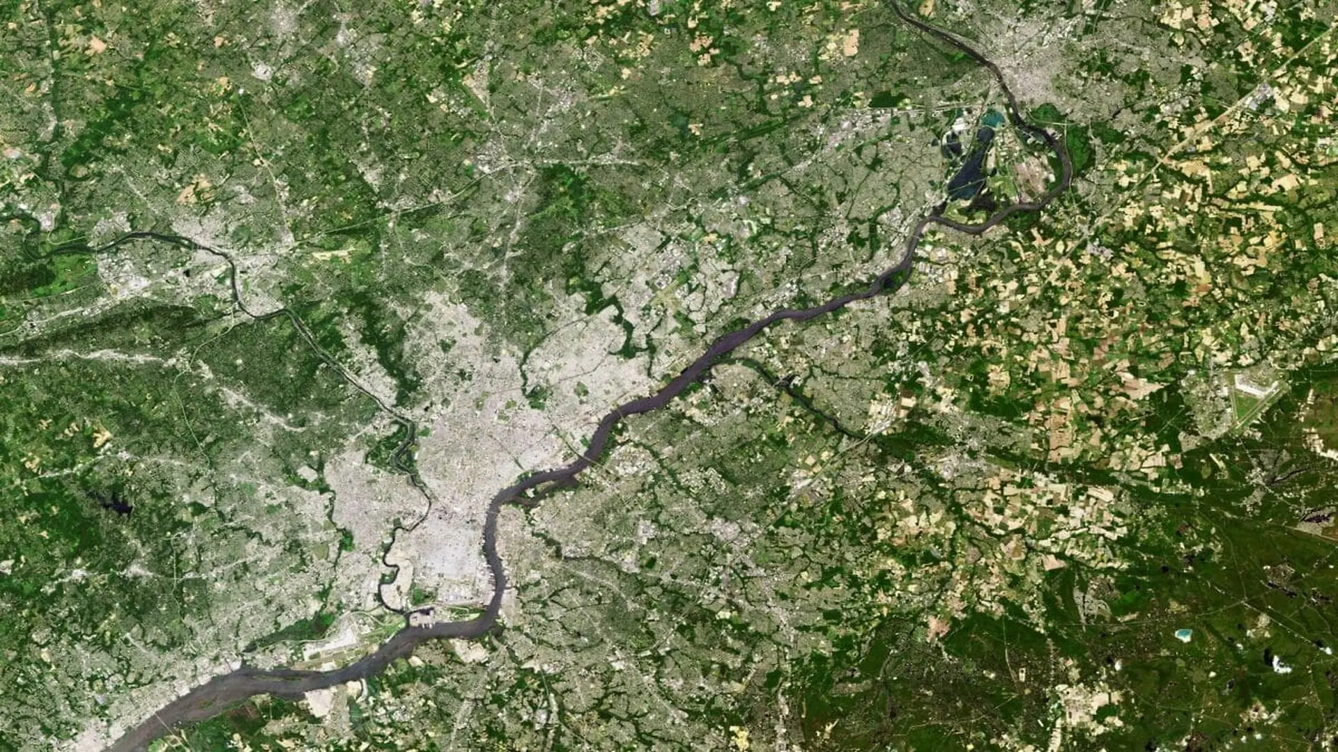
A June 1, 2013, image captured by Landsat 8 reveals that Philadelphia is still surrounded by a swath of green, more than three centuries after William Penn first established the settlement. The shot, taken with the Operational Land Imager on board the satellite, anchors a NASA Earth Observatory feature that revisits historic American landscapes for the nation’s 250th anniversary.
Nestled between the Schuylkill and Delaware rivers, the city’s early character and its later role as a political hub were both forged by those waterways. The twin rivers supplied natural borders and early trade routes that helped the fledgling settlement thrive.
Penn laid out Philadelphia in 1682 as the heart of a Quaker colony, arriving in an area already traversed by Swedish and Dutch explorers and inhabited by the Lenni Lenape (Delaware) peoples. A treaty with the Lenape secured the land for settlement.
Penn called the region Sylvania, a nod to its forested appearance—a name that endures in “Pennsylvania.” Contemporary accounts describe the spot he chose as a high, dry stretch beside the water, edged with pines, a description that matches the verdant cover still visible from orbit.
River Access Fueled Colonial Prosperity
Positioned just upstream of the Delaware Bay and the Atlantic Ocean, Philadelphia became an industrial, commercial, and cultural crossroads for the colonies. The river routes allowed ships to sail from the open sea into the bay and up the waterways directly to the city, making it a convenient stop for Atlantic‑linked trade.
That maritime advantage accelerated growth far beyond many neighboring settlements that lacked a direct coastal connection.
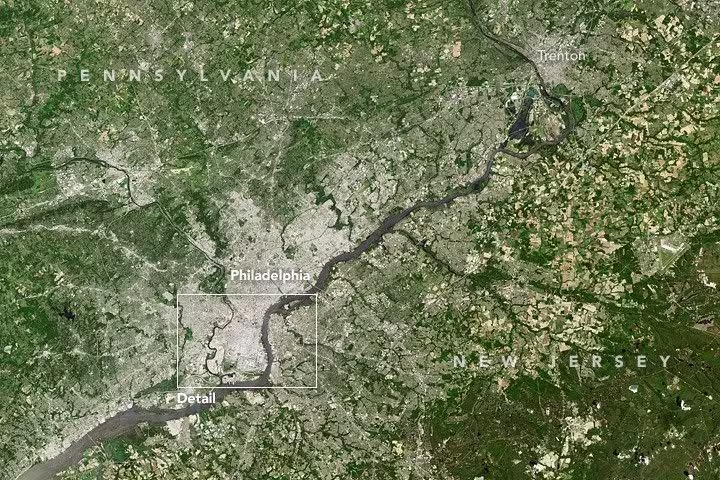
The Landsat view highlights how much of that original tree cover endures. Despite dense urban development, the landscape remains green more than three centuries after Penn’s arrival—a point the Earth Observatory article emphasizes as striking given the city’s size.
The same riverine geography that spurred early growth also placed Philadelphia near the geographic centre of the thirteen colonies, a factor that later made it a practical meeting point for delegates travelling from both northern and southern territories.
Philadelphia Hosted the Birth of the Nation
Nearly a century after its founding, the city became the stage for two pivotal moments in American history. In 1776, the Declaration of Independence was signed in Carpenter’s Hall, close to the red‑brick building that then housed Pennsylvania’s colonial government.
Eight years later, the Constitution was adopted in the same structure, now known as Independence Hall. Both historic signings occurred within a compact area of the city’s downtown.
From 1781 to 1788, Philadelphia also served as the seat of the United States government, anchoring the young nation’s political life even after the Revolutionary War concluded.
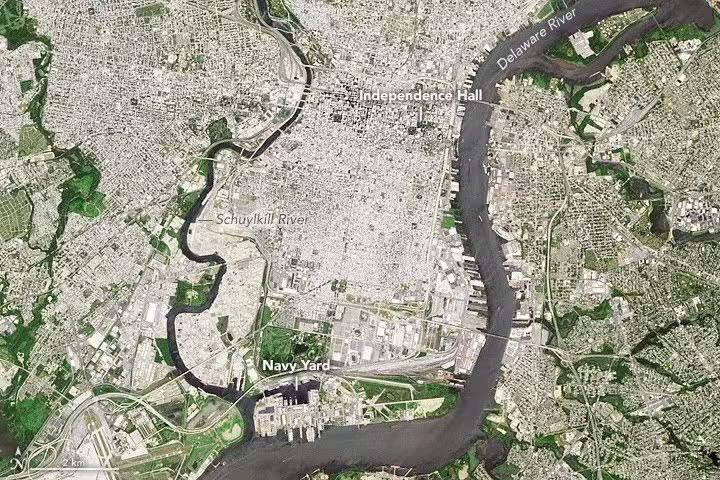
The city’s layout still bears the imprint of that era. A cluster of skyscrapers crowns Center City around Independence Hall, while a tighter grid of row houses spreads south into South Philadelphia, home to the historic Italian Market.
South Philadelphia began as an independent town before being incorporated into the city in 1854, driven by a population surge that pushed the two areas together and extended the municipal boundaries far beyond Penn’s original riverside plan.
Modern Philadelphia: Education, Health and a Mosaic of Cultures
Today, Philadelphia ranks as the United States’ fifth‑largest city, with a metropolitan population exceeding six million. That puts it among a select group of American metros that surpass the million‑resident threshold.
The city’s 19th‑century industrial boom left a lasting imprint on its architecture; many of the dense street grids and row‑house neighborhoods captured in the satellite image trace back to that manufacturing heyday.
Current economic drivers have shifted toward education and health services, mirroring a broader transition away from heavy industry in many historic urban centers. Yet the historic core around Independence Hall remains largely preserved.
South Philadelphia continues to reflect layers of immigration. The neighborhood hosts a sizable African‑American community and still shows traces of once‑prominent Italian, Irish, and Jewish populations, all of which arrived through the area’s longstanding role as a gateway for newcomers.
This article has been fact checked for accuracy, with information verified against reputable sources. Learn more about us and our editorial process.
Last reviewed on .
Article history
- Latest version
Reference(s)
- Nussbaum, Allison. “Operational Land Imager (OLI) - NASA Science.”, October 1, 2025 NASA <https://science.nasa.gov/mission/landsat/oli/>.
- “The Avalon Project : Frame of Government of Pennsylvania - May 5, 1682.”, doi: http://www.yale.edu/lawweb/avalon/states/. <http://avalon.law.yale.edu/17th_century/pa04.asp>.
- “Brief Biography of William Penn.” <http://www.ushistory.org/penn/bio.htm>.
- <https://en.wikipedia.org/wiki/Independence_Hall>.
Cite this page:
- Posted by Karan Das