The Search for Ubar: Satellite Find Raises New Questions About Arabia’s Lost City
Satellite imagery, old trade routes and ruins guide the hunt for a lost Arabian city, but scientists still debate what lies beneath the desert sands.
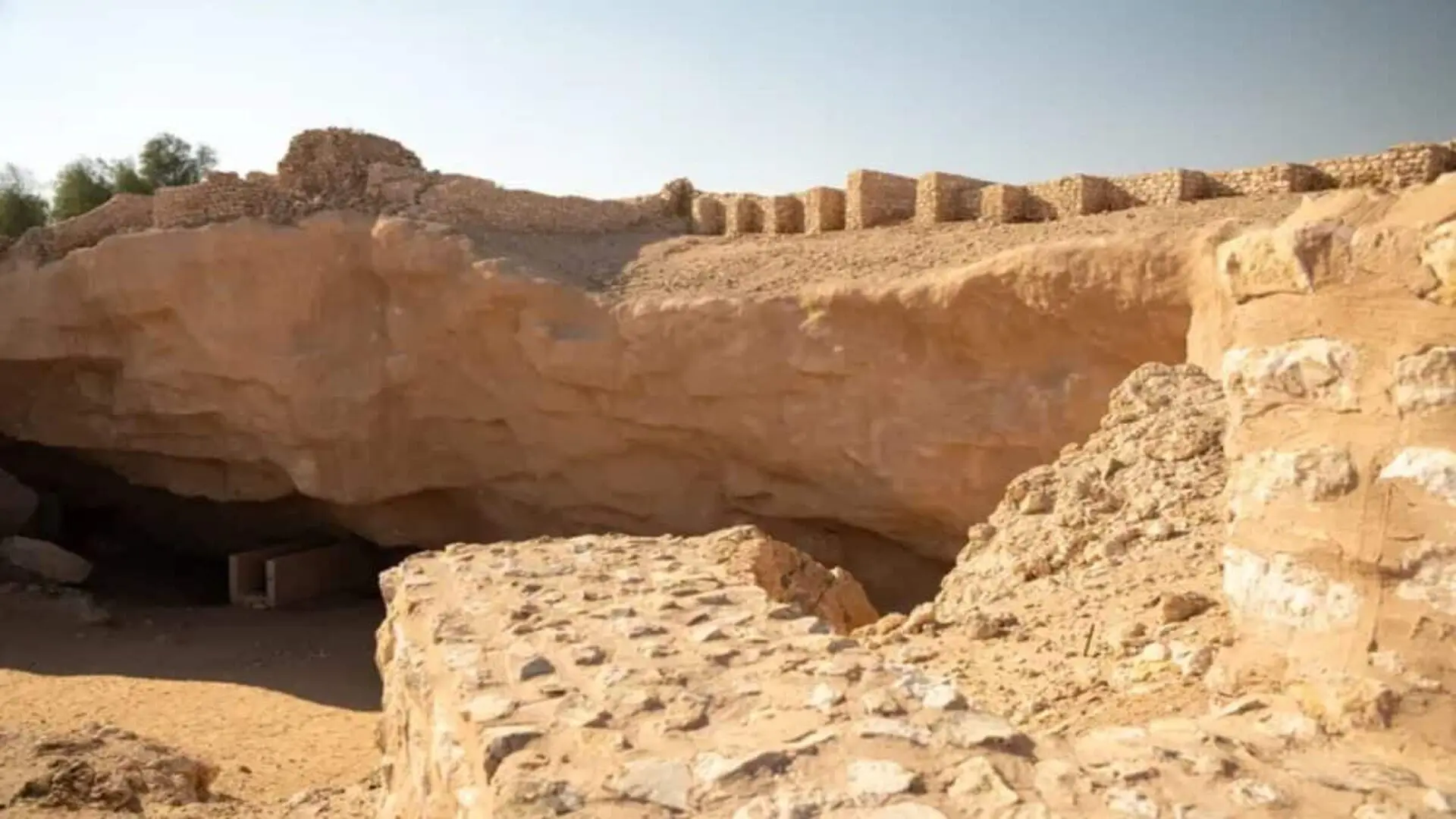
For decades the Arabian Desert has hidden a tantalizing story: a once‑prosperous oasis known as Ubar, often called the “Atlantis of the Sands,” supposedly vanished beneath shifting dunes. While satellite images in the 1990s seemed to pinpoint a candidate site, scholars continue to debate whether the ruins truly match the legendary capital of the incense trade.
Early Explorers Charted the Desert’s Myths
In 1931 British traveler Bertram Thomas became the first European to cross the Empty Quarter, guided by Bedouin informants who spoke of a forgotten city. Thomas recorded the routes and later published his findings in The Geographical Journal, coining the evocative nickname that captured public imagination. His account inspired a generation of adventurers—including T. E. Lawrence, Harry St. John Philby, Wilfred Thesiger, and American explorer Wendell Phillips—to pursue the elusive settlement along ancient caravan corridors that once ferried frankincense and myrrh to the Mediterranean.
NASA Imagery Sparks a Breakthrough
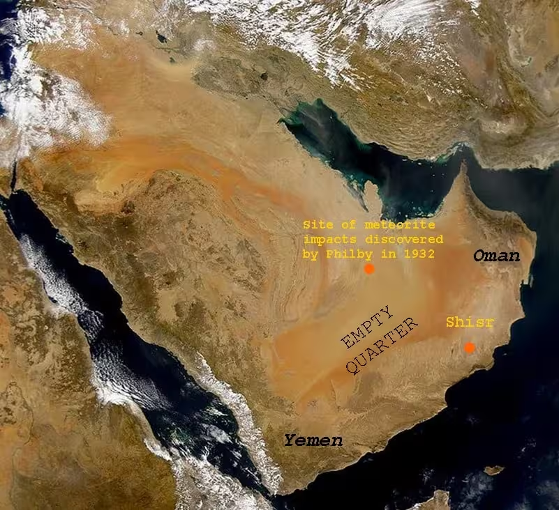
During the 1980s filmmaker‑archaeologist Nicholas Clapp assembled a team that included explorer Sir Ranulph Fiennes and archaeologist Juris Zarins. By analysing NASA satellite photographs of historic caravan pathways, they identified an oasis near Shisr in Oman as a potential convergence point. Subsequent digs uncovered a fortified enclosure, collapsed walls, assorted artifacts and a permanent well. A 1992 report in The New York Times described the find as “virtually sure” to be the fabled Ubar.
The announcement highlighted the rare instance in which space‑based technology seemed to validate a centuries‑old narrative. Yet the archaeological record remained incomplete, prompting further scrutiny.
Reassessing Shisr’s Place in History
Later research revealed that Shisr had been documented long before the 1990s. Wilfred Thesiger had noted the site, and oil‑company geologists recorded its remains in the 1940s. Structural analysis suggests the visible fortress dates to the 16th century, and UNESCO classifies the location as a medieval settlement rather than a prehistoric metropolis. Nonetheless, excavations recovered trade items linked to Persia, Rome and Greece, indicating that Shisr functioned as a significant waypoint on the incense routes.
Zarins has argued that the term “Ubar” may refer to a broader cultural sphere or a network of communities rather than a single urban centre. Shifts in trade patterns and a decline in groundwater availability could have caused the settlement’s eventual abandonment, a scenario supported by a sinkhole discovered on the site.
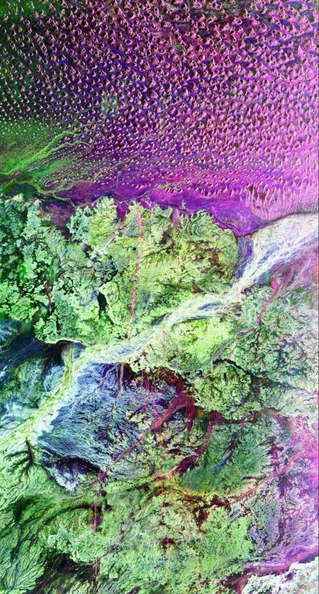
“We’re going to try to find precisely how well these cities stand out, if there are water sources associated with them, if the springs are perennial, and if they have these ancient trade routes running across them—because we know there were routes running across there during medieval times. Now it’s just a matter of getting out there and finding the ancient ones,” he stated.
This article has been fact checked for accuracy, with information verified against reputable sources. Learn more about us and our editorial process.
Last reviewed on .
Article history
- Latest version
Cite this page:
- Posted by Karan Das