Scientists Fled a Storm Into Antarctica’s Danger Zone and Found a Hidden Island Missing From Modern Maps
A storm drove researchers into Antarctica’s danger zone, where they uncovered a critical error in navigation maps that could mislead ships in icy waters
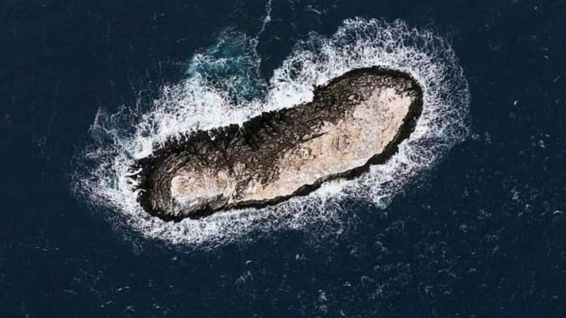
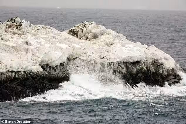
A mottled “iceberg” spotted in the Weddell Sea turned out to be a solid, rocky feature that was absent from existing charts. When the crew of the German icebreaker Polarstern closed in, they realized the silhouette ahead was not a floating mass of ice.
It was an unmapped island.
The discovery emerged during a 2026 Antarctic campaign coordinated by the Alfred Wegener Institute, Helmholtz Centre for Polar and Marine Research. According to an official AWI statement, a 93‑person multinational team had been operating in the northwestern Weddell Sea since 8 February 2026, when deteriorating weather forced the vessel to seek refuge near Joinville Island.
Diverting to the lee of Joinville Island brought the ship into a region that nautical charts listed only as a hazard area, without specifying the nature of the danger.
A Storm‑Driven Detour Leads to an Unrecorded Landmass
The Polarstern mission was not intended to hunt for new islands. AWI explained that the primary objectives involved studying meltwater and ice discharge from the Larsen Ice Shelf and tracking recent sea‑ice retreat linked to global ocean circulation.
When a gale forced the vessel to alter course, the crew sheltered behind Joinville Island, inadvertently steering the icebreaker into the charted danger zone.
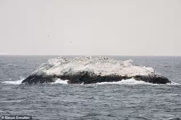
Bathymetry expert Simon Dreutter noted that the chart flagged “unexplored dangers to navigation,” but offered no clue about the feature’s identity. From the bridge, the crew first mistook the object for a dirty iceberg, only to recognize rock upon closer inspection.
The vessel altered its heading, and as it neared the target, the crew confirmed they were facing an island.
Sonar Scans and Drone Flights Map the New Island
Keeping a minimum clearance of 50 metres beneath the keel, Polarstern closed to roughly 150 metres from the shoreline, circled the formation, and deployed its onboard multibeam echo‑sounder to chart the surrounding seabed.
A drone was also launched. Its overlapping photographs were processed using photogrammetry, yielding a detailed elevation model and a georeferenced aerial view of the coast.
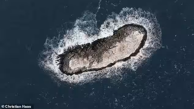
AWI reports that this marks the first systematic survey of the feature. The island measures about 130 metres in length, 50 metres wide, and rises roughly 16 metres above sea level.
For scale, the landmass is slightly longer than the 118‑metre Polarstern itself and about twice as wide. While not a continent‑shifting find, the size is significant for vessels navigating a region where ice, weather, and sparse chart data already pose challenges.
Why Satellite Data Missed the Feature
The puzzle extends beyond the island’s existence: why did nautical charts label the area as a hazard while other databases omitted the coastline altogether?
AWI acknowledges that the reasons remain unclear, including why the chart’s hazard symbol sits roughly one nautical mile from the island’s true position.
Remote sensing struggled to differentiate the island because its ice cover blended with surrounding icebergs. In the polar environment, a white or gray shape amid sea ice does not automatically indicate permanent land.
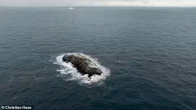
The episode underscores that even today, small, ice‑covered coastal features can evade detection in global datasets, especially where in‑situ measurements are limited.
Accurate representation matters for bathymetric products such as the International Bathymetric Chart of the Southern Ocean. Sparse sampling and interpolation can cause minor islands to disappear from compiled maps.
The broader issue of Antarctic cartography is highlighted in U.S. Geological Survey documentation on mapping the Antarctic region, which stresses coordinated scientific data as essential for understanding the continent and its surrounding Southern Ocean.
Next Steps: Naming and Chart Updates
The island has yet to receive an official international name. AWI indicated that the research team must now follow the formal naming protocol for newly identified features.
After the designation is finalized, the scientists intend to release the precise coordinates and push the data into updated nautical charts and related repositories. Accurate charting is crucial for ships operating in waters where hidden obstacles can be hard to spot.
The expedition also recorded observations of sea‑ice variability in the northwestern Weddell Sea, noting pronounced differences in ice thickness and early signs of surface melt. AWI plans further analysis and modeling based on the collected data.
This article has been fact checked for accuracy, with information verified against reputable sources. Learn more about us and our editorial process.
Last reviewed on .
Article history
- Latest version
Reference(s)
- “Uncharted island soon to appear on nautical charts.”, April 8, 2026 <https://www.awi.de/en/about-us/service/press/single-view/unkartierte-insel-demnaechst-auf-seekarten-verzeichnet.html>.
- “Report.” <https://pubs.usgs.gov/fedgov/70039167/report.pdf>.
Cite this page:
- Posted by Divya Iyer