Ancient Andean Landscape Revealed Beneath Massive 22 Million Year Old Volcanic Blanket
A massive volcanic deposit in Chile has revealed how quickly the Andes mountains rose before a prehistoric eruption, uncovering a hidden chapter of history.
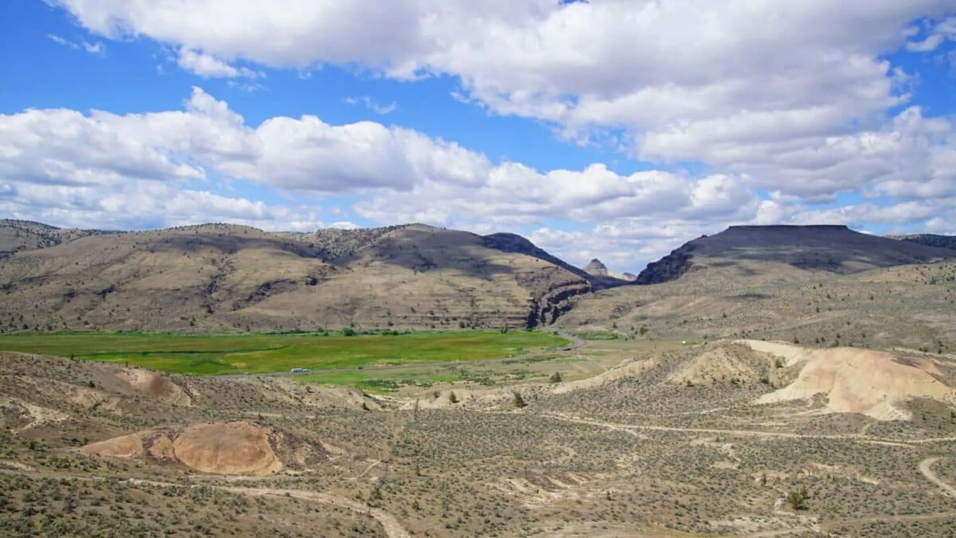
A geological investigation into the heart of the Andes has uncovered a novel way to reconstruct the ancient history of mountain building. By analyzing vast, ancient volcanic deposits that once blanketed the landscape, researchers have successfully “unwrapped” the terrain as it existed over 20 million years ago, providing fresh insight into the slow, steady rise of one of the world’s most iconic mountain ranges.
A Volcanic Time Capsule
The study, published in Science Advances, centers on the massive Cardones ignimbrite. Roughly 21.9 million years ago, a colossal eruption from the Lauca Caldera in northern Chile blanketed the western reaches of the Central Andes. This cataclysmic event, which expelled over 1,260 cubic kilometers of volcanic material and left deposits up to one kilometer thick, inadvertently acted as a preservation agent for the prehistoric topography beneath it.
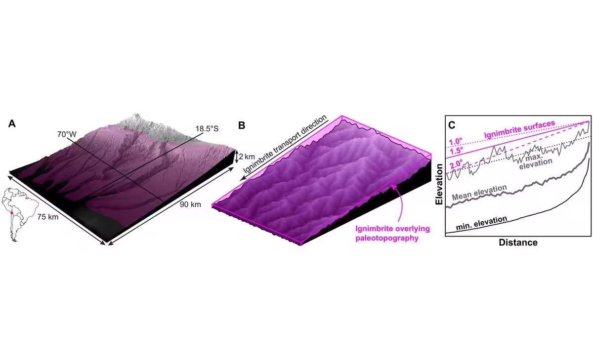
Dr. Byron Adams of UCL Earth Sciences notes that this technique offers a departure from traditional geomorphology. While researchers typically rely on the chemical signatures trapped within minerals to date tectonic shifts, this new methodology utilizes the geometric relationship between preserved volcanic “blankets,” river drainage systems, and the underlying buried surface.
Mapping the Pace of Tectonic Growth
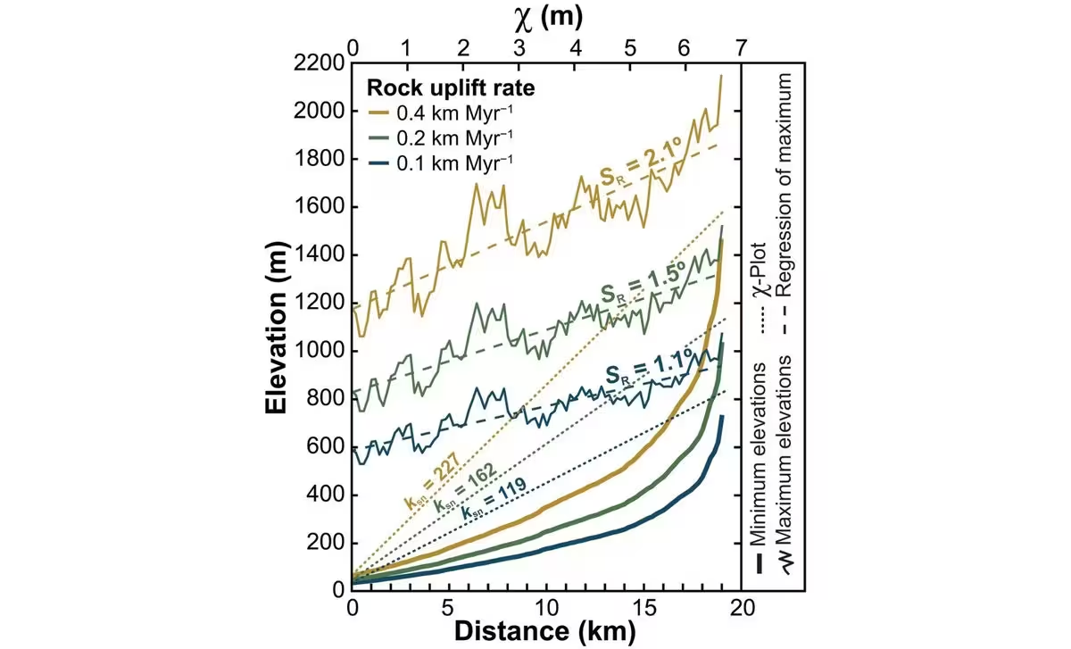
To determine how the Andes reached their current stature, the team employed sophisticated river-driven landscape evolution models. By simulating hundreds of potential terrains and comparing them against the actual geometry of the Cardones ignimbrite, the researchers could effectively filter out configurations that were physically impossible. They discovered that only landscapes with low-relief slopes were compatible with the volcanic layer, effectively ruling out periods of rapid, dramatic mountain uplift during that era.
The findings suggest that the rocks of the western Central Andes rose at a rate of less than 0.26 kilometers per million years—a pace of roughly 2.5 centimeters per century. This slow-and-steady progression aligns with the published data and complements independent geological studies, including mineral cooling histories, which have long hinted at a more gradual development of the Andean margin rather than a singular, sudden spike in elevation.
A New Tool for Global Geoscience
The implications of this research extend far beyond the Andes. Dr. Frances Cooper, also of UCL Earth Sciences, emphasizes that this analytical framework is highly portable. Because massive ignimbrite deposits exist across various volcanic regions worldwide, this method could provide a standardized way to look back through the geologic record to understand the environmental conditions that preceded ancient eruptions.
By treating volcanic burial as a unique diagnostic window rather than a simple obfuscation of the past, geologists now have a powerful tool to untangle the complex, long-term interactions between volcanic activity, surface erosion, and the slow climb of the earth’s crust.
This article has been fact checked for accuracy, with information verified against reputable sources. Learn more about us and our editorial process.
Last reviewed on .
Article history
- Latest version
Reference(s)
- Adams, Byron A.., et al. “Landscapes buried beneath large-volume ignimbrites reveal preeruptive uplift rates.” Science Advances, vol. 12, no. 37, September 11, 2026 American Association for the Advancement of Science (AAAS), doi: 10.1126/sciadv.aee5374. <https://www.science.org/doi/10.1126/sciadv.aee5374?referrer=https%3A%2F%2Fscitechdaily.com%2F>.
Cite this page:
- Posted by Vikram Desai