Why This 2002 NASA Satellite Photo of the Bahamas Still Looks Identical 20 Years Later
A NASA satellite image captured years ago still astonishes scientists with an unexpected feature that sets it apart from every other picture.
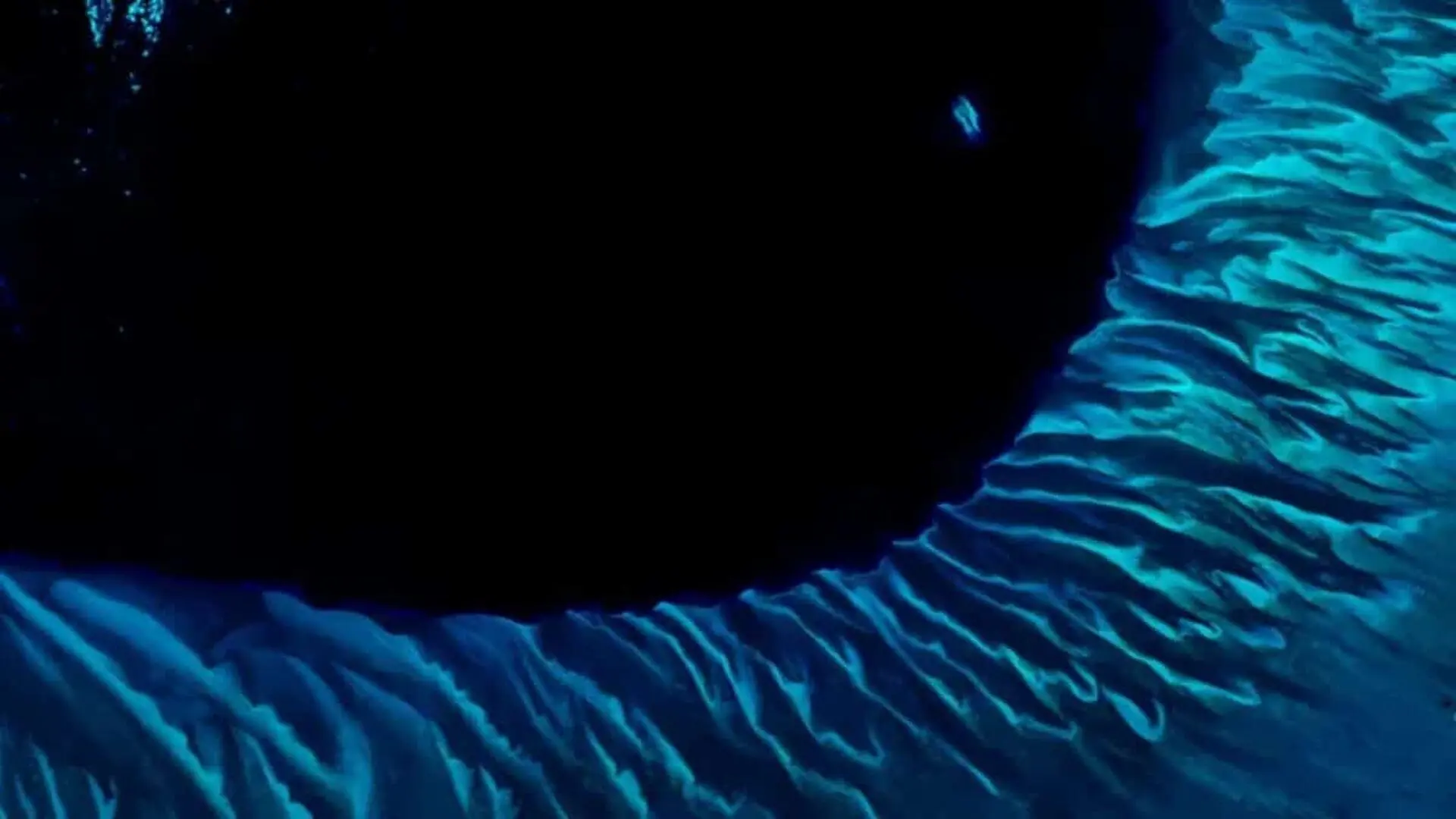
A striking view of the Great Bahama Bank captured by NASA Earth Observatory continues to draw attention almost twenty years after it first appeared, offering a rare visual record of a marine environment that has changed very little over that span.
First released as the Observatory’s Image of the Day in 2002, the photograph resurfaced when it won the publication’s Tournament Earth 2020, outshining a host of newer satellite captures. Oceanographer Serge Andréfouet, who originally highlighted the picture’s distinctiveness, said its enduring appeal was unsurprising.
The picture also marks a milestone in coral‑reef science, having been gathered during the Millennium Coral Reef Mapping Project – a NASA‑funded effort aimed at updating global reef maps that had remained largely unchanged since the nineteenth century.
Ancient Forces Sculpt a Shallow Seafloor
NASA Earth Observatory notes that the bank emerged as dry land during past ice ages before being submerged as sea levels rose. Today, the platform is covered by water only two metres (seven feet) deep in many places, and its surface consists mainly of white carbonate sand and limestone derived from coral skeletons. Similar deposits helped build the Florida peninsula.
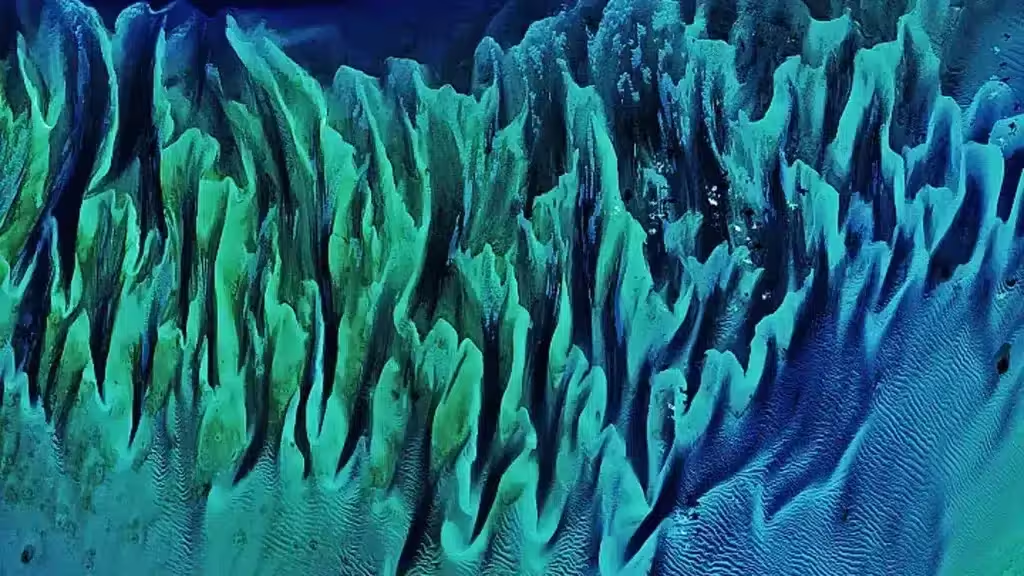
The curved lines visible from orbit are underwater sand ripples that follow the slopes of submerged dunes, likely formed by relatively strong currents near the seabed. Shifts in sand quantity, seagrass cover and water depth generate the blue‑green shades that dominate the picture.
Why the Satellite Shot Went Viral
The scene was captured on January 17, 2001 by the Enhanced Thematic Mapper Plus (ETM+) sensor on Landsat 7, using spectral bands 1, 2 and 3.
NASA explains that the satellite’s blue spectral band made shallow‑water features easier to discern than with earlier missions, a capability that proved especially useful for monitoring coastal zones and reef habitats. For Serge Andréfouet, the image stood out from the moment he first examined it.
“There are many nice seagrass and sand patterns worldwide, but none like this anywhere on Earth,” he said. “I am not surprised it is still a favorite, especially for people who see it for the first time.”
The image has been reproduced on countless websites, in textbooks and even on party visuals. When Landsat 8 revisited the same coordinates on February 15, 2020, the underwater patterns remained largely unchanged.
A Cornerstone for Reef Mapping and Conservation
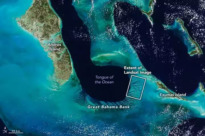
The shallow bank drops abruptly into the Tongue of the Ocean, a deep basin that reaches about 2,000 metres (6,500 feet). The region supports more than 160 fish and coral species and lies adjacent to Andros Island, home to one of the world’s largest fringing reefs.
A broader view of the area was obtained on April 4, 2020 by the Moderate Resolution Imaging Spectroradiometer (MODIS) aboard NASA’s Terra satellite, highlighting the contrast between the bright, shallow bank and the darker surrounding waters.
The original capture formed part of the Millennium Coral Reef Mapping Project, which eventually gathered more than 1,700 Landsat 7 images. NASA notes that Landsat 7 was the first mission in the program capable of imaging both coastal waters and the open ocean. Reef maps derived from these satellite data are now combined with sea‑surface temperature information to pinpoint regions vulnerable to coral bleaching and to track the health of coral reef ecosystems worldwide.
This article has been fact checked for accuracy, with information verified against reputable sources. Learn more about us and our editorial process.
Last reviewed on .
Article history
- Latest version
Reference(s)
- Migrate, NASA. “Still Sandy After All These Years - NASA Science.”, May 14, 2020 NASA <https://science.nasa.gov/earth/earth-observatory/still-sandy-after-all-these-years-146697/>.
- <https://www.researchgate.net/scientific-contributions/Serge-Andrefouet-13012048>.
- Cermak, Alicia. “Landsat 8 - NASA Science.”, June 15, 2023 NASA <https://science.nasa.gov/mission/landsat-8/>.
- “MODIS Web.” <https://modis.gsfc.nasa.gov/about/>.
- Cermak, Alicia. “Landsat 7 - NASA Science.”, June 15, 2023 NASA <https://science.nasa.gov/mission/landsat-7/>.
Cite this page:
- Posted by Karan Das