Recent Solar Storm Exposed A Hidden GPS Vulnerability In Regions Thought To Be Safe
A rare space weather event has revealed unexpected impacts on GPS accuracy, prompting new concerns about the reliability of global navigation systems.
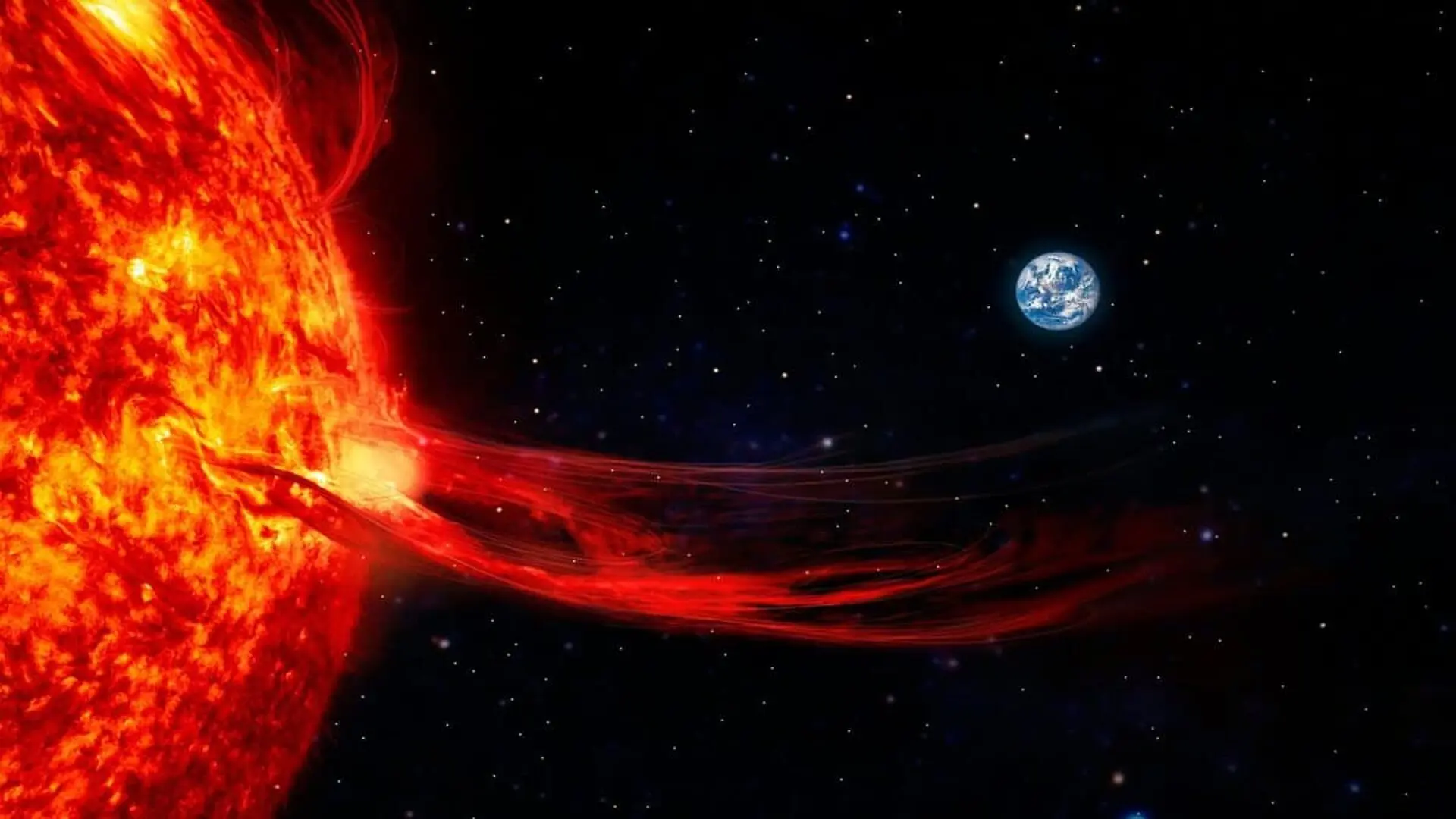
Modern society relies heavily on the Global Positioning System (GPS) for everything from agricultural automation and transportation logistics to the high-precision timing signals that anchor global financial and telecommunications infrastructure. While these services are often viewed as constant and reliable, a new study highlights a persistent vulnerability: the ionosphere, an atmospheric layer that can fluctuate wildly during periods of heightened solar activity, potentially destabilizing the satellite signals we take for granted.
Solar Storms Shift the Boundaries of Ionospheric Interference
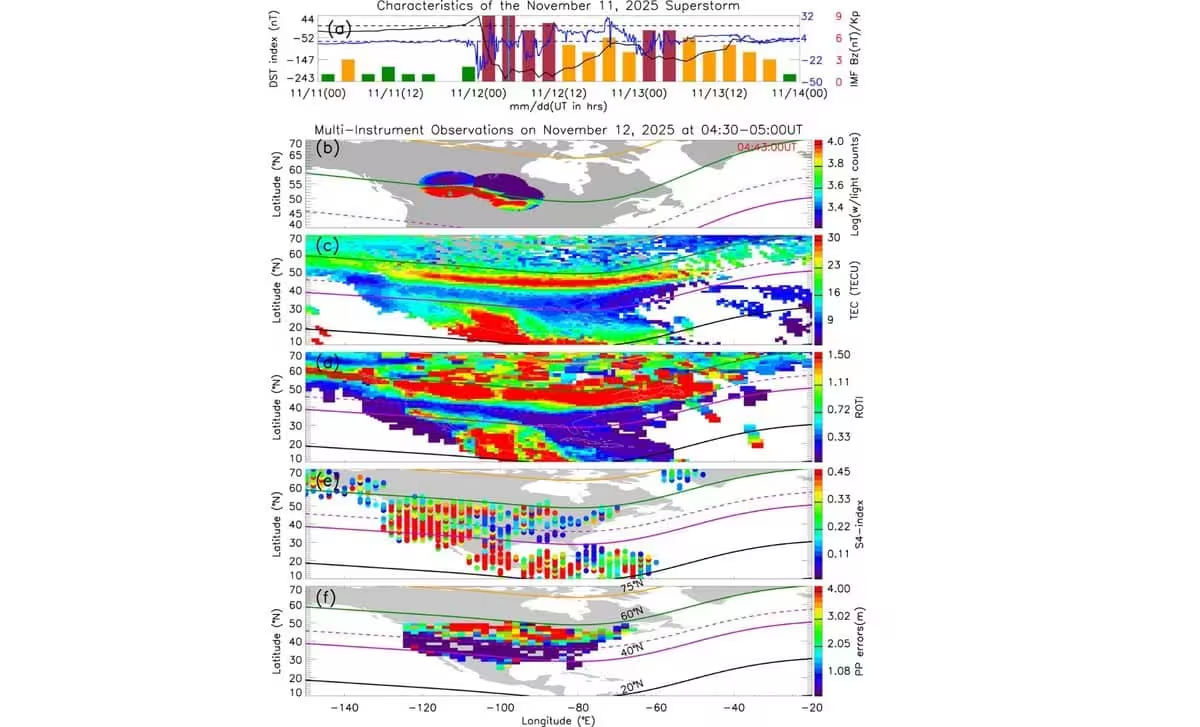
The core of the problem lies in the path GPS signals must travel to reach Earth. As they pass through the ionosphere, variations in electron density can refract or delay the radio waves, leading to reduced precision. The investigation into a significant event in November 2025 revealed that a geomagnetic storm caused the auroral oval—the high-latitude ring where the northern and southern lights typically shimmer—to migrate much farther toward the equator than experts previously anticipated.
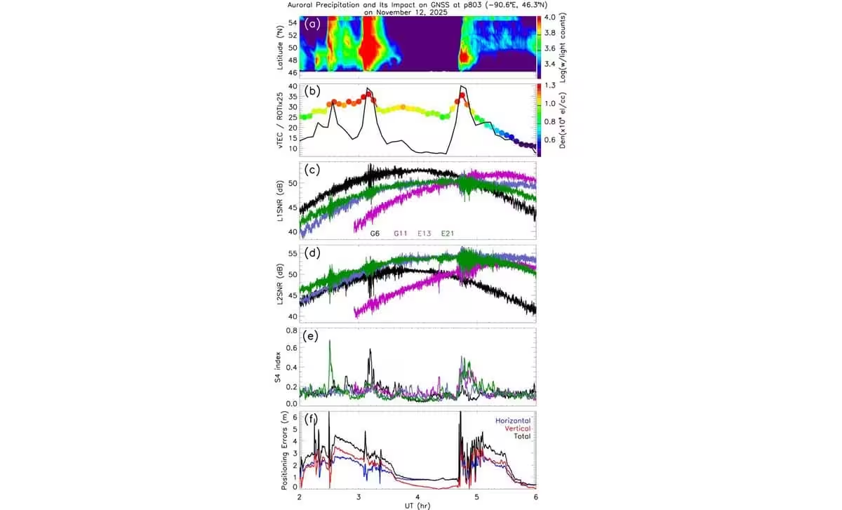
As this high-latitude region pushed into lower latitudes, it created a massive boundary zone where electron density fluctuated violently. This shift triggered intense amplitude scintillation, a phenomenon where GPS signals shimmer and fade as they traverse the turbulent, charged particles of the upper atmosphere. Researchers likened this effect to the visual distortion seen when looking through heated air rising from a paved road, which effectively masks the true position of the satellite signal.
Precision Industries Face Emerging Operational Risks
While a few meters of positioning error might be negligible for a driver following a smartphone map, the consequences for industrial operations are severe. Precision agriculture, which utilizes satellite-guided equipment to optimize planting and harvesting, is particularly sensitive to these shifts. Even minor signal deviations can lead to significant overlap or navigational errors in automated machinery. Similarly, the National Institute of Standards and Technology (NIST) has emphasized that the synchronization signals provided by GPS are essential for the stability of national power grids, banking systems, and data networks.
The November 2025 event serves as a stark reminder of the evolving nature of space weather. While the massive geomagnetic storm of May 2024 resulted in larger, more localized positioning errors—reaching up to 70 meters in some parts of the United States—the 2025 event demonstrated a different kind of threat: widespread, strong signal fading across mid-latitudes where such interference had rarely been documented before.
Improving Predictive Capabilities for a Tech-Dependent World
Forecasting the precise impact of solar activity on GPS remains a formidable challenge for scientists. As noted by the NOAA Space Weather Prediction Center, the raw intensity of a solar storm does not correlate linearly with the level of disruption experienced by ground-based technology. Instead, the damage is contingent on a complex interplay between solar particles, local magnetic field interactions, and the shifting state of the ionosphere on Earth.
Researchers are calling for more robust, physics-based modeling and broader, coordinated global observations to track how these disturbances evolve in real time. The latest data underscores that areas previously thought to be immune to space-weather-induced navigation errors are now increasingly at risk, prompting a reevaluation of how we protect critical infrastructure as the reliance on autonomous systems continues to grow.
This article has been fact checked for accuracy, with information verified against reputable sources. Learn more about us and our editorial process.
Last reviewed on .
Article history
- Latest version
Reference(s)
- Yizengaw, E.., et al. “Impacts of Mid‐Latitude Ionospheric Dynamics on RF Applications During the November 2025 Superstorm Event.” Geophysical Research Letters, vol. 53, no. 17, August 29, 2026 American Geophysical Union (AGU), doi: 10.1029/2026GL124645. <https://agupubs.onlinelibrary.wiley.com/doi/10.1029/2026GL124645>.
- “Responsible Use of Positioning, Navigation and Timing Services.”, February 24, 2020 NIST <https://www.nist.gov/pnt>.
- Younas, Waqar., et al. “Spatio‐Temporal Evolution of Mid‐Latitude GPS Scintillation and Position Errors During the May 2024 Solar Storm.” Journal of Geophysical Research: Space Physics, vol. 130, no. 6, June 9, 2025 American Geophysical Union (AGU), doi: 10.1029/2025JA033839. <https://agupubs.onlinelibrary.wiley.com/doi/10.1029/2025JA033839>.
- “Space%20Weather%20101%20Factsheet%20Final.” <https://www.spaceweather.gov/sites/default/files/images/Space%20Weather%20101%20Factsheet%20Final.pdf>.
Cite this page:
- Posted by Farah Siddiqui