Sacred Sites in Nepal Follow Hidden Terrain and Water Patterns
A national-scale spatial analysis reveals that temples and monasteries are deliberately positioned on smooth ground and near water, defying random population spread.
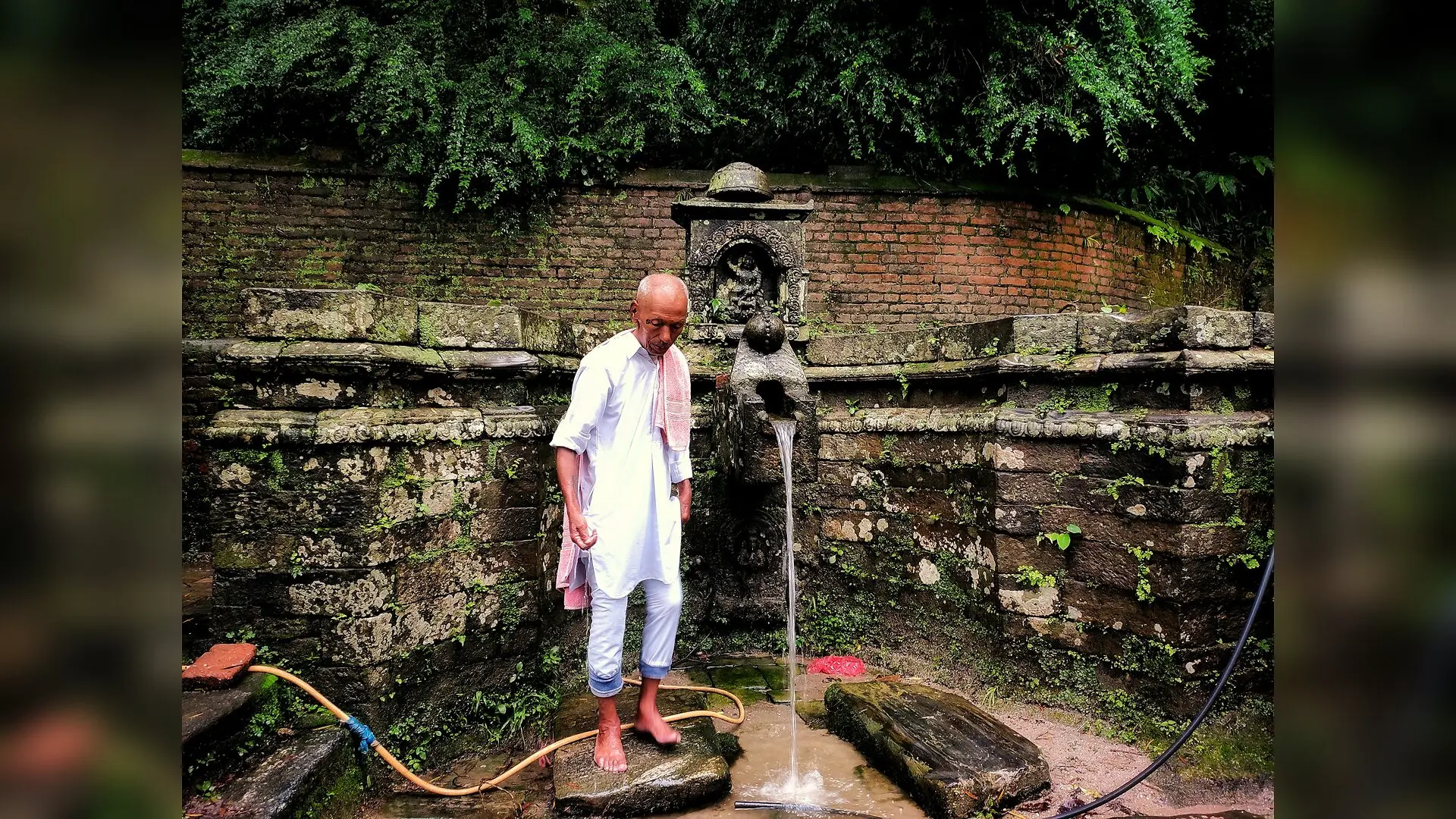
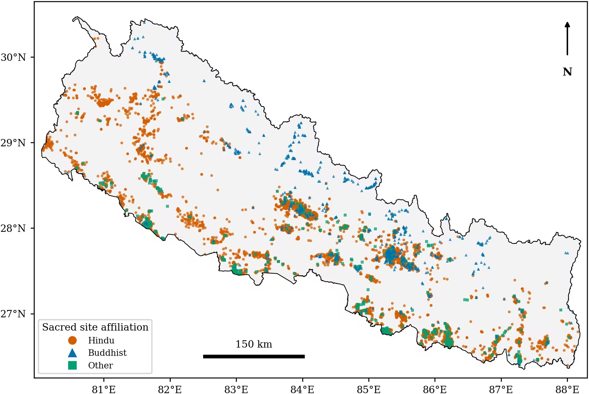
When researchers mapped more than 8,000 places of worship across Nepal, they discovered that sacred sites do not just follow where people live, but instead occupy very specific types of land and water settings that change dramatically across the country’s towering elevation gradients. The study, published in the PLOS One journal, examines whether the placement of temples, monasteries, and shrines is structured by terrain and water once population distribution is accounted for. The findings reveal a distinct environmental logic underlying Nepal’s sacred geography, offering a quantitative test of ancient traditions.
Separating Human Settlement from Sacred Preferences
Human beings generally build their homes on flat, accessible land near water sources, which creates a major methodological challenge when studying religion. Because communities construct places of worship where they live, any perceived preference for a river terrace might simply reflect practical settlement patterns rather than a deliberate spiritual choice. To solve this puzzle, the authors compared 8,212 mapped places of worship from OpenStreetMap against 10,000 synthetic control points weighted by the 2021 national census population across 6,743 administrative wards.
This matched-control design allowed the team to isolate environmental preferences from the background distribution of human population. The investigators also built a second control set using 50,000 building centroids from the Google Open Buildings dataset to ensure the results did not depend on synthetic population modeling. By analyzing these datasets through machine learning classifiers and non-parametric effect sizes, the team tested whether sacred placement follows physical landscapes differently across Nepal’s diverse physiographic belts.
How Landscape Preferences Shift Across Physiographic Belts
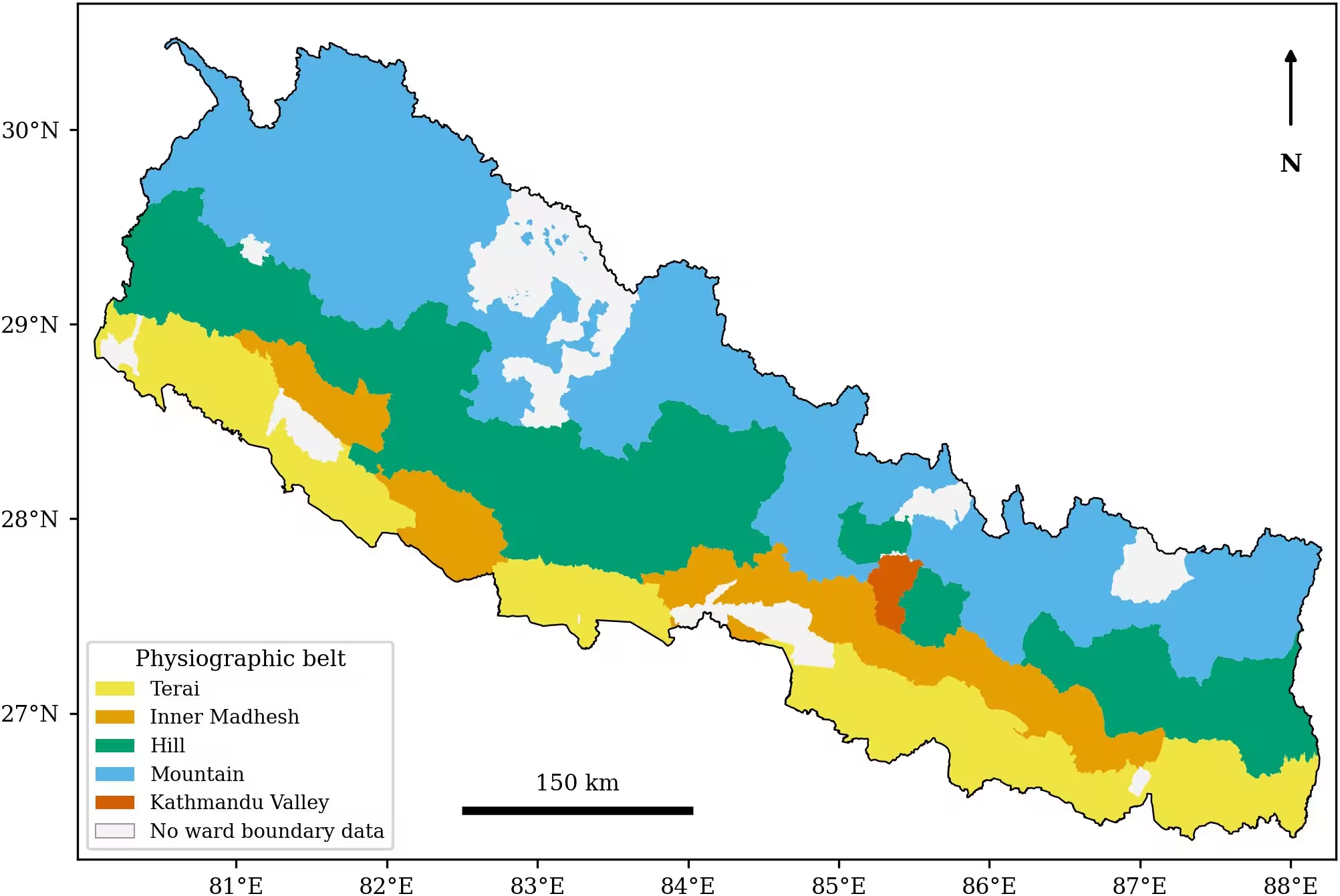
Nepal rises from roughly 60 meters above sea level on the flat southern Gangetic plain up to 8,848 meters at Sagarmatha peak in the high Himalaya. The study analyzed five distinct physiographic zones: the Terai, Inner Madhesh, Hill, Mountain, and the Kathmandu Valley. The results show that the dominant environmental factor guiding sacred site placement changes from one belt to another.
In the flat Terai plain, sacred sites show a medium-to-large preference for locally elevated ground, standing well above their immediate surroundings to escape flood risks. In contrast, sacred sites in the Hill, Mountain, and Inner Madhesh belts sit on significantly smoother, less rugged ground than population-matched controls. Mountain shrines specifically avoid steep slopes and high ridges, sitting instead within inhabited valleys at lower relative elevations than their wider surroundings.
Proximity to standing water emerged as the most consistent signal across the entire country. Sacred sites sit closer to lakes, ponds, and reservoirs than population-matched controls in every single physiographic belt. Flowing rivers also attract sacred sites in the Hill and Mountain belts, whereas geological structures such as tectonic faults and thrusts showed little to no attraction, with sites often positioned farther from thrust lines than random controls to avoid unstable, unbuildable ground.
Comparing Hindu and Buddhist Traditions in High Altitude Regions
The research also explored differences between Hindu and Buddhist sites within specific belts. In the high Mountain belt, the two major traditions diverge in their landscape positioning. Buddhist sites sit closer to rivers and water bodies and occupy less prominent local terrain than Hindu sites in the same region. Even after controlling for visitor infrastructure and trekking route accommodation points, this distinct prominence contrast between Buddhist and Hindu mountain sites remained consistent.
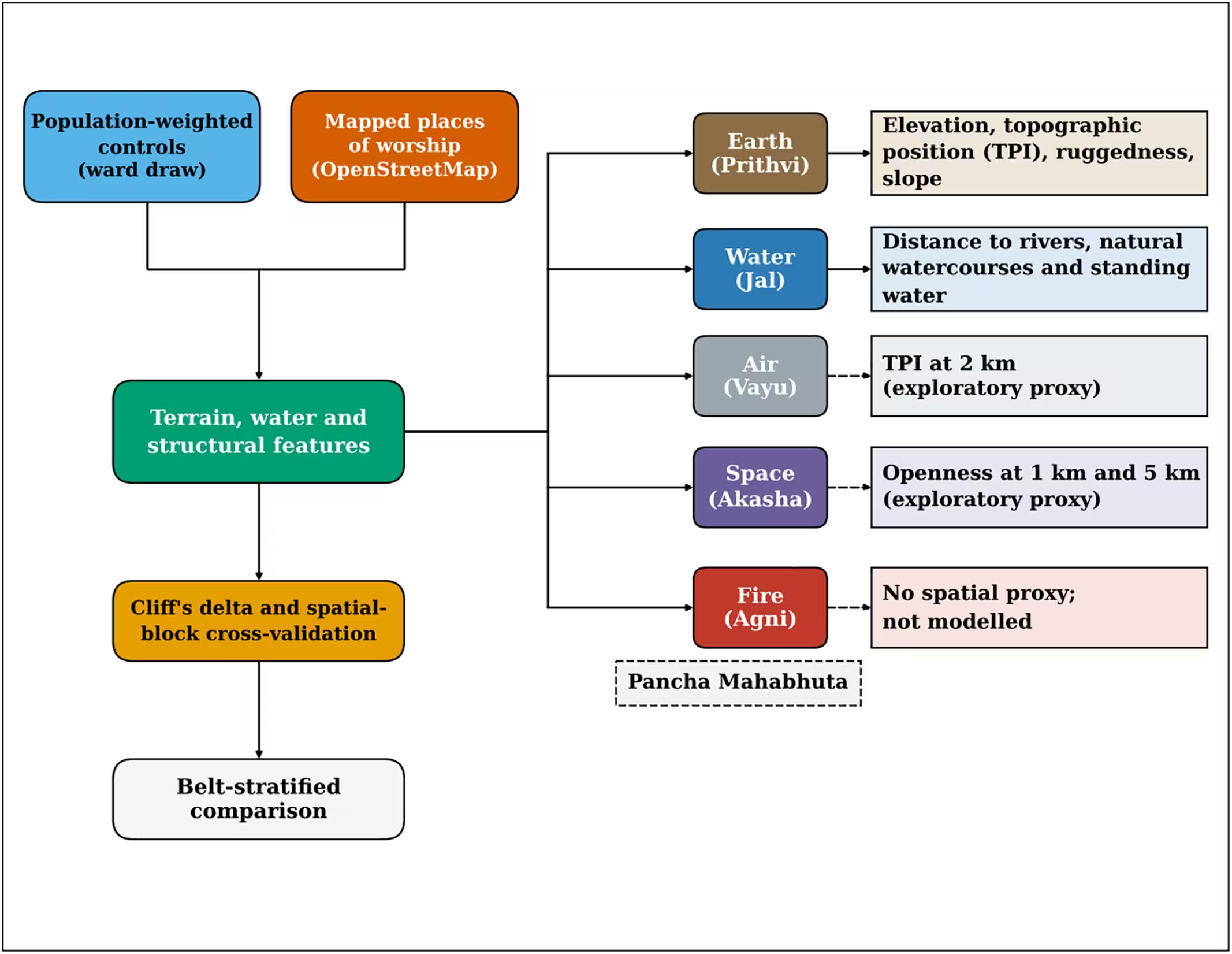
The authors note that these spatial regularities correspond closely to elements of the classical Pancha Mahabhuta, the traditional five-element framework of earth, water, fire, air, and space. While the study treats this framework as an interpretive lens rather than a proven causal mechanism, the clear empirical alignment between sacred sites and the physical elements of earth and water provides a rare quantitative validation of ancient South Asian architectural and landscape treatises.
Evaluating Open Data Biases and Next Steps
The researchers emphasize that their dataset relies on volunteered geographic information, which tends to map urban and accessible areas more thoroughly than remote rural terrain. Although adding road-proximity controls raised predictive accuracy across all models, road-free spatial cross-validation models still achieved area under the curve scores between 0.75 and 0.84. This indicates that the environmental terrain signals carry genuine weight beyond mere mapping accessibility.
Future field verification, finer-scale population metrics, and repeated mapping snapshots will help clarify how these landscape patterns hold up over time. As rapid infrastructure development and climate hazards threaten heritage sites, understanding the environmental logic of historical sacred geography offers valuable insights for regional conservation and hazard resilience.
The research was published in PLOS One on November 19, 2026.
This article has been fact checked for accuracy, with information verified against reputable sources. Learn more about us and our editorial process.
Last reviewed on .
Article history
- Latest version
Reference(s)
- Awasthi, Bhuwan., et al. “Terrain, water, and the placement of sacred sites across Nepal's physiographic belts.” PLOS One, vol. 21, no. 11, November 19, 2026, pp. e0358906 Public Library of Science (PLoS), doi: 10.1371/journal.pone.0358906. <https://doi.org/10.1371/journal.pone.0358906>.
Cite this page:
- Posted by Divya Iyer