Hidden Dams, Not Roads: How the Red Pyramid’s Surrounding Walls Managed Floods 4,600 Years Ago
New study suggests two ancient earthen walls on Dahshur are a 4,500‑year‑old dam system, not ramps, built to control floods for Egypt’s early pyramids.
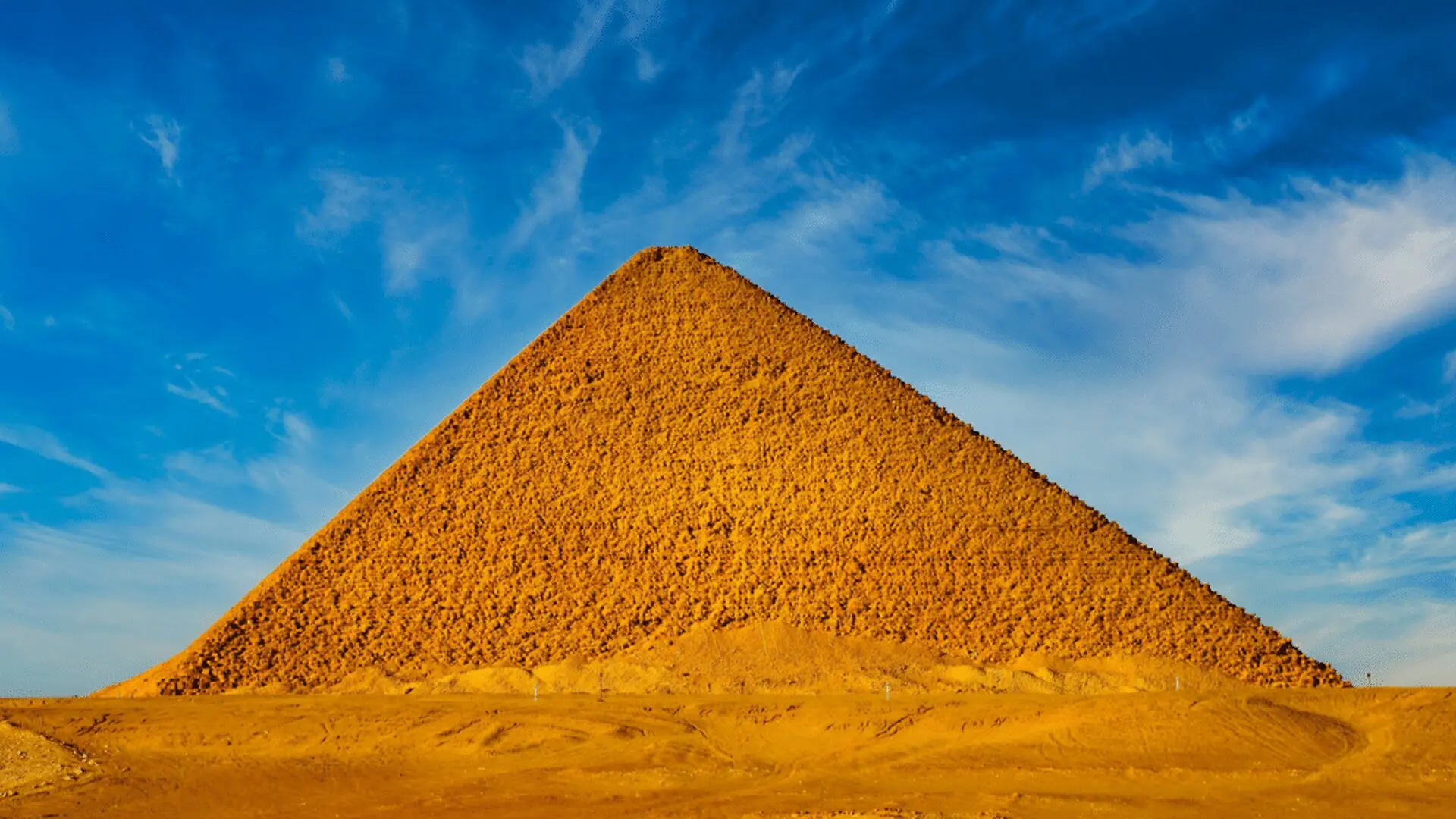
A recent investigation published in npj Heritage Science overturns a near‑century‑old assumption about two massive stone walls that stretch across the Wadi Dahshur valley. Rather than serving as transport routes for quarry stone, the authors argue the structures constitute a coordinated hydraulic complex intended to retain water, trap sediment, and moderate flash floods that once surged through the desert landscape.
Rethinking a Historical Misinterpretation
Cartographers dating back to the 1850s, including Erbkam, Lepsius and De Morgan, first recorded the twin linear features on their surveys. Aerial reconnaissance by the Royal Air Force in 1925 reinforced their visibility, leading scholars by the late 1940s to label them as causeways linking nearby limestone quarries with the Red Pyramid. Although Egyptologist Dieter Arnold questioned the ramp hypothesis in 1981, he still regarded the monuments as transport pathways.
In the new study, researchers Xavier Landreau, Guillaume Piton and Sayed Hemeda demonstrate that the western wall’s irregular geometry contradicts a roadway interpretation. Its staggered outline matches a “duckbill weir,” a spillway form that expands the length of a water‑overflow edge and is typical of dam engineering rather than of transport infrastructure. Because neither wall has been excavated and both remain cloaked in sand, the team reconstructed their shapes using satellite data, historic maps and digital terrain models.
A Paired Dam System Controlling Ancient Floods
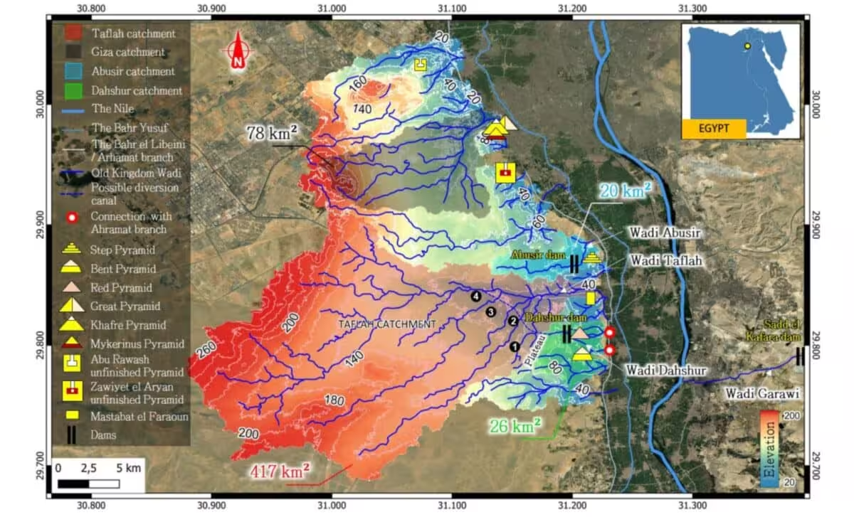
According to the authors, the eastern wall, situated nearest to the pyramid, functioned as the primary reservoir dam, while the western counterpart, roughly 200 metres upstream, acted as a check dam that captured sediment before it could fill the main basin. The intervening low‑lying area, spanning about 8.5 hectares, likely served as an energy‑dissipation zone, slowing water velocity prior to downstream flow.
Topographic analysis of maps from 1974 suggests the eastern reservoir once stored several hundred thousand cubic metres of water before sand infill obscured its capacity. A diversion channel, initially noted by De Morgan in 1897, traced a nearly kilometre‑long route along the pyramid’s western flank before turning toward its base. Subsequent electrical‑resistivity surveys have validated a preserved segment of this channel, and the study proposes that it may have supported barges or sledges transporting construction material, echoing similar hydraulic installations identified at Giza and Wadi el‑Jarf.
The authors draw a parallel with the Snefru‑era dam at Sadd el‑Kafara, which failed after a catastrophic flood—an outcome they attribute to an inadequate spillway. By contrast, the duckbill design at Dahshur would have provided roughly twice the discharge capacity of a straight weir of comparable width, representing a deliberate engineering refinement.
To account for the water source, the team highlights the expansive Wadi Taflah catchment situated nearby. A modest diversion following the flat 80‑metre‑above‑sea‑level divide could have amplified the effective drainage area a hundredfold. Paleoclimatic data indicate that Old Kingdom precipitation levels exceeded modern values, supplying sufficient runoff to fill the dams during seasonal flood events.
The researchers caution that the sites lie within a restricted military zone, and without archaeological excavation it remains uncertain whether the dams date to the Red Pyramid’s construction phase or whether the central depression in the eastern wall represents an intentional spillway rather than an erosional breach. Nonetheless, the convergence of geomorphological and hydraulic indicators leads them to classify the Dahshur walls as purpose‑built water‑management structures, urging future fieldwork and broader surveys of comparable desert features that may have been misidentified as roads.
This article has been fact checked for accuracy, with information verified against reputable sources. Learn more about us and our editorial process.
Last reviewed on .
Article history
- Latest version
Reference(s)
- “Google Scholar.” <https://scholar.google.co.uk/scholar?as_q=&num=10&btnG=Search+Scholar&as_epq=&as_oq=&as_eq=&as_occt=any&as_sauthors=%22Xavier%20Landreau%22&as_publication=&as_ylo=&as_yhi=&as_allsubj=all&hl=en>.
- Landreau, Xavier., et al. “Two possible ancient dams near the Red Pyramid on the Dahshur Plateau, Egypt.” npj Heritage Science, July 20, 2026 Springer Science and Business Media LLC, doi: 10.1038/s40494-026-02833-9. <https://doi.org/10.1038/s40494-026-02833-9>.
Cite this page:
- Posted by David Anderson