NASA Satellite Captures Rare Time Lapse of Volcano Awakening After 500 Years
NASA’s NISAR satellite has captured a groundbreaking orbital record of a rare volcanic eruption in Russia’s Kamchatka Peninsula, revealing new insights.
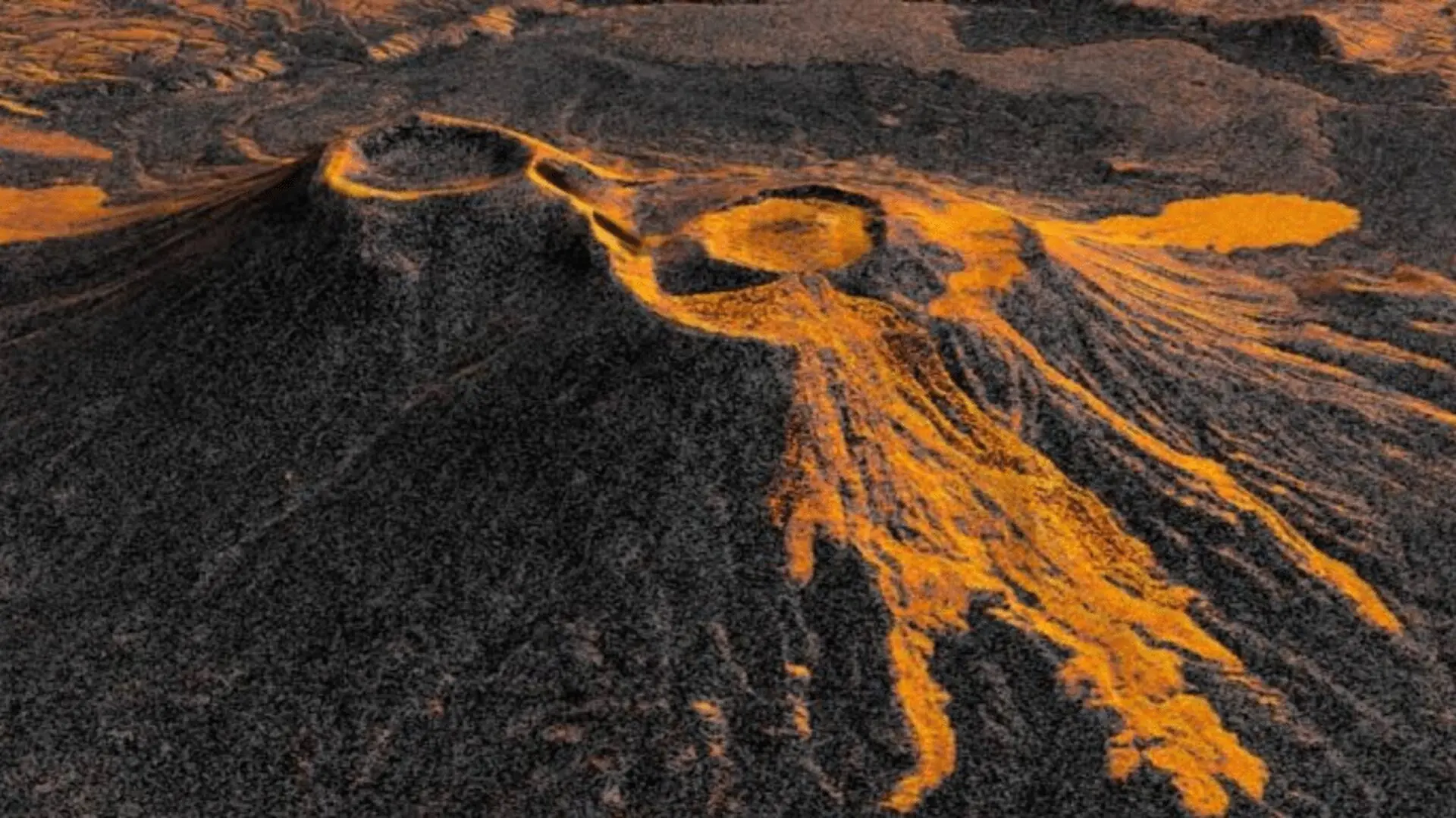
The Krasheninnikov volcano, a remote giant situated on the Pacific coastline of Russia’s Kamchatka Peninsula, has provided researchers with a dramatic demonstration of modern orbital surveillance. After a silence lasting nearly five centuries, the volcano stirred to life in 2025, a shift in geological status that experts link to an 8.8-magnitude earthquake that struck the region on July 30 of that year. This rare event has offered the first high-resolution look at the mechanics of such an eruption, captured by the collaborative NASA-ISRO Synthetic Aperture Radar (NISAR) mission.
Mapping Volcanic Shifts From Orbit
Following its initial observations in late December 2025, NISAR began a rigorous monitoring schedule, passing over the Kamchatka site every 12 days from varying orbital angles. By synthesizing 17 distinct radar passes collected through mid-August, geophysicists constructed a clear time-lapse sequence illustrating the eruption’s progression. The data reveals a distinct pattern: molten material initially accumulated within an inner caldera before breaching the rim and spilling outward, ultimately forming a sprawling, fan-shaped flow of volcanic debris.
This capability marks a significant departure from traditional remote sensing. Unlike optical satellites that are often thwarted by dense cloud cover or the perpetual darkness of high-latitude winters, the NASA-ISRO Synthetic Aperture Radar (NISAR) mission utilizes microwave pulses to pierce through atmospheric interference. By measuring the backscattered signals, the satellite creates detailed maps where each pixel represents a 10-meter-square plot, allowing scientists to distinguish between molten lava and the surrounding landscape with high precision.
Transforming Hazard Monitoring
For geophysicists like Matthew Pritchard of Cornell University, the consistency provided by NISAR is a game-changer for planetary science. “The consistency is crucial. Twice every 12 days, acquiring in this high-resolution mode and in two observation directions, this shows the promise of NISAR to closely monitor natural hazards,” Pritchard noted. He emphasized that the mission is now granting researchers an unprecedented view of volcanic systems that were historically too isolated or difficult to access for ground-based sensor networks.
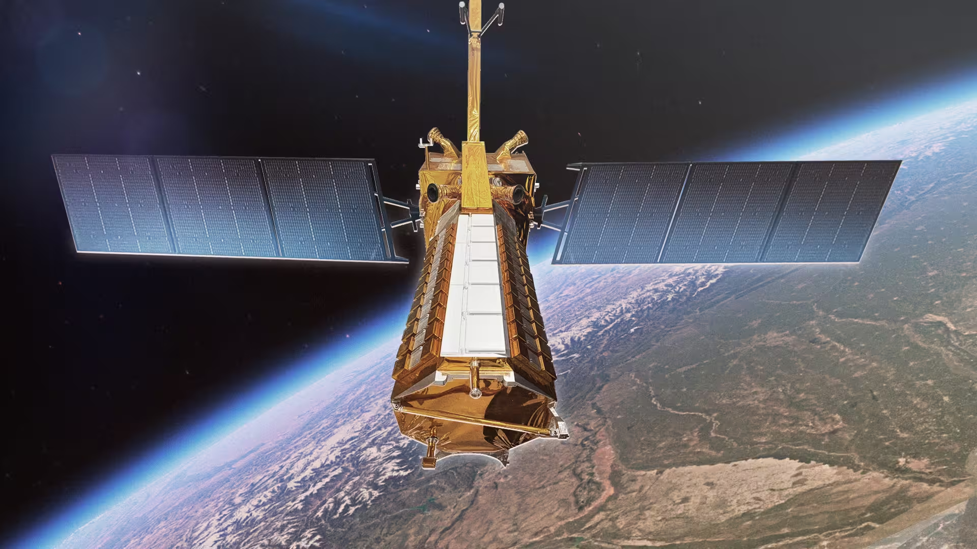
The dual-band radar system—which features an L-band component from NASA’s Jet Propulsion Laboratory and an S-band instrument from the Indian Space Research Organisation—is designed to scan nearly all of Earth’s land and ice surfaces on a consistent rotation. This global reach ensures that the roughly 1,300 volcanoes identified as active worldwide can now be scrutinized with a level of detail that was not available during earlier field studies in the region.
As the mission continues to supply data to the Alaska Satellite Facility Distributed Active Archive Center, the scientific community is gaining a more robust understanding of how geological landscapes evolve. Beyond the academic interest in volcanic behavior, these observations serve a vital public safety function, providing objective, repeat-pass data that can help identify signs of tectonic or magmatic shifts before they escalate, offering a clearer picture of the volatile processes shaping our planet.
This article has been fact checked for accuracy, with information verified against reputable sources. Learn more about us and our editorial process.
Last reviewed on .
Article history
- Latest version
Reference(s)
- Carney, Stephen. “US-India Satellite Captures Time-lapse Video of Volcanic Eruption - NASA.”, September 24, 2026 NASA <https://www.nasa.gov/missions/nisar/us-india-satellite-captures-time-lapse-video-of-volcanic-eruption/>.
Cite this page:
- Posted by Vikram Desai