LiDAR Uncovers Miles of Hidden Inca Roads Buried Beneath the Jungle Near Machu Picchu
A new LiDAR survey has uncovered 1.5 miles of hidden Inca roads near Machu Picchu, offering fresh insights into the ancient civilization’s complex network.
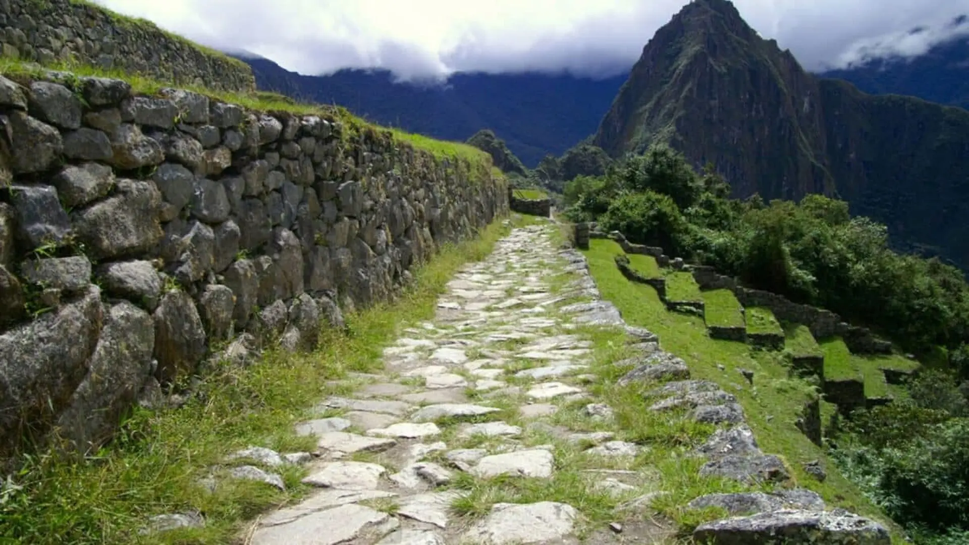
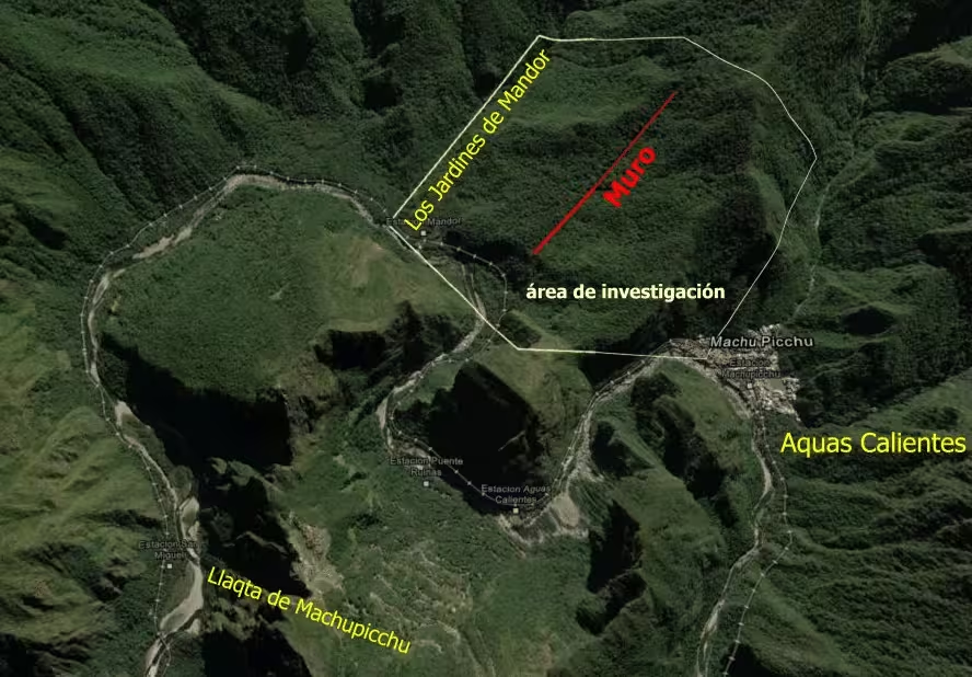
Archaeologists employing advanced LiDAR scanning have unveiled a hidden network of pre-Columbian infrastructure buried beneath the dense canopy surrounding the iconic site of Machu Picchu. The survey identified roughly 1.5 miles of ancient roadways, which extend toward a series of platforms and terraces located in the vicinity of the Mandor Wall. To protect the integrity of the findings, both the Peruvian government and the team from the University of Warsaw have elected to keep the exact coordinates of the discovery classified.
Situated nearly 8,000 feet above sea level in the Andes, the find challenges long-held assumptions about the geographic reach and urban layout of the Inca Empire. While Machu Picchu has been the subject of extensive study for over a century, these newly identified paths suggest that historical activity was far more integrated across the rugged landscape than previously understood.
Expanding the Map of Inca Civilization
Designated a UNESCO World Heritage Site, Machu Picchu is widely recognized for its masterfully engineered stone walls, agricultural terraces, and ramps that appear to be carved directly into the mountain cliffs. The site acts as the centerpiece for a broader national park system, which includes more than 60 distinct archaeological monuments connected by an intricate series of thoroughfares.
According to Mariusz Ziółkowski, director of the Center for Andean Studies at the University of Warsaw, these satellite locations played vital roles in supporting the primary settlement, or Llagta de Machu Picchu. The recent LiDAR data indicates that the scope of this influence extends into areas previously thought to be largely undeveloped.
Precision Mapping Through Dense Forest
LiDAR technology has revolutionized the field by allowing researchers to strip away vegetation digitally, revealing surface structures invisible to the naked eye. Among the features detected is a 0.75-mile stretch of road characterized by the distinct zigzag geometry typical of Inca construction. This stylistic hallmark suggests the network was active during the height of the Machu Picchu occupation, though researchers plan to conduct further analysis next year to establish a definitive timeline for the site.
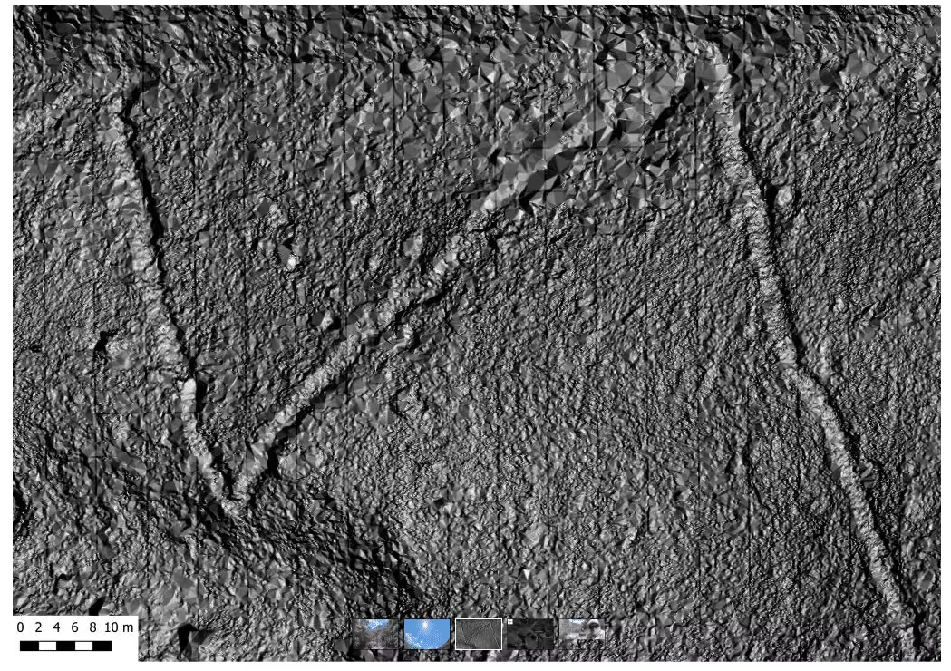
Rewriting the Archaeological Narrative
The discovery is particularly significant because the roads are located on the bank opposite to most of the known satellite monuments. This indicates that Inca urban planning was not confined to a single sector but involved a deliberate, broad-scale transformation of the local geography. In a formal statement, Ziółkowski emphasized that the findings necessitate a revision of current hypotheses regarding how the entire urban complex functioned.
“This discovery complements and significantly revised hypotheses regarding the functioning of the entire complex,” Ziółkowski stated.
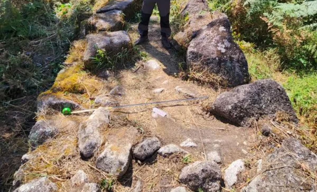
As researchers prepare for future ground-based excavations, they anticipate that the Mandor Wall area may reveal even more about the religious and social scope of the region. By defining the size and function of these newly discovered platforms, experts hope to gain a deeper understanding of the sophisticated logistics that sustained the Inca state. Until then, the site will remain restricted to prevent unauthorized interference or damage to these fragile historical resources.
This article has been fact checked for accuracy, with information verified against reputable sources. Learn more about us and our editorial process.
Last reviewed on .
Article history
- Latest version
Reference(s)
- <https://whc.unesco.org/en/list/274/>.
- “A new discovery at Machu Picchu | University of Warsaw.” <https://en.uw.edu.pl/a-new-discovery-at-machu-picchu/>.
Cite this page:
- Posted by Vikram Desai