NASA Shows Black Mesas Sculpting Dunes in Mauritania’s Sahara - Wind Scour Revealed
NASA images reveal three black mesas actively reshaping the Sahara, evidence of an ancient force still sculpting the desert today.
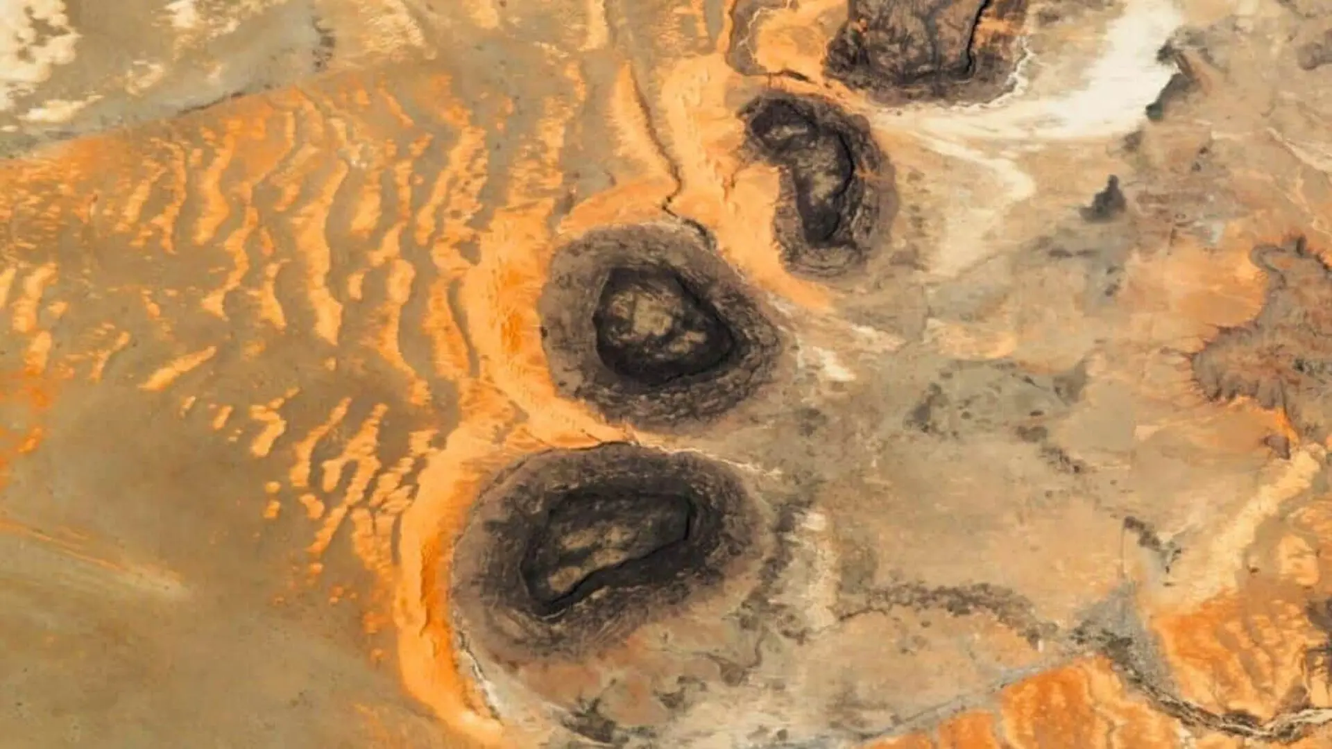
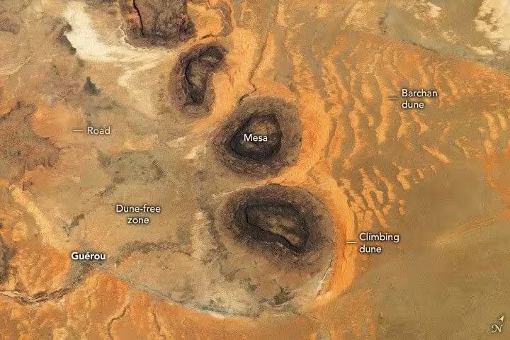
An astronaut aboard the International Space Station captured a striking view of three flat‑topped mesas rising 1,000‑1,300 feet above the Sahara’s desert floor in southern Mauritania. The image, released by NASA’s Earth Observatory, shows a dark cluster of circular hills located about eight miles northwest of Guérou, with their eastern sides edged by flowing orange‑tinged dunes while the western flank remains starkly bare.
That sharp east‑west contrast is not accidental; it records how the mesas steer wind patterns, dictating where sand can settle and where it is stripped away. The three remnants belong to a once‑vast Paleozoic sandstone formation that has been sculpted apart by millions of years of erosion, yet still imprints the modern desert landscape.
Why the Mesas Appear Jet‑Black
Unlike typical tan or ochre sandstone, the mesas are cloaked in a deep black hue. NASA attributes this coloration to rock varnish, a thin coating enriched with manganese and iron oxides that slowly accumulates on exposed rock surfaces in arid settings. According to ScienceDirect, the varnish forms through a series of micrometer‑thin layers, likely aided by microbial activity that concentrates manganese at the surface. This process unfolds over millennia, meaning the dark facades in the astronaut’s photograph record an extensive exposure history.
The largest of the trio stretches roughly six miles across its widest point. A fourth mesa, visible in a broader 2014 ISS shot but omitted from the 2023 frame, lies just north of the group. Live Science notes that during the Paleozoic era (approximately 541–252 million years ago) these hills were part of a single massive outcrop, later fragmented by water and wind erosion into the isolated features observed today.
Two Distinct Dune Forms Shaped by the Same Rocks
The sand structures flanking the mesas belong to two separate categories, each reflecting a different wind‑sand interaction. Dominant northeasterly breezes transport sand grains toward the western faces of the hills. When these winds encounter the upwind slopes, they decelerate, depositing sand that builds into steep, wall‑adjacent ridges known as climbing dunes.
Beyond the immediate vicinity, finer dunes develop downwind, taking the classic barchan form—crescent‑shaped mounds that point away from the prevailing wind. According to the Earth Observatory, this barchan field stretches up to 15 kilometers (about nine miles) from the mesas, appearing in the photograph as a flowing, reddish‑yellow tail that contrasts with the darker desert plain.
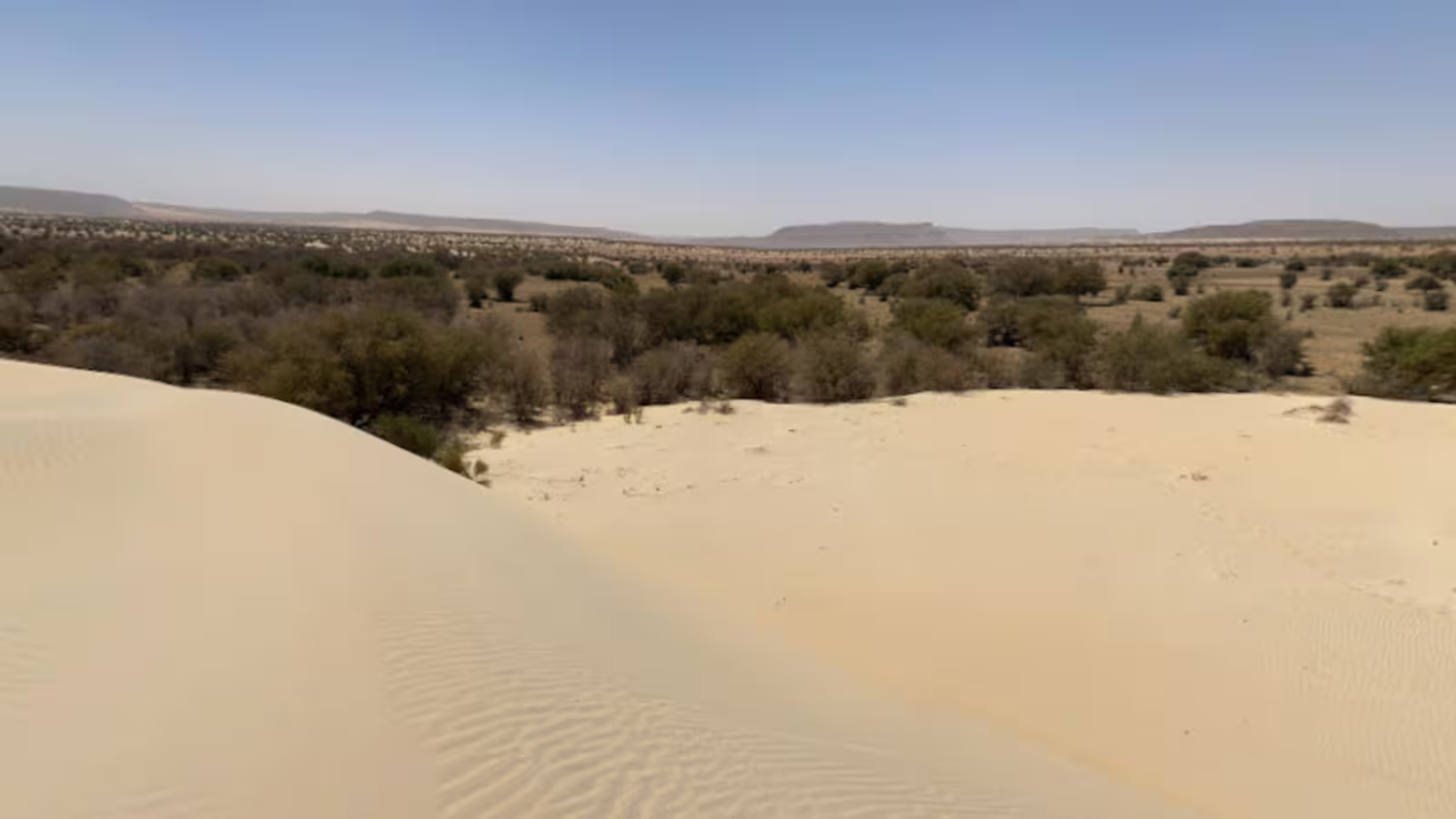
Climbing dunes are relatively uncommon because they require a steep, stable surface that prevents sand from spilling sideways. The sheer, flat‑walled edges of the mesas provide precisely that geometry, making this locale a textbook example of how topography can govern sediment transport in arid environments.
Fast Vortices Erase Sand on the Western Side
The sand‑free expanse west of the hills results from a process NASA calls wind scour. As wind is forced through the narrow gaps between the mesas, it accelerates into vortex‑like streams that outrun the surrounding easterly flow. These high‑speed currents erode any accumulating sand rather than depositing it, leaving the ground immediately downwind of the rocks stark and bare.
From orbit, the 2023 image reveals a clear, barren plain stretching westward, starkly juxtaposed with the dune‑laden eastern side. A wider 2014 astronaut photograph captures the same pattern over a larger area, including an additional larger mesa farther east and an extended barchan field that confirms the dune system’s reach beyond the 2023 frame.
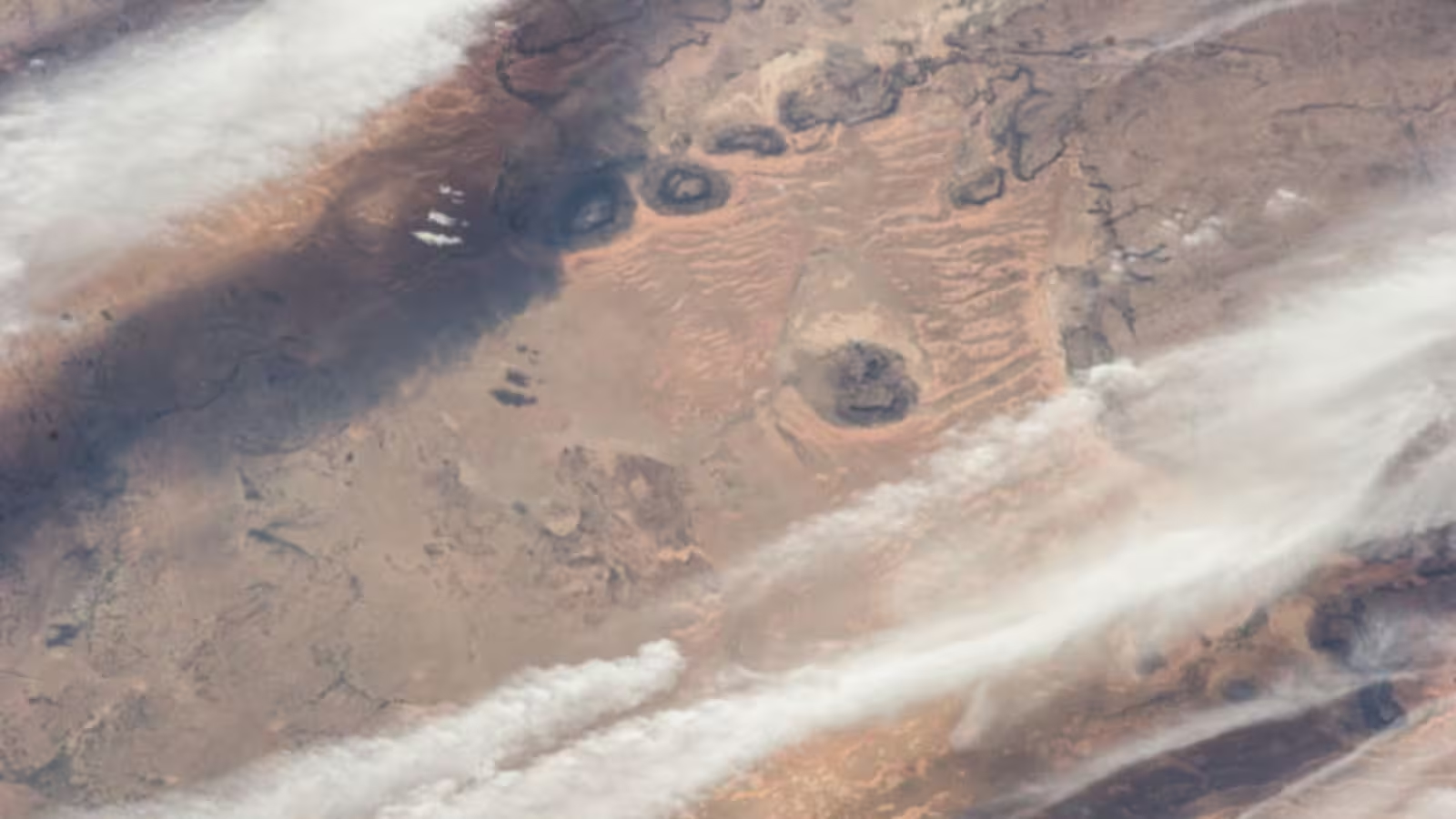
The Mauritanian mesas lie within a segment of the Sahara that also hosts the famed Richat Structure—often dubbed the “Eye of the Sahara”—approximately 285 miles to the north. Live Science suggests that the original Paleozoic formation of the black mesas may once have resembled this concentric ringed feature before erosion fragmented it into the isolated hills captured by the astronaut today.
This article has been fact checked for accuracy, with information verified against reputable sources. Learn more about us and our editorial process.
Last reviewed on .
Article history
- Latest version
Reference(s)
- Migrate, NASA. “Black Mesas and Sand Dunes in Mauritania - NASA Science.”, August 13, 2023 NASA <https://earthobservatory.nasa.gov/images/151705/black-mesas-and-sand-dunes-in-mauritania>.
- <https://www.sciencedirect.com/topics/earth-and-planetary-sciences/rock-varnish>.
Cite this page:
- Posted by Karan Das