Archaeologists Use Spy Satellite Images to Map a Massive Hidden City Beneath Ancient Fields
Advanced scanning technology is finally revealing the hidden secrets buried beneath an ancient capital, uncovering parts of the city lost for centuries.
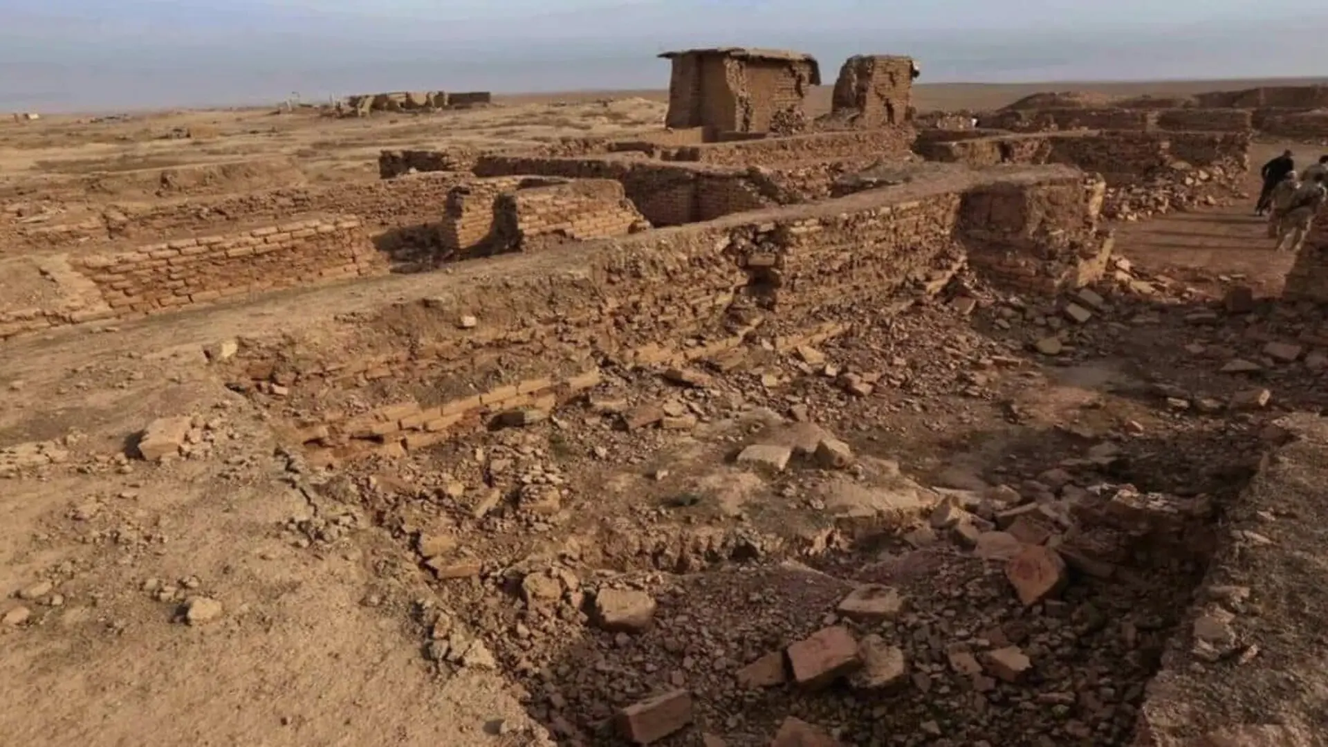
Archaeologists are unveiling the hidden layout of Nimrud’s lower city, providing an unprecedented look at a sprawling 340-hectare urban expanse that has remained largely obscured for nearly two centuries. While excavations since 1845 have historically prioritized the royal acropolis, modern technology is finally shedding light on the everyday lives of the merchants, artisans, and citizens who once populated the Assyrian capital.
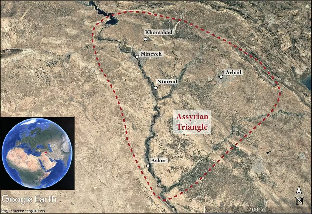
The Nimrud Lower Town Archaeological Project (NiLTAP), directed by Daniele Morandi Bonacossi and Francesca Simi of the University of Udine, is utilizing a sophisticated suite of non-invasive tools to map the site. By integrating satellite imagery, drone-based topography, and magnetic sensing, the team is successfully piecing together the structural reality of a city that functioned as the imperial heart of the Assyrian Empire between 879 B.C. and 707 B.C.
Preserved Beneath the Soil
A significant factor in the success of this research is the site’s exceptional state of preservation. Following the collapse of the Assyrian Empire in 612 B.C., the lower city was never subjected to heavy reoccupation. Today, agricultural activities only affect the top 20 centimeters of soil, leaving the underlying archaeological strata remarkably intact. This unique preservation allowed previous attempts to understand the site, such as those by Paolo Fiorina in the late 1980s, to provide a foundation for modern inquiry, despite work being cut short by geopolitical instability.
The NiLTAP team’s methodology began by analyzing declassified reconnaissance data, including 1960s and 70s imagery from U-2 aircraft and the CORONA and HEXAGON satellite programs. As detailed in the journal Antiquity, these archives provided early evidence of ancient gates, defensive walls, and distinct urban districts.
Digital Reconstruction of an Ancient Capital
During their 2025 field season, the team implemented a rigorous ground-truthing program. By dividing the lower town into 40-by-40-meter survey units, researchers mapped pottery density to understand shifting settlement patterns across the Middle, Neo, and Post-Assyrian eras. Inscriptions on recovered baked bricks and fragments of prisms belonging to kings Sennacherib and Ashurbanipal have further confirmed the area’s historical significance.
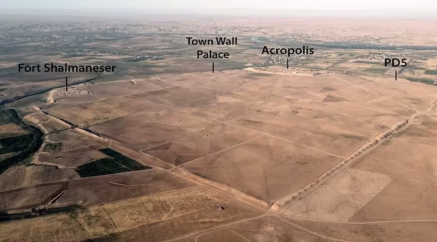
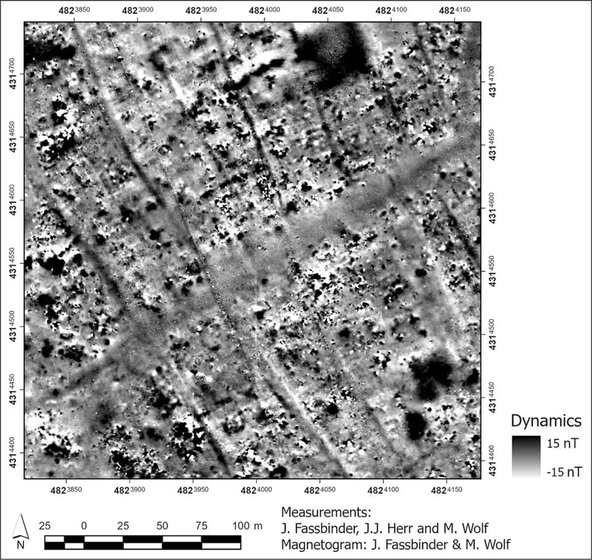
Magnetic survey data has proved transformative, allowing the team to visualize buried infrastructure without disturbing the earth. The scans revealed a complex, organized layout consisting of residential neighborhoods, transit routes, and large industrial or administrative complexes. These findings have also challenged established narratives regarding the city’s infrastructure. While it was once assumed the Patti-Hegalli canal was the sole source of water for the populace, the evidence now points to a more complex hydraulic network, suggesting that the city’s water management history requires a thorough re-examination.
As the project moves into its next phases, the team plans to expand its geophysical surveying and conduct targeted excavations to confirm the data gathered from the surface. This work marks a turning point in Assyrian studies, shifting focus from monumental royal architecture to the broader, sophisticated urban systems that sustained one of history’s greatest empires.
This article has been fact checked for accuracy, with information verified against reputable sources. Learn more about us and our editorial process.
Last reviewed on .
Article history
- Latest version
Reference(s)
- Bonacossi, Daniele. “New approaches to Assyrian capitals: the Nimrud Lower Town Archaeological Project | Antiquity | Cambridge Core.”, pp. 1-8. Cambridge Core, doi: 10.15184/aqy.2026.10423. <https://www.cambridge.org/core/journals/antiquity/article/new-approaches-to-assyrian-capitals-the-nimrud-lower-town-archaeological-project/053947F856A06A8B2EB7A68E44A7581D>.
Cite this page:
- Posted by Zara Tariq