Satellites Track Bismarck Sea Underwater Volcano Rising Toward Surface, May Birth New Island
Scientists track an underwater volcano that could create a new island, offering a rare glimpse into Earth’s dynamic geology and potential land formation.
Satellite monitoring since early May indicates that a submarine volcano in the Bismarck Sea is rising toward the ocean surface, potentially giving birth to a new island.
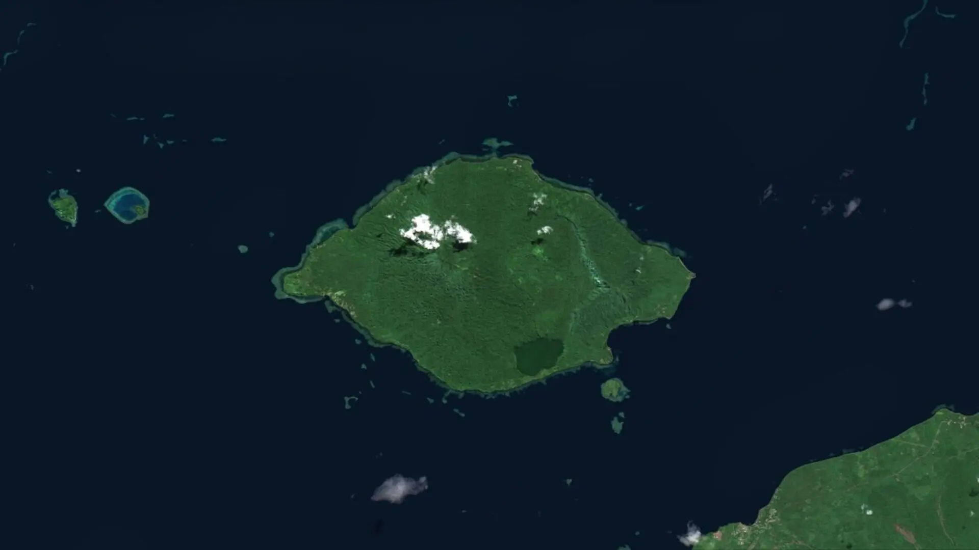
The activity was first flagged after a cluster of earthquakes erupted beneath the central Bismarck Sea, north of Papua New Guinea. Subsequent satellite passes have captured towering steam columns, drifting pumice fields, and extensive thermal anomalies.
Researchers find the situation both intriguing and challenging. The volcano lies in a region of the seafloor that remains poorly charted, leaving many fundamental questions unanswered. Nonetheless, the continuous stream of space‑based observations is helping scientists piece together the underwater dynamics.
Remote Ocean Volcano Under Continuous Surveillance
Seismic stations first recorded the disturbance on May 8, detecting a series of tremors beneath the Bismarck Sea. NASA later confirmed via satellite that an underwater eruption was in progress.
The discovery also underscored how little is mapped in this part of the ocean floor. No detailed charts exist for the area, complicating efforts to pinpoint the exact volcanic structure involved. The zone is riddled with faults, volcanic ridges, rifts, scarps and active tectonic boundaries, creating a highly complex geological environment.
Current evidence points to Titan Ridge, where two tectonic plates converge. Even there, scientists cannot yet identify which vent has ignited, the original depth of the source, or the timing of its last activity.
Satellite Data Shows Volcano Ascending Toward the Surface
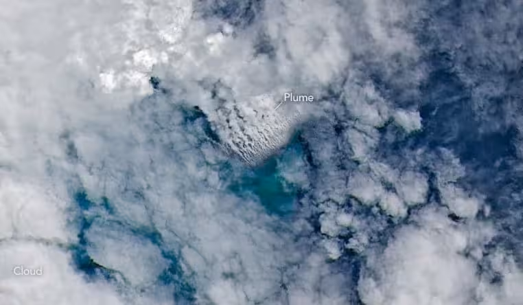
Day after day, space‑borne sensors have recorded signs of a shallower eruption. On May 9, NASA’s Aqua and Terra platforms captured expansive white steam plumes over the water. Other satellites observed the plumes extending several kilometers upward, while NASA’s PACE instrument noted discoloration of the surrounding seawater.
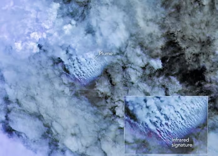
By May 10‑11, sharper images from ESA’s Sentinel‑2 and NASA/USGS Landsat 9 revealed volcanic activity much closer to the water’s edge. On May 12, the Suomi NPP satellite recorded thermal hotspots covering roughly 7 sq km (2.7 sq mi).
Simon Carn, a volcanologist at Michigan Technological University, explained that the extensive heat signature indicates a large volume of hot material now resides near the surface, and that the active vent appears shallower than older seafloor maps suggested.
Potential Emergence of a New Landmass
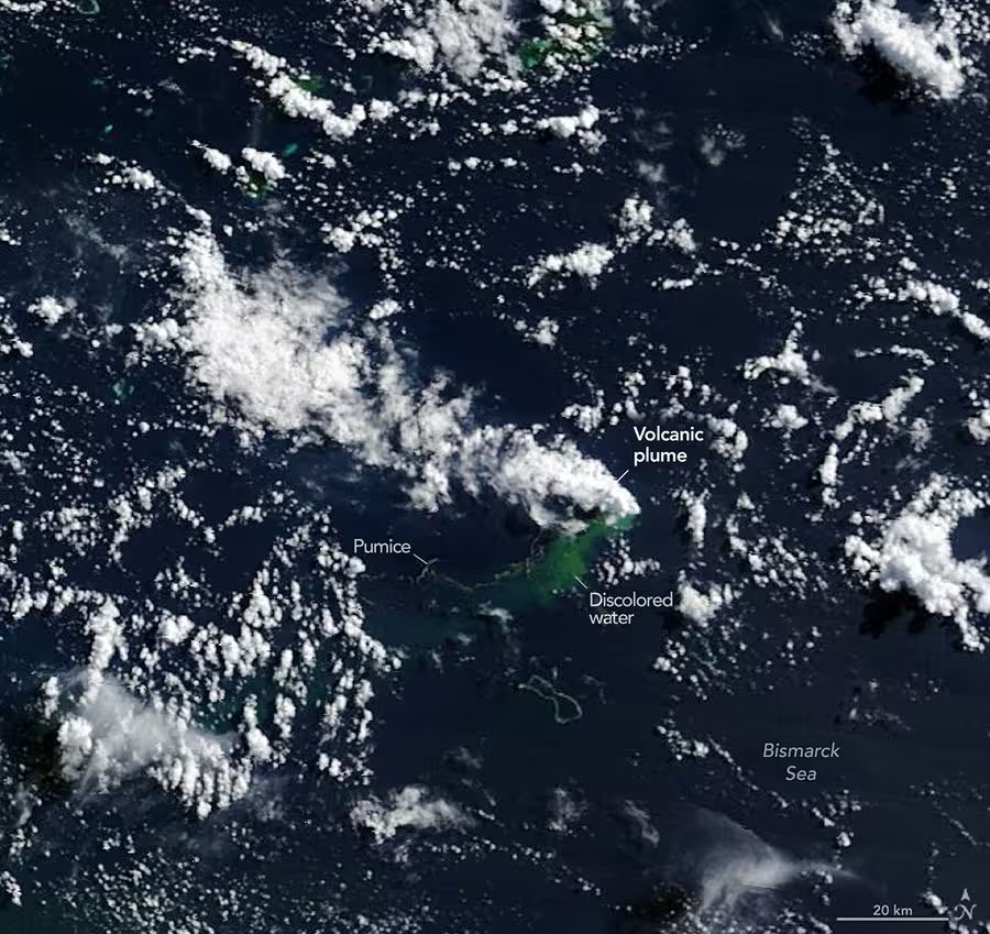
A striking by‑product of the eruption is the development of extensive pumice rafts that drift across the sea. These lightweight volcanic rocks can float for weeks or months, sometimes traveling hundreds of kilometres with ocean currents.
Jim Garvin, chief scientist at NASA’s Goddard Space Flight Center, said researchers are watching to see whether the activity will generate a new island—a phenomenon rarely captured from start to finish by modern satellites.
Even if a summit breaches sea level, its persistence is uncertain. The eruption could build a tuff cone as magma meets seawater, but the nascent land might collapse or erode rapidly.
The eruption has remained relatively gentle, likely reflecting its position on a volcanic ridge where a transform fault intersects a back‑arc spreading center. As Carn noted:
“Spreading centers are associated with less explosive activity, while the most explosive eruptions are usually along subduction zones and involve large stratovolcanoes.”
The duration of the current activity remains unknown. A 1972 eruption on the same ridge lasted only four days, whereas a nearby eruption near St. Andrew Strait, about 100 km (62 mi) away, persisted for roughly four years after beginning in 1957.
“We’re now eagerly waiting to see if a new island is about to be born – something that we’ve only rarely been able to observe with satellites as it happens,” Garvin said.
Should an island emerge, scientists hope to monitor how flora, fauna and microbial life colonize the fresh substrate, while also tracking the influences of rainfall, erosion and chemical weathering on its long‑term evolution.
This article has been fact checked for accuracy, with information verified against reputable sources. Learn more about us and our editorial process.
Last reviewed on .
Article history
- Latest version
Reference(s)
- Garrison, Michala. “New Eruption in the Bismarck Sea - NASA Science.”, May 21, 2026 NASA <https://science.nasa.gov/earth/earth-observatory/new-eruption-in-the-bismarck-sea/>.
- <https://volcano.si.edu/volcano.cfm?vn=250030>.
- “Simon Carn | GMES.” <https://www.mtu.edu/geo/department/faculty/carn/>.
- “James.b.garvin.” <https://science.gsfc.nasa.gov/sci/bio/james.b.garvin>.
Cite this page:
- Posted by Vikram Desai