Ancient Lake Sediments Reveal 14,300 Years of Climate Shifts in China
New research from Aranji Nur links fluctuating monsoon strength and westerly winds to millennia of environmental change in northeastern Asia.
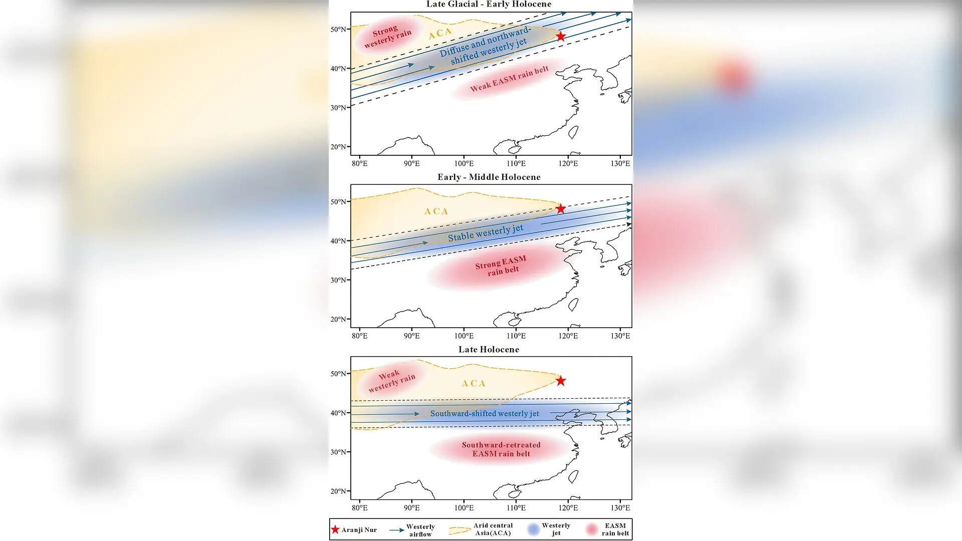
Sediment cores extracted from a closed lake in northeastern China reveal that shifts in major atmospheric circulation systems drove four distinct climate phases over the past 14,300 years. The findings offer a detailed look at how the region transitioned from arid conditions to a wetter environment and back again.
Ancient Lakebed Sediments Reveal 14,300 Years of Climate Shifts
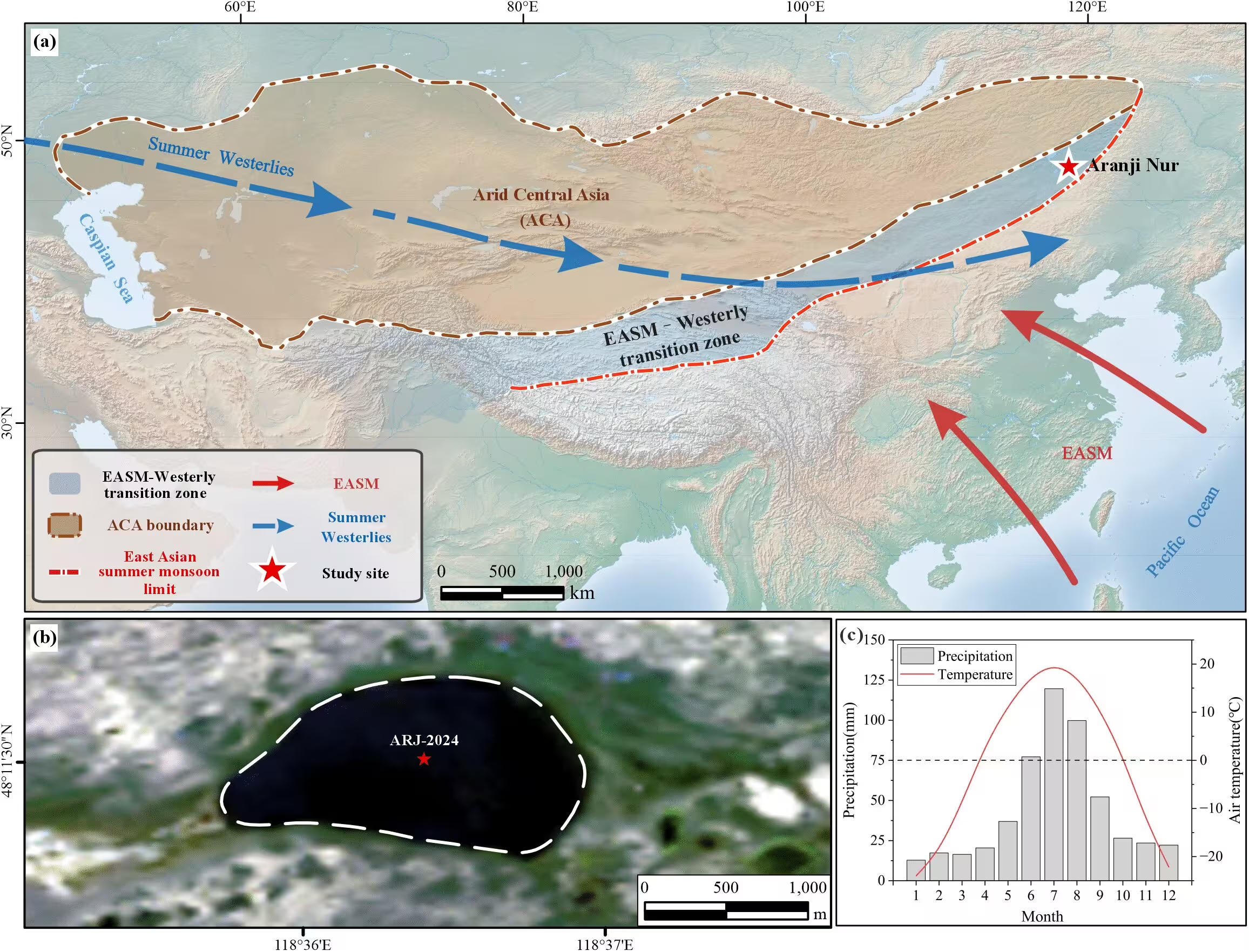
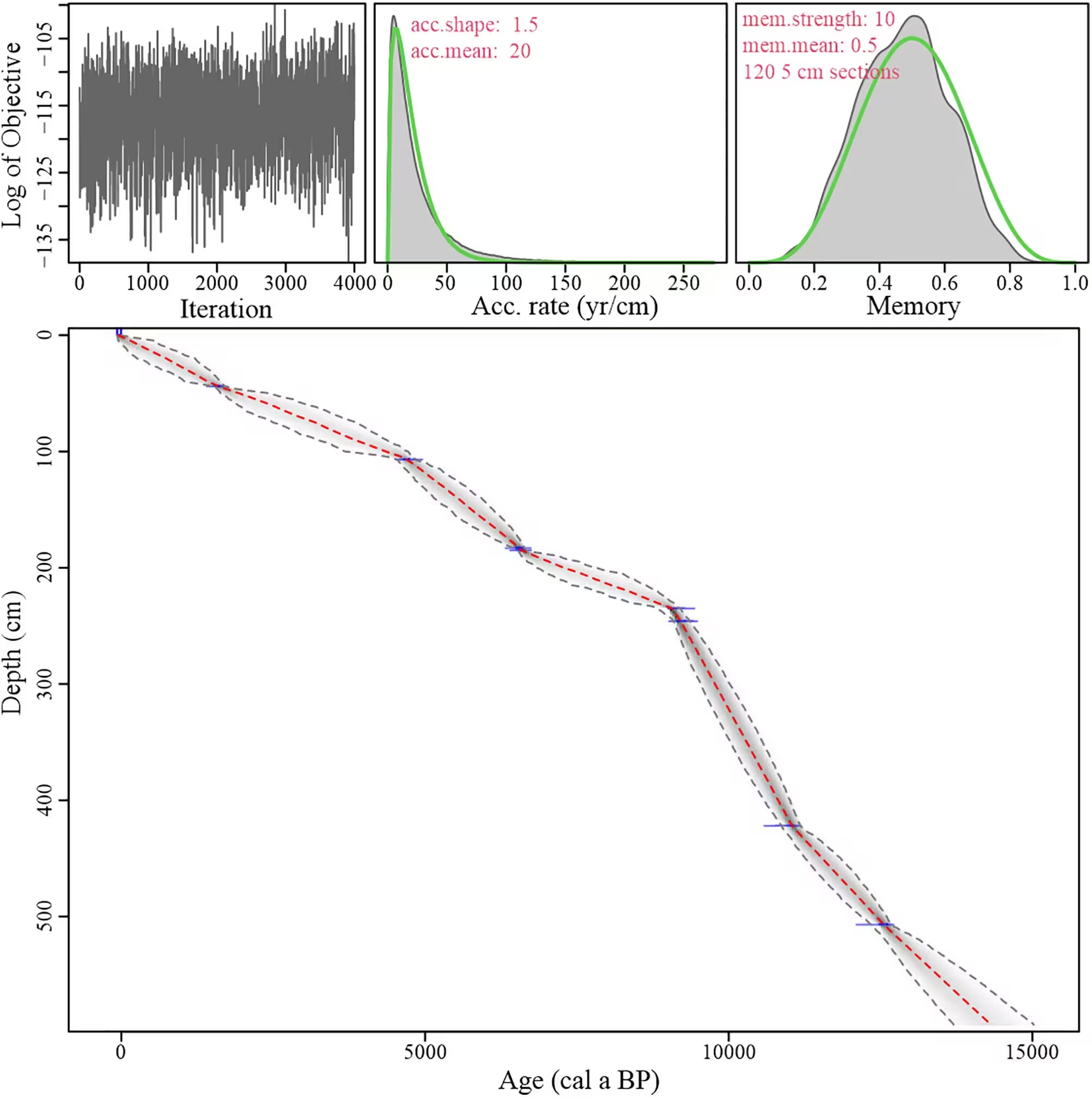
Researchers examined a 594-centimeter sediment sequence recovered from Aranji Nur, a small lake located on the southwestern margin of the Hulunbuir Grassland. By analyzing grain-size distributions and radiocarbon dating samples, the team tracked how moisture availability changed across the region since the Late Glacial period. The study, published in PLOS One, highlights the complex interplay between the East Asian summer monsoon and mid-latitude westerly winds.
The sedimentary record was divided into four major stages based on physical characteristics and statistical grain-size parameters. During the first stage, spanning from 14.3 to 9.2 thousand years before present, the sediment contained relatively high proportions of sand and showed frequent fluctuations. This points to a generally dry climate with limited vegetation cover and exposed sandy soils that eroded easily during episodic runoff events.
Why the Early Holocene Was Much Wetter Across the Grassland
Between 9.2 and 4.8 thousand years ago, sand content dropped significantly while silt became the dominant fraction. This shift suggests that increased effective moisture promoted robust vegetation growth and soil stabilization, which starved the lake of coarse-grained detritus. The wet conditions during this middle phase coincided with the peak strength of the East Asian summer monsoon, which carried more moisture into northern China.
As the millennia progressed into the third stage, lasting from 4.8 to 1.5 thousand years ago, moisture availability began to decline gradually. Although sand content remained relatively low in the lake center, regional vegetation and soil records indicated a drying trend as the summer monsoon weakened. Furthermore, a southward shift in the westerly jet stream likely altered moisture transport pathways across the interior of Eurasia, restricting the amount of water vapor reaching the transition zone.
What the Return to Arid Conditions Means for the Future
Since approximately 1.5 thousand years ago, the lake sediments have exhibited an increase in sand content along with marked fluctuations. This fourth stage reflects a return to a drier regional climate, mirroring conditions seen in earlier epochs. The renewed aridity is attributed to the combined effect of a weaker summer monsoon and the continued southward displacement of mid-latitude westerlies, which together reduced the overall moisture budget of the Hulunbuir Grassland.
The authors note that while lake sediment grain size is a powerful proxy for past environments, local factors such as shoreline reworking and episodic overland flow also influence deposition. Even so, the strong agreement between the Aranji Nur data and wider regional paleoclimate records underscores the sensitivity of monsoon-westerly transition zones to planetary-scale atmospheric adjustments.
The research was published in PLOS One on November 19, 2026.
This article has been fact checked for accuracy, with information verified against reputable sources. Learn more about us and our editorial process.
Last reviewed on .
Article history
- Latest version
Reference(s)
- Huang, Yi., et al. “Hydroclimatic evolution under changing westerly–monsoon influences in northeastern China since the Late Glacial.” PLOS One, vol. 21, no. 11, November 19, 2026, pp. e0363067 Public Library of Science (PLoS), doi: 10.1371/journal.pone.0363067. <https://doi.org/10.1371/journal.pone.0363067>.
Cite this page:
- Posted by Vikram Desai