Why 28 Percent of Baghdad Roads Face Extreme Flood Risk During Heavy Rains
A new geospatial network model reveals that limited alternative driving routes turn moderate rain pools into major mobility crises across the Iraqi capital.
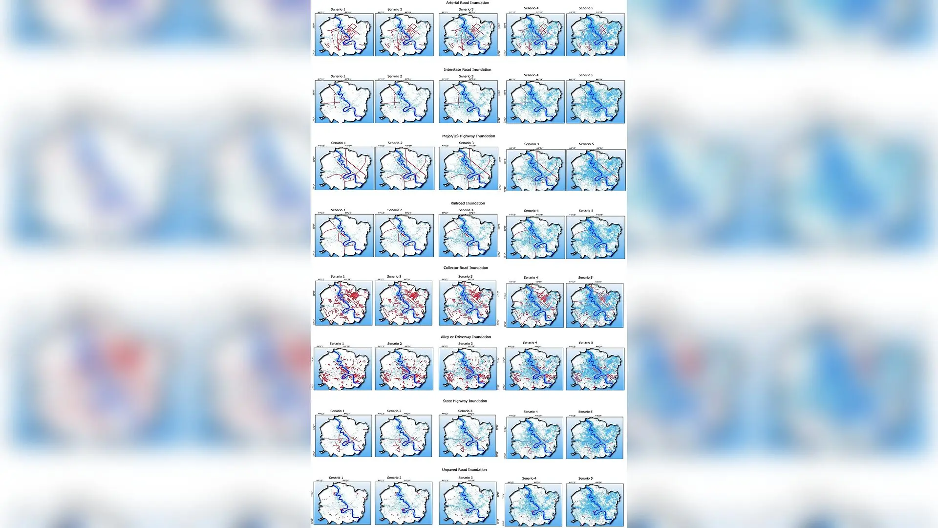
Shallow rainwater ponding on low-relief streets in Baghdad can paralyze citywide transit and emergency access, according to a recent evaluation that mapped transport vulnerability across more than 6,000 kilometers of roads. Researchers found that about 28 percent of the Iraqi capital’s roadway network faces high or very high flood risk, driven as much by the lack of alternative driving routes as by low-lying terrain and river proximity.
Urban flooding is a growing global concern as climate variability and expanding concrete surfaces outpace drainage capacity. In Middle Eastern cities such as Baghdad, heavy rainfall frequently causes surface runoff to accumulate, closing major roads and delaying medical transport. While traditional flood maps highlight where water gathers, they typically ignore how individual streets function within the wider transport network. To address this gap, a team of researchers designed a multi-criteria decision framework that connects physical flood susceptibility with road network connectivity.
Mapping the Vulnerability of Baghdad Streets
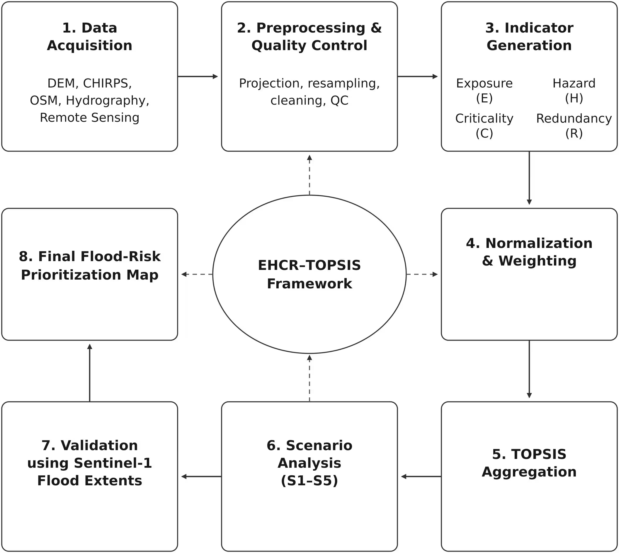
The study, published in PLOS Water, integrated several globally accessible datasets within geographic information software, harmonizing raster and vector layers to a 30-meter spatial resolution. The researchers examined four core dimensions, known as the EHCR framework: Exposure, Hazard, Criticality, and Redundancy. Exposure captured the proximity of roads to the Tigris River and secondary drainage channels, alongside local drainage density derived from digital elevation models. Hazard incorporated terrain slope, surface elevation, and rainfall concentration indexes calculated from precipitation records spanning from 1981 to 2025.
Criticality measured the functional importance of each road segment by calculating betweenness centrality, which identifies shortest paths connecting different parts of the city, and service-access reachability to major hospitals and emergency facilities. Redundancy quantified the availability of alternative routing options by counting substitute paths and computing detour ratios when a segment is blocked. By assigning weights based on regional hydrogeomorphology—giving more influence to exposure and hazard than to criticality and redundancy—the team applied the Technique for Order of Preference by Similarity to Ideal Solution, or TOPSIS, to rank every road segment from zero to one.
Concentrated Risks in Eastern and Northeastern Districts
The resulting composite index revealed that high-risk transportation corridors are heavily concentrated in eastern and northeastern Baghdad. These areas combine low-relief alluvial topography, where ground slopes are generally below two degrees, with dense built-up surfaces that prevent rainwater infiltration. When intense seasonal rainfall occurs, these low-lying sectors experience significant runoff accumulation.
According to the length classification derived using natural breaks in the data, moderate-risk roads account for 31.7 percent of the network, while low and very low risk categories comprise 24.0 percent and 18.3 percent, respectively. High-risk segments represent 17.2 percent of the network, and very high-risk segments cover 10.8 percent. Crucially, the analysis demonstrated that physical susceptibility maps alone are insufficient. Several road segments situated in areas of only moderate physical susceptibility were elevated to high-risk categories because their closure would sever vital connections with few detour alternatives available.
Independent Verification Using Satellite Radar
To validate the model, the team utilized Sentinel-1 synthetic aperture radar satellite imagery captured during the 2019 and 2022 rainy-season flood events. By applying a backscatter change-detection threshold to pre-event and event-phase imagery, the researchers mapped flooded road observations and intersected them with the EHCR-TOPSIS risk classes. Across the pooled events, 80.35 percent of all independently observed inundated road locations fell directly within segments classified as high or very high risk.
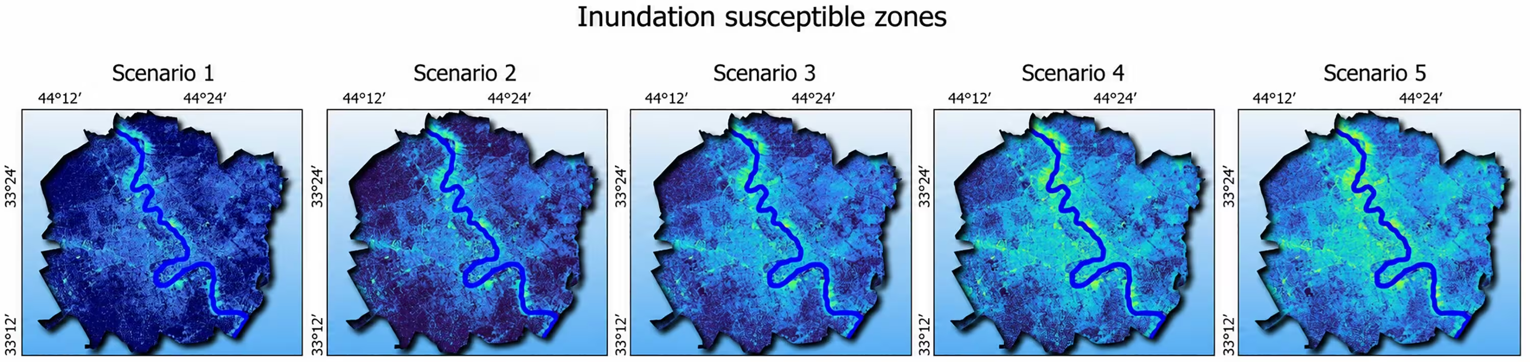
The remaining 19.65 percent of inundated points occurred on roads classified as moderate, low, or very low risk. The authors noted that these mismatches likely stem from unrepresented street-scale variables, such as local drainage failures, culverts, small depressions, and curbs that cannot be resolved at a 30-meter resolution. Sensitivity tests involving five alternative parameter scenarios for rainfall thresholds and drainage extraction further confirmed that the primary high-risk hotspots remained stable regardless of minor configuration changes.
Implications for Infrastructure Resilience
The framework offers a practical screening tool for data-scarce urban environments where dynamic hydrodynamic models are difficult to deploy. By identifying critical corridors where flood exposure coincides with limited redundancy, municipal agencies can better prioritize maintenance, pre-position emergency resources, and plan targeted drainage upgrades. Future refinements of the approach could integrate real-time traffic dynamics and climate projections to further mitigate urban flood disruptions.
The research was published in PLOS Water on November 19, 2026.
This article has been fact checked for accuracy, with information verified against reputable sources. Learn more about us and our editorial process.
Last reviewed on .
Article history
- Latest version
Reference(s)
- Khudhair, Hasanain Hikmat., et al. “Integrated flood risk and transport-network resilience in Baghdad using an EHCR–TOPSIS framework.” PLOS Water, vol. 5, no. 11, November 19, 2026, pp. e0000644 Public Library of Science (PLoS), doi: 10.1371/journal.pwat.0000644. <https://doi.org/10.1371/journal.pwat.0000644>.
Cite this page:
- Posted by Vikram Desai