How Thirteen European Cities Stopped Vendors From Guessing Their Crowd Sizes
A new standardized municipal framework uses open data ontologies to track urban crowds without sacrificing citizen privacy.
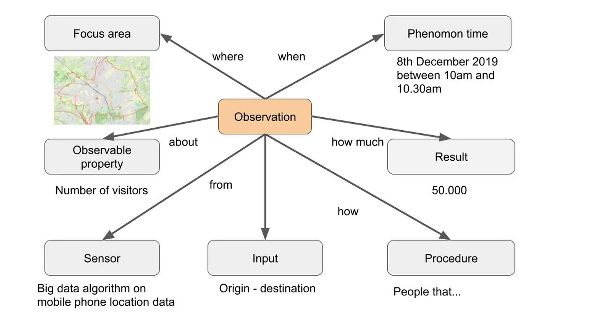
When thirteen city administrations in Flanders decided to figure out how many people were actually walking their streets, they realized their private technology suppliers were speaking completely different languages. Municipal leaders in Belgium faced a chaotic vendor market where tracking methods ranged from Wi-Fi sniffers to mobile phone data, making it nearly impossible to compare crowd sizes or protect local privacy.
To fix this fragmented reality, an interdisciplinary team of researchers coordinated by IMEC developed a standardized definition manual for urban mobility. The collaborative framework is detailed in a study published in the ISPRS Annals of the Photogrammetry, Remote Sensing and Spatial Information Sciences, outlining how local governments can regain control over public space data.
Why Counting City Crowds Became a Major Legal and Technical Headache
For more than a decade, city governments have experimented with smart technologies to optimize traffic, boost local retail, and manage events. However, relying on commercial vendors for crowd metrics created severe blind spots. Different telecom providers use unique cell tower layouts, meaning their raw location data cannot be easily combined or verified. Furthermore, changing a supplier or even a software algorithm often wiped out years of historical baseline measurements.
This volatility left public servants with little confidence in the final numbers, rendering expensive datasets difficult to use for official policymaking. Privacy concerns added another layer of urgency. Under strict European Union regulations, collecting identifiable personal traces such as smartphone MAC addresses or unique vehicle license plates poses significant legal risks.
How Structured Ontologies Bring Order to Municipal Surveillance
To bridge the gap between municipal needs and vendor capabilities, researchers organized eight participatory workshops throughout 2019. These sessions brought together regional representatives from mobility, GIS, and IT departments to co-create a standardized vocabulary based on the Semantic Sensor Network ontology. Endorsed by the World Wide Web Consortium, this international standard allows authorities to describe both physical sensors and complex software calculation procedures in a transparent manner.
By defining clear observation rules, cities can now require private vendors to document every calibration and data extrapolation step. This structure separates raw input streams from final population counts, allowing municipal workers to audit how numbers are calculated without guessing.
Six Core Profiles That Distinguish Residents from Casual Visitors
The newly established framework introduces six distinct population profiles to categorize everyone present within municipal boundaries. These categories eliminate ambiguity by establishing strict time thresholds and behavioral definitions for daily city life:
- Resident: Individuals with permanent or temporary housing rights based on administrative data and living patterns.
- Structural Day Visitor: Commuting students or employees who visit the city regularly during daylight hours without staying overnight.
- Random Day Visitor: Irregular daytime visitors such as shoppers, tourists, or meeting attendees with no fixed weekly pattern.
- Structural Staying Visitor: Individuals who spend the night on a regular schedule, including shift workers or second-home owners.
- Random Staying Visitor: Multi-day tourists or occasional overnight guests staying without a routine pattern.
- In Transit: Commuters and travelers passing through the focus area for less than an hour without lingering.
What This Framework Means for Future Urban Planning and Procurement
The authors point out that while these standardized profiles rely heavily on mobile operator data, smaller local sensors will be required to build higher-resolution insights. Initial deployments in Flemish cities demonstrate that having a common language strengthens municipal bargaining power during contract negotiations with third-party tech suppliers.
As urban centers continue to gather vast amounts of real-time operational data, the researchers stress that local authorities must conduct rigorous privacy impact assessments for every specific monitoring use case. Establishing transparent data processing agreements ensures that digital modernization does not compromise public trust or civil liberties.
The research was published in ISPRS Annals of the Photogrammetry, Remote Sensing and Spatial Information Sciences on December 31, 9999.
This article has been fact checked for accuracy, with information verified against reputable sources. Learn more about us and our editorial process.
Last reviewed on .
Article history
- Latest version
Reference(s)
- Walravens, N.., et al. “MONITORING MOVEMENT IN THE SMART CITY: OPPORTUNITIES AND CHALLENGES OF MEASURING URBAN BUSTLE.” ISPRS Annals of the Photogrammetry, Remote Sensing and Spatial Information Sciences, vol. VI-4/W2-2020, September 15, 2020, pp. 181-188. Copernicus GmbH, doi: 10.5194/isprs-annals-vi-4-w2-2020-181-2020. <https://doi.org/10.5194/isprs-annals-vi-4-w2-2020-181-2020>.
Cite this page:
- Posted by Ali Farooqui