China Is Using AI To Build The First Complete Geological Map Of Mars By 2028
China aims to complete the first AI-driven geological map of Mars by 2028, paving the way for the ambitious Tianwen-3 sample return mission.
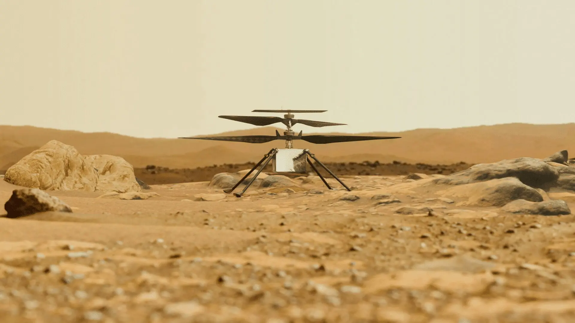
China is moving toward the completion of a comprehensive geological survey of Mars, with plans to finalize a high-resolution, AI-driven map of the planet by the end of 2028. This ambitious undertaking is designed to establish a definitive reference framework for Martian history, serving as a critical scientific precursor to the upcoming Tianwen-3 sample return mission.
Advanced Cartography for Future Exploration
The project represents an unprecedented effort to synthesize data from multiple generations of orbital and surface missions into a cohesive global atlas. By leveraging artificial intelligence to process vast datasets, researchers aim to categorize complex geological formations and surface structures that define the evolution of the Red Planet.
Hou Zengqian, the lead scientist for the Tianwen-3 mission, has emphasized that the map will provide a standardized global benchmark for identifying Martian geological ages. The initiative draws heavily on insights gained from the Zhu Rong rover, which successfully touched down in 2021 as part of the Tianwen-1 mission. Observations from the rover provided significant evidence of past water activity, including potential remnants of ancient oceans and intermittent flooding events that occurred billions of years ago.
China plans to complete a new-generation geologic map of Mars by the end of 2028, aiming to reconstruct the red planet’s watery past and introduce a Chinese system for dividing Martian geologic time https://t.co/8Dl2MpQb0wpic.twitter.com/NlkjLTt3ww
— China Xinhua News (@XHNews) September 28, 2026
Beyond the global atlas, the project involves the creation of a high-fidelity 1:50,000 scale geological map specifically targeting the designated landing zone for the Tianwen-3 mission. Scientists believe this methodology could eventually serve as a blueprint for mapping other planetary bodies, including the moon, Venus, and various asteroids.
Scaling Up the Tianwen-3 Sample Return
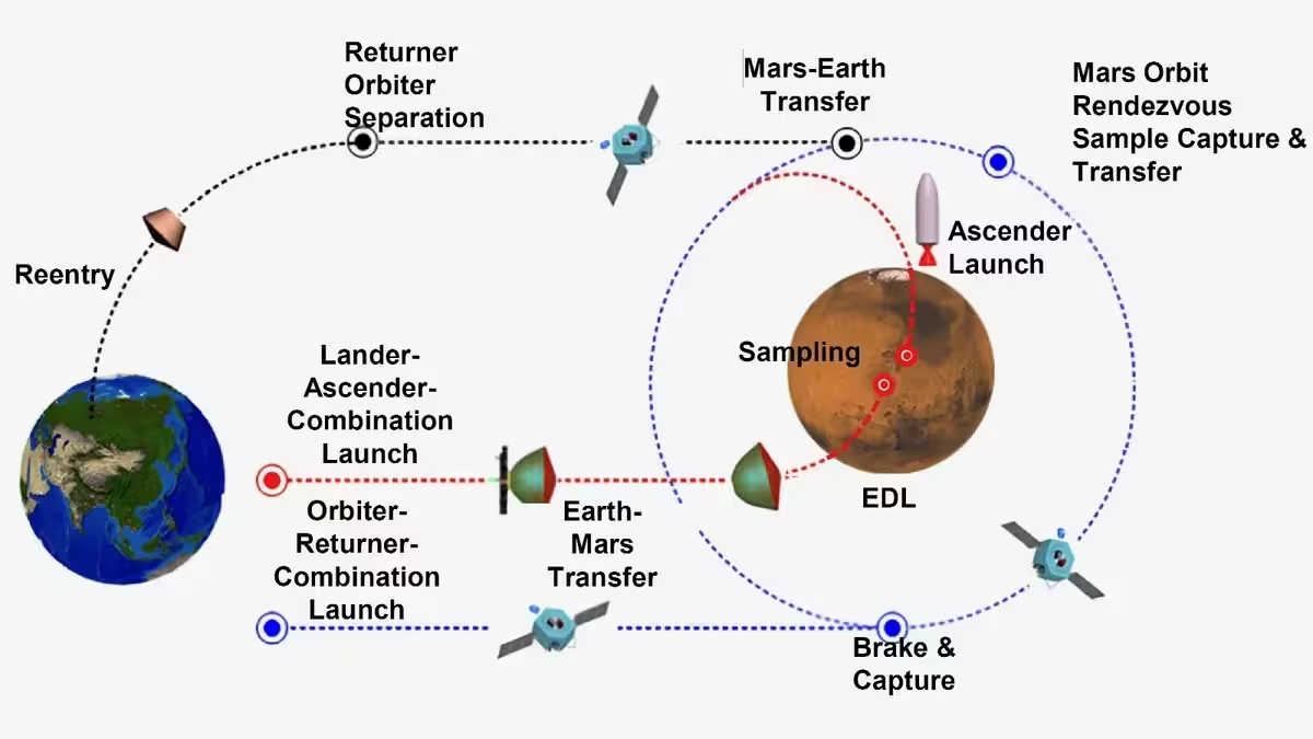
The mapping initiative is inextricably linked to China’s Tianwen-3 mission, which is slated for a late 2028 launch. The mission structure involves a dual-launch architecture: one vessel will transport the lander and ascent vehicle, while a second craft will facilitate the transport of collected materials back to Earth. The goal is to secure and return at least 500 grams of Martian soil and rock by approximately 2031.
Diverging Strategies in Global Mars Exploration
China’s systematic approach to planetary data comes at a time of shifting priorities for the United States. NASA’s Perseverance rover, currently stationed in Jezero Crater, has already successfully cached a significant collection of samples. However, the joint NASA-European Space Agency initiative to retrieve these materials has encountered substantial hurdles, including rising costs—projected to reach $11 billion—and scheduling delays that have pushed the potential return date toward 2040.
These challenges have prompted NASA to pivot toward new mission architectures, contrasting with China’s integrated strategy that prioritizes extensive geological mapping as a fundamental prerequisite for successful sample extraction. While both nations seek to unravel the secrets of the Martian surface, their differing timelines and organizational strategies highlight the evolving nature of deep-space competition.
Building a Lasting Scientific Foundation
The history of Mars exploration has transitioned from initial flybys, such as the 1965 Mariner 4 mission, to the robust robotic presence of the modern era. Although China’s Zhu Rong rover concluded its active service following a decline in power caused by dust accumulation, the data it transmitted remains vital to the ongoing mapping project.
By integrating AI-enhanced analysis with the physical findings of past rovers, China is positioning its 2028 map not just as a cartographic achievement, but as a foundational scientific database. As the global space community looks toward the next decade of discovery, the creation of highly detailed planetary records is increasingly viewed as an essential requirement for minimizing risk and maximizing the scientific yield of future landing operations.
This article has been fact checked for accuracy, with information verified against reputable sources. Learn more about us and our editorial process.
Last reviewed on .
Article history
- Latest version
Reference(s)
- “https://xhtxs.cn/bfjP.” <https://t.co/8Dl2MpQb0w>.
- “https://twitter.com/XHNews/status/2104598089332056411/photo/1.” <https://t.co/NlkjLTt3ww>.
- <https://www.scmp.com/news/china/science/article/3369127/china-reveals-plan-map-entire-surface-mars-2028-amid-race-us>.
Cite this page:
- Posted by Asif Iqbal