New AI-Powered Drone System Automatically Detects Deadly Rip Currents From Above
By analyzing surface water motion and filtering out wave noise, a new computer vision pipeline maps dangerous ocean currents from ordinary drone footage.
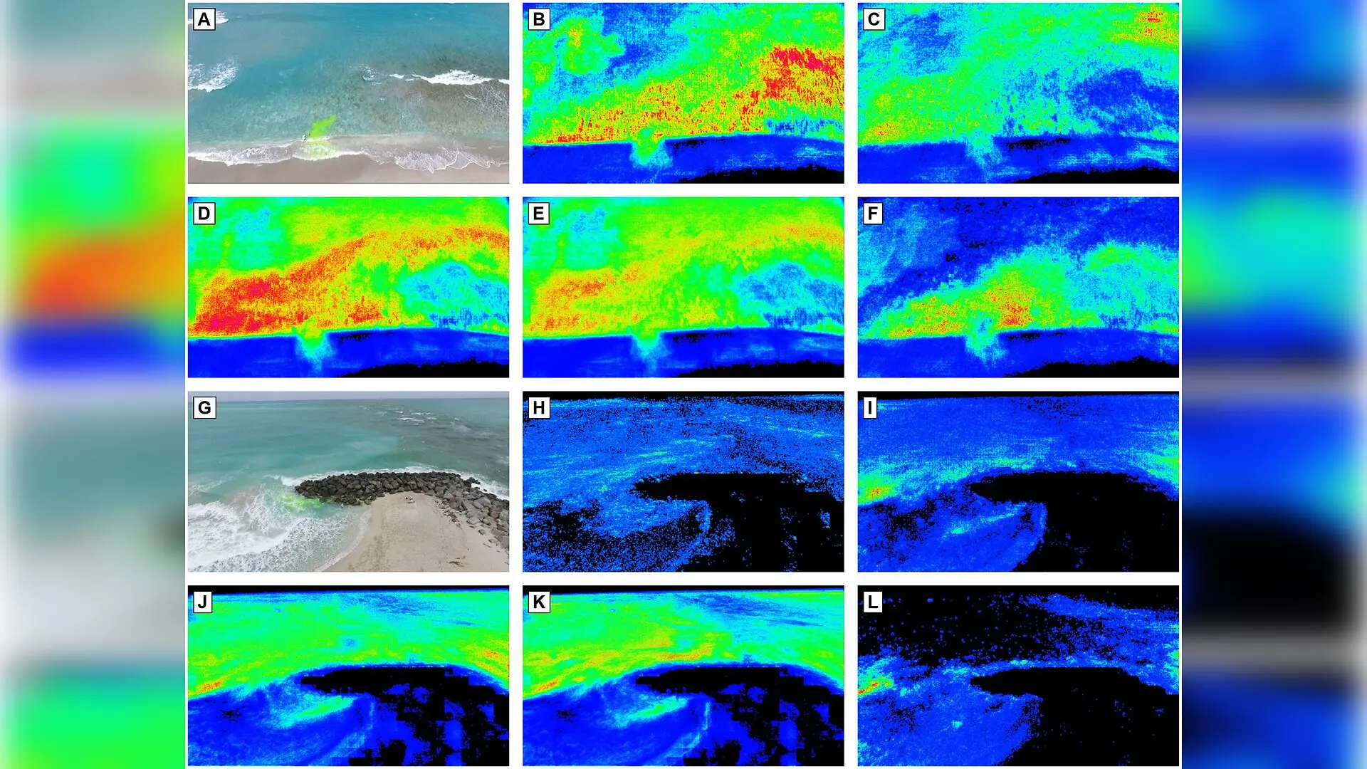
A new automated drone-video analysis framework is successfully mapping treacherous rip currents down to the individual pixel without requiring costly ground-based instruments or manual surveying markers.
Rip currents present a severe hazard to beachgoers around the world, driving the vast majority of lifeguard rescues and drowning events in the surf zone. While physical monitoring typically relies on expensive sensors and specialized equipment deployed directly in dangerous breaking waves, unmanned aerial vehicles offer an appealing alternative for wide-area coverage. However, raw drone footage is frequently disrupted by shifting surface waves, camera shaking, and glare. To overcome these obstacles, researchers developed an end-to-end processing pipeline that translates uncalibrated aerial video into precise pixel-level likelihood maps of offshore water movement.
The system, published in PLOS One by Kaiqi Yang, Stephen B. Leatherman, and Anchen Sun, operates entirely from aerial imagery captured by small quadcopters flying at altitudes between 45 and 70 meters. By combining computer vision techniques with physical fluid dynamics models, the pipeline successfully isolates slow, persistent seaward drift from fast-moving wave turbulence.
How Drone Video Converts Into Rip Current Maps
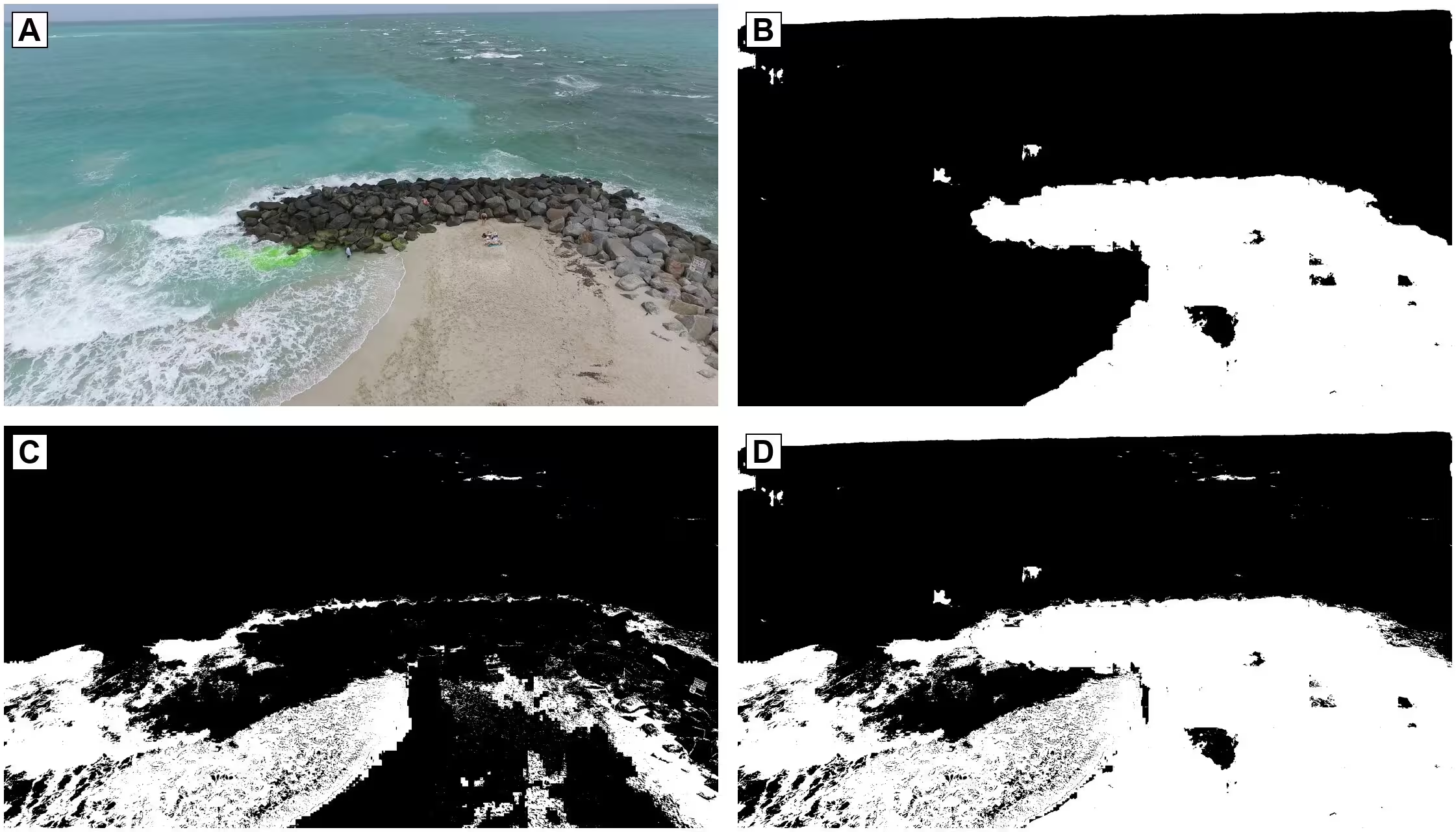
The processing architecture relies on several distinct computational stages to extract meaningful current data from unstructured video frames. First, the framework applies dense optical flow algorithms, which track pixel-level motion across successive video frames to estimate fluid velocity. Because breaking waves and foam create massive visual noise that can obscure underlying currents, the team integrated a specialized convolutional neural network utilizing a U-Net architecture and a ResNet-18 encoder. This deep learning component classifies image regions into categories such as sea, land, sky, and foam, effectively masking out non-ocean environments.
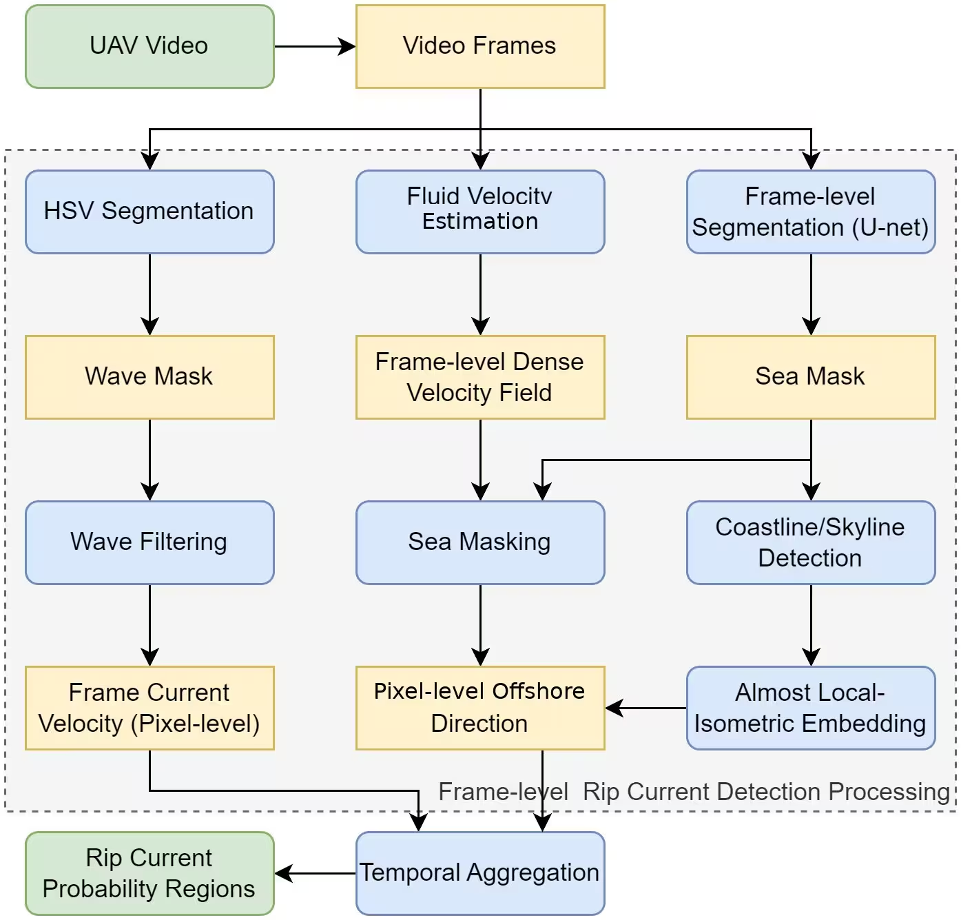
Next, the software applies a sphere-aware geometric projection technique that maps two-dimensional screen coordinates directly onto a three-dimensional spherical model of Earth. This mathematical transformation accounts for camera tilt and lens perspective, translating image-plane velocities into accurate ground-scale measurements. A directional filter then evaluates whether the estimated water flow points seaward within a specific angular tolerance relative to the local shoreline orientation.
Integrating Temporal Data to Suppress Wave Noise
A major challenge in video-based ocean monitoring is that surface waves move back and forth, creating zero-mean oscillatory motion that can trick basic movement detectors. To solve this problem, the team implemented a per-pixel temporal accumulator that tracks water movement across a window of 600 frames over a 20-second duration. While random wave movements cancel each other out over time, the steady, persistent seaward drift of a rip current accumulates continuously. This temporal integration allows the true hazard signal to emerge clearly above background turbulence.
The researchers tested their pipeline using aerial video recordings captured at Palm Beach and Haulover Park in Florida, comparing the automated heatmaps against expert consensus annotations provided by coastal science specialists. At the physically neutral default setting, the framework achieved precision-recall area-under-the-curve scores of 0.636 at Palm Beach and 0.660 at Haulover, significantly outperforming random chance.
Current Limitations and Future Directions
Despite these promising results, the authors note several important limitations that define the current operating scope of the software. The system assumes a relatively straight shoreline with uniform offshore bathymetry, meaning complex coastal geometries like embayed beaches or heavily modified jetties can reduce accuracy. Furthermore, optical flow relies entirely on visible surface tracers such as foam, sediment, or dye, making the method ineffective during calm, glassy water conditions or heavy glare.
Future development efforts will focus on expanding testing to diverse coastal environments featuring rocky shores and rough weather, portneying the computational workload to graphics processing units for real-time deployment on lightweight embedded hardware, and integrating motion-compensation algorithms to counteract drone drift during extended flights.
The research was published in PLOS One on October 29, 2026.
This article has been fact checked for accuracy, with information verified against reputable sources. Learn more about us and our editorial process.
Last reviewed on .
Article history
- Latest version
Reference(s)
- Yang, Kaiqi., et al. “Rip current detection in nearshore areas through UAV video analysis using optical flow and almost local-isometric embedding techniques on the sphere.” PLOS One, vol. 21, no. 10, October 29, 2026, pp. e0360672 Public Library of Science (PLoS), doi: 10.1371/journal.pone.0360672. <https://doi.org/10.1371/journal.pone.0360672>.
Cite this page:
- Posted by Kamran Akhtar