Scientists Discover Two Hidden Magma Reservoirs Beneath A Famous Volcano
Satellite data reveals unexpected ground movements at a famous lava-lake volcano, forcing scientists to rethink what is happening deep underground.
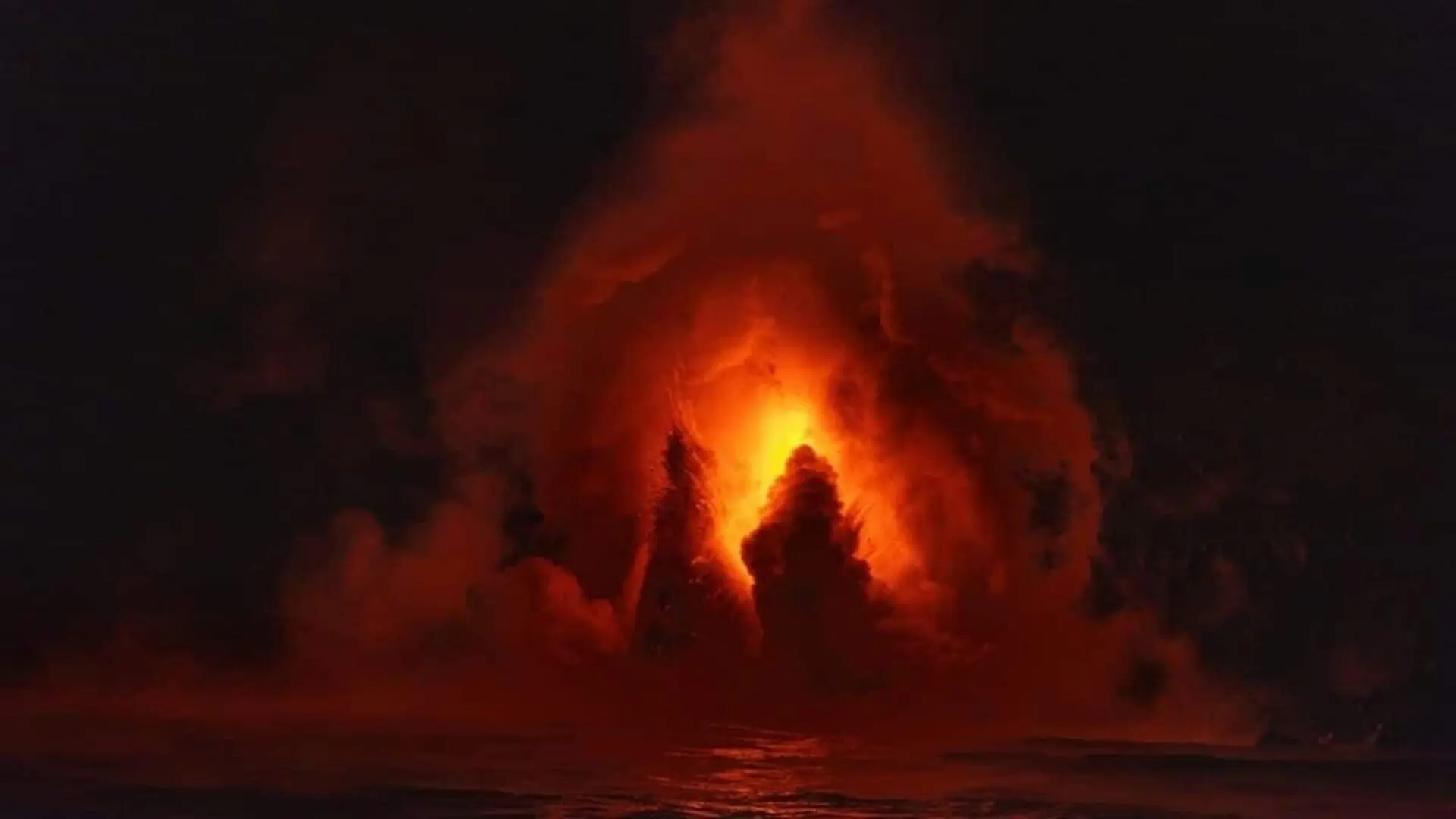
Researchers have identified two previously unknown magma sources beneath Nicaragua’s Masaya volcano, revealing a subsurface structure far more intricate than earlier models suggested. By analyzing six years of satellite data, a team from Penn State University observed distinct sections of the volcano moving in opposing directions, a phenomenon that underscores the complex plumbing system feeding the site’s iconic, persistent lava lake.
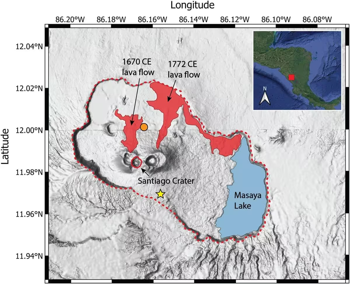
Located near the capital city of Managua, Masaya is a significant geological site where approximately 2 million people reside within a 13-mile radius. While the findings, published in Geophysical Research Letters, provide new insights into the volcano’s internal mechanics, researchers emphasize that there is no immediate threat to the surrounding communities.
Mapping Hidden Movements from Orbit
To investigate the volcanic architecture, the team utilized data from the Sentinel-1 satellite, which captures imagery of the region every 12 days. By employing a technique known as interferometric synthetic aperture radar (InSAR), the researchers were able to detect millimeter-scale changes in surface elevation.
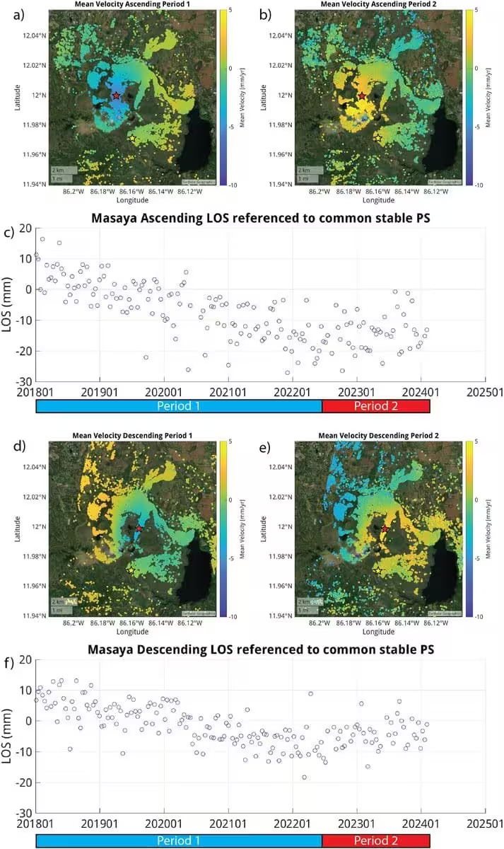
InSAR functions by bouncing microwave signals off the Earth’s surface to track shifts in distance between the satellite and the ground. This capability is particularly vital in tropical climates like Nicaragua, as the radar signals can penetrate cloud cover that would otherwise obscure optical observations. By comparing these measurements over a six-year period from 2018 to 2024, the team successfully mapped where the ground was experiencing uplift or subsidence.
Deciphering a Complex Plumbing System
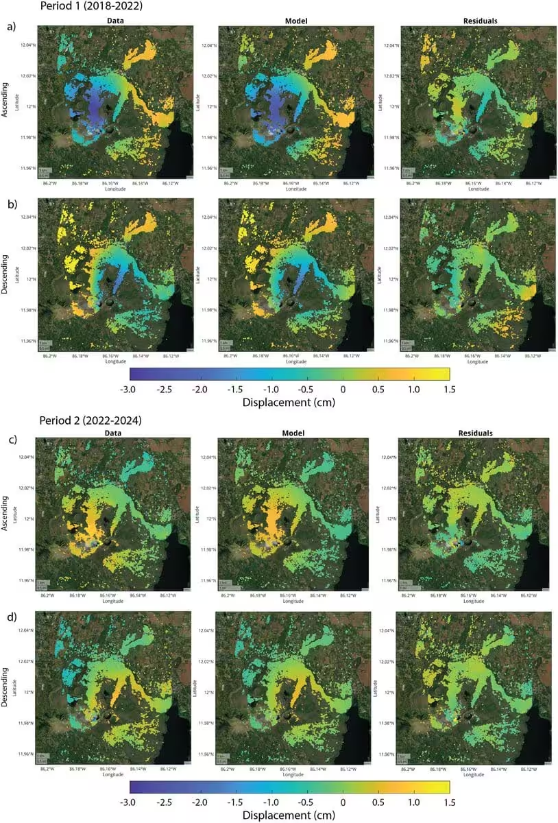
The satellite data revealed that between 2018 and 2024, the central caldera underwent a shift from subsidence to uplift. Geologists interpret this as a change in magma storage, where the removal of material causes the ground to sink, while the arrival of new magma increases internal pressure, forcing the surface to rise.
Simultaneously, the area surrounding the Santiago crater showed persistent deflation. Lead author Lizzie Johnson, who contributed to the study as a Penn State undergraduate, noted that this divergent behavior indicates the existence of at least two distinct reservoirs. While the deeper system appears to be inflating, a shallower reservoir near the Santiago crater seems to be losing volume.
Understanding these dynamics is crucial for long-term safety, even though the volcano has not produced a major lava flow since 1772. The site remains a source of significant volcanic gas emissions, particularly sulfur dioxide, which poses ongoing environmental and health risks to visitors and nearby residents.
According to Young Cheol Kim, who recently completed his doctoral work on the project, consistent monitoring is essential to define the baseline behavior of the volcano. By identifying these deviations from the norm, scientists hope to refine their predictive capabilities for future volcanic activity.
“These observations help scientists better understand how magma moves beneath Masaya and may improve monitoring and eruption forecasting in the future,” Johnson concluded.
This article has been fact checked for accuracy, with information verified against reputable sources. Learn more about us and our editorial process.
Last reviewed on .
Article history
- Latest version
Reference(s)
- “Sentinel-1.” <https://www.esa.int/Applications/Observing_the_Earth/Copernicus/Sentinel-1>.
Cite this page:
- Posted by David Anderson