Ghana Heat Mapping Reveals Severe Intra-Urban Temperature Divides
New high-resolution models across Accra show dense urban cores suffer from sustained heat and a lack of nighttime cooling, impacting millions.
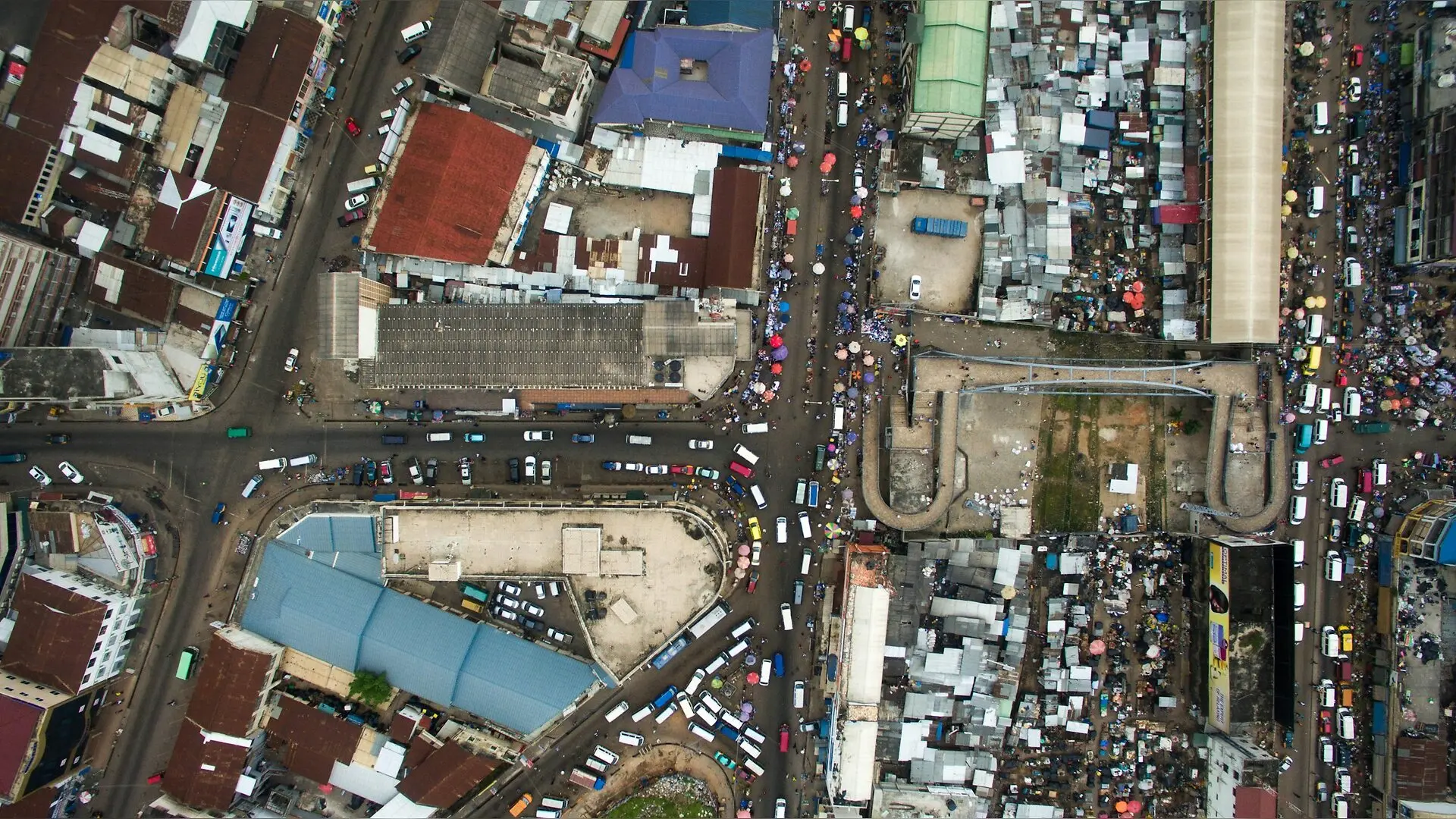
Residents of the Greater Accra Metropolitan Area in Ghana experience stark temperature differences of up to six degrees depending on their neighborhood, according to a recent field campaign that reveals deep thermal divides across the rapidly growing West African urban center. As cities across Sub-Saharan Africa expand faster than the global average, dense commercial zones and industrial sectors are locking in extreme heat while denying residents the crucial nighttime cooling needed for human physiological recovery. The new study maps these microclimates at a fine spatial resolution of fifty meters by fifty meters, offering an unprecedented look at how local land use, building density, and vanishing green spaces shape everyday thermal exposure.
Mapping Microclimates Across Six Million Urban Residents
To capture how heat moves through the region, researchers deployed individual temperature sensors across one hundred forty-three outdoor monitoring sites between August 2022 and December 2023. These sensors were housed in custom solar radiation shields positioned just above roof level and programmed to sample conditions continuously across an eighteen-month period that spanned both the hot, rainy season and the dry Harmattan season. The team combined these ground-based measurements with satellite observations and spatial predictors in a mixed-effects land use regression framework, which is detailed in the study published in Environmental Research, Health.
The resulting predictive models achieved high statistical accuracy, with cross-validated coefficients of determination ranging from zero point seventy-three to zero point eighty-seven. By separating the data into twenty-four-hour, daytime, and nighttime windows, the researchers tracked how incoming solar radiation drives daytime peaks while surface materials and coastal breezes govern nighttime conditions. The models accounted for topography, vegetation indices, water bodies, road networks, and gridded climate reanalysis fields from ERA5-Land to project temperatures across the entire fifteen-hundred-square-kilometer metropolitan zone.
Why Dense Urban Centers Trap Unrelenting Nighttime Heat
The analysis revealed that the urban core of the Accra Metropolitan Assembly and the industrial area of Tema endured the highest sustained heat burden, averaging thirty degrees Celsius across the campaign. During the study period, the Accra Metropolitan Assembly recorded fifty-seven percent of days with an overall mean temperature exceeding thirty degrees Celsius and thirty-five percent of days with maximum temperatures surpassing thirty-five degrees Celsius. In contrast, peripheral northern and western districts experienced cooler nights that dropped between nineteen point five and twenty-four point two degrees Celsius.
This geographic disparity is tightly linked to vegetation cover and building density. Wealthier neighborhoods in the region boast an average tree cover of twenty-three point one percent, whereas the poorest areas retain just three point five percent tree cover. This lack of urban canopy prevents efficient radiative cooling after sunset. Peri-urban and rural areas showed roughly three degrees Celsius greater reduction in mean diurnal temperature range and six degrees Celsius greater reduction in maximum diurnal range compared to the densely built urban core, depriving inner-city residents of vital nocturnal relief.
What These Findings Mean for Public Health and Adaptation
Sustained high temperatures, particularly at night, are established risk factors for cardiovascular, respiratory, renal, and perinatal health conditions. While daytime peaks create acute heat stress, inadequate nighttime cooling halts the body’s ability to recover from thermal strain. The new spatial models show that heat exposure in the Greater Accra Metropolitan Area intersects heavily with existing socioeconomic and environmental gradients, where low-income residents often live in denser, less-vegetated environments with limited adaptive capacity.
The authors note that large-scale green infrastructure, such as parks and street trees, can be challenging to implement in informal settlements due to land tenure issues and funding constraints. Instead, low-cost interventions like reflective cool roofs offer feasible near-term solutions for lowering indoor temperatures in vulnerable communities. By pinpointing exactly which neighborhoods experience the highest thermal loads, urban planners can target cooling investments more equitably, supporting sustainable growth and climate resilience as the regional urban population continues to climb.
The research was published in Environmental research, health : ERH on November 17, 2026.
This article has been fact checked for accuracy, with information verified against reputable sources. Learn more about us and our editorial process.
Last reviewed on .
Article history
- Latest version
Reference(s)
- Doyle, Hannah., et al. “High resolution spatiotemporal modelling of outdoor temperature for assessment of heat-related health inequalities in Accra, Ghana.” Environmental Research: Health, vol. 4, no. 4, November 17, 2026, pp. 045008 IOP Publishing, doi: 10.1088/2752-5309/aebbe2. <https://doi.org/10.1088/2752-5309/aebbe2>.
- Posted by William Moore