AI Framework Spots 30 Percent More Ocean Eddies from Space
A new neural network processes multi-sensor satellite observations in seconds to reveal hidden swirling vortices across global seas.
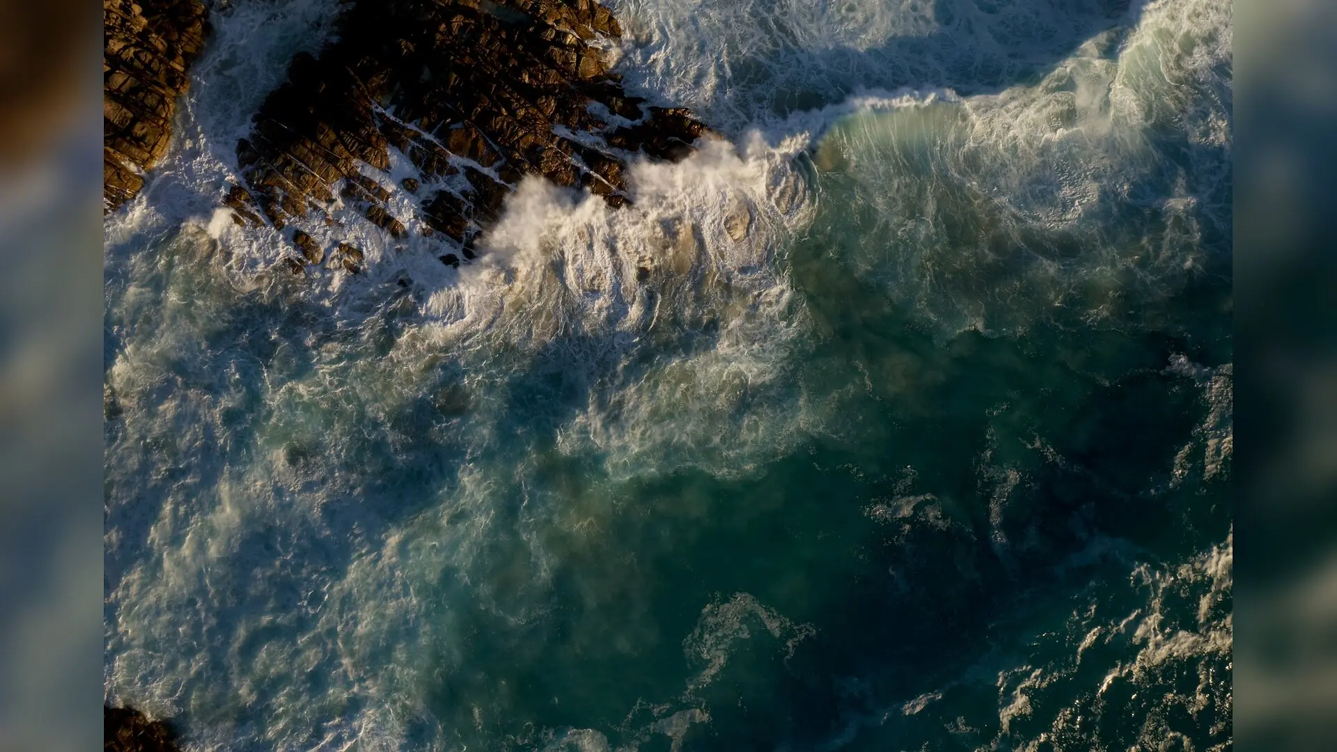
Oceanographers tracking swirling vortex structures known as mesoscale eddies across the global seas have a powerful new computational tool, as a research team has developed an artificial intelligence framework that maps these turbulent ocean features with unprecedented clarity. The system runs on a standard laptop CPU in under a minute, handling complex multi-sensor data to reveal roughly 30 percent more eddies than traditional numerical methods.
Mesoscale eddies are giant rotating water masses roughly 100 kilometers across that act as the weather systems of the ocean, transporting heat, salt, and marine nutrients over vast distances. Traditional computer programs designed to spot these structures rely on rigid rule-based thresholds applied to sea surface height maps, which often struggle with noisy data and can merge adjacent vortices into a single blob. To overcome these limitations, a group of scientists led by Matteo Broccoli of the CMCC Foundation in Italy created a multimodal machine learning architecture based on a convolutional neural network structure called a U-Net, combining altimetry and sea surface temperature data in a study published on the arXiv preprint server in November 2026.
How Artificial Intelligence Learns to See Hidden Ocean Whirlpools
The newly engineered framework processes six physical variables simultaneously on a global grid with a tenth-degree resolution. These inputs include sea surface height, sea surface temperature, zonal and meridional components of geostrophic velocity, and surface phase velocities. The inclusion of phase velocities is a crucial design choice, as the core of a rotating eddy naturally creates distinct circular signatures in phase space that neural networks can readily identify.
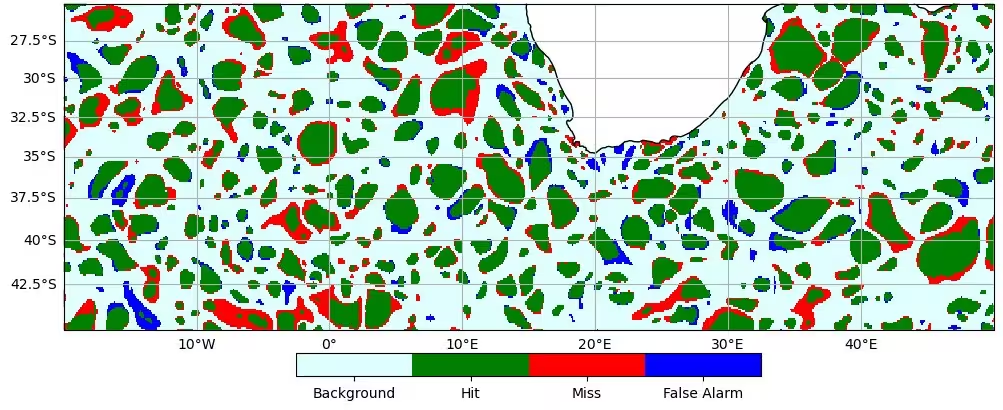
Rather than just performing a simple binary classification task to find where an eddy is located, the model operates as a multi-task network. It simultaneously segments the eddy boundaries and reconstructs the spatial sea surface temperature anomaly associated with the rotating water mass. The researchers implemented specialized loss functions, including boundary-coupling and gradient-matching terms, to ensure that the temperature reconstruction sharpens and regularizes the detected physical contours rather than producing blurry pixel maps.
Training Models on High-Resolution Satellite Data
The team developed two distinct model variants to test how high-resolution observations influence detection capabilities. The first variant, named NADIRnet, was trained on conventional nadir altimetry datasets collected by traditional satellite tracks from January 2022 to May 2024. The second variant, called SWOTnet, underwent a two-phase curriculum training strategy, utilizing higher-resolution wide-swath altimetry data provided by the Surface Water and Ocean Topography mission.
Because the wide-swath mission data spans a shorter timeframe, SWOTnet was first pre-trained on conventional altimetry before being fine-tuned on the enriched SWOT fields. Evaluated against validation splits using both pixel-wise and structure-wise metrics such as Intersection-over-Union matching, the models demonstrated high precision and recall. Most residual disagreements with target datasets stemmed from slight boundary placements rather than missed or false detections.
Uncovering a Larger and Finer Population of Ocean Eddies
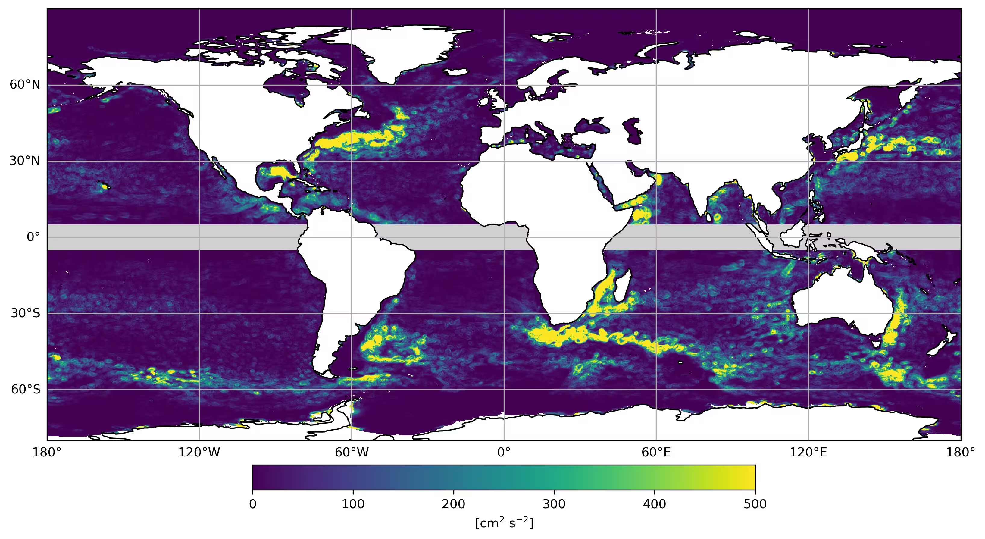
When deployed across global ocean data, the machine learning models consistently identified a larger population of eddies than standard automated tracking schemes, detecting approximately 500 more structures daily with an average diameter about seven kilometers smaller. Traditional algorithms often collapse complex vorticity fields into simplified shapes, whereas the neural network successfully resolves individual eddies in turbulent regions like the Lofoten Basin in the Norwegian Sea.
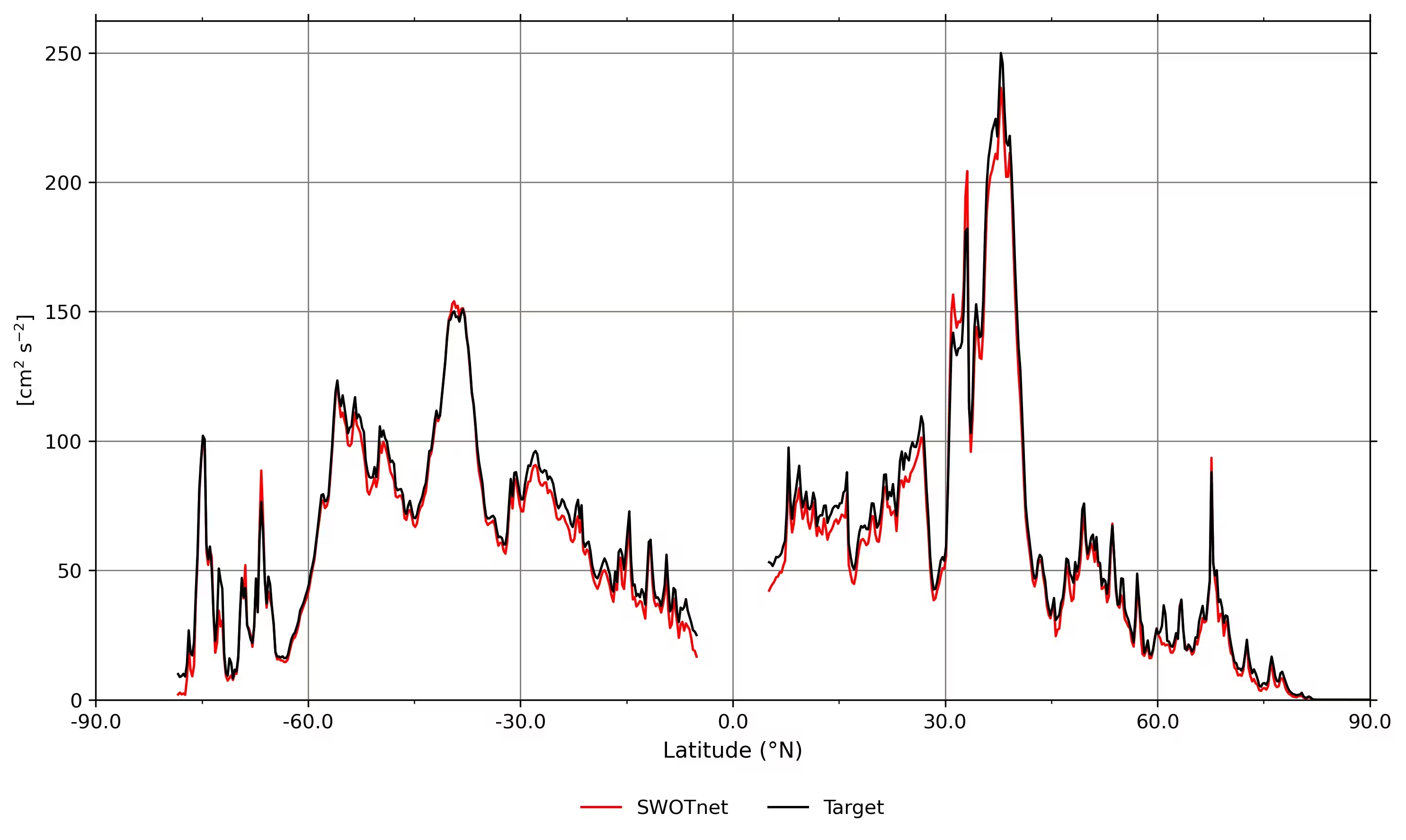
Crucially, the higher-resolution training signal embedded into SWOTnet successfully transferred when the model was applied back onto coarser conventional altimetry datasets. By utilizing the temperature anomaly channel as a physical anchor, SWOTnet detected about 30 percent more eddies on conventional maps than traditional baseline algorithms. This capability opens up the possibility of reprocessing the entire multi-decadal satellite altimetry record dating back to 1993 with enhanced spatial fidelity.
Real-World Validation and Future Oceanographic Expeditions
Beyond standard data products, the research team tested the framework’s versatility by applying it without any retraining to entirely unseen datasets. When fed outputs from the VarDyn variational reconstruction product and raw Level-3 wide-swath satellite retrievals featuring observational gaps, the model generated physically coherent and spatially continuous eddy contours across orbital swathes.
This computational robustness proved practical during real-world operations in July 2026, when SWOTnet ran on board the research vessel Marion Dufresne during the WHIRLS project field campaign in the Agulhas region. Operating on a standard portable computer, the software successfully delivered daily eddy position updates to assist cruise planning. Future research will focus on scaling this framework across historical archives to refine global estimates of ocean heat transport and marine circulation dynamics.
The study was posted to the arXiv preprint server on November 17, 2026.
This article has been fact checked for accuracy, with information verified against reputable sources. Learn more about us and our editorial process.
Last reviewed on .
Article history
- Latest version
Reference(s)
- Broccoli, Matteo. “Improving Eddy Detection from Wide-Swath Altimetry with Multimodal Data-Driven Models.” arXiv.org <http://arxiv.org/abs/2611.22601v1>.
Cite this page:
- Posted by Vikram Desai