Nearly 70 Percent of This Major Coastal City Faces Hour-Long Transit Gaps to General Hospitals
New spatial mapping reveals stark healthcare inequities between urban cores and mountainous outskirts, highlighting major hurdles for aging populations.
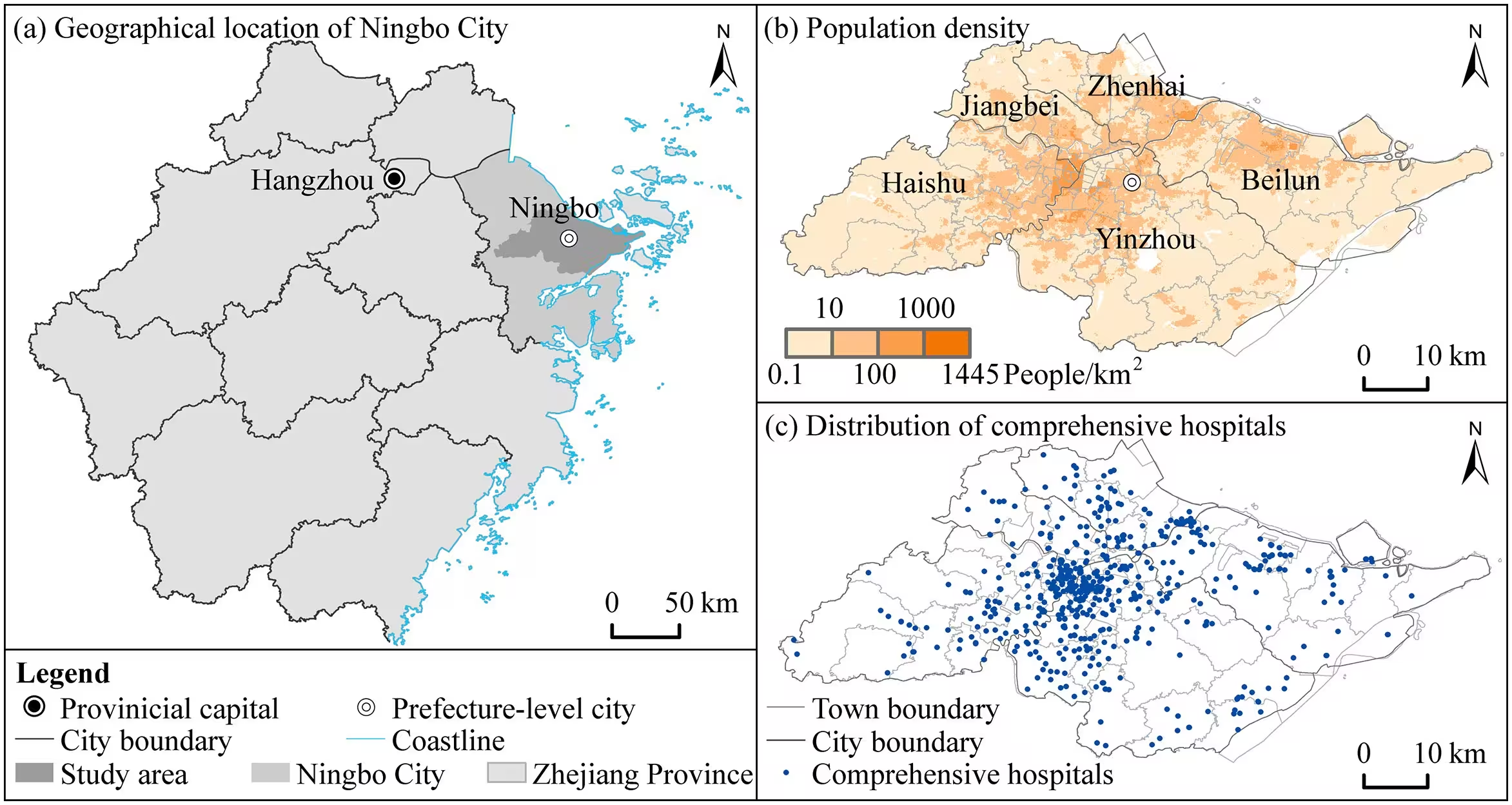
Residents living in the peripheral neighborhoods of Ningbo, China, face stark healthcare disadvantages, as a comprehensive spatial analysis reveals that nearly 70 percent of the city requires over an hour of public transit to reach a general hospital. While emergency ambulances navigate the urban core and outlying zones much faster, routine public transportation options leave vast tracts of the medium-sized coastal city isolated from timely medical care.
The investigation, published in PLOS One, examined the spatial distribution and equity of emergency medical services across five core urban districts. Led by researchers from Ningbo University, the work highlights a glaring divide between emergency response capabilities and routine transit accessibility in a rapidly urbanizing region characterized by an aging population.
How Emergency and Routine Travel Times Shape City Disparities
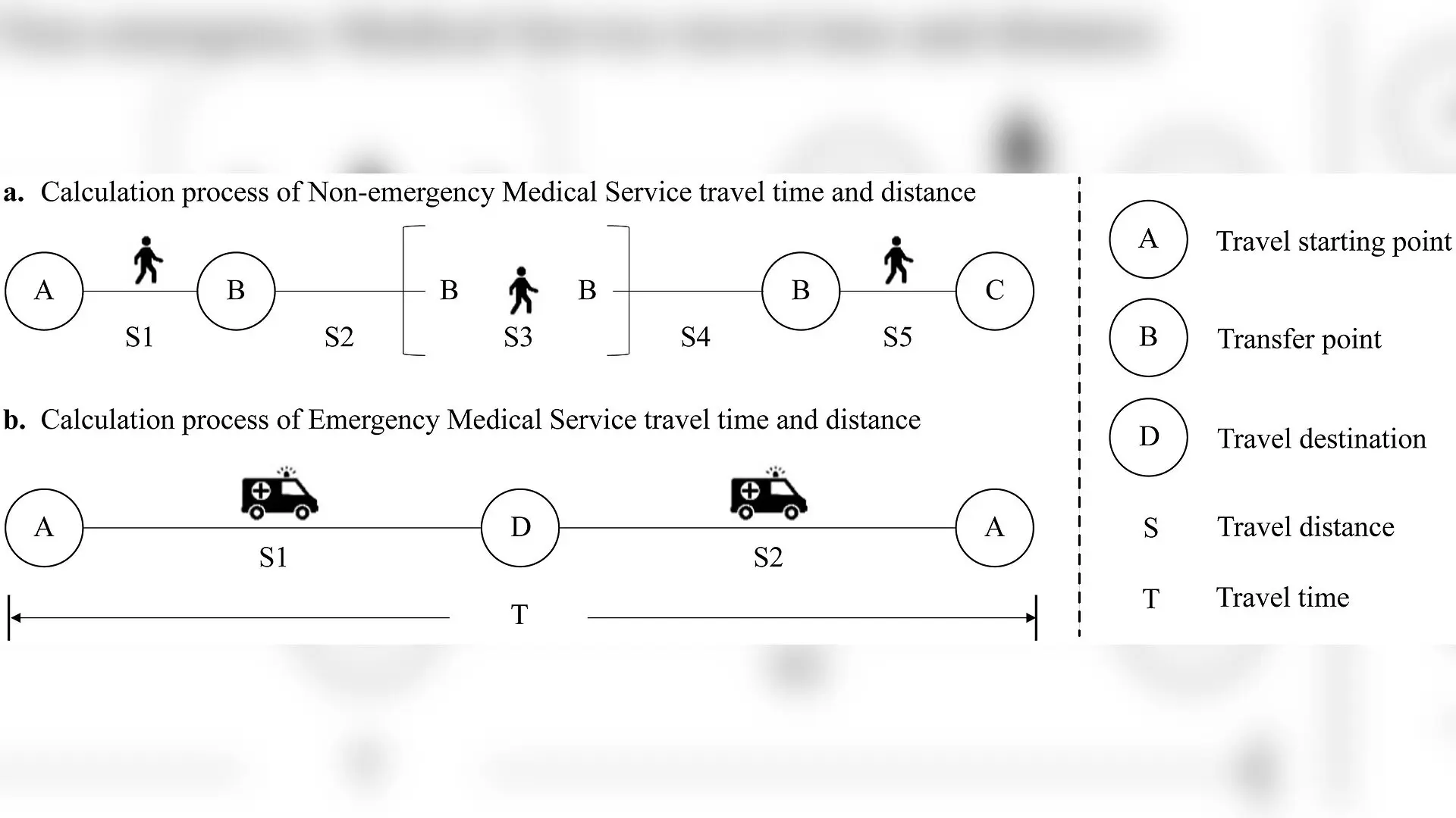
To evaluate how easily people can reach healthcare, the study modeled travel times across 9,029 grid cells covering central Ningbo. Investigators contrasted emergency medical travel, measured as an ambulance round trip from a hospital to an incident site and back, against non-emergency medical travel, represented by public bus and transit networks.
The findings show that public transit coverage falls drastically short of modern urban planning ideals. Only 1.78 percent of the study area sits within a 15-minute service radius of a general hospital via public transport. Meanwhile, a staggering 68.45 percent of the region requires more than 60 minutes of travel time for a routine medical trip.
In contrast, emergency ambulance scenarios perform significantly better on paper. Ambulances cover 14.68 percent of the area within a 15-minute window, and only 5.19 percent of the region exceeds 60 minutes of travel time. This massive gap underscores how heavily outer neighborhoods rely on specialized pre-hospital transport networks rather than standard public buses for urgent medical needs.
Measuring Healthcare Inequity Through Gini Coefficients and Spatial Clustering
Beyond raw travel durations, the team assessed spatial equity by pairing population distribution data with accessibility metrics using economic Lorenz curves and Gini coefficients. Both emergency and non-emergency modes yielded Gini scores exceeding 0.4, with emergency accessibility scoring 0.5156 and non-emergency scoring 0.4898. These high figures signal substantial spatial inequality across the resident population.
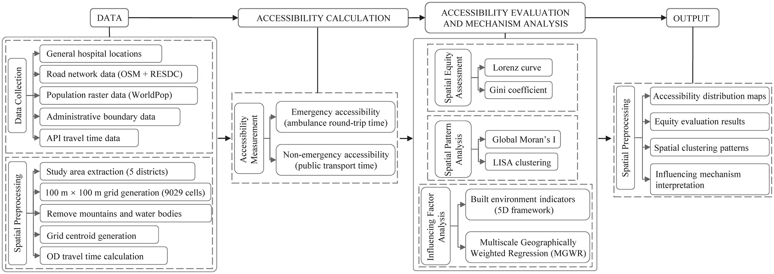
Spatial autocorrelation analysis further confirmed intense geographic clustering, yielding a global Moran’s I index of 0.846. High-value clusters, representing long travel times and poor accessibility, concentrated heavily in the western and southern mountainous outskirts. Low-value clusters, denoting rapid access, dominated the central built-up districts where general hospitals and tertiary medical institutions cluster tightly.
The authors note that these patterns stem from historic urban development strategies prioritizing city centers over suburbs. Because medical infrastructure remains heavily centralized, outlying residents experience severe barriers that are compounded by rugged terrain and sparse transit lines.

Which Built Environment Factors Drive Access Gaps?
Using a multiscale geographically weighted regression model, the team analyzed eleven built environment indicators to see what shapes these disparities. Elements such as bus route density, road density, and the number of bus stops generally help narrow accessibility gaps by improving local mobility. Conversely, high building density and intense urban development exacerbate inequalities by concentrating populations and straining local medical demand.
The investigators emphasize that while their models provide robust benchmarks, the study focused solely on potential transportation access rather than real-time traffic congestion or actual patient hospital choices. Future urban planning initiatives must address these infrastructure imbalances to protect vulnerable and aging communities.
The research was published in PLOS One on November 4, 2026.
This article has been fact checked for accuracy, with information verified against reputable sources. Learn more about us and our editorial process.
Last reviewed on .
Article history
- Latest version
Reference(s)
- Fu, Minxia., et al. “Spatial accessibility and equity of emergency medical services: Evidence from Ningbo.” PLOS One, vol. 21, no. 11, November 4, 2026, pp. e0362204 Public Library of Science (PLoS), doi: 10.1371/journal.pone.0362204. <https://doi.org/10.1371/journal.pone.0362204>.
Cite this page:
- Posted by Ali Farooqui