AI Detects Weather Fronts Directly From Satellite Imagery
A new machine learning framework identifies cold, warm, and occluded fronts from space in real time, matching human forecaster agreement.
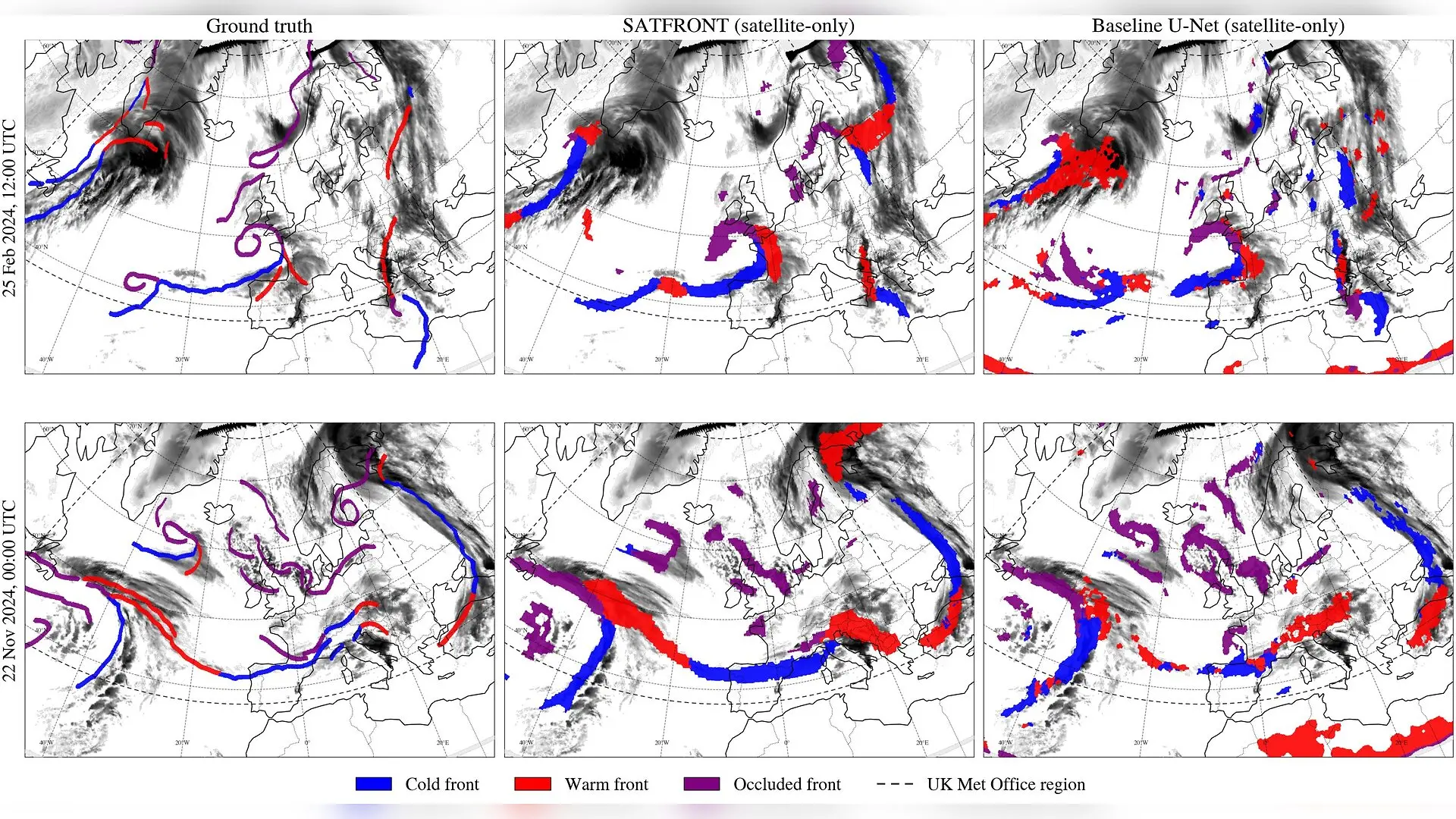
Over the skies of Europe and the Northeast Atlantic, atmospheric boundaries known as cold, warm, and occluded fronts drive much of the region’s severe weather and heavy precipitation. Identifying these weather boundaries has traditionally required meteorologists to manually draw lines on weather charts, a process that is both time-consuming and subjective. To overcome this limitation, researchers have developed a deep learning framework called SATFRONT that detects these three major weather front types directly from geostationary satellite imagery. The authors report that the model can generate high-frequency frontal analyses without relying on numerical weather prediction models, opening the door for automated, real-time meteorological monitoring.
How Satellite Imagery Shapes Modern Front Detection
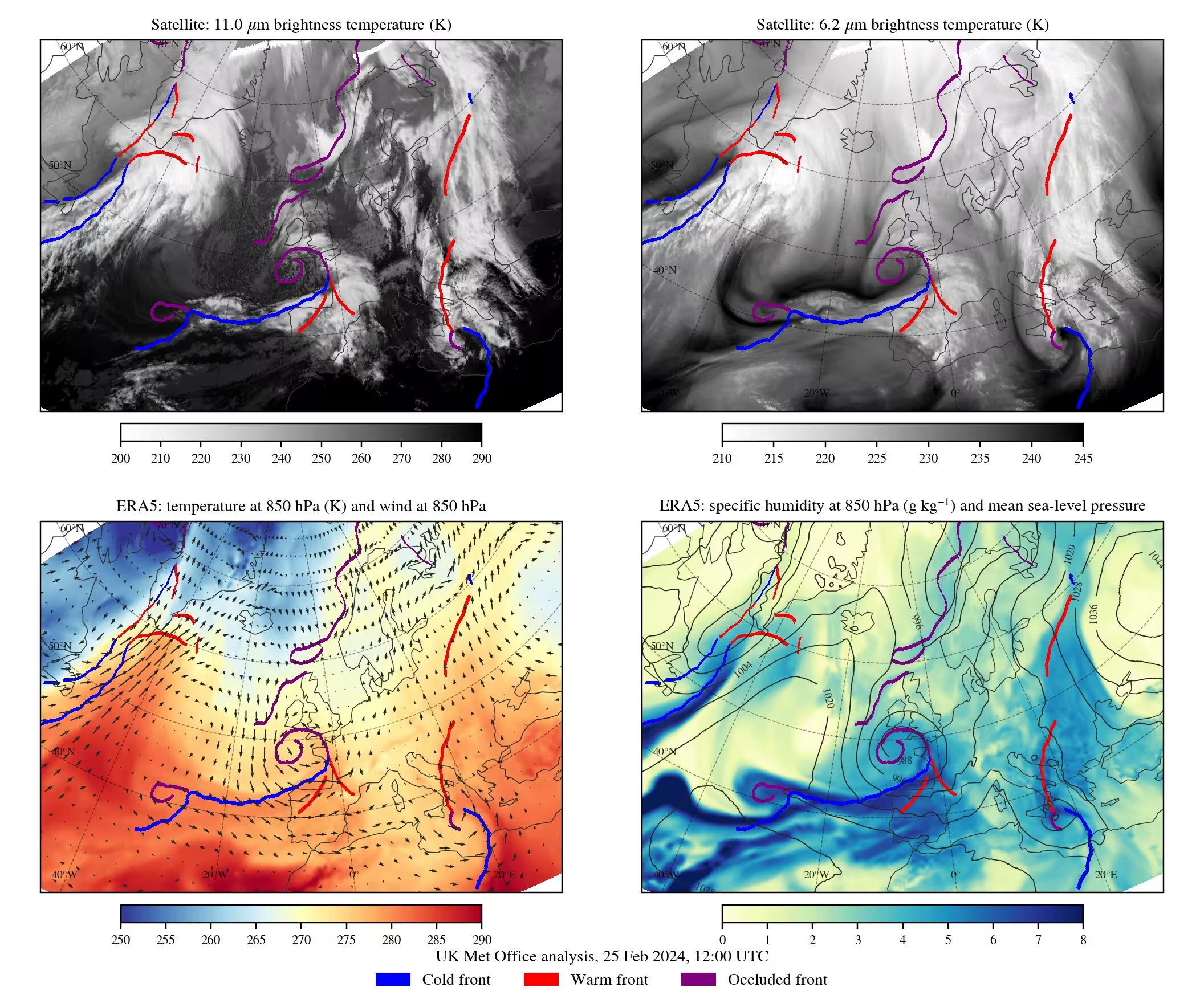
Weather forecasting relies heavily on tracking the leading edges of advancing air masses, such as cold fronts and warm fronts, as well as occluded fronts where one air mass overtakes another. While traditional forecasting tools depend on atmospheric state variables like temperature, pressure, and humidity from numerical models, these gridded datasets typically become available only hours or days after observations are taken. By contrast, geostationary satellites capture infrared radiation and cloud structures multiple times per hour. The study, published in arXiv, demonstrates that an artificial intelligence model can process eight infrared channels and seven auxiliary spatial features to identify frontal structures with low latency.
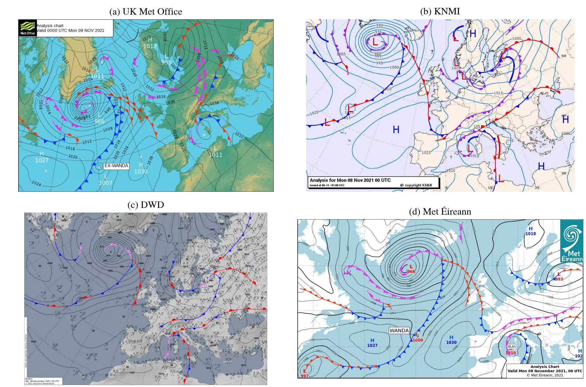
To train the model across diverse operational standards, the research team utilized historical surface analyses from five European national meteorological services, including the Finnish Meteorological Institute and the German Weather Service. They implemented a shared encoder-decoder architecture featuring service-specific output heads. This design allows the neural network to learn a common visual representation of weather patterns while adapting to the unique chart-drawing conventions of each meteorological agency. The authors evaluated the model against 2024 data from the UK Met Office.
Performance Metrics and the Impact of Reanalysis Data
When evaluated using satellite observations alone, SATFRONT achieved a Critical Success Index score of 0.428 at a 150-kilometer tolerance. This performance metric places the model’s accuracy squarely within the range of natural agreement observed between independently produced analyses from different human meteorological services. Furthermore, the satellite-only model substantially outperformed an older operational rule-based satellite product known as ASII-SAT, which scored 0.133. The researchers noted that cold fronts were generally easier to identify than warm fronts, largely because warm fronts often feature broad and diffuse cloud structures that obscure sharp boundaries.
To measure the value of traditional atmospheric data, the team also tested a hybrid configuration that incorporated 28 variables from the ERA5 reanalysis dataset, which includes temperature and wind fields at various pressure levels. Adding ERA5 increased the overall success index to 0.591 and improved the precise spatial placement of individual fronts, particularly for warm fronts. However, because reanalysis data requires days to process, the satellite-only setup remains the primary candidate for time-critical, real-time operational forecasting.
Limitations and Future Outlook for Automated Meteorology
Despite the promising results, the authors acknowledge several limitations in their current methodology. The model was trained primarily on data covering Europe and the Northeast Atlantic, meaning its ability to generalize to tropical or polar regions remains untested. Additionally, extracting ground truth labels from historical chart images can introduce minor extraction errors, and the satellite observations were not explicitly corrected for parallax displacement caused by viewing high-altitude clouds at oblique angles.
Future work will involve testing the framework across additional meteorological agencies and geographic regions, as well as consulting operational forecasters to determine how effectively the automated predictions serve as first-guess charts. By leveraging high-frequency geostationary data available every 30 minutes, this automated approach could soon provide meteorologists with continuous, consistent tracking of severe weather systems worldwide.
The study was posted to the arXiv preprint server on October 30, 2026.
This article has been fact checked for accuracy, with information verified against reputable sources. Learn more about us and our editorial process.
Last reviewed on .
Article history
- Latest version
Reference(s)
- Dravilas, Ioannis. “SATFRONT: Detecting Atmospheric Fronts with Satellite Data using Machine Learning.” arXiv.org <http://arxiv.org/abs/2610.42111v1>.
Cite this page:
- Posted by Kamran Akhtar