Are Global Population Maps Hiding Millions of People in the Wrong Locations
Millions of people live in “ghost settlements” missing from global maps, leaving them dangerously vulnerable to natural disasters and ignored by policymakers.
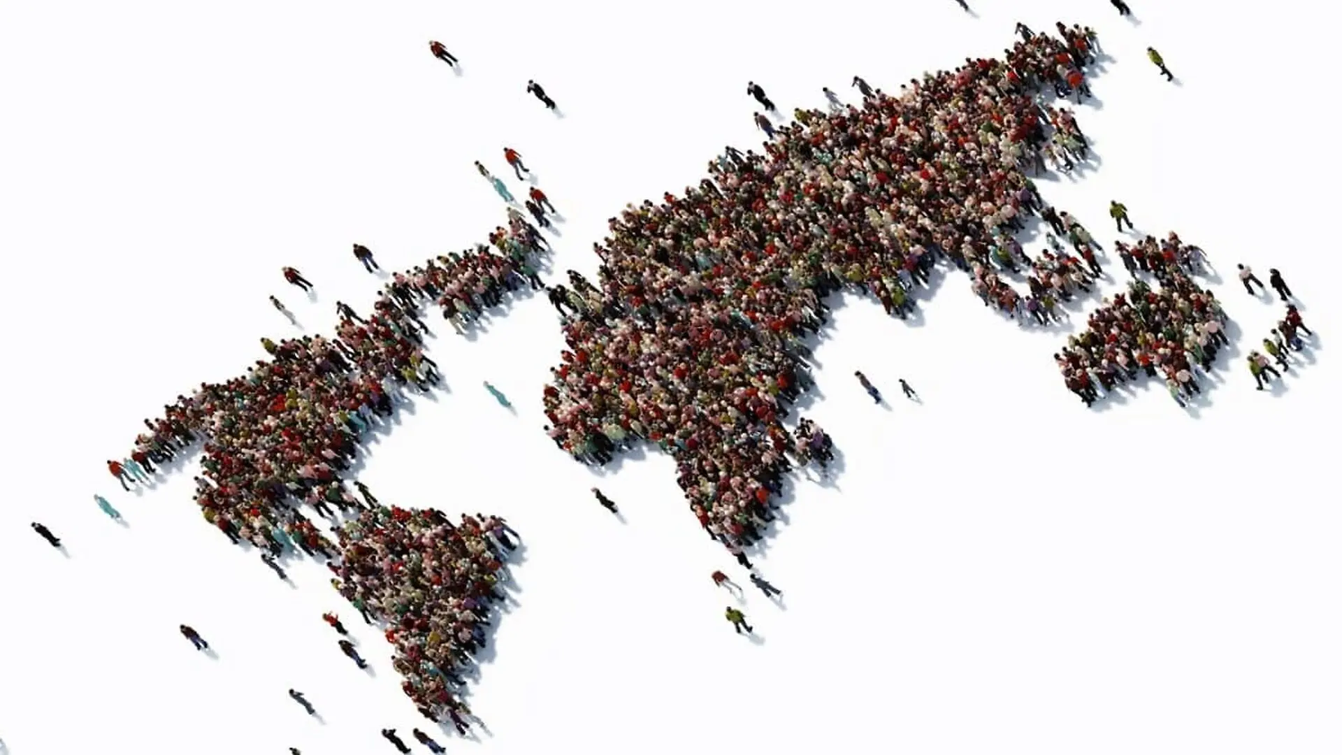
High-resolution population maps are essential tools for modern disaster management, guiding critical decisions on where to place warning sirens, construct shelters, and dispatch emergency relief. However, a new analysis suggests these tools may contain significant geographical inaccuracies, potentially leading officials to underestimate the number of residents in vulnerable rural areas.
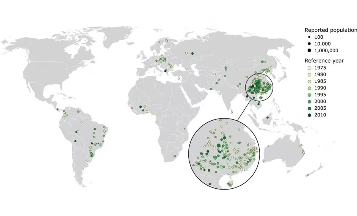
The research, led by Josias Láng-Ritter, a postdoctoral specialist in water and environmental engineering at Aalto University, examined the reliability of historical population data by focusing on communities relocated due to dam construction. By comparing official resettlement figures with data from global population grids, his team identified stark discrepancies that raise questions about how human settlements are represented on digital maps.
Data Discrepancies Across 307 Dam Projects
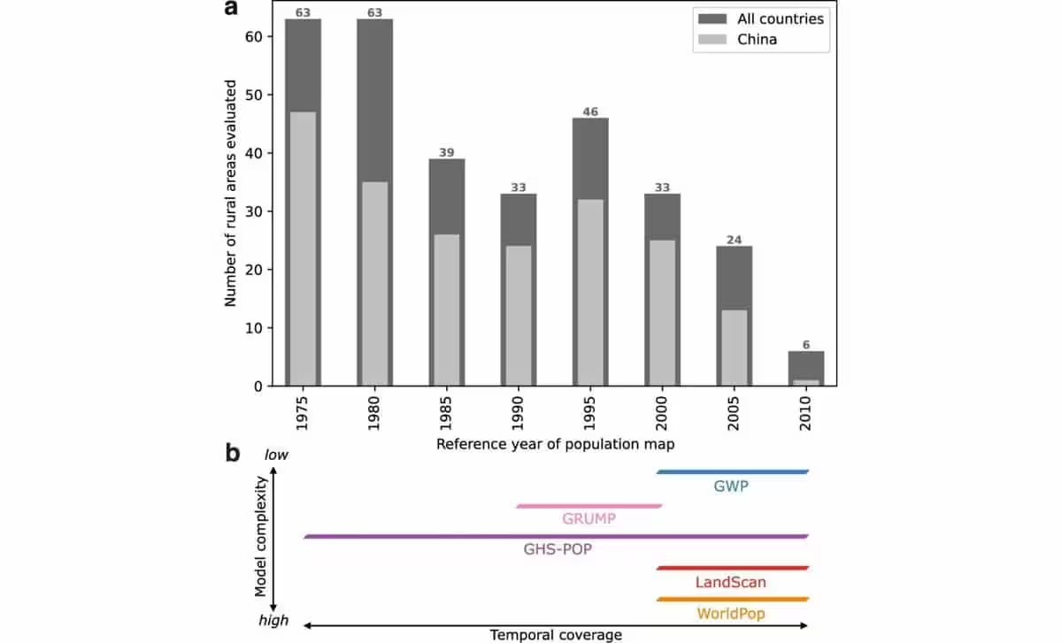
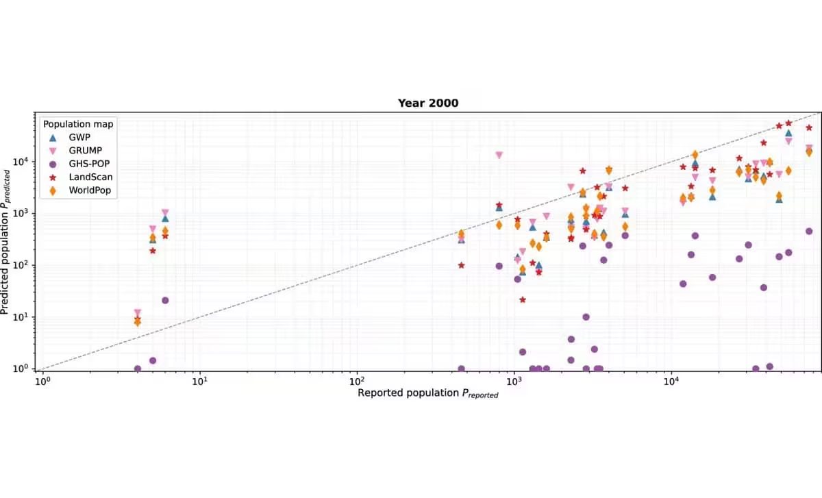
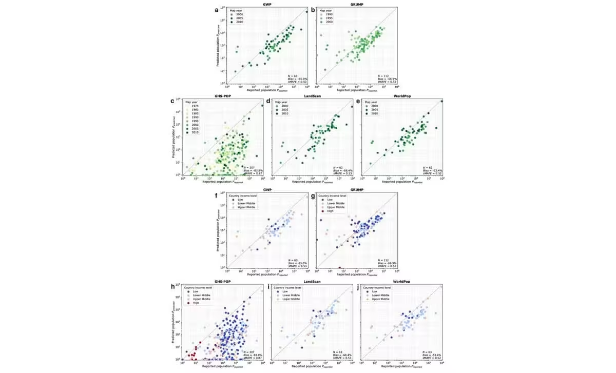
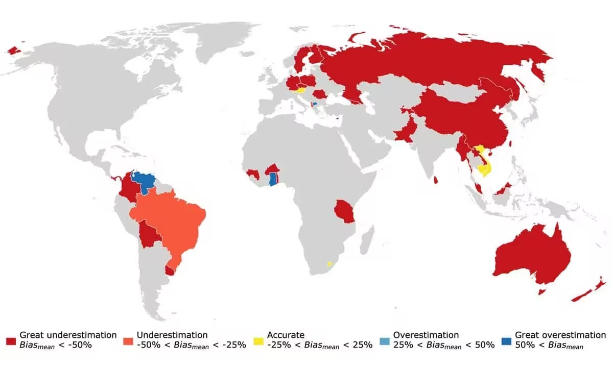
The study, published in Nature Communications, utilized records from 307 dam projects across 35 countries. By analyzing the period between 1975 and 2010, researchers compared documented population counts in regions prior to reservoir flooding against standard population estimation datasets.
The results revealed that, in the analyzed rural locations, these mapping systems underestimated resident counts by between 53 and 84 percent. While these figures sparked widespread speculation regarding whether global population totals were significantly miscalculated, Láng-Ritter has firmly dismissed such claims. He maintains that his findings do not imply the existence of “missing” humans on a global scale, but rather point to a failure in the spatial distribution of data.
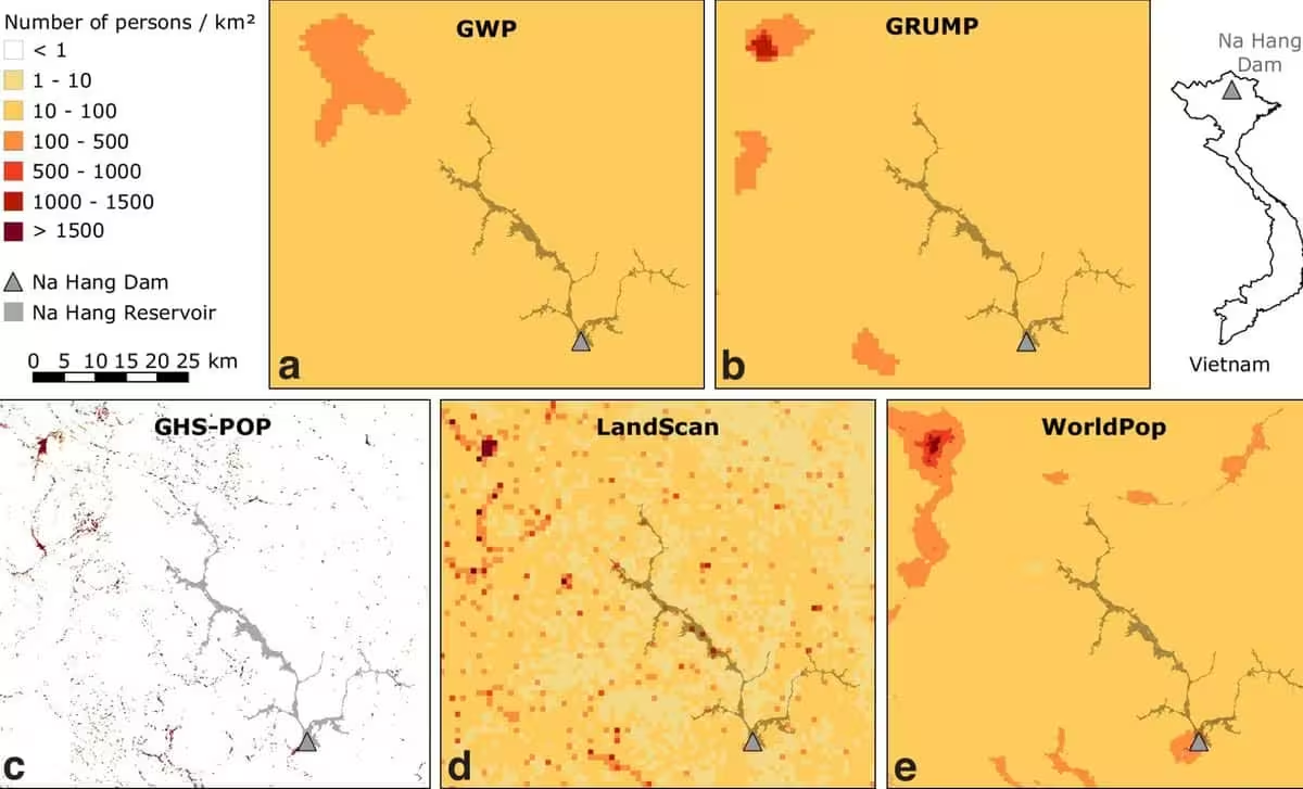
The core of the issue lies in how census data—which tracks population by administrative province—is transformed into gridded map data. If a mapping model incorrectly allocates residents to urban centers, the rural figures will naturally appear lower, even if the regional total remains mathematically accurate.
Scientific Debate Over Methodology and Mapping Errors
The interpretation of these findings has faced scrutiny from the broader scientific community. In a critique published on arXiv, researchers led by Till Koebe of Saarland University argued that the observed gaps might be a result of technical artifacts rather than a systemic failure to count people.
Other experts, including teams from WorldPop and the European Commission’s Joint Research Centre, have pointed to the role of satellite imagery in population modeling. Many of these models rely on high-resolution satellite data to identify human-built structures. If the imagery used was captured after a reservoir was filled, the model would effectively “erase” the former village from its calculations. In this scenario, the residents were not omitted from the total count but were likely mapped to incorrect geographical coordinates.
Láng-Ritter welcomes this feedback, describing it as a necessary contribution to refining how population science is conducted. He emphasizes that his results should not be used as a literal benchmark for planning, but rather as an indicator that current methodologies require more rigorous validation.
Consequences for Disaster Risk Management
The implications for humanitarian and disaster planning are tangible. Even small spatial misalignments can mean the difference between a community being included or excluded from a projected flood zone. If planners rely on inaccurate maps, they may unintentionally under-resource vulnerable areas or fail to position life-saving supplies where they are most needed.
While acknowledging the gravity of these potential errors, Láng-Ritter noted to Popular Mechanics that there is currently no documented evidence of a specific emergency response failure directly caused by these mapping discrepancies. He advocates for the use of local, on-the-ground knowledge to supplement global models, especially in high-risk zones where satellite-derived data might be outdated.
Looking forward, the research team highlights the need for updated comparisons using modern data, as the study’s reliance on historical records leaves current mapping accuracy an open question. For now, the takeaway remains clear: global population aggregates are effective for broad summaries, but they may lack the precision necessary for the granular, life-critical tasks of local emergency management.
This article has been fact checked for accuracy, with information verified against reputable sources. Learn more about us and our editorial process.
Last reviewed on .
Article history
- Latest version
Reference(s)
- Láng-Ritter, Josias. “Global gridded population datasets systematically underrepresent rural population - Nature Communications.”, vol. 16, no. 1, March 18, 2025, pp. 2170 Nature, doi: 10.1038/s41467-025-56906-7. <https://www.nature.com/articles/s41467-025-56906-7>.
- Koebe, Till. “Reply To: Global Gridded Population Datasets Systematically Underrepresent Rural Population by Josias Láng-Ritter et al.” arXiv.org <https://arxiv.org/abs/2602.09248>.
- Gorman, Shawn. “Scientists May Have Severely Miscalculated How Many Humans Are on Earth—or Maybe the Maps Got It Wrong.”, October 23, 2026 Popular Mechanics <https://www.popularmechanics.com/science/a74218575/missing-humans-map-populations/>.
Cite this page:
- Posted by Vikram Desai