Ensemble Model Maps Panama Road Landslide Risks
Combining statistical ratios and machine learning reveals that over 71 kilometers of primary mountain roads in western Panama face high landslide exposure.
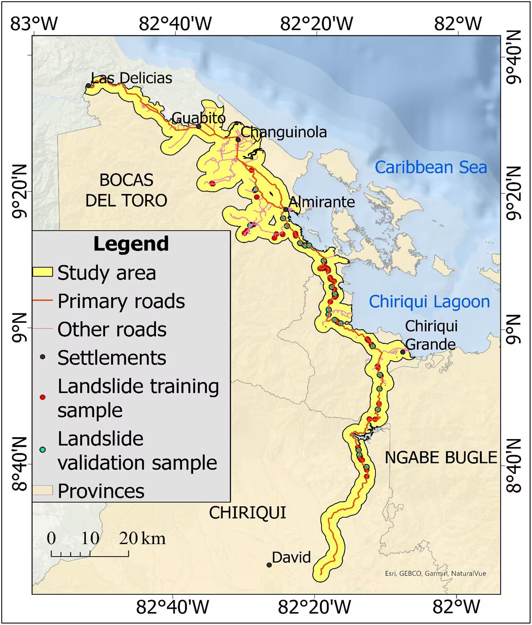
Steep mountain roads in western Panama face escalating risks from rainfall-triggered slope failures as changing climate conditions alter tropical precipitation regimes. Researchers mapped 87 landslide scars along 266.55 km of primary transportation corridors to build predictive maps identifying vulnerable infrastructure segments. More than 71 km of these vital regional roadways intersect zones classified as having high or very high susceptibility to slope collapses. The findings were published in PLOS One by Dereck Mbeh Petiangma and colleagues, offering a new approach for protecting critical trade and travel arteries.
Combining Two Modeling Techniques for Better Accuracy
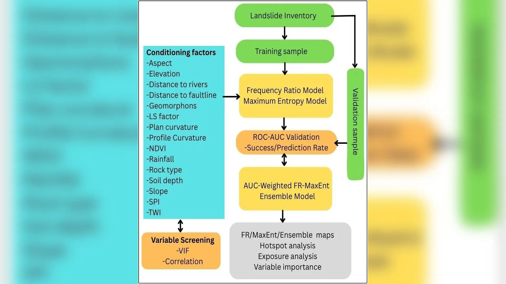
To assess where disasters are most likely to strike, the scientific team adopted an integrated modeling framework that merged two distinct statistical techniques. The first approach, called the Frequency Ratio method, evaluates the mathematical relationship between historical landslides and environmental conditioning factors such as elevation, slope, and soil depth. The second approach, known as Maximum Entropy or MaxEnt, relies on presence-only data originally designed for ecological niche modeling to capture complex, nonlinear interactions among multiple predictors.
By combining these models using an area-under-the-curve weighting procedure, the authors generated a unified susceptibility surface that balanced the transparency of bivariate ratios with the flexibility of machine learning. The resulting ensemble model achieved a high prediction-rate score of 0.945, outperforming the standalone methods and providing a narrower confidence interval for its predictions. This statistical weighting reduced spatial overprediction while successfully concentrating more than 80 percent of observed landslides within the top susceptibility tiers.
Topography and Vegetation Drive Susceptibility Patterns
The analysis revealed that slope steepness and normalized difference vegetation index values exert the strongest influence on landslide susceptibility across the 1,231.93 square kilometer study area. Elevations range from 5 meters in coastal lowlands up to 1,997 meters in highland volcanic terrain where grades frequently exceed 19.8 degrees. While dense forest cover generally helps stabilize soils, intermediate vegetation densities often coincide with steep, moisture-rich slopes that experience accelerated runoff during extreme rainfall events exceeding 490 millimeters annually.
Hydrological indicators such as the stream power index and topographic wetness index further demonstrated that concentrated surface water flow and shallow soils significantly amplify failure risks. Geological units consisting of volcanic rocks, pyroclastic deposits, and weathered sedimentary layers also shape local vulnerability, although structural factors like distance to fault lines showed varying degrees of influence depending on the modeling algorithm used.
Pinpointing Vulnerable Road Corridors and Hotspots
Hotspot analysis using Getis-Ord Gi statistics identified statistically significant clusters of high susceptibility at confidence levels reaching 99 percent along specific subdistrict corridors. The most exposed road segments are concentrated in Hornito, Bajo Cedro, and Valle de Agua Arriba, where primary transit links connect Bocas del Toro Province and the Rambala-Hornito-David route to the rest of the country. These locations correspond directly to areas where mud and debris flows have historically disrupted regional mobility and economic activity.
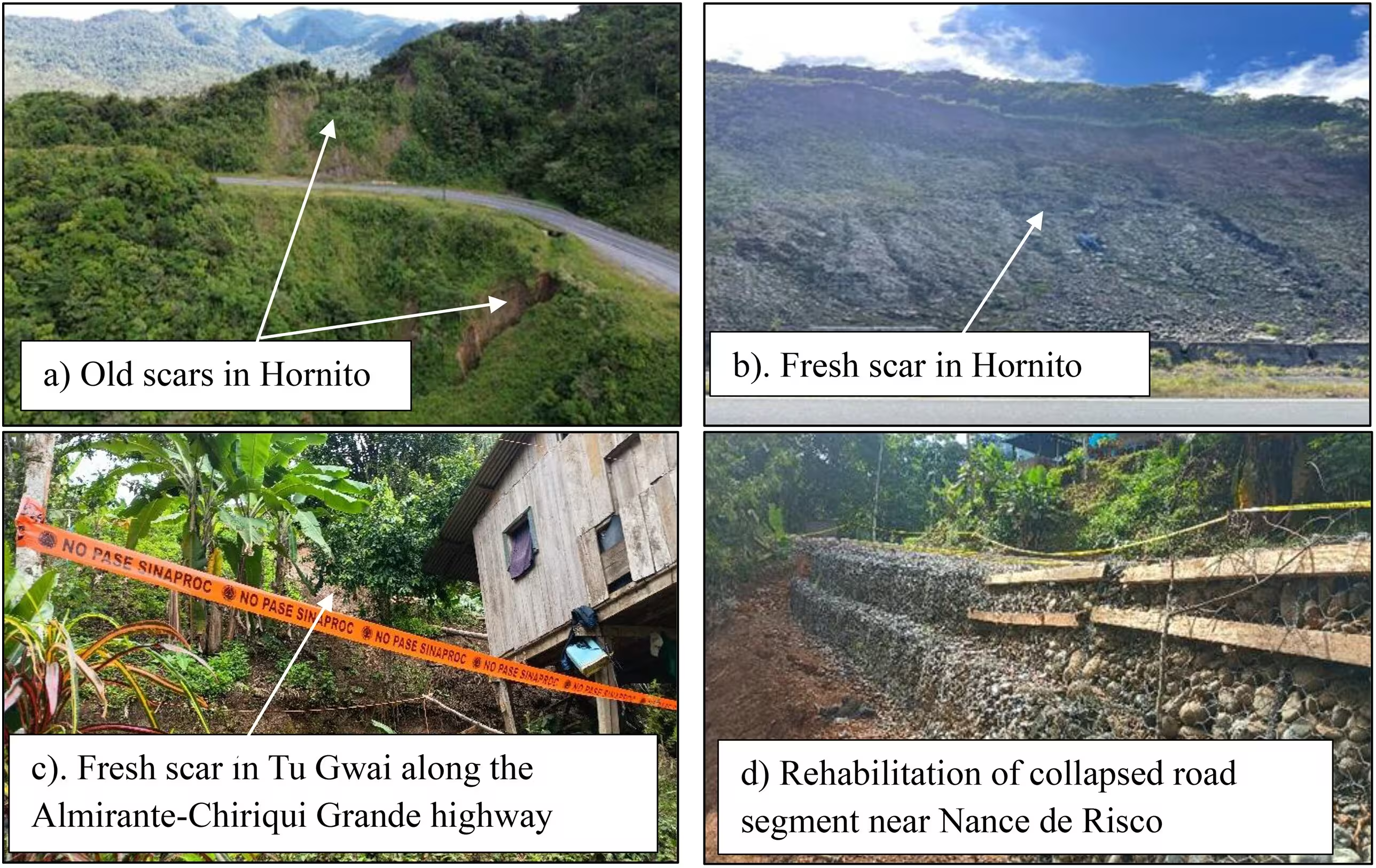
The authors note that the spatial distribution of these hazards makes them prime candidates for targeted mitigation investments. Recommended interventions include enhanced rainfall monitoring, engineering-based slope stabilization, improved roadside drainage networks, and ecosystem-based bio-engineering solutions to reinforce vulnerable embankments before severe tropical storms trigger widespread blockages.
Study Limitations and Future Research Directions
While the ensemble framework demonstrated strong stability across alternative training and validation data partitions, the authors acknowledged certain methodological constraints. The foundational landslide inventory was restricted to 87 mapped events due to the narrow spatial extent and limited accessibility of mountainous linear infrastructure. Furthermore, the reliance on long-term historical rainfall percentiles captured broad climatic trends rather than specific storm thresholds that immediately precede slope failures.
Future research initiatives aim to expand field-mapped inventories, incorporate dynamic antecedent precipitation metrics, utilize higher-resolution soil and climate datasets, and evaluate alternative corridor buffer distances. These refinements will help local authorities better anticipate climate-related geohazards and build long-term infrastructure resilience across vulnerable tropical transportation networks.
The research was published in PLOS One on November 5, 2026.
This article has been fact checked for accuracy, with information verified against reputable sources. Learn more about us and our editorial process.
Last reviewed on .
Article history
- Latest version
Reference(s)
- Petiangma, Dereck Mbeh., et al. “Ensemble frequency ratio-maximum entropy landslide susceptibility modelling for climate‑resilient road corridors in Bocas del Toro and Chiriquí, Panama.” PLOS One, vol. 21, no. 11, November 5, 2026, pp. e0362084 Public Library of Science (PLoS), doi: 10.1371/journal.pone.0362084. <https://doi.org/10.1371/journal.pone.0362084>.
Cite this page:
- Posted by Deepak Malhotra