New Study Tracks Millions of German Ambulance Dispatches to Measure Real-Time Health Toll of Heatwaves
Researchers in northern Germany are combining neighborhood-scale microclimate sensors and artificial intelligence to uncover how extreme weather triggers acute medical emergencies.

Extreme temperatures and shifting weather patterns are placing unprecedented stress on emergency medical services in northern Germany, raising urgent questions about how local microclimates trigger acute health crises. While scientists have long known that heatwaves and freezing spells drive up hospital admissions, most studies rely on coarse regional weather stations that miss neighborhood-level temperature spikes. To uncover the real-time health toll of urban heat islands and environmental pollution, an observational study protocol published in JMIR Research Protocols details a massive multi-year project tracking millions of ambulance movements.
How Will Researchers Track Ambulance Dispatches Against Weather Extremes?
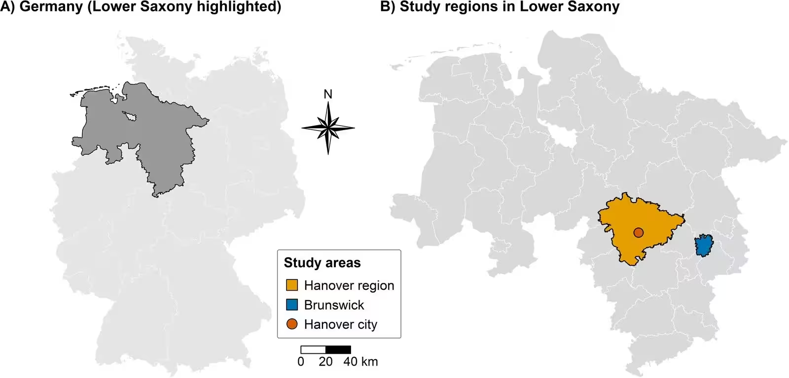
Led by Dominik Schröder and an interdisciplinary team of researchers from the University Medical Center Göttingen and Leibniz University Hannover, the project focuses on two major metropolitan regions in Lower Saxony, namely Hanover and Brunswick. These areas combine densely populated urban centers with surrounding suburban and rural landscapes, creating a diverse testing ground for environmental health research. The study utilizes anonymized prehospital emergency medical dispatches data spanning multiple emergency service providers across the region. By examining records that date back through years of digital documentation up to 2030, the investigators aim to capture acute health responses to thermal stress with unprecedented temporal and spatial precision.
To move beyond blunt weather measurements, the team is integrating data from established meteorological stations with dense networks of research-grade crowdsourced urban sensors, such as SenseCAP S1000 devices. These instruments measure near-surface air temperature, humidity, and solar radiation to map out microclimatic variations caused by buildings, pavement, and vegetation. Furthermore, mobile measurements taken along specific bicycle and vehicle routes will validate these localized thermal comfort models. The investigation also incorporates high-resolution microclimate simulations using the PALM parallelized large-eddy simulation model system, which accounts for atmospheric conditions, building geometry, and heat dispersion at the neighborhood scale.
What Role Do Air Pollution and Traffic Play in Emergency Calls?
Environmental stressors rarely act in isolation, which is why the research framework also tracks key air pollutants including particulate matter designated as PM10 and PM2.5, ultrafine particles, and carbon dioxide. Traffic-related emissions feeding into the pollution models are derived from the MATSim multi-agent transport simulation framework. This advanced setup generates spatially and temporally resolved emission estimates based on actual traffic activity patterns. By coupling these transport simulations with agent-based pedestrian models, the researchers can estimate individual-level exposure to both heat and air pollution along realistic movement trajectories in outdoor urban environments.
Handling free-text entries in emergency logs, such as dispatch notes and symptom descriptions, presents a significant technical challenge. To overcome this, the study deploys localized large language models and text-mining approaches to categorize unstructured data regarding heat-related complaints, respiratory deterioration, or dehydration. An experienced emergency medical professional manually classifies a training sample to evaluate the artificial intelligence models using precision, recall, and F1-scores, ensuring that automated text extraction remains robust and reliable.
What Analytical Methods Guide the Population-Based Study?
To connect environmental exposures with emergency medical demand, the analytical framework employs quasi-Poisson regression models incorporating distributed lag nonlinear model structures. These statistical models evaluate how daily mean air temperatures correlate with total daily emergency dispatch counts, accounting for short-term and medium-term temporal lags ranging from zero to six days for heat exposure, and up to 14 days for cold-related effects. Natural cubic splines control for long-term seasonal trends, day-of-the-week variations, and public holidays, while geographic information system mapping visualizes spatial distribution patterns and potential urban heat hotspots.
The study design also accounts for potential confounding factors, including air pollution, humidity, and underlying sociodemographic characteristics such as neighborhood-level population structures. Because prehospital emergency medical dispatches data are collected for operational rather than research purposes, the authors note inherent limitations such as varying spatial precision and coding practices across providers. The investigation is explicitly designed to characterize population- and area-level associations rather than individual-level causal effects, providing a scalable framework that could eventually inform climate adaptation and urban resilience planning across Europe.
The research was published in JMIR research protocols on November 17, 2026.
This article has been fact checked for accuracy, with information verified against reputable sources. Learn more about us and our editorial process.
Last reviewed on .
Article history
- Latest version
Reference(s)
- Schröder, Dominik., et al. “Impact of Climatic and Environmental Conditions on Prehospital Emergency Medical Dispatches in Germany: Protocol for an Exploratory, Population-Based Observational Study.” JMIR Research Protocols, vol. 15, November 17, 2026, pp. e97722-e97722. JMIR Publications Inc., doi: 10.2196/97722. <https://doi.org/10.2196/97722>.
Cite this page:
- Posted by David Anderson