Climate Change Is Shifting Plague Transmission Risks Across Mountain Ecosystems
New ecological modeling reveals that warming temperatures and changing rainfall patterns will alter disease hotspots and expose previously unrecognized vulnerable regions in northwestern China.
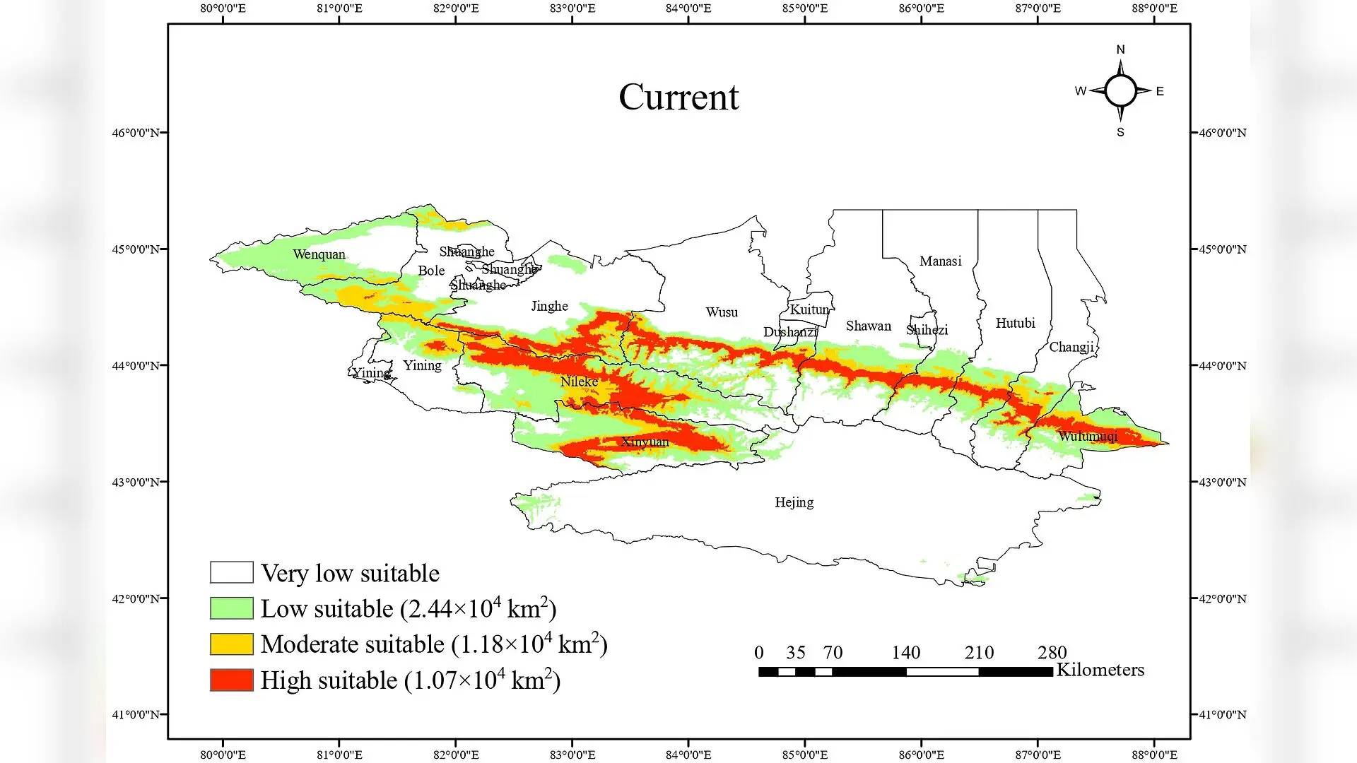
Climate change is reshaping the distribution of plague in northwestern China, shifting high-risk transmission zones across thousands of square kilometers and highlighting previously unrecognized danger areas. Researchers analyzing the Northern Tianshan Mountain plague focus found that while some habitats will contract under future warming scenarios, others will expand dramatically as shifting precipitation patterns alter environmental conditions for both animal hosts and the bacteria itself.
The study, published in PLOS Neglected Tropical Diseases on October 26, 2026, was conducted by Fang Li and colleagues from the Xinjiang Key Laboratory of Vector-borne Infectious Diseases and associated institutions. The researchers evaluated the spatiotemporal dynamics of the gray marmot, known scientifically as Marmota baibacina, which serves as the primary host, alongside the plague bacterium Yersinia pestis.
How Climate Models and Copula Statistics Map Disease Risk
To forecast how these populations will respond to global temperature increases, the team utilized an optimized maximum entropy model, abbreviated as MaxEnt, combined with bivariate conditional Copula functions. This advanced statistical approach allowed the scientists to evaluate the complex, non-linear dependencies between the host animal’s habitat suitability and the pathogen’s distribution across four different greenhouse gas emission pathways outlined by the Intergovernmental Panel on Climate Change.
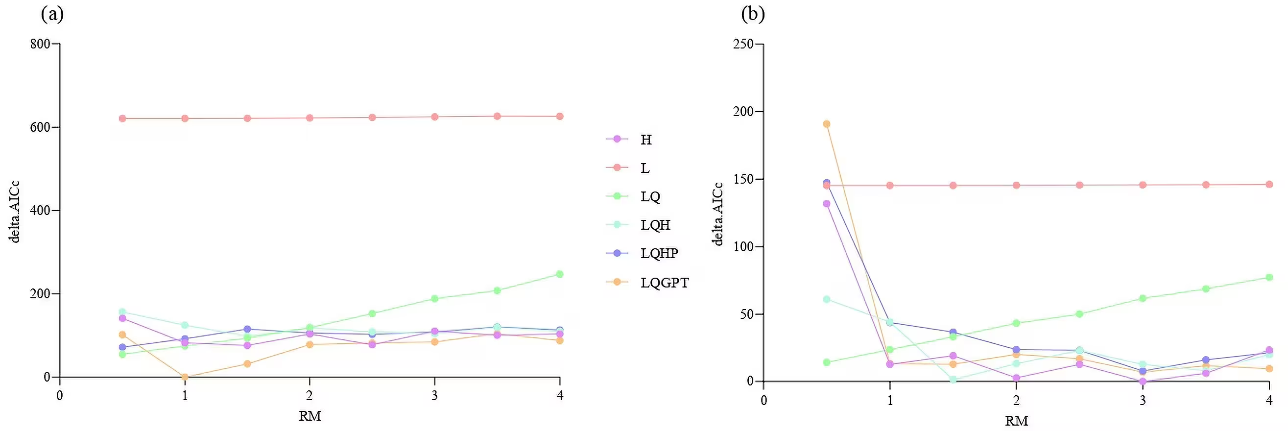
The analysis revealed that environmental variables such as the precipitation seasonality index, which measures the variability of rainfall over the year, and minimum winter temperatures act as the primary filters governing where the disease can persist. Specifically, the bacterium Yersinia pestis showed a strict linear response to precipitation seasonality, expanding its suitable range as rainfall variability increased, whereas the marmot host exhibited a distinct threshold effect at a precipitation seasonality index value of 74.14.
Western Hotspots and the Discovery of New Vulnerable Regions
The models indicated that high-risk transmission zones are not uniformly distributed across the 700-kilometer mountain range. Instead, the western sector experiences significantly greater distributional dynamics, showing higher rates of both habitat contraction and expansion than the eastern region. Nileke County, Jinghe County, and Wusu City emerged as major epizootic hotspots, accounting for more than half of all spatial changes under future climate simulations and aligning with historical pathogen isolation records.
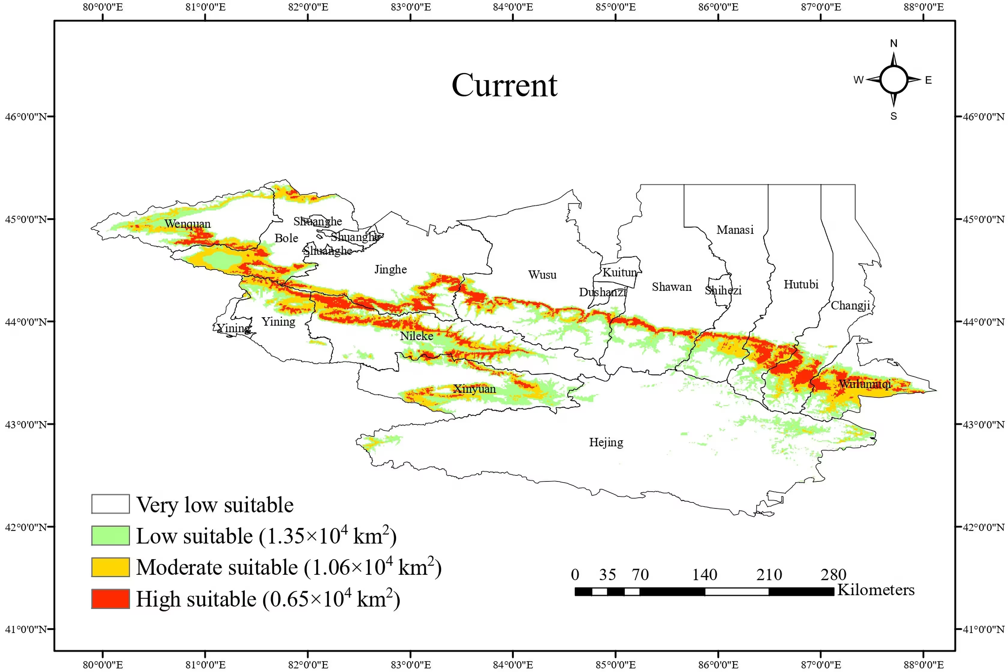
Most notably, the predictive modeling identified Xinyuan County as a previously unrecognized high-risk region. Located in the Ili River Valley with elevations spanning 1,800 to 3,700 meters, Xinyuan County features a humid continental climate and shares continuous mountain meadow terrain with neighboring endemic zones without natural geographical barriers. Although marmots have been reported there, formal disease surveillance had not previously been established.
Implications for Public Health Surveillance and Resource Allocation
The authors suggest that these findings can help public health authorities optimize scarce monitoring resources by prioritizing the identified western hotspots and implementing systematic passive surveillance in emerging zones like Xinyuan County. However, the researchers noted certain limitations in their model, such as the assumption that flea vectors perfectly co-occur with high-suitability host and pathogen zones without experiencing independent climate-driven shifts. Future iterations of the framework aim to incorporate direct flea niche data to refine local risk assessments.
The research was published in PLOS Neglected Tropical Diseases on October 26, 2026.
This article has been fact checked for accuracy, with information verified against reputable sources. Learn more about us and our editorial process.
Last reviewed on .
Article history
- Latest version
Reference(s)
- Li, Fang., et al. “Integrating MaxEnt and copula models to assess plague-associated ecological suitability under climate change in Northern Tianshan, China.” PLOS Neglected Tropical Diseases, vol. 20, no. 10, October 26, 2026, pp. e0014818 Public Library of Science (PLoS), doi: 10.1371/journal.pntd.0014818. <https://doi.org/10.1371/journal.pntd.0014818>.
Cite this page:
- Posted by Raj Joshi